Bow Fiddle

Island in Banffshire

Scotland

Bow Fiddle

Rock outcrop This outcrop is partly in Cullen Links and partly on the Cullen Sands.
Rock outcrop Credit: don cload

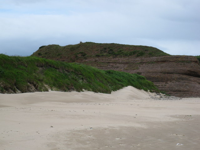
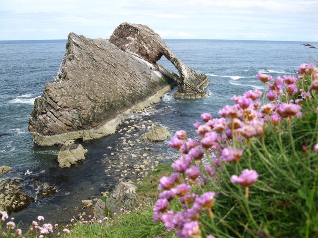
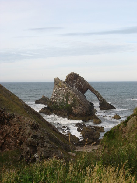
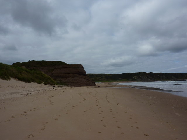
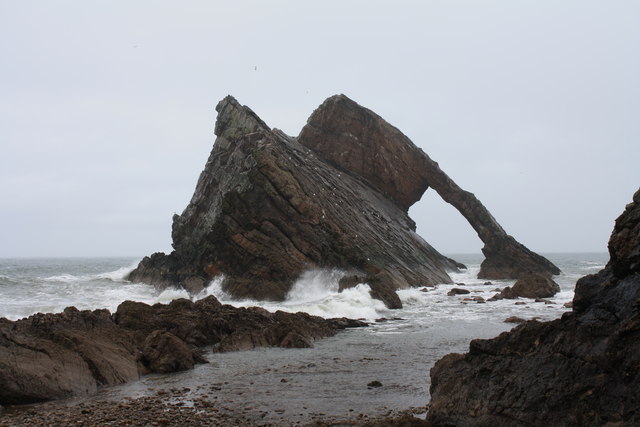
Bow Fiddle, located in Banffshire, is not an island as mentioned, but rather a unique rock formation on the north-east coast of Scotland. This distinctive natural monument is situated near the village of Portknockie, approximately 8 kilometers west of the town of Cullen. The Bow Fiddle Rock, often referred to as Bow Fiddle due to its resemblance to a violin bow, is a prominent sea stack that stands tall in the Moray Firth.

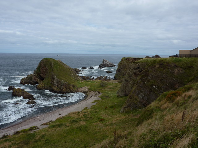
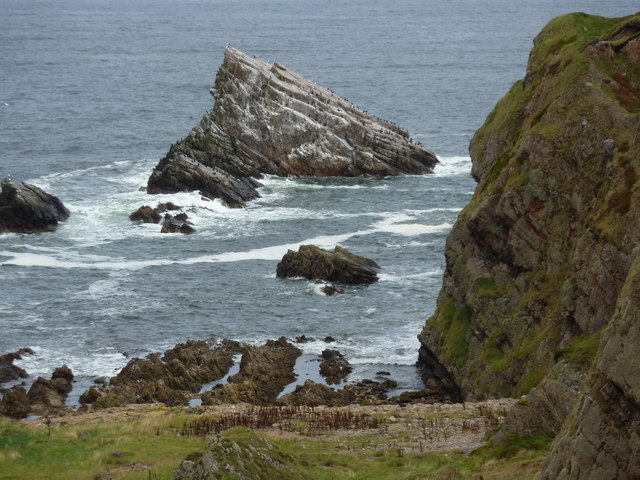
The rock formation is composed of quartzite and stands around 43 meters high. Its arch-like shape has been formed over centuries of erosion caused by the relentless crashing of waves against the coast. The archway created by this erosion provides a picturesque frame for the magnificent coastal views that stretch out towards the North Sea.

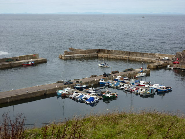
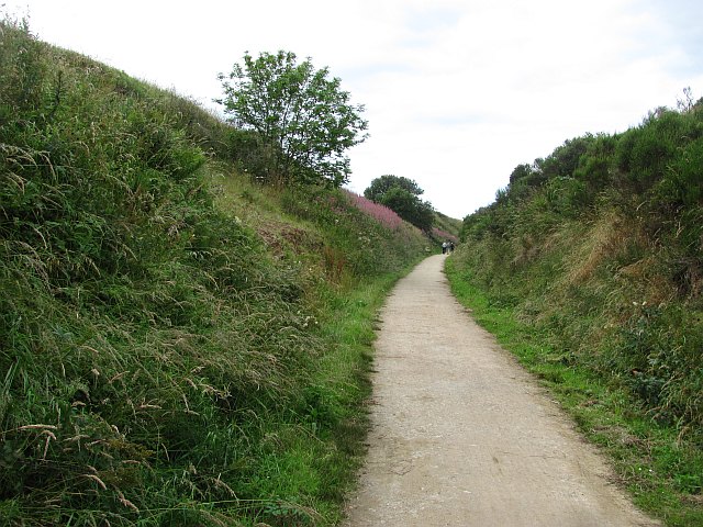
Bow Fiddle Rock has become a popular tourist destination, attracting visitors from all over the world. Its unique shape and dramatic setting make it a favored spot for photographers, nature enthusiasts, and rock climbers. The area surrounding the rock offers stunning coastal walks along rugged cliffs, providing an opportunity to witness the diverse marine life and seabirds that inhabit the region.

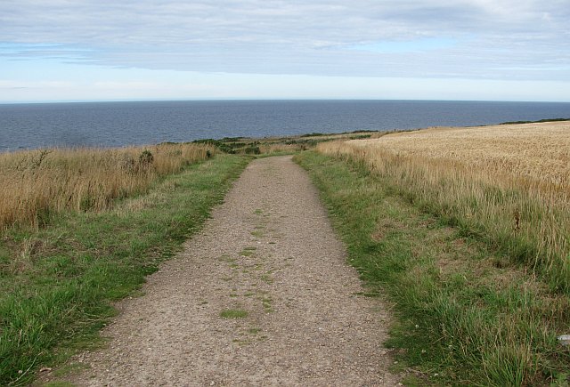
Accessible via a short walk from Portknockie, Bow Fiddle Rock is easily reached and provides a remarkable spectacle regardless of the weather. Whether bathed in sunlight, shrouded in mist, or standing against crashing waves, the Bow Fiddle Rock is a captivating natural wonder that showcases the beauty and power of nature along the Scottish coastline.

If you have any feedback on the listing, please let us know in the comments section below.

Bow Fiddle Images

Images are sourced within 2km of 57.706552/-2.8494682 or Grid Reference NJ4968. Thanks to Geograph Open Source API. All images are credited.

Rock outcrop This outcrop is partly in Cullen Links and partly on the Cullen Sands.
Rock outcrop
This outcrop is partly in Cullen Links and partly on the Cullen Sands.
Bow Fiddle Rock Famous rock feature at Portknockie.
Bow Fiddle Rock
Famous rock feature at Portknockie.
Portknockie Harbour
Portknockie Harbour
Bow Fiddle Rock
Bow Fiddle Rock
Reddish rock outcrop in Cullen Bay
Coast at Portknockie Triangular rock in the middle is Shitten Craig. The cat sitting on the fence in <a href="https://www.geograph.org.uk/photo/2620784">NJ4968 : Wee cat on fence</a> has cleared off.
Coast at Portknockie
Triangular rock in the middle is Shitten Craig. The cat sitting on the fence in NJ4968 : Wee cat on fence has cleared off.
Wee cat on fence By a chapel on the coast at Portknockie.
Wee cat on fence
By a chapel on the coast at Portknockie.
Cormorants and gulls on Shitten Craig Rocky coastline at Portknockie, Moray Firth.
Cormorants and gulls on Shitten Craig
Rocky coastline at Portknockie, Moray Firth.
Fishing boat leaving Portknockie harbour A few boats out at sea; the hills of Cromarty in the distance.
Fishing boat leaving Portknockie harbour
A few boats out at sea; the hills of Cromarty in the distance.
Youth Centre, Portknockie
New house, Church Street, Portknockie
Moray Coast Railway A cutting behind Cullen Links. The trackbed is now a path.
Moray Coast Railway
A cutting behind Cullen Links. The trackbed is now a path.
Moray Coast Railway The start of a section of trackbed which has been turned into a path to Cullen.
Moray Coast Railway
The start of a section of trackbed which has been turned into a path to Cullen.
Portknockie Harbour Fishing off the harbour wall at Portknockie.
Portknockie Harbour
Fishing off the harbour wall at Portknockie.
Coast path, Banffshire Well surfaced but not tarred section of the cycle route. It runs through a barley field by Tronach Head. A line on the horizon may be the haar, out at sea but ready to return.
Coast path, Banffshire
Well surfaced but not tarred section of the cycle route. It runs through a barley field by Tronach Head. A line on the horizon may be the haar, out at sea but ready to return.
Bow Fiddle Rock Bow Fiddle Rock is a classic example of a sea stack with a dramatic natural arch. It is named after its unusual shape which is supposed to resemble a violin bow, and it is the most visited tourist attraction in the village of Portknockie.
Bow Fiddle Rock
Bow Fiddle Rock is a classic example of a sea stack with a dramatic natural arch. It is named after its unusual shape which is supposed to resemble a violin bow, and it is the most visited tourist attraction in the village of Portknockie.
Triangulation Pillar S7179 at Portknockie
Ordnance Survey  Flush Bracket G4051 This can be found on a boundary wall at Cullen Bay Hotel.
For more detail see : <span class="nowrap"><a title="http://www.bench-marks.org.uk/bm16939" rel="nofollow ugc noopener" href="http://www.bench-marks.org.uk/bm16939">Link</a><img style="margin-left:2px;" alt="External link" title="External link - shift click to open in new window" src="https://s1.geograph.org.uk/img/external.png" width="10" height="10"/></span>
Ordnance Survey Flush Bracket G4051
This can be found on a boundary wall at Cullen Bay Hotel. For more detail see : LinkExternal link
Show me another place!

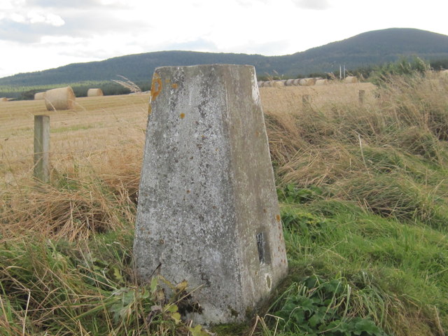
Bow Fiddle is located at Grid Ref: NJ4968 (Lat: 57.706552, Lng: -2.8494682)

Unitary Authority: Moray

Police Authority: North East

What 3 Words

///intend.reverses.replying. Near Portknockie, Moray

Related Wikis

Bow Fiddle Rock

Bow Fiddle Rock is a natural sea arch near Portknockie on the north-eastern coast of Scotland. It is so called because it resembles the tip of a fiddle...

Green Castle, Portknockie

Green Castle is a naturally defended rocky outcrop in the village of Portknockie in Moray, Scotland, that was occupied successively by small promontory...
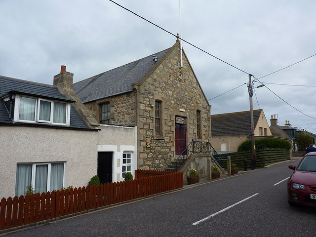
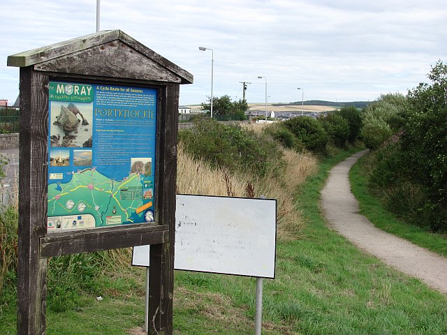
Portknockie

Portknockie (Scottish Gaelic: Port Chnocaidh, the hilly port) is a coastal village on the Moray Firth within Moray, Scotland. The village's name is written...

Portknockie railway station

Portknockie railway station was a railway station that served the small fishing village of Portknockie, close to Cullen in Moray. The railway station was...

Nearby Amenities

Located within 500m of 57.706552,-2.8494682
Bow Fiddle Rock
Tourism: viewpoint
Lat/Long: 57.7055644/-2.8531964
Bench
Lat/Long: 57.7032861/-2.8487451
Bench
Lat/Long: 57.7044957/-2.8471763
Bench
Lat/Long: 57.7046905/-2.8479249
Whale’s Mouth
Fee: no
Natural: cave_entrance
Lat/Long: 57.7033307/-2.847439
Fee: no
Natural: cave_entrance
Lat/Long: 57.7057655/-2.8532098
The data included in this document is from www.openstreetmap.org. The data is made available under ODbL.

Have you been to Bow Fiddle?

Leave your review of Bow Fiddle below (or comments, questions and feedback).