Mussel Rock

Island in Cornwall

England

Mussel Rock

Sandymouth Holiday Resort
Sandymouth Holiday Resort Credit: Charli

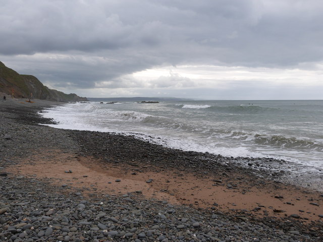
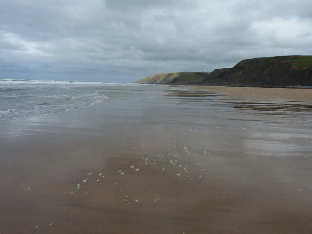
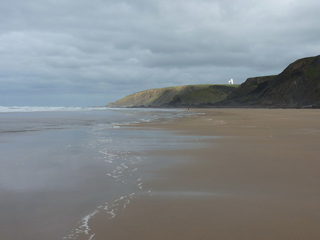
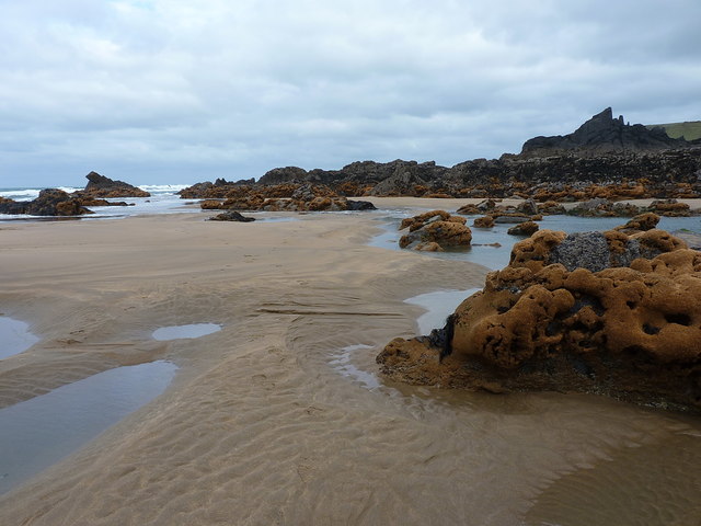
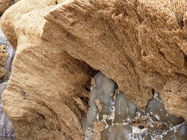
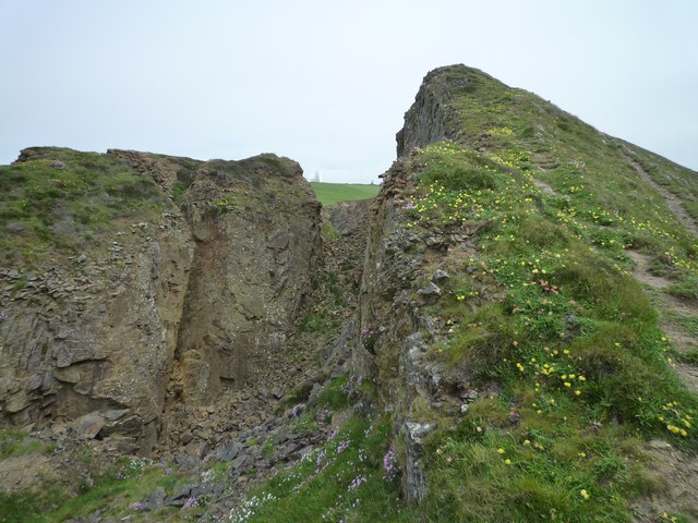
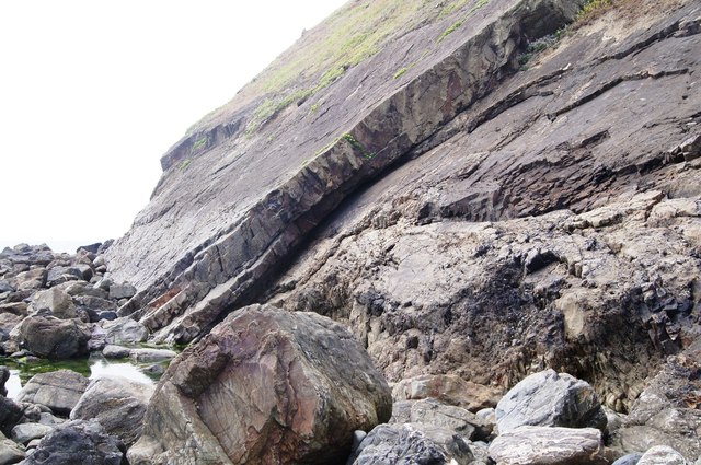
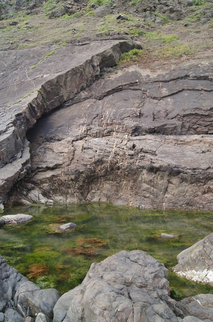
Mussel Rock is a small island located off the coast of Cornwall, England. Situated approximately 300 meters from the mainland, it is a prominent feature of the local landscape. The island is mostly composed of rugged cliffs, with its highest point reaching about 60 meters above sea level.

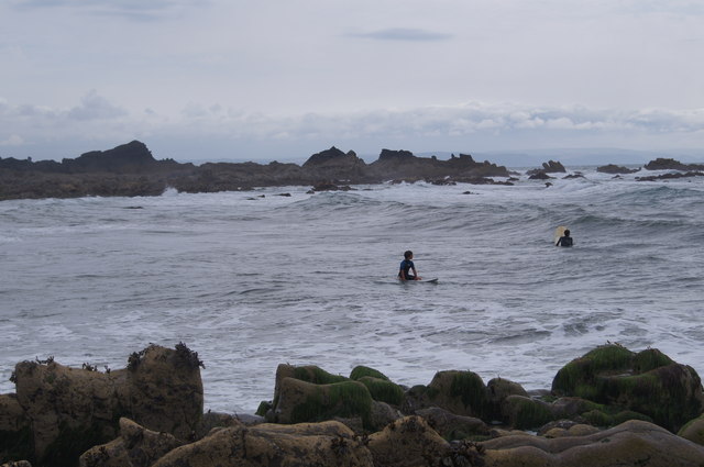
Mussel Rock gets its name from the abundance of mussels found in the surrounding waters. The island is a popular destination for nature enthusiasts and birdwatchers due to its rich biodiversity. It serves as a breeding ground for various seabird species, including puffins, kittiwakes, and guillemots. The surrounding waters are also home to seals and a variety of fish species.

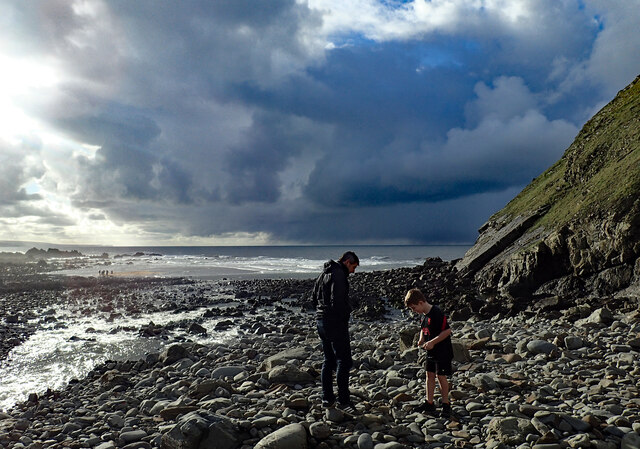
Access to Mussel Rock is mainly dependent on tidal conditions, as during high tide, the island becomes completely cut off from the mainland. However, during low tide, a natural causeway is formed, allowing visitors to explore the island on foot. This phenomenon adds to the charm and uniqueness of Mussel Rock.

In addition to its natural beauty, the island has some historical significance. It is believed to have been used as a lookout point during World War II due to its strategic location. Remnants of old structures and defensive positions can still be found on the island, serving as a reminder of its past.

Mussel Rock is a picturesque and ecologically diverse island that offers visitors a chance to connect with nature and explore its rich history. Whether it be birdwatching, enjoying the stunning coastal views, or simply immersing oneself in the tranquility of the island, Mussel Rock is a must-visit destination for nature lovers and history enthusiasts alike.

If you have any feedback on the listing, please let us know in the comments section below.
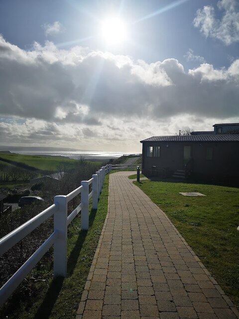
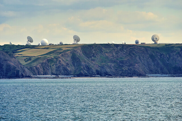
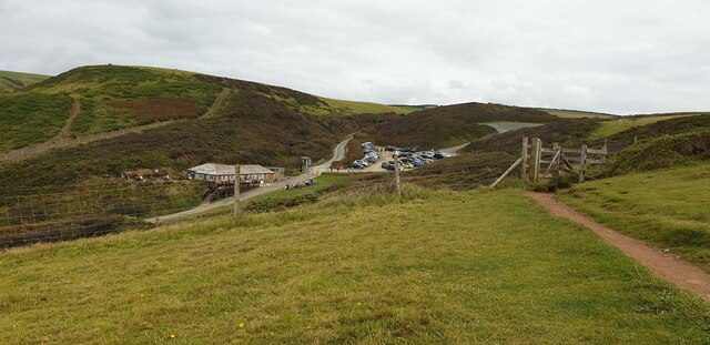
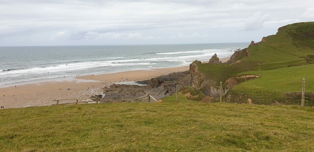
Mussel Rock Images

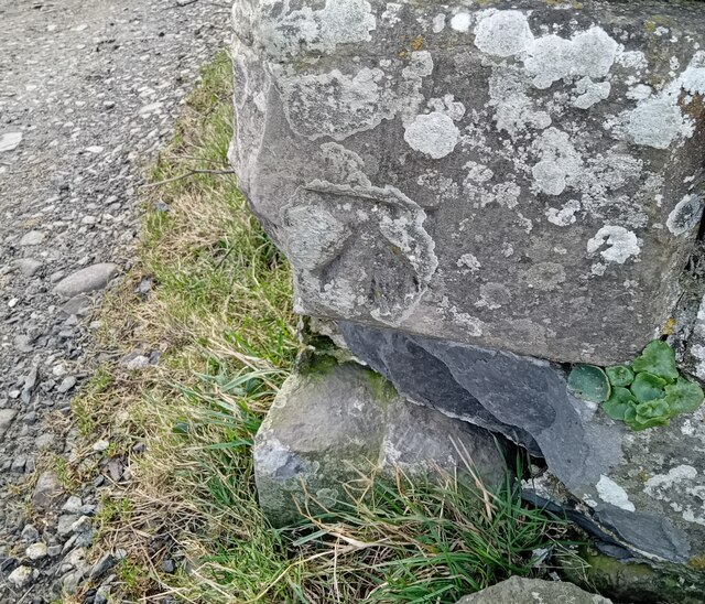
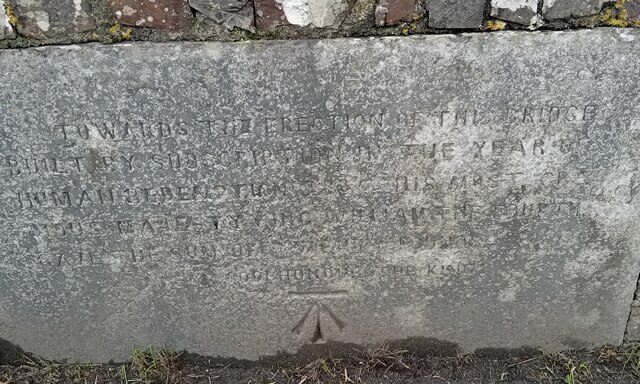
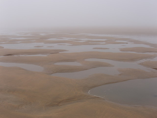
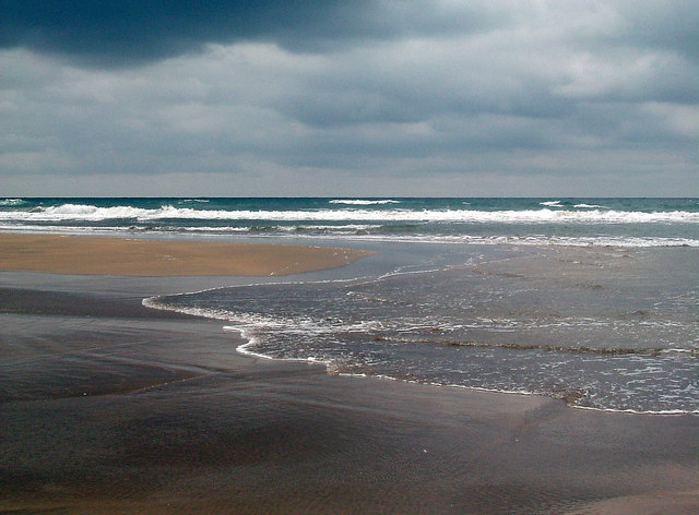
Images are sourced within 2km of 50.872117/-4.5609488 or Grid Reference SS1911. Thanks to Geograph Open Source API. All images are credited.

Sandymouth Holiday Resort
Morwenstow Satellite Dishes GCHQ Bude, also known as GCHQ Composite Signals Organisation Station Morwenstow, abbreviated to GCHQ CSO Morwenstow, is a UK Government satellite ground station and eavesdropping centre located on the north Cornwall coast between the small villages of Morwenstow and Coombe. It is operated by the British signals intelligence service, officially known as the Government Communications Headquarters (GCHQ). It is located on part of the site of the former World War II airfield, RAF Cleave. The station comprises twenty-one satellite antennae of various sizes, including three that have a diameter of 100 ft (<span class="nowrap"><a title="https://en.wikipedia.org/wiki/GCHQ_Bude" rel="nofollow ugc noopener" href="https://en.wikipedia.org/wiki/GCHQ_Bude">Link</a><img style="margin-left:2px;" alt="External link" title="External link - shift click to open in new window" src="https://s1.geograph.org.uk/img/external.png" width="10" height="10"/></span> Wikipedia).
Morwenstow Satellite Dishes
GCHQ Bude, also known as GCHQ Composite Signals Organisation Station Morwenstow, abbreviated to GCHQ CSO Morwenstow, is a UK Government satellite ground station and eavesdropping centre located on the north Cornwall coast between the small villages of Morwenstow and Coombe. It is operated by the British signals intelligence service, officially known as the Government Communications Headquarters (GCHQ). It is located on part of the site of the former World War II airfield, RAF Cleave. The station comprises twenty-one satellite antennae of various sizes, including three that have a diameter of 100 ft (LinkExternal link Wikipedia).
Car Park at Sandy Mouth Viewed from up on the hills, looking down onto the car park at Sandy Mouth.
Car Park at Sandy Mouth
Viewed from up on the hills, looking down onto the car park at Sandy Mouth.
Sandy Mouth Beach The beach at Sandy Mouth from the cliff.
Sandy Mouth Beach
The beach at Sandy Mouth from the cliff.
Ordnance Survey Cut Mark This OS cut mark can be found on the roadside barn at Stowe Barton. It marks a point 102.376m above mean sea level.
Ordnance Survey Cut Mark
This OS cut mark can be found on the roadside barn at Stowe Barton. It marks a point 102.376m above mean sea level.
Ordnance Survey Cut Mark This OS cut mark can be found on the west parapet of King William's Bridge. It marks a point 21.199m above mean sea level.
Ordnance Survey Cut Mark
This OS cut mark can be found on the west parapet of King William's Bridge. It marks a point 21.199m above mean sea level.
Sandy Mouth on a misty day This is a strip of sand below cliffs. Much of the country was basking in sunshine, but this part of the North Cornish coast was misty - it cleared in the afternoon.
Sandy Mouth on a misty day
This is a strip of sand below cliffs. Much of the country was basking in sunshine, but this part of the North Cornish coast was misty - it cleared in the afternoon.
Low tide at Sandy Mouth Low tide was at 14.46 on this day; the picture being taken just two minutes before this time. Ahead stretches the Atlantic Ocean.
Low tide at Sandy Mouth
Low tide was at 14.46 on this day; the picture being taken just two minutes before this time. Ahead stretches the Atlantic Ocean.
Heavy sky at Sandymouth Bay, near Bude, Cornwall
Beach at Sandy Mouth Bay Looking more or less north along the beach at relatively low tide, towards one of the radio dishes of the GCHQ Satellite Station at Morwenstow.
Beach at Sandy Mouth Bay
Looking more or less north along the beach at relatively low tide, towards one of the radio dishes of the GCHQ Satellite Station at Morwenstow.
Warren Long Beach The map assigns names to several stretches of sand along here, of which we are approaching Warren Long Beach a little way north of Sandy Mouth Bay.
Warren Long Beach
The map assigns names to several stretches of sand along here, of which we are approaching Warren Long Beach a little way north of Sandy Mouth Bay.
On Warren Little Beach These colonies of honeycomb worms (Sabellaria alveolata) decorate the tidal rocks along a stretch of the coast here.
On Warren Little Beach
These colonies of honeycomb worms (Sabellaria alveolata) decorate the tidal rocks along a stretch of the coast here.
Internal structure of a honeycomb  worm colony One of many colonies on the rocks here; this one's suffered a little at the hands of a storm which has broken a large chunk off, exposing the interior. Each tube contains a single worm of the species Sabellaria alveolata, and is roughly 10-12" long. The worm settles into the colony after 5 or 6 weeks as a drifting larva, and then spends the rest of its life filter-feeding from the upper end of the tube (and presumably extending it to solidify the colony)
Internal structure of a honeycomb worm colony
One of many colonies on the rocks here; this one's suffered a little at the hands of a storm which has broken a large chunk off, exposing the interior. Each tube contains a single worm of the species Sabellaria alveolata, and is roughly 10-12" long. The worm settles into the colony after 5 or 6 weeks as a drifting larva, and then spends the rest of its life filter-feeding from the upper end of the tube (and presumably extending it to solidify the colony)
Duckpool beach in Winter With the stream from Duckpool Combe.
Duckpool beach in Winter
With the stream from Duckpool Combe.
Cliff at Steeple Point
Enjoying the sea at Duckpool
Smooth fault line - Duckpool
Rock pool at Duckpool
Show me another place!

Mussel Rock is located at Grid Ref: SS1911 (Lat: 50.872117, Lng: -4.5609488)

Unitary Authority: Cornwall

Police Authority: Devon and Cornwall

What 3 Words

///releasing.lowest.mermaids. Near Flexbury, Cornwall

Related Wikis

Coombe, Morwenstow

Coombe (Cornish: Komm) is a hamlet in northeast Cornwall, England, United Kingdom. Combe is situated in the civil parish of Morwenstow three miles (5 km...

Sandymouth Beach

Sandymouth is a beach three miles (5 km) north of Bude in Cornwall, England, United Kingdom. == Topography == The area is formed from cliffs and rock formations...

Stowe, Kilkhampton

Stowe House in the parish of Kilkhampton in Cornwall, England, UK, was a mansion built in 1679 by John Grenville, 1st Earl of Bath (1628–1701) and demolished...

GCHQ Bude

GCHQ Bude, also known as GCHQ Composite Signals Organisation Station Morwenstow, abbreviated to GCHQ CSO Morwenstow, is a UK Government satellite ground...

Nearby Amenities

Located within 500m of 50.872117,-4.5609488
Source: PGS
Lat/Long: 50.8763078/-4.5616812
Steeple Point
Natural: headland
Lat/Long: 50.876424/-4.5617591
Barrier: stile
Foot: yes
Material: wood
Stile: stepover
Lat/Long: 50.8759391/-4.5575722
Source: PGS
Lat/Long: 50.8762249/-4.5617904
Warren Gutter Beach
Natural: beach
Lat/Long: 50.8708172/-4.5602593
Barrier: kissing_gate
Lat/Long: 50.8743521/-4.5571215
Bench
Backrest: no
Survey Date: 2023-11-25
Waste: dog_excrement
Lat/Long: 50.8739851/-4.5573105
The data included in this document is from www.openstreetmap.org. The data is made available under ODbL.

Have you been to Mussel Rock?

Leave your review of Mussel Rock below (or comments, questions and feedback).