Barton upon Irwell

Settlement in Lancashire

England

Barton upon Irwell

Barton Road Bridge and Swing Aqueduct – 1978 Taken during one of the Mersey Ferries regular cruises along the Manchester Ship Canal. The distant cranes identify Irwell Park Wharf, an important interchange point for rail-borne bulk materials such as ores and timber.

The whole complex of bridge, aqueduct and control tower is Listed Grade II*.
Barton Road Bridge and Swing Aqueduct – 1978 Credit: Alan Murray-Rust

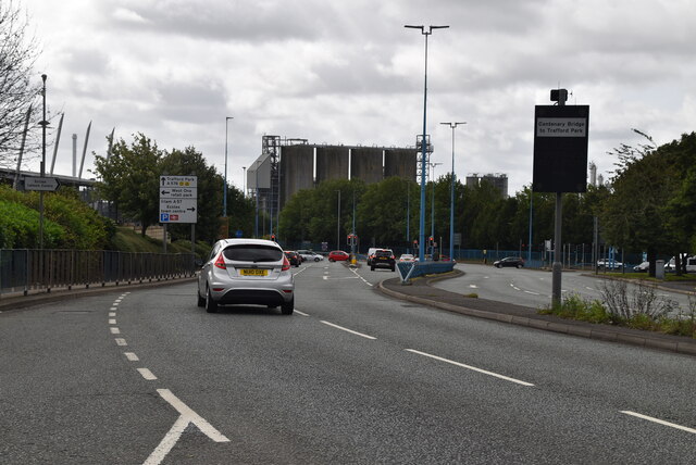
Barton upon Irwell is a small village located in the ceremonial county of Lancashire, England. Situated on the southern bank of the River Irwell, the village is part of the Metropolitan Borough of Trafford. With a population of around 2,500 residents, Barton upon Irwell offers a peaceful and close-knit community atmosphere.

The village has a rich history, dating back to the medieval period. It was once an important crossing point over the River Irwell, serving as a key trade route between Manchester and the rest of the country. Today, the village still retains some of its historic charm, with a number of well-preserved buildings and landmarks such as St. Catherine's Church, which dates back to the 14th century.

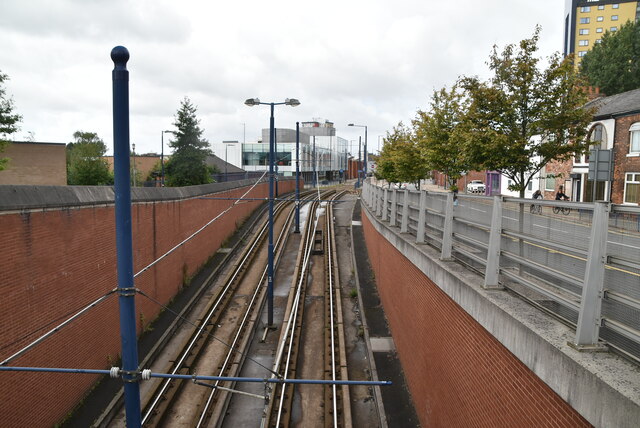
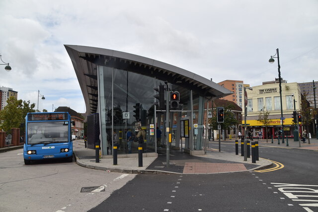
Barton upon Irwell benefits from its proximity to Manchester city center, which is only a few miles away. This allows residents to easily access the city's amenities, employment opportunities, and cultural attractions. The village also enjoys excellent transport links, with nearby motorway connections and a train station providing convenient access to other parts of the region.

In terms of amenities, Barton upon Irwell offers a range of local shops, pubs, and restaurants, catering to the needs of its residents. The village is also surrounded by picturesque countryside, providing opportunities for outdoor activities such as walking and cycling.

Overall, Barton upon Irwell is a charming village with a rich history, offering a peaceful and close-knit community for its residents, while also benefiting from its proximity to the bustling city of Manchester.

If you have any feedback on the listing, please let us know in the comments section below.

Barton upon Irwell Images

Images are sourced within 2km of 53.475523/-2.356794 or Grid Reference SJ7697. Thanks to Geograph Open Source API. All images are credited.

Barton Road Bridge and Swing Aqueduct – 1978 Taken during one of the Mersey Ferries regular cruises along the Manchester Ship Canal. The distant cranes identify Irwell Park Wharf, an important interchange point for rail-borne bulk materials such as ores and timber.

The whole complex of bridge, aqueduct and control tower is Listed Grade II*.
Barton Road Bridge and Swing Aqueduct – 1978
Taken during one of the Mersey Ferries regular cruises along the Manchester Ship Canal. The distant cranes identify Irwell Park Wharf, an important interchange point for rail-borne bulk materials such as ores and timber. The whole complex of bridge, aqueduct and control tower is Listed Grade II*.
Barton Swing Aqueduct detail – 1978 Taken during one of the Mersey Ferries regular cruises along the Manchester Ship Canal. This gives a good close up of the gate that closes off the Bridgewater Canal when the aqueduct is swung.
Barton Swing Aqueduct detail – 1978
Taken during one of the Mersey Ferries regular cruises along the Manchester Ship Canal. This gives a good close up of the gate that closes off the Bridgewater Canal when the aqueduct is swung.
Barton Road Bridge and Swing Aqueduct – 1978 Taken during one of the Mersey Ferries regular cruises along the Manchester Ship Canal. Looking back after passing through. The road bridge is already being swung back in favour of road traffic.

The whole complex of bridge, aqueduct and control tower is Listed Grade II*.
Barton Road Bridge and Swing Aqueduct – 1978
Taken during one of the Mersey Ferries regular cruises along the Manchester Ship Canal. Looking back after passing through. The road bridge is already being swung back in favour of road traffic. The whole complex of bridge, aqueduct and control tower is Listed Grade II*.
Barton Swing Aqueduct, Bridgewater Canal Southern end of the aqueduct carrying the historic canal over the Manchester Ship Canal, viewed from a barge.
Barton Swing Aqueduct, Bridgewater Canal
Southern end of the aqueduct carrying the historic canal over the Manchester Ship Canal, viewed from a barge.
The Eccles Cross Built in buff terracotta and brick, this fine building opened in September 1920 as the Regent Cinema. It closed as a cinema in 1962, becoming unsurprisingly a Bingo Hall. It lasted in this guise for only four years before lying empty until 1983 when it became a wine bar, and later a night club called The Silver Screen. In 1999 it re-opened as a Wetherspoons pub under the name The Eccles Cross, the original of which had once stood close by.
The Eccles Cross
Built in buff terracotta and brick, this fine building opened in September 1920 as the Regent Cinema. It closed as a cinema in 1962, becoming unsurprisingly a Bingo Hall. It lasted in this guise for only four years before lying empty until 1983 when it became a wine bar, and later a night club called The Silver Screen. In 1999 it re-opened as a Wetherspoons pub under the name The Eccles Cross, the original of which had once stood close by.
Trafford Centre Tram Terminus The end of the line for the tram.
Trafford Centre Tram Terminus
The end of the line for the tram.
Outside the Trafford Centre 
The tramline follows the  B5211 Barton Dock Road.
Outside the Trafford Centre
The tramline follows the B5211 Barton Dock Road.
Ladywell Roundabout The A576 is a 10 mile long road across Manchester from Trafford Park to Middleton, via Eccles.
<span class="nowrap"><a title="http://www.sabre-roads.org.uk/wiki/index.php?title=A576" rel="nofollow ugc noopener" href="http://www.sabre-roads.org.uk/wiki/index.php?title=A576">Link</a><img style="margin-left:2px;" alt="External link" title="External link - shift click to open in new window" src="https://s1.geograph.org.uk/img/external.png" width="10" height="10"/></span>
Ladywell Roundabout
The A576 is a 10 mile long road across Manchester from Trafford Park to Middleton, via Eccles. LinkExternal link
A576 The A576 is a 10 mile long road across Manchester from Trafford Park to Middleton, via Eccles.
<span class="nowrap"><a title="http://www.sabre-roads.org.uk/wiki/index.php?title=A576" rel="nofollow ugc noopener" href="http://www.sabre-roads.org.uk/wiki/index.php?title=A576">Link</a><img style="margin-left:2px;" alt="External link" title="External link - shift click to open in new window" src="https://s1.geograph.org.uk/img/external.png" width="10" height="10"/></span>
A576
The A576 is a 10 mile long road across Manchester from Trafford Park to Middleton, via Eccles. LinkExternal link
Metrolink emerging from Ladywell Tunnel The Metrolink is a light rail system. The network consists of eight lines which radiate from Manchester city centre to termini at Altrincham, Ashton-under-Lyne, Bury, East Didsbury, Eccles, Manchester Airport, Rochdale and The Trafford Centre.
Wikipedia: <span class="nowrap"><a title="https://en.wikipedia.org/wiki/Manchester_Metrolink" rel="nofollow ugc noopener" href="https://en.wikipedia.org/wiki/Manchester_Metrolink">Link</a><img style="margin-left:2px;" alt="External link" title="External link - shift click to open in new window" src="https://s1.geograph.org.uk/img/external.png" width="10" height="10"/></span> 
Website: <span class="nowrap"><a title="http://www.metrolink.co.uk/" rel="nofollow ugc noopener" href="http://www.metrolink.co.uk/">Link</a><img style="margin-left:2px;" alt="External link" title="External link - shift click to open in new window" src="https://s1.geograph.org.uk/img/external.png" width="10" height="10"/></span>
Metrolink emerging from Ladywell Tunnel
The Metrolink is a light rail system. The network consists of eight lines which radiate from Manchester city centre to termini at Altrincham, Ashton-under-Lyne, Bury, East Didsbury, Eccles, Manchester Airport, Rochdale and The Trafford Centre. Wikipedia: LinkExternal link Website: LinkExternal link
Lamb Hotel
Lamb Hotel
Eccles Metrolink Station Eccles Interchange is a transport hub in Eccles. It is composed of a bus station, and a single-platform Metrolink light rail station, the latter of which is the terminus of the system's Eccles Line. It opened on 21 July 2000. It is roughly 310 metres away from Eccles railway station.
Eccles Metrolink Station
Eccles Interchange is a transport hub in Eccles. It is composed of a bus station, and a single-platform Metrolink light rail station, the latter of which is the terminus of the system's Eccles Line. It opened on 21 July 2000. It is roughly 310 metres away from Eccles railway station.
College Croft
College Croft
Eccles Interchange Eccles Interchange is a transport hub in Eccles. It is composed of a bus station, and a single-platform Metrolink light rail station, the latter of which is the terminus of the system's Eccles Line. It opened on 21 July 2000. It is roughly 310 metres away from Eccles railway station.
Eccles Interchange
Eccles Interchange is a transport hub in Eccles. It is composed of a bus station, and a single-platform Metrolink light rail station, the latter of which is the terminus of the system's Eccles Line. It opened on 21 July 2000. It is roughly 310 metres away from Eccles railway station.
The Eccles Cross Founded in 1979 by Tim Martin, Wetherspoon is a large chain of pubs with over 1000 pubs [2018] around the UK, run by JD Wetherspoon plc.

Unlike other large chains, Wetherspoon do not operate their own brewery. 

Wetherspoon are known for not playing any music.

According to the company website, the name Wetherspoon came from one of Martin's teachers in New Zealand, while the initials are those of Sheriff J D Hogg from 'The Dukes of Hazzard' TV series.

Wetherspoon also run Lloyd's N° 1 Bars which play music.

Wikipedia <span class="nowrap"><a title="https://en.wikipedia.org/wiki/Wetherspoons" rel="nofollow ugc noopener" href="https://en.wikipedia.org/wiki/Wetherspoons">Link</a><img style="margin-left:2px;" alt="External link" title="External link - shift click to open in new window" src="https://s1.geograph.org.uk/img/external.png" width="10" height="10"/></span>
Company website <span class="nowrap"><a title="http://www.jdwetherspoon.co.uk/" rel="nofollow ugc noopener" href="http://www.jdwetherspoon.co.uk/">Link</a><img style="margin-left:2px;" alt="External link" title="External link - shift click to open in new window" src="https://s1.geograph.org.uk/img/external.png" width="10" height="10"/></span>
The Eccles Cross
Founded in 1979 by Tim Martin, Wetherspoon is a large chain of pubs with over 1000 pubs [2018] around the UK, run by JD Wetherspoon plc. Unlike other large chains, Wetherspoon do not operate their own brewery. Wetherspoon are known for not playing any music. According to the company website, the name Wetherspoon came from one of Martin's teachers in New Zealand, while the initials are those of Sheriff J D Hogg from 'The Dukes of Hazzard' TV series. Wetherspoon also run Lloyd's N° 1 Bars which play music. Wikipedia LinkExternal link Company website LinkExternal link
Eccles Interchange Eccles Interchange is a transport hub in Eccles. It is composed of a bus station, and a single-platform Metrolink light rail station, the latter of which is the terminus of the system's Eccles Line. It opened on 21 July 2000. It is roughly 310 metres away from Eccles railway station.
Eccles Interchange
Eccles Interchange is a transport hub in Eccles. It is composed of a bus station, and a single-platform Metrolink light rail station, the latter of which is the terminus of the system's Eccles Line. It opened on 21 July 2000. It is roughly 310 metres away from Eccles railway station.
Show me another place!

Barton upon Irwell is located at Grid Ref: SJ7697 (Lat: 53.475523, Lng: -2.356794)

Unitary Authority: Salford

Police Authority: Greater Manchester

What 3 Words

///losses.busy.chefs. Near Eccles, Manchester

Related Wikis

Barton upon Irwell

Barton upon Irwell (also known as Barton-on-Irwell or Barton) is a suburb of the City of Salford, Greater Manchester, England, with a population of 12...

Barton Road Swing Bridge

Barton Road Swing Bridge (or Barton Road Bridge) is a swing bridge for road traffic in Greater Manchester that crosses the Manchester Ship Canal between...

Barton Aqueduct

The Barton Aqueduct, opened on 17 July 1761, carried the Bridgewater Canal over the River Irwell at Barton-upon-Irwell, in the historic county of Lancashire...

Trafford Waters

Trafford Waters is a major mixed-use development, currently under construction in Trafford, Greater Manchester on land between the Manchester Ship Canal...

ROF Patricroft

The Royal Ordnance Factory, ROF Patricroft, was an engineering factory was classified as a Medium Machine Shop. It was located in Patricroft, near the...

Barton Power Station

Barton Power Station was a coal-fired power station on the Bridgewater Canal in Trafford Park, near Eccles, Lancashire, England. == History == The construction...

The Grapes, Eccles

The Grapes is a Grade II listed public house at 439 Liverpool Rd, Peel Green, Eccles, Salford M30 7HD.It is on the Campaign for Real Ale's National Inventory...

Patricroft

Patricroft is a suburb near Eccles, Greater Manchester, England. == History == Patricroft may derive its name from 'Pear-tree croft', or more likely,...

Nearby Amenities

Located within 500m of 53.475523,-2.356794
Bus Stop
Cawdor Street/The Barton Inn
Bus: yes
Naptan AtcoCode: 1800NF41061
Naptan Bearing: NW
Naptan CommonName: Cawdor Street/The Barton Inn
Naptan Indicator: Wade Court
Naptan Landmark: WADE COURT
Naptan NaptanCode: mangpdja
Naptan PlusbusZoneRef: MNCRPIC
Naptan ShortCommonName: The Barton Inn
Naptan Street: CAWDOR STREET
Naptan Verified: no
Network: TfGM
Public Transport: platform
Source: naptan_import
Lat/Long: 53.4786778/-2.3548216
Bus Stop
Barton Road/Kirkman Avenue
Bus: yes
Naptan AtcoCode: 1800NF28651
Naptan Bearing: NW
Naptan CommonName: Barton Road/Kirkman Avenue
Naptan Indicator: O/s House 45
Naptan Landmark: HOUSE 45
Naptan NaptanCode: mangmdgt
Naptan PlusbusZoneRef: MNCRPIC
Naptan ShortCommonName: Kirkman Avenue
Naptan Street: BARTON ROAD
Naptan Verified: no
Network: TfGM
Public Transport: platform
Source: naptan_import
Lat/Long: 53.4781963/-2.3565202
Bus Stop
Barton Road/Kirkman Avenue
Bus: yes
Naptan AtcoCode: 1800NF28661
Naptan Bearing: SE
Naptan CommonName: Barton Road/Kirkman Avenue
Naptan Indicator: Opp House 53
Naptan Landmark: HOUSE 53
Naptan NaptanCode: mangmdgw
Naptan Notes: INDICATOR AMENDED
Naptan PlusbusZoneRef: MNCRPIC
Naptan ShortCommonName: Kirkman Avenue
Naptan Street: BARTON ROAD
Naptan Verified: no
Network: TfGM
Public Transport: platform
Source: naptan_import
Lat/Long: 53.4779285/-2.3559153
Bus Stop
Barton Road/Barton Bridge
Bus: yes
Naptan AtcoCode: 1800NF28671
Naptan Bearing: SE
Naptan CommonName: Barton Road/Barton Bridge
Naptan Indicator: Bartn Swng Brdg
Naptan Landmark: BARTN SWNG BRDG
Naptan NaptanCode: mangmdja
Naptan PlusbusZoneRef: MNCRPIC
Naptan ShortCommonName: Barton Bridge
Naptan Street: BARTON ROAD
Naptan Verified: no
Network: TfGM
Public Transport: platform
Source: naptan_import
Lat/Long: 53.4752107/-2.353964
Bus Stop
Barton Road/Barton Bridge
Bus: yes
Naptan AtcoCode: 1800NF28681
Naptan Bearing: NW
Naptan CommonName: Barton Road/Barton Bridge
Naptan Indicator: Nr Sub Station
Naptan Landmark: SUB STATION
Naptan NaptanCode: mangmdjd
Naptan Notes: INDICATOR AMENDED
Naptan PlusbusZoneRef: MNCRPIC
Naptan ShortCommonName: Barton Bridge
Naptan Street: BARTON ROAD
Naptan Verified: no
Network: TfGM
Public Transport: platform
Source: naptan_import
Lat/Long: 53.4749054/-2.353856
Bus Stop
Peel Green Road/Barton Road
Bus: yes
Naptan AtcoCode: 1800NF28691
Naptan Bearing: SW
Naptan CommonName: Peel Green Road/Barton Road
Naptan Indicator: House 17
Naptan Landmark: HOUSE 17
Naptan NaptanCode: mangmdjg
Naptan Notes: INDICATOR AMENDED
Naptan PlusbusZoneRef: MNCRPIC
Naptan ShortCommonName: Barton Road
Naptan Street: PEEL GREEN ROAD
Naptan Verified: no
Network: TfGM
Public Transport: platform
Source: naptan_import
Lat/Long: 53.475063/-2.3552434
Bus Stop
Peel Green Road/Higher Croft
Bus: yes
Naptan AtcoCode: 1800NF28701
Naptan Bearing: W
Naptan CommonName: Peel Green Road/Higher Croft
Naptan Indicator: O/s House 75a
Naptan Landmark: HOUSE 75A/B
Naptan NaptanCode: mangmdjm
Naptan Notes: INDICATOR AMENDED
Naptan PlusbusZoneRef: MNCRPIC
Naptan ShortCommonName: Higher Croft
Naptan Street: PEEL GREEN ROAD
Naptan Verified: no
Network: TfGM
Public Transport: platform
Source: naptan_import
Lat/Long: 53.4740365/-2.3588659
Bus Stop
Peel Green Road/Higher Croft
Bus: yes
Naptan AtcoCode: 1800NF28711
Naptan Bearing: E
Naptan CommonName: Peel Green Road/Higher Croft
Naptan Indicator: O/s House 124
Naptan Landmark: HOUSE 122
Naptan NaptanCode: mangmdjp
Naptan PlusbusZoneRef: MNCRPIC
Naptan ShortCommonName: Higher Croft
Naptan Street: PEEL GREEN ROAD
Naptan Verified: no
Network: TfGM
Public Transport: platform
Source: naptan_import
Lat/Long: 53.4742761/-2.3599075
Bus Stop
Peel Green Road/Haddon Road
Bus: yes
Naptan AtcoCode: 1800NF28721
Naptan Bearing: E
Naptan CommonName: Peel Green Road/Haddon Road
Naptan Indicator: O/s House 166
Naptan Landmark: HOUSE 166
Naptan NaptanCode: mangmdjt
Naptan PlusbusZoneRef: MNCRPIC
Naptan ShortCommonName: Haddon Road
Naptan Street: PEEL GREEN ROAD
Naptan Verified: no
Network: TfGM
Public Transport: platform
Source: naptan_import
Lat/Long: 53.4746086/-2.3628935
Bus Stop
Peel Green Road/Haddon Road
Bus: yes
Naptan AtcoCode: 1800NF28731
Naptan Bearing: W
Naptan CommonName: Peel Green Road/Haddon Road
Naptan Indicator: Opp House 137
Naptan Landmark: HOUSE 137
Naptan NaptanCode: mangmdjw
Naptan PlusbusZoneRef: MNCRPIC
Naptan ShortCommonName: Haddon Road
Naptan Street: PEEL GREEN ROAD
Naptan Verified: no
Network: TfGM
Public Transport: platform
Source: naptan_import
Lat/Long: 53.4746157/-2.3635113
Bus Stop
Barton Lane/Grand Union Way
Bus: yes
Naptan AtcoCode: 1800NF29361
Naptan Bearing: NE
Naptan CommonName: Barton Lane/Grand Union Way
Naptan Indicator: Tooley Flats
Naptan Landmark: TOOLEY FLATS
Naptan NaptanCode: mangmgpj
Naptan PlusbusZoneRef: MNCRPIC
Naptan ShortCommonName: Grand Union Way
Naptan Street: BARTON LANE
Naptan Verified: no
Network: TfGM
Public Transport: platform
Source: naptan_import
Lat/Long: 53.4763564/-2.3525421
Bus Stop
Barton Lane/Kings Head Hotel
Bus: yes
Naptan AtcoCode: 1800NF29371
Naptan Bearing: SW
Naptan CommonName: Barton Lane/Kings Head Hotel
Naptan Indicator: Wasteland
Naptan Landmark: HOUSE 529
Naptan NaptanCode: mangmgpm
Naptan PlusbusZoneRef: MNCRPIC
Naptan ShortCommonName: Kings Head Hotel
Naptan Street: BARTON LANE
Naptan Verified: no
Network: TfGM
Public Transport: platform
Source: naptan_import
Lat/Long: 53.4763844/-2.3521958
Bus Stop
Trafford Road/Cawdor Street
Bus: yes
Naptan AtcoCode: 1800NF29381
Naptan Bearing: N
Naptan CommonName: Trafford Road/Cawdor Street
Naptan Indicator: Opp All Snts Sc
Naptan Landmark: ENGELS HOUSE
Naptan NaptanCode: mangmgpt
Naptan PlusbusZoneRef: MNCRPIC
Naptan ShortCommonName: Cawdor Street
Naptan Street: TRAFFORD ROAD
Naptan Verified: no
Network: TfGM
Public Transport: platform
Source: naptan_import
Lat/Long: 53.4774672/-2.3538321
Bus Stop
Trafford Road/Adelaide Street
Bus: yes
Naptan AtcoCode: 1800NF29391
Naptan Bearing: SW
Naptan CommonName: Trafford Road/Adelaide Street
Naptan Indicator: Nr Nursring Hm
Naptan Landmark: NURSING HOME
Naptan NaptanCode: mangmgpw
Naptan PlusbusZoneRef: MNCRPIC
Naptan ShortCommonName: Adelaide Street
Naptan Street: TRAFFORD ROAD
Naptan Verified: no
Network: TfGM
Public Transport: platform
Source: naptan_import
Lat/Long: 53.4780184/-2.3528573
Bus Stop
Peel Green Road/Barton Road
Bus: yes
Naptan AtcoCode: 1800NF01551
Naptan Bearing: NE
Naptan CommonName: Peel Green Road/Barton Road
Naptan Indicator: Nr House 12
Naptan Landmark: HOUSE 12
Naptan NaptanCode: mangjgjd
Naptan Notes: INDICATOR AMENDED
Naptan PlusbusZoneRef: MNCRPIC
Naptan ShortCommonName: Barton Road
Naptan Street: PEEL GREEN ROAD
Naptan Verified: no
Network: TfGM
Public Transport: platform
Source: naptan_import
Lat/Long: 53.4752253/-2.3550791
Bus Stop
Cawdor Street/The Barton Inn
Bus: yes
Naptan AtcoCode: 1800NF02661
Naptan Bearing: SE
Naptan CommonName: Cawdor Street/The Barton Inn
Naptan Indicator: Barton Inn
Naptan Landmark: FLATS
Naptan NaptanCode: mangjgwt
Naptan Notes: INDICATOR AMENDED
Naptan PlusbusZoneRef: MNCRPIC
Naptan ShortCommonName: The Barton Inn
Naptan Street: CAWDOR STREET
Naptan Verified: no
Network: TfGM
Public Transport: platform
Source: naptan_import
Lat/Long: 53.4785172/-2.3544134
Bus Stop
Redclyffe Road/Church Rectory
Bus: yes
Naptan AtcoCode: 1800SJ03191
Naptan Bearing: NW
Naptan CommonName: Redclyffe Road/Church Rectory
Naptan Indicator: Opp B & Q
Naptan Landmark: B & Q
Naptan NaptanCode: manjpdtm
Naptan PlusbusZoneRef: MNCRPIC
Naptan ShortCommonName: Church Rectory
Naptan Street: REDCLYFFE ROAD
Naptan Verified: no
Network: TfGM
Public Transport: platform
Source: naptan_import
Lat/Long: 53.472412/-2.3519821
Noexit: yes
Lat/Long: 53.4776217/-2.3506538
Noexit: yes
Lat/Long: 53.4773026/-2.3515262
Turning Circle
Lat/Long: 53.4740309/-2.3628332
Barrier: bollard
Lat/Long: 53.4739553/-2.3516398
Barrier: entrance
Lat/Long: 53.4773233/-2.3583956
Noexit: yes
Lat/Long: 53.4797632/-2.3552348
Barrier: bollard
Lat/Long: 53.4744174/-2.3587704
Traffic Signals
Traffic Signals Direction: forward
Lat/Long: 53.4753604/-2.3543023
Traffic Signals
Traffic Signals Direction: forward
Lat/Long: 53.4753262/-2.3547288
Traffic Signals
Traffic Signals Direction: backward
Lat/Long: 53.475695/-2.3545554
Traffic Signals
Traffic Signals Direction: backward
Lat/Long: 53.4756015/-2.3541981
Barrier: stile
Lat/Long: 53.4723085/-2.3617996
St Catherine's, Barton Upon Irwell
Denomination: anglican
Disused Amenity: place_of_worship
Historic: ruins
Religion: christian
Lat/Long: 53.4729919/-2.3544629
Noexit: yes
Lat/Long: 53.4788033/-2.3555486
Noexit: yes
Lat/Long: 53.478697/-2.3554096
Barrier: bollard
Bicycle: yes
Foot: yes
Motor Vehicle: no
Lat/Long: 53.4776462/-2.3585563
Noexit: yes
Lat/Long: 53.4787516/-2.3565474
Traffic Calming: hump
Lat/Long: 53.4780744/-2.3528545
Traffic Calming: table
Lat/Long: 53.477843/-2.3535888
Traffic Calming: table
Lat/Long: 53.477673/-2.353526
Traffic Calming: table
Lat/Long: 53.4778585/-2.3532454
Noexit: yes
Lat/Long: 53.475653/-2.3515493
Source: OS StreetView
Lat/Long: 53.4759179/-2.349296
Noexit: yes
Lat/Long: 53.4759749/-2.3523776
Give Way
Direction: backward
Lat/Long: 53.4762619/-2.3503642
Noexit: yes
Lat/Long: 53.4756395/-2.3523755
Noexit: yes
Lat/Long: 53.4757877/-2.3499143
Give Way
Direction: backward
Lat/Long: 53.4763464/-2.3500545
Noexit: yes
Lat/Long: 53.476538/-2.3501377
Noexit: yes
Lat/Long: 53.4764581/-2.3503506
Noexit: yes
Lat/Long: 53.4758045/-2.3498371
Give Way
Direction: backward
Lat/Long: 53.4764703/-2.3494323
Generator Method: photovoltaic
Generator Output Electricity: yes
Generator Source: solar
Generator Type: solar_photovoltaic_panel
Power: generator
Lat/Long: 53.4761927/-2.3498745
Generator Method: photovoltaic
Generator Output Electricity: yes
Generator Source: solar
Generator Type: solar_photovoltaic_panel
Power: generator
Lat/Long: 53.4761574/-2.3500127
Noexit: yes
Lat/Long: 53.4777117/-2.350604
Noexit: yes
Lat/Long: 53.4774496/-2.3508953
Noexit: yes
Lat/Long: 53.4774044/-2.3510051
Noexit: yes
Lat/Long: 53.4769611/-2.351253
Traffic Signals
Traffic Signals: bridge
Traffic Signals Direction: forward
Lat/Long: 53.474098/-2.3531753
Traffic Signals
Traffic Signals: bridge
Traffic Signals Direction: backward
Lat/Long: 53.474868/-2.3536985
Traffic Calming: hump
Lat/Long: 53.4779884/-2.3548244
Traffic Calming: hump
Lat/Long: 53.4773592/-2.3540324
Bridge Support: pivot_pier
Lat/Long: 53.4748029/-2.3523304
Artwork Type: sculpture
Description: Anchor
Material: metal
Tourism: artwork
Lat/Long: 53.4739297/-2.3536837
Bench
Backrest: yes
Material: wood
Lat/Long: 53.473888/-2.3537351
Bench
Backrest: yes
Material: wood
Lat/Long: 53.4739311/-2.3535996
Bench
Backrest: yes
Material: wood
Lat/Long: 53.4735739/-2.3546039
The data included in this document is from www.openstreetmap.org. The data is made available under ODbL.

Have you been to Barton upon Irwell?

Leave your review of Barton upon Irwell below (or comments, questions and feedback).