Àird Fhada

Island in Argyllshire

Scotland

Àird Fhada

Cara with Gigha and Islay behind
Cara with Gigha and Islay behind Credit: Archie Cochrane

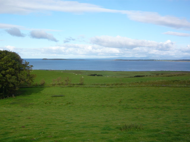
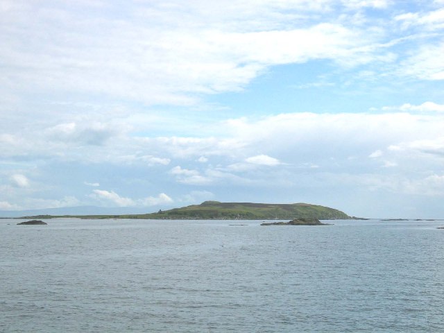
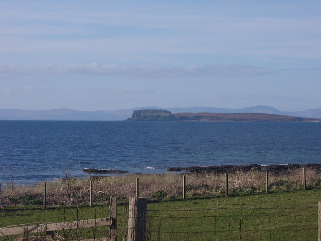
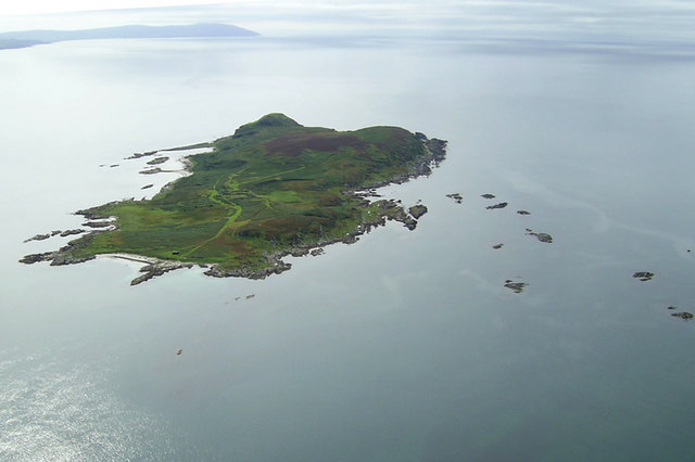
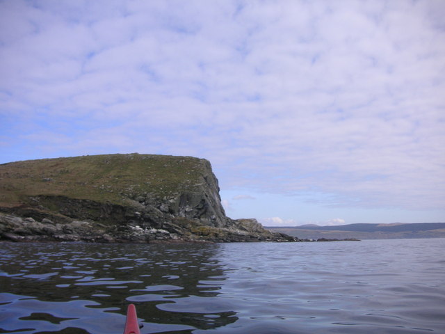
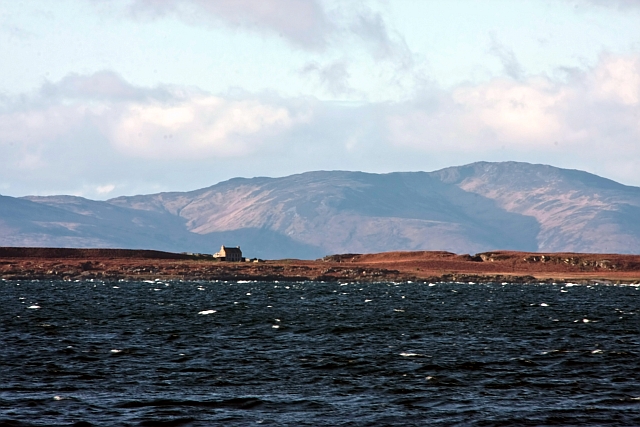
Àird Fhada is a small island located in Argyllshire, Scotland. Situated in the Inner Hebrides, it is surrounded by the Atlantic Ocean, offering breathtaking views and a tranquil atmosphere. The island spans an area of approximately 2 square miles and has a population of around 60 residents.

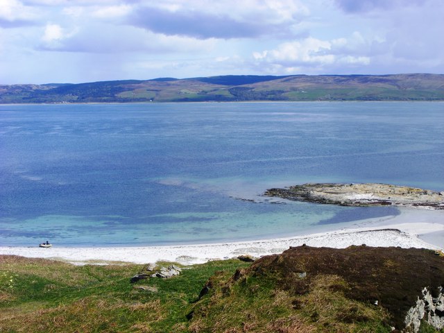
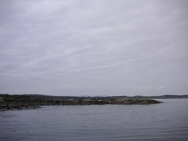
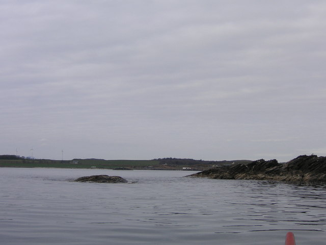
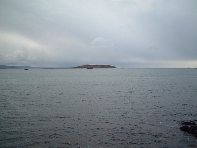
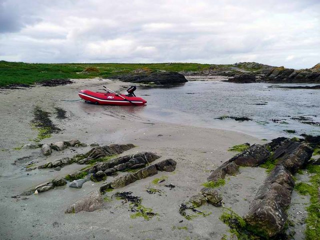
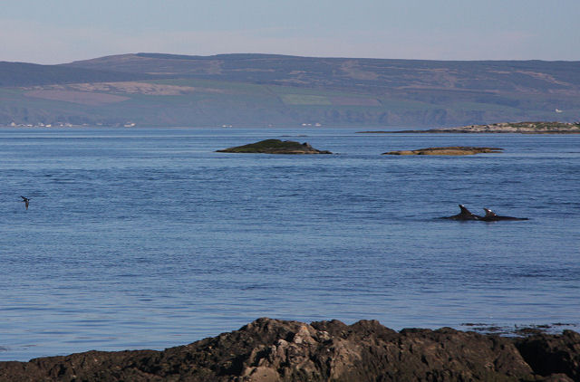
The landscape of Àird Fhada is characterized by rugged hills and stunning rocky cliffs, with lush greenery and wildflowers dotting the terrain. The island is home to a diverse range of wildlife, including seabirds, otters, and seals, making it a haven for nature enthusiasts and birdwatchers.

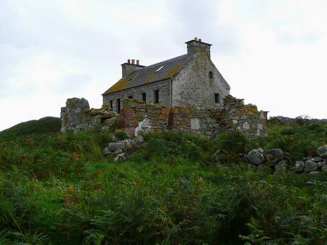
The island boasts a rich history, with archaeological sites dating back thousands of years. Visitors can explore ancient ruins and standing stones, providing a glimpse into the island's past. The ruins of a medieval castle can also be found on Àird Fhada, adding to its historical significance.

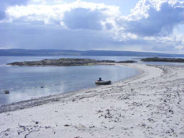
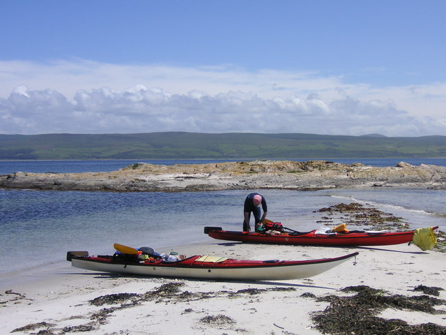
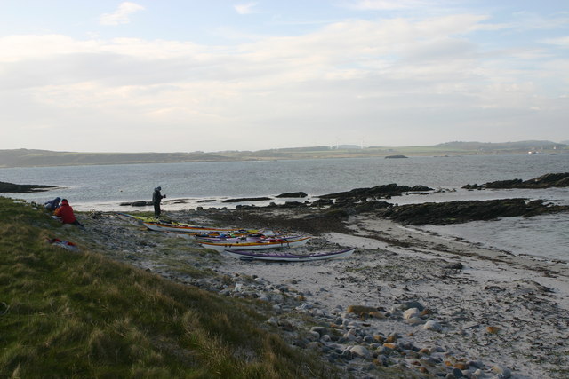
Despite its small size, Àird Fhada offers a variety of outdoor activities for visitors to enjoy. The island's coastline provides opportunities for fishing, kayaking, and sailing, while its hills and trails are perfect for hiking and biking. The island's peaceful atmosphere and unspoiled beauty make it an ideal destination for those seeking a tranquil retreat.

In terms of facilities, Àird Fhada has a small local shop, a post office, and a community center. However, for more extensive amenities, visitors can take a short ferry ride to the nearby mainland.

Overall, Àird Fhada is a hidden gem in Argyllshire, offering a unique blend of natural beauty, rich history, and a peaceful escape from the hustle and bustle of everyday life.

If you have any feedback on the listing, please let us know in the comments section below.

Àird Fhada Images

Images are sourced within 2km of 55.62969/-5.7463724 or Grid Reference NR6443. Thanks to Geograph Open Source API. All images are credited.

Cara with Gigha and Islay behind
Beach on the east coast of Cara Island Cara is an uninhabited island just south of Gigha. This image looks across the Sound of Gigha towards the Kintyre peninsula.
Beach on the east coast of Cara Island
Cara is an uninhabited island just south of Gigha. This image looks across the Sound of Gigha towards the Kintyre peninsula.
Beach on Cara Well sheltered beach protected by rock skerries on the east coast of Cara
Beach on Cara
Well sheltered beach protected by rock skerries on the east coast of Cara
Cara Island off Gigha
Cara Island taken from A'Chleit Cara Island with Isle of Islay in the background.
Cara Island taken from A'Chleit
Cara Island with Isle of Islay in the background.
Aird Fhada
Aird Fhada
Cara Island from the Air Aerial shot of Cara Island from NR6444
Cara Island from the Air
Aerial shot of Cara Island from NR6444
Skerries  ( North East Cara )
Skerries ( North East Cara )
Mull of Cara
Mull of Cara
Port na Cile ( Cara ) Gigha and Jura behind.
Port na Cile ( Cara )
Gigha and Jura behind.
Corr Eilean Corr Eilean. Gigha in background.
Corr Eilean
Corr Eilean. Gigha in background.
Mull of Cara Mull of Cara from south.
Mull of Cara
Mull of Cara from south.
Cara taken from Gigha's south pier My late grandfather was the pilot & quartermaster on the old MacBraynes steamer serving Islay and Gigha for 40 years, but in all that time he refused to ever set foot on Cara.  Apparently it's populated by Brownies - no, not small girls in brown dresses - rather the sprites they took the name from.  And no superstitious old salt worth his salt would ever take the risk of going there!
Cara taken from Gigha's south pier
My late grandfather was the pilot & quartermaster on the old MacBraynes steamer serving Islay and Gigha for 40 years, but in all that time he refused to ever set foot on Cara. Apparently it's populated by Brownies - no, not small girls in brown dresses - rather the sprites they took the name from. And no superstitious old salt worth his salt would ever take the risk of going there!
Landing at Port na Cille, Cara
Cara House, Cara Showing signs of habitation, with glazed windows.  Not sure if this is only a holiday home, or more permanent.
Cara House, Cara
Showing signs of habitation, with glazed windows. Not sure if this is only a holiday home, or more permanent.
Two dolphins off Gigha's southern coastline This pair of dolphins is heading south between the islands of Gigha and Cara.
Two dolphins off Gigha's southern coastline
This pair of dolphins is heading south between the islands of Gigha and Cara.
Sea kayak camp on the northern tip of Cara This was the second night's camp on a three day trip with Swaledale Outdoor Club, having crossed the sound from Gigha (seen on the horizon here) on a windy day early in the season.
Sea kayak camp on the northern tip of Cara
This was the second night's camp on a three day trip with Swaledale Outdoor Club, having crossed the sound from Gigha (seen on the horizon here) on a windy day early in the season.
Cara House, Cara Island Seen from A Chleit with Islay beyond.
Cara House, Cara Island
Seen from A Chleit with Islay beyond.
Show me another place!

Àird Fhada is located at Grid Ref: NR6443 (Lat: 55.62969, Lng: -5.7463724)

Unitary Authority: Argyll and Bute

Police Authority: Argyll and West Dunbartonshire

What 3 Words

///fuzzy.intrigued.shred. Near Campbeltown, Argyll & Bute

Related Wikis

Cara Island

Cara Island (Scottish Gaelic: Cara) is a small island which is located off the west coast of Kintyre in Scotland. == Geography and etymology == Cara is...

St Fionnlagh's Chapel

St Fionnlagh's Chapel (St Finla's Chapel) is a ruined medieval chapel on Cara Island, Argyll and Bute, Scotland. First recorded in the 15th century, the...

Ardminish

Ardminish (Scottish Gaelic: Aird Mhèanais) is the sole village on the Isle of Gigha in the Inner Hebrides, in Argyll and Bute, Scotland, and considered...

Achamore House

Achamore House is a mansion on the Isle of Gigha, Scotland. It was built in 1884 for Lt-Col William James Scarlett, and the extensive gardens were laid...

Nearby Amenities

Located within 500m of 55.62969,-5.7463724
Created By: dmgroom_coastlines
Lat/Long: 55.629988/-5.74859
The data included in this document is from www.openstreetmap.org. The data is made available under ODbL.

Have you been to Àird Fhada?

Leave your review of Àird Fhada below (or comments, questions and feedback).