Beckford, Little

Settlement in Gloucestershire Wychavon

England

Beckford, Little

A46 approaching Teddington Hands roundabout
A46 approaching Teddington Hands roundabout Credit: Peter Whatley

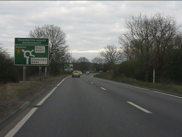
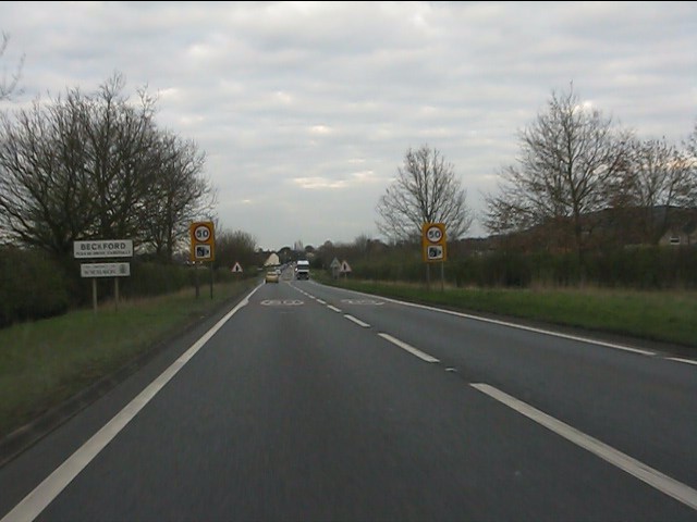
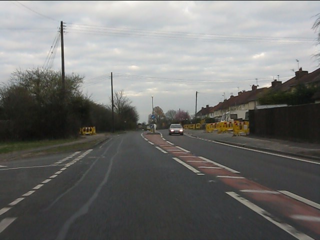
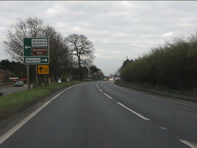
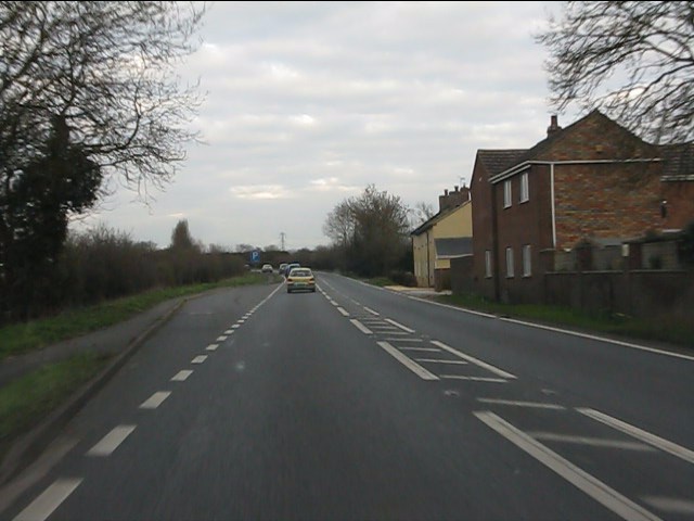
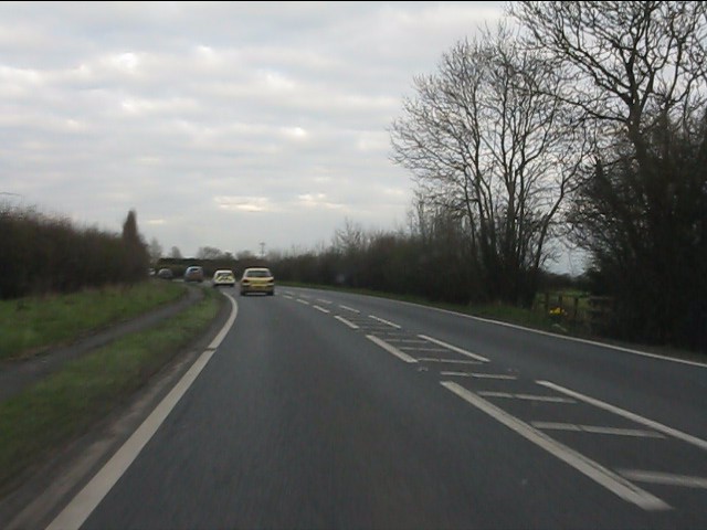
Beckford is a small village located in the district of Tewkesbury, in the county of Gloucestershire, England. Situated on the western edge of the Cotswolds, the village lies approximately six miles northeast of Tewkesbury and ten miles southwest of Evesham. It is positioned along the B4079 road, which connects the neighboring towns and villages.

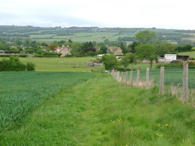
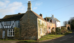
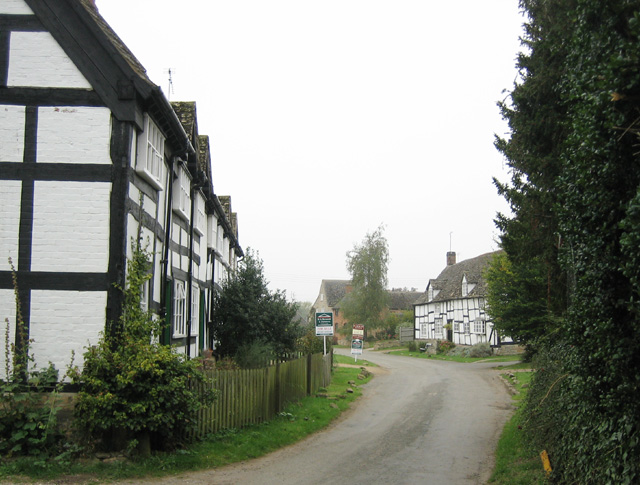
With a population of around 1,000 residents, Beckford maintains a quiet and close-knit community atmosphere. The village features a picturesque setting, surrounded by rolling countryside and farmland. The landscape is dotted with several historic buildings, including a medieval church, St. John the Baptist, which dates back to the 12th century.

Beckford offers a range of amenities to its residents and visitors. The village has a primary school, providing education for local children, and a village hall that hosts various community events and activities. There is also a post office, a convenience store, and a pub, the Beckford Inn, which serves as a popular meeting place for locals.

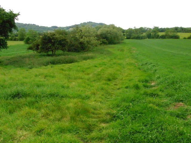
Nature enthusiasts can take advantage of the village's proximity to the Cotswolds Area of Outstanding Natural Beauty. The surrounding countryside offers opportunities for walking, cycling, and exploring the region's scenic landscapes. Additionally, the village benefits from its location near the M5 motorway and the nearby railway station in Ashchurch, providing convenient transport links to larger towns and cities in the region.

Overall, Beckford is a charming village that combines rural tranquility with easy access to amenities and natural beauty, making it an attractive place to live or visit in Gloucestershire.

If you have any feedback on the listing, please let us know in the comments section below.

Beckford, Little Images

Images are sourced within 2km of 52.014731/-2.038582 or Grid Reference SO9735. Thanks to Geograph Open Source API. All images are credited.

A46 approaching Teddington Hands roundabout
A46 at Teddington Hands roundabout
A46 north of The Elms
A46 entering Beckford Despite the signage, houses have been alongside for a while - albeit set back from the A46 a short way.
A46 entering Beckford
Despite the signage, houses have been alongside for a while - albeit set back from the A46 a short way.
A46 at the second turning for Beckford There are two left turns off the A46 at Little Beckford, effectively forming a small triangle.
A46 at the second turning for Beckford
There are two left turns off the A46 at Little Beckford, effectively forming a small triangle.
A46 approaching Beckford crossroads
A46 near Beckford
A46 near Beckford
A46 at Hill View cottages
A46 east of Hill View cottages
Great Washbourne church Great Washbourne church viewed from the north-west.
Great Washbourne church
Great Washbourne church viewed from the north-west.
Interior, Great Washbourne church The interior of St Mary's church at Great Washbourne
Interior, Great Washbourne church
The interior of St Mary's church at Great Washbourne
Remains of frescos, Great Washbourne church Remains of wall frescos in St Mary's church Great Washbourne.
Remains of frescos, Great Washbourne church
Remains of wall frescos in St Mary's church Great Washbourne.
Remains of frescos, Great Washbourne church Remains of wall frescos in St Mary's church Great Washbourne.
Remains of frescos, Great Washbourne church
Remains of wall frescos in St Mary's church Great Washbourne.
War Memorial, Great Washbourne church The names of three who fell in the Great War: A V Dyer, R Myatt, and A Shakespeare, on a war memorial on the wall of St Mary's church, Great Washbourne.
War Memorial, Great Washbourne church
The names of three who fell in the Great War: A V Dyer, R Myatt, and A Shakespeare, on a war memorial on the wall of St Mary's church, Great Washbourne.
Houses opposite Great Washbourne church
Bridleway bridge Footpath and bridleway part here ,south of Little Beckford.
Bridleway bridge
Footpath and bridleway part here ,south of Little Beckford.
View to Alstone Fields area Field-edge footpath.
View to Alstone Fields area
Field-edge footpath.
Footpath to Little Beckford
Show me another place!

Beckford, Little is located at Grid Ref: SO9735 (Lat: 52.014731, Lng: -2.038582)

Administrative County: Worcestershire

District: Wychavon

Police Authority: West Mercia

What 3 Words

///worldwide.provider.refutes. Near Bredon, Worcestershire

Related Wikis

Beckford, Worcestershire

Beckford is a small village on the main Cheltenham to Evesham Road, five miles north-east of Tewkesbury, on the Worcestershire—Gloucestershire border....

Beckford railway station

Beckford railway station was a station on the Midland Railway between Great Malvern and Evesham. It was designed by the architect George Hunt and opened...

Beckford Priory

Beckford Priory was a medieval house of Augustinian Canons, historically within Gloucestershire, presently in Worcestershire, England. It was founded in...

Beckford Nature Reserve

Beckford Nature Reserve is near Beckford, in Worcestershire, England, situated immediately north of the village. The nature reserve was created from a...

Great Washbourne

Great Washbourne is a village and former civil parish, now in the parish of Dumbleton, in the Tewkesbury district, in Gloucestershire, England, 6 miles...

Conderton

Conderton is a small hamlet in the Wychavon district of Worcestershire, England. == Toponymy == The name Conderton is derived from the Old English Cantware...

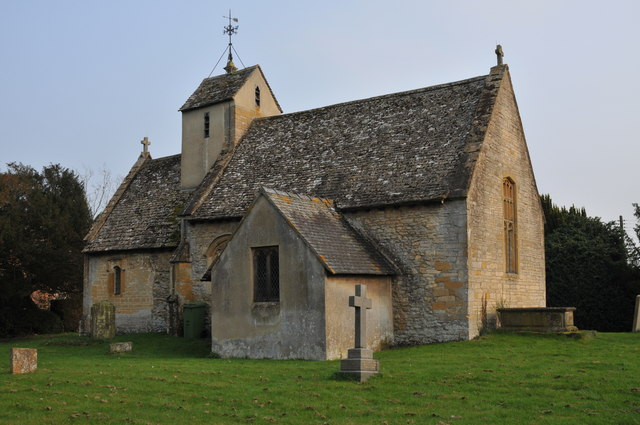
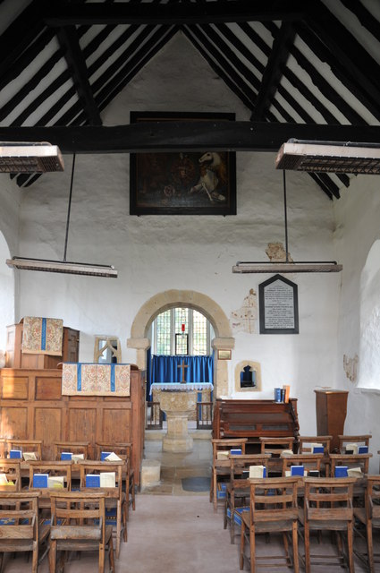
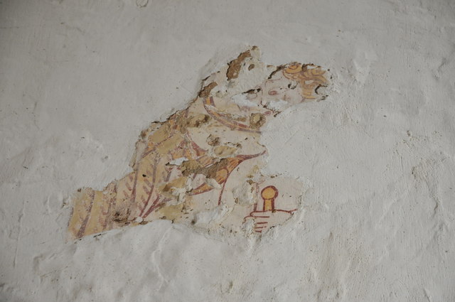
St Mary's Church, Little Washbourne

St Mary's Church, is a historic Anglican church at Little Washbourne in the civil parish of Dumbleton, Gloucestershire, England under the care of the Churches...

Little Washbourne

Little Washbourne is a village and former civil parish, now in the parish of Dumbleton, in the Tewkesbury district, in Gloucestershire, England, 6 miles...

Nearby Amenities

Located within 500m of 52.014731,-2.038582
Bus Stop
Back Lane
Bus: yes
Naptan AtcoCode: 2000G082600
Naptan Bearing: SE
Naptan CommonName: Back Lane
Naptan Indicator: Adj
Naptan NaptanCode: wocdgjtd
Naptan Street: Back Lane
Naptan Verified: no
Public Transport: platform
Source: naptan_import
Lat/Long: 52.0144446/-2.0364571
Bus Stop
Little Beckford Estate
Bus: yes
Naptan AtcoCode: 2000G084300
Naptan Bearing: NE
Naptan CommonName: Little Beckford Estate
Naptan Indicator: opp
Naptan NaptanCode: wocdgjwm
Naptan Street: Cheltenham Road
Naptan Verified: no
Public Transport: platform
Source: naptan_import
Lat/Long: 52.0136349/-2.0380447
Bus Stop
Little Beckford Estate
Bus: yes
Naptan AtcoCode: 2000G084301
Naptan Bearing: SW
Naptan CommonName: Little Beckford Estate
Naptan Indicator: adj
Naptan NaptanCode: wocdgjwp
Naptan Street: Cheltenham Road
Public Transport: platform
Shelter: yes
Source: naptan_import;survey
Lat/Long: 52.01366/-2.0370145
Bus Stop
Cheltenham Road
Bench: no
Bin: no
Bus: yes
Naptan AtcoCode: 2000G673010
Naptan Bearing: NE
Naptan CommonName: Cheltenham Road
Naptan Indicator: Adj
Naptan NaptanCode: wocdawam
Naptan Street: Cheltenham Road
Public Transport: platform
Shelter: no
Source: naptan_import;survey
Lat/Long: 52.014634/-2.0346137
Fixme: Does a public bridleway leave the read and head south-west from here?
Note: Definitive Statement and historic OS 25k map suggest Beckford BR 20 starts somewhere here.
Lat/Long: 52.0114454/-2.0357955
Barrier: stile
Lat/Long: 52.0163338/-2.0338827
Barrier: stile
Lat/Long: 52.0164121/-2.0339808
Bus Stop
Bench: no
Bin: no
Bus: yes
Public Transport: platform
Shelter: no
Lat/Long: 52.0144989/-2.0343486
Post Box
Collection Times: Mo-Fr 16:30; Sa 07:00
Post Box Mounting: telegraph_pole
Post Box Type: lamp
Ref: GL20 10
Royal Cypher: GVIR
Royal Cypher Wikidata: Q33102169
Lat/Long: 52.013556/-2.0370143
Waste Basket
Lat/Long: 52.0135773/-2.0370388
Bench
Lat/Long: 52.0136071/-2.0370763
Power: pole
Source: bing
Lat/Long: 52.0179817/-2.0350724
Power: pole
Source: bing
Lat/Long: 52.0174205/-2.0340425
Power: pole
Source: bing
Lat/Long: 52.0185248/-2.0364994
Power: pole
Source: bing
Lat/Long: 52.0183597/-2.0357242
Power: pole
Source: bing
Lat/Long: 52.016402/-2.0318967
Power: pole
Source: bing
Lat/Long: 52.0134256/-2.0317733
Power: pole
Source: bing
Lat/Long: 52.0131136/-2.0328918
Power: pole
Source: bing
Lat/Long: 52.0128297/-2.033954
Power: pole
Source: bing
Lat/Long: 52.0123113/-2.0344394
Power: pole
Source: bing
Lat/Long: 52.011121/-2.035515
Power: pole
Source: bing
Lat/Long: 52.0113472/-2.0383072
Power: pole
Source: bing
Lat/Long: 52.0110335/-2.0396161
Power: pole
Source: bing
Lat/Long: 52.010705/-2.0409411
Power: pole
Lat/Long: 52.0124359/-2.0349289
Blacksmiths Lane Beckford
Power: pole
Transformer: distribution
Voltage Primary: 11000
Lat/Long: 52.0125911/-2.0355941
Little Beckford
Power: pole
Transformer: distribution
Voltage Primary: 11000
Lat/Long: 52.0145709/-2.0351891
Location Transition: yes
Power: pole
Lat/Long: 52.0154631/-2.0364102
Beckford House
Location Transition: yes
Power: pole
Transformer: distribution
Voltage Primary: 11000
Lat/Long: 52.0164432/-2.0367582
Power: pole
Lat/Long: 52.0166133/-2.0362969
Power: pole
Lat/Long: 52.0170268/-2.0351489
Power: pole
Lat/Long: 52.0190554/-2.0393861
Power: pole
Lat/Long: 52.0188219/-2.038151
Back Lane Beckford
Power: pole
Transformer: distribution
Voltage Primary: 11000
Lat/Long: 52.0189444/-2.0388342
Power: pole
Lat/Long: 52.0186849/-2.0373791
Beckford Manor House
Power: pole
Transformer: distribution
Voltage Primary: 11000
Lat/Long: 52.0182784/-2.0368588
Power: pole
Lat/Long: 52.0159464/-2.0446908
Beckford Sewage Works
Power: pole
Transformer: distribution
Voltage Primary: 11000
Lat/Long: 52.015518/-2.04409
Power: pole
Lat/Long: 52.0167594/-2.0328469
Power: pole
Lat/Long: 52.0112337/-2.0368829
Thorne Villa
Power: pole
Transformer: distribution
Voltage Primary: 11000
Lat/Long: 52.0121412/-2.040398
Power: pole
Lat/Long: 52.0117479/-2.039364
Power: pole
Lat/Long: 52.0113389/-2.0383823
Power: pole
Lat/Long: 52.0116707/-2.0350295
The data included in this document is from www.openstreetmap.org. The data is made available under ODbL.

Have you been to Beckford, Little?

Leave your review of Beckford, Little below (or comments, questions and feedback).