Beckford

Settlement in Gloucestershire Wychavon

England

Beckford

A46 north of The Elms
A46 north of The Elms Credit: Peter Whatley

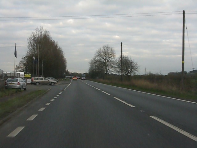
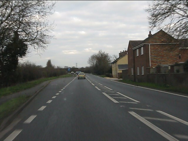
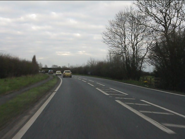
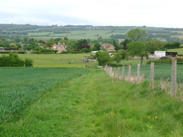
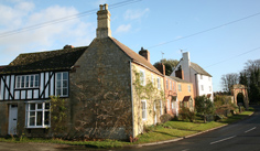
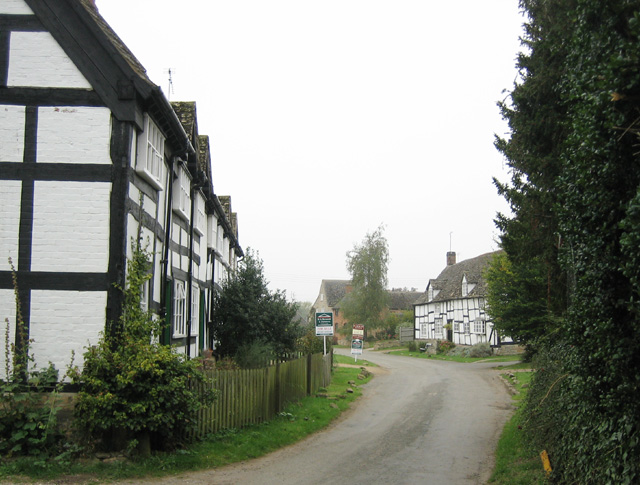
Beckford is a picturesque village located in the county of Gloucestershire, England. Situated at the foot of Bredon Hill, it lies approximately 10 miles north of the historic city of Cheltenham. The village is nestled amidst stunning countryside, offering breathtaking views of the surrounding landscape.

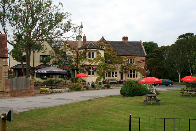
With a population of around 1,000 residents, Beckford is a close-knit community that exudes a welcoming and friendly atmosphere. It boasts a range of amenities, including a well-stocked village shop, a post office, and a charming 17th-century pub, which serves as a popular gathering spot for locals and visitors alike.

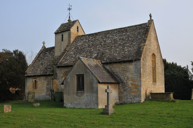
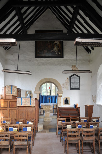
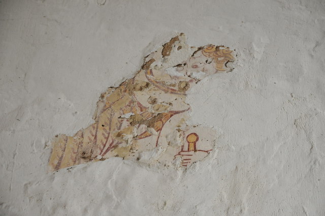
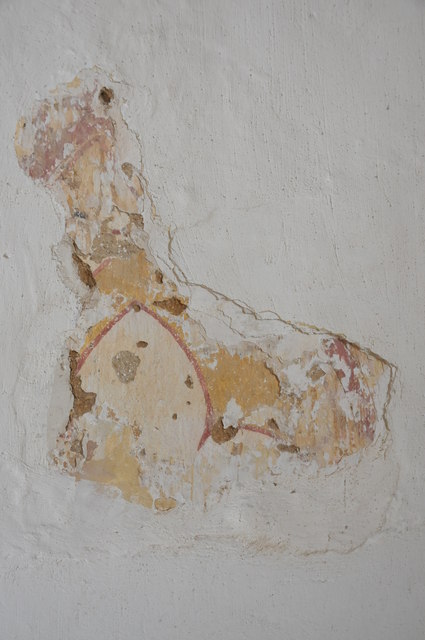
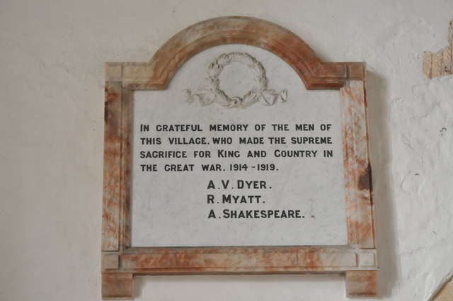
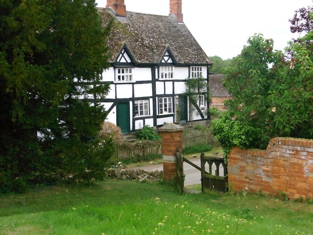
The village is home to St. John the Baptist Church, a Grade II listed building with a rich history dating back to the 12th century. The church's architectural beauty and serene surroundings make it a popular destination for tourists seeking a glimpse into Beckford's past.

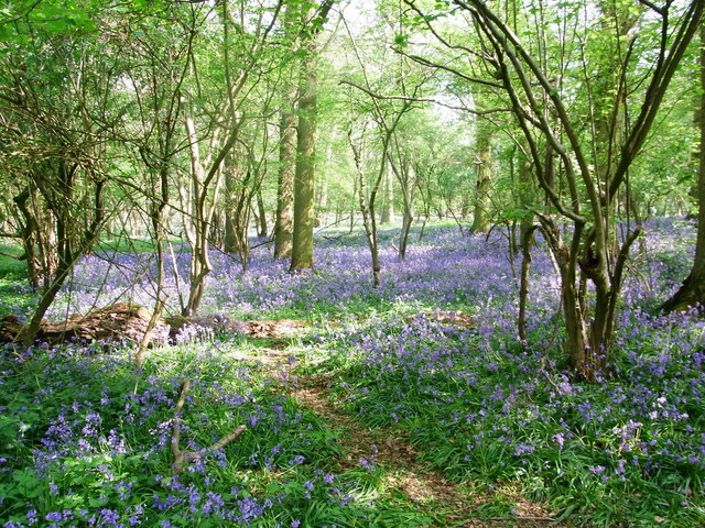
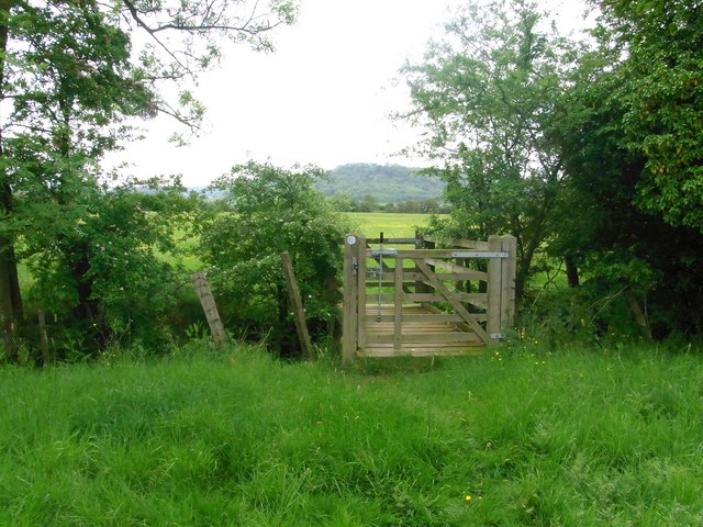
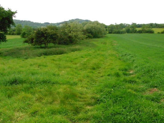
Nature enthusiasts are drawn to Beckford due to its proximity to Bredon Hill, a designated Area of Outstanding Natural Beauty. The hill offers numerous walking trails, allowing visitors to explore its diverse flora and fauna and enjoy panoramic views of the Worcestershire countryside.

Beckford's location provides easy access to nearby towns and cities, with the M5 motorway just a short drive away. This makes it an ideal base for those looking to explore the wider region, including the Cotswolds, Worcester, and Stratford-upon-Avon.

In summary, Beckford is a charming village in Gloucestershire, offering a tranquil setting, rich history, and close proximity to beautiful natural landscapes and cultural attractions.

If you have any feedback on the listing, please let us know in the comments section below.
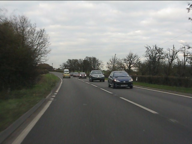
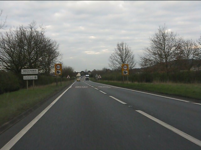
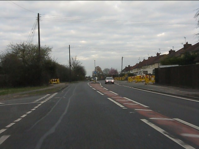
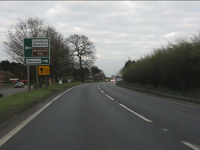
Beckford Images

Images are sourced within 2km of 52.019829/-2.038134 or Grid Reference SO9735. Thanks to Geograph Open Source API. All images are credited.

A46 north of The Elms
A46 entering Beckford Despite the signage, houses have been alongside for a while - albeit set back from the A46 a short way.
A46 entering Beckford
Despite the signage, houses have been alongside for a while - albeit set back from the A46 a short way.
A46 at the second turning for Beckford There are two left turns off the A46 at Little Beckford, effectively forming a small triangle.
A46 at the second turning for Beckford
There are two left turns off the A46 at Little Beckford, effectively forming a small triangle.
A46 approaching Beckford crossroads
A46 near Beckford
A46 near Beckford
A46 at Hill View cottages
A46 east of Hill View cottages
Great Washbourne church Great Washbourne church viewed from the north-west.
Great Washbourne church
Great Washbourne church viewed from the north-west.
Interior, Great Washbourne church The interior of St Mary's church at Great Washbourne
Interior, Great Washbourne church
The interior of St Mary's church at Great Washbourne
Remains of frescos, Great Washbourne church Remains of wall frescos in St Mary's church Great Washbourne.
Remains of frescos, Great Washbourne church
Remains of wall frescos in St Mary's church Great Washbourne.
Remains of frescos, Great Washbourne church Remains of wall frescos in St Mary's church Great Washbourne.
Remains of frescos, Great Washbourne church
Remains of wall frescos in St Mary's church Great Washbourne.
War Memorial, Great Washbourne church The names of three who fell in the Great War: A V Dyer, R Myatt, and A Shakespeare, on a war memorial on the wall of St Mary's church, Great Washbourne.
War Memorial, Great Washbourne church
The names of three who fell in the Great War: A V Dyer, R Myatt, and A Shakespeare, on a war memorial on the wall of St Mary's church, Great Washbourne.
Spring in Buckland Coppice A small but beautiful bluebell wood.
Spring in Buckland Coppice
A small but beautiful bluebell wood.
Houses opposite Great Washbourne church
Bridleway bridge Footpath and bridleway part here ,south of Little Beckford.
Bridleway bridge
Footpath and bridleway part here ,south of Little Beckford.
View to Alstone Fields area Field-edge footpath.
View to Alstone Fields area
Field-edge footpath.
Footpath to Little Beckford
The Beckford Inn Beside the A46.
The Beckford Inn
Beside the A46.
Show me another place!

Beckford is located at Grid Ref: SO9735 (Lat: 52.019829, Lng: -2.038134)

Administrative County: Worcestershire

District: Wychavon

Police Authority: West Mercia

What 3 Words

///passenger.revolts.guard. Near Bredon, Worcestershire

Related Wikis

Beckford Priory

Beckford Priory was a medieval house of Augustinian Canons, historically within Gloucestershire, presently in Worcestershire, England. It was founded in...

Beckford Nature Reserve

Beckford Nature Reserve is near Beckford, in Worcestershire, England, situated immediately north of the village. The nature reserve was created from a...

Beckford, Worcestershire

Beckford is a small village on the main Cheltenham to Evesham Road, five miles north-east of Tewkesbury, on the Worcestershire—Gloucestershire border....

Beckford railway station

Beckford railway station was a station on the Midland Railway between Great Malvern and Evesham. It was designed by the architect George Hunt and opened...

Conderton

Conderton is a small hamlet in the Wychavon district of Worcestershire, England. == Toponymy == The name Conderton is derived from the Old English Cantware...

Great Washbourne

Great Washbourne is a village and former civil parish, now in the parish of Dumbleton, in the Tewkesbury district, in Gloucestershire, England, 6 miles...

Grafton, Worcestershire

Grafton is a hamlet in Worcestershire, England, situated between the villages of Beckford and Ashton under Hill, south-east of Bredon Hill. The name Grafton...

Overbury

Overbury is a village and civil parish in Worcestershire, England, midway between Evesham and Tewkesbury south of Bredon Hill. The manor of Overbury was...

Nearby Amenities

Located within 500m of 52.019829,-2.038134
Post Box
Collection Times: Mo-Fr 16:45; Sa 11:15
Post Box Mounting: building
Post Box Type: wall
Ref: GL20 36
Royal Cypher: EIIR
Royal Cypher Wikidata: Q33102113
Lat/Long: 52.0205623/-2.0347359
Bus Stop
Church
Bus: yes
Naptan AtcoCode: 2000G082500
Naptan Bearing: NE
Naptan CommonName: Church
Naptan Indicator: Adj
Naptan Landmark: Church
Naptan NaptanCode: wocdgjta
Naptan Street: Main Street
Naptan Verified: no
Note: Position corrected June 2015.
Public Transport: platform
Source: naptan_import
Lat/Long: 52.0207169/-2.0345983
Bus Stop
Village Hall
Bus: yes
Naptan AtcoCode: 2000G501670
Naptan Bearing: N
Naptan CommonName: Village Hall
Naptan Indicator: Adj
Naptan NaptanCode: wocdamgm
Naptan Street: Main Street
Naptan Verified: no
Public Transport: platform
Source: naptan_import
Lat/Long: 52.0207825/-2.039444
Bus Stop
Village Hall
Bus: yes
Naptan AtcoCode: 2000G591670
Naptan Bearing: SE
Naptan CommonName: Village Hall
Naptan Indicator: opp
Naptan Landmark: Village Hall
Naptan NaptanCode: wocgdtpm
Naptan Street: Main Street
Naptan Verified: no
Public Transport: platform
Source: naptan_import
Lat/Long: 52.0204592/-2.0388064
Bus Stop
Church
Bus: yes
Naptan AtcoCode: 2000G673014
Naptan Bearing: W
Naptan CommonName: Church
Naptan Indicator: Opp
Naptan NaptanCode: wocdawda
Naptan Street: Main Street
Naptan Verified: no
Note: Position corrected June 2015.
Public Transport: platform
Source: naptan_import
Lat/Long: 52.0204216/-2.0352642
Recycling
Lat/Long: 52.0196357/-2.0324814
Milepost
HE Ref: 148507
Addr Locality: Beckford
Historic: milestone
Listed Status: Grade II
Source Listed Status: English Heritage
Lat/Long: 52.0199848/-2.0380846
Barrier: stile
Lat/Long: 52.0163338/-2.0338827
Barrier: stile
Lat/Long: 52.0164121/-2.0339808
HE Ref: 148504
Historic: tomb
Listed Status: Grade II
Source Listed Status: English Heritage
Lat/Long: 52.0207826/-2.0361056
HE Ref: 148502
Historic: tomb
Listed Status: Grade II
Source Listed Status: English Heritage
Lat/Long: 52.0208905/-2.0364192
HE Ref: 148503
Historic: tomb
Listed Status: Grade II
Source Listed Status: English Heritage
Lat/Long: 52.0209201/-2.036014
HE Ref: 148499
Addr Locality: Beckford
Barrier: gate_pier
Heritage: 2
Heritage Operator: Historic England
Listed Status: Grade II
Note: Location given by English Heritage incorrect.
Source Listed Status: English Heritage
Lat/Long: 52.0206854/-2.0350242
Barrier: kissing_gate
Lat/Long: 52.0211239/-2.0366054
HE Ref: 148499
Addr Locality: Beckford
Barrier: gate_pier
Heritage: 2
Heritage Operator: Historic England
Listed Status: Grade II
Note: Location given by English Heritage incorrect.
Source Listed Status: English Heritage
Lat/Long: 52.0207172/-2.0347743
Bench
Lat/Long: 52.0225924/-2.0355514
Bench
Lat/Long: 52.0226484/-2.036039
Public Bookcase
Defibrillator
Access: yes
Booth: K6
Colour: red
Defibrillator Location: inside old red phone box (now used as book exchange) next to church in Beckford
Disused Amenity: telephone
Emergency: defibrillator
Man Made: telephone_box
Public Bookcase Type: phone_box
Lat/Long: 52.0207109/-2.0346803
Waste Basket
Waste: dog_excrement
Lat/Long: 52.0227368/-2.0368544
Barrier: kissing_gate
Lat/Long: 52.0227651/-2.0368836
Defibrillator
Description: On exterior wall of Beckford Village Hall, to the right of the main entrance, when looking from Main Street.
Emergency: defibrillator
Outdoor: yes
Lat/Long: 52.02039/-2.0392189
Power: pole
Source: bing
Lat/Long: 52.0179817/-2.0350724
Power: pole
Source: bing
Lat/Long: 52.0174205/-2.0340425
Power: pole
Source: bing
Lat/Long: 52.0185248/-2.0364994
Power: pole
Source: bing
Lat/Long: 52.0183597/-2.0357242
Addr Housename: Olands
Addr Street: Main Street
Addr Village: Beckford
Lat/Long: 52.0198403/-2.037068
Location Transition: yes
Power: pole
Lat/Long: 52.0154631/-2.0364102
Beckford House
Location Transition: yes
Power: pole
Transformer: distribution
Voltage Primary: 11000
Lat/Long: 52.0164432/-2.0367582
Power: pole
Lat/Long: 52.0166133/-2.0362969
Power: pole
Lat/Long: 52.0170268/-2.0351489
Power: pole
Lat/Long: 52.0197363/-2.0319302
Power: pole
Lat/Long: 52.0191875/-2.0329106
Power: pole
Lat/Long: 52.0185966/-2.0341176
Power: pole
Lat/Long: 52.019426/-2.0447713
Power: pole
Lat/Long: 52.0196249/-2.0433605
Power: pole
Lat/Long: 52.0197685/-2.0423345
Beckford Village Hall
Power: pole
Transformer: distribution
Voltage Primary: 11000
Lat/Long: 52.0200367/-2.0394994
Power: pole
Lat/Long: 52.0198345/-2.0408868
Power: pole
Lat/Long: 52.0192147/-2.0402451
Power: pole
Lat/Long: 52.0190554/-2.0393861
Power: pole
Lat/Long: 52.0188219/-2.038151
Power: pole
Lat/Long: 52.0195721/-2.0417056
Beckford Home Farm
Power: pole
Transformer: distribution
Voltage Primary: 11000
Lat/Long: 52.0193806/-2.0411772
Back Lane Beckford
Power: pole
Transformer: distribution
Voltage Primary: 11000
Lat/Long: 52.0189444/-2.0388342
Power: pole
Lat/Long: 52.0186849/-2.0373791
Power: pole
Lat/Long: 52.0189886/-2.0361198
Power: pole
Lat/Long: 52.019303/-2.035865
Beckford
Power: pole
Transformer: distribution
Voltage Primary: 11000
Lat/Long: 52.0196245/-2.0355854
Beckford Manor House
Power: pole
Transformer: distribution
Voltage Primary: 11000
Lat/Long: 52.0182784/-2.0368588
Beckford Hall
Power: pole
Transformer: distribution
Voltage Primary: 11000
Lat/Long: 52.0219543/-2.0377164
Power: pole
Lat/Long: 52.022803/-2.0379739
Power: pole
Lat/Long: 52.0236984/-2.0382415
Power: pole
Lat/Long: 52.0167594/-2.0328469
The data included in this document is from www.openstreetmap.org. The data is made available under ODbL.

Have you been to Beckford?

Leave your review of Beckford below (or comments, questions and feedback).