Heisgeir

Island in Ross-shire

Scotland

Heisgeir

Weary worker by the B895 In fact just a boulder dressed up with helmet and overalls. A bit of light relief in this moorland landscape on a cold, wet, windy May day. Five years later, and still there <a href="https://www.geograph.org.uk/photo/5802841">NB4943 : Weary worker still by the B895 near Griais, Isle of Lewis</a>.
Weary worker by the B895 Credit: M J Richardson

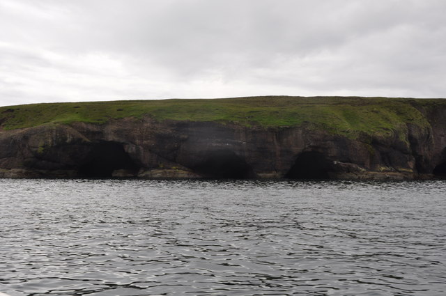
Heisgeir is a small island located off the west coast of Ross-shire, in the Highlands of Scotland. With an area of around 1.5 square kilometers, it is a relatively small landmass that is part of the Outer Hebrides archipelago. The island is uninhabited and boasts stunning natural landscapes, making it a popular destination for nature enthusiasts and birdwatchers.

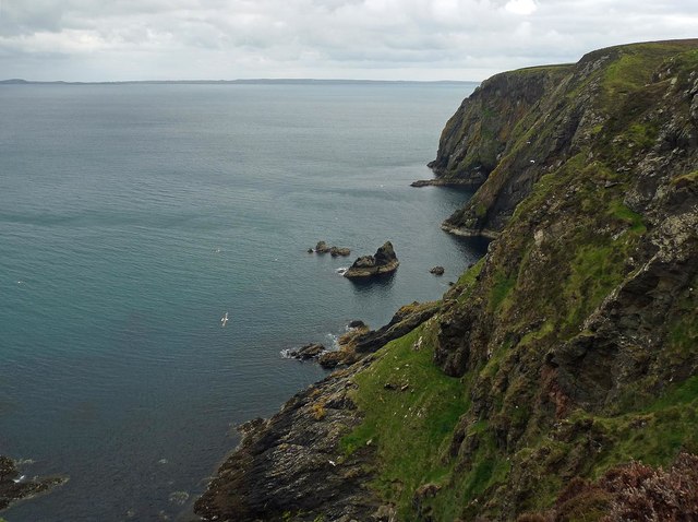
Heisgeir is renowned for its rich biodiversity, particularly its birdlife. The island is home to a variety of seabirds, including puffins, guillemots, razorbills, and kittiwakes. These birds nest on the cliffs and rocky outcrops that line the island's shores, creating a spectacle for visitors.

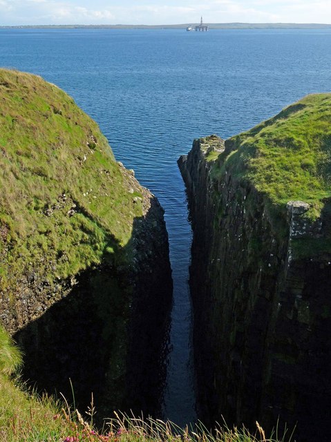
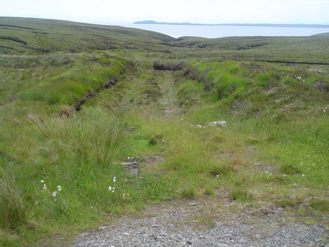
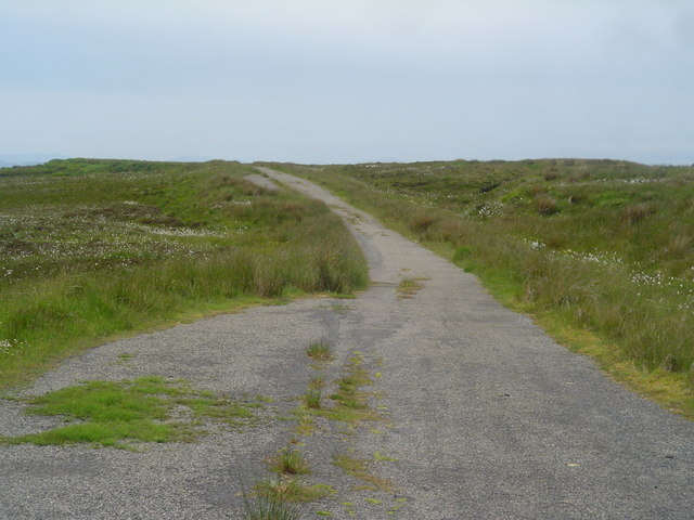
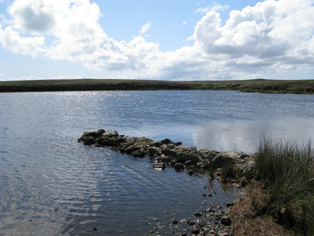
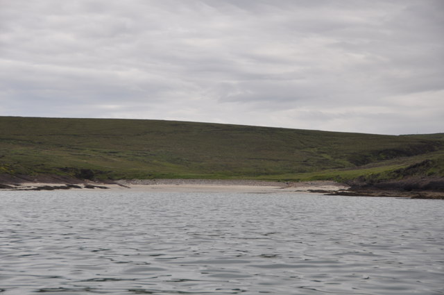
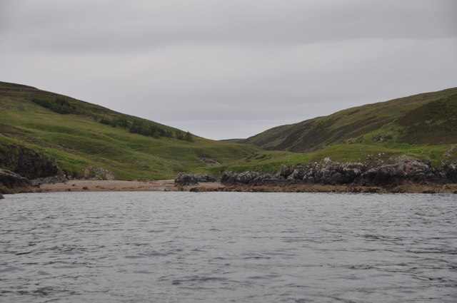
The island's coastline is rugged and picturesque, with towering cliffs and hidden coves. It is an ideal place for coastal walks and exploring the shoreline. Heisgeir also offers opportunities for fishing and boating in its surrounding waters.

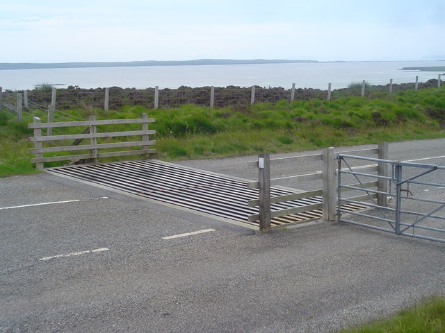
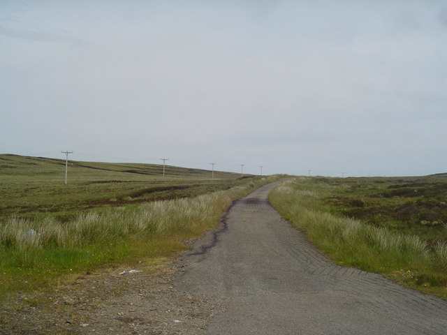
Access to Heisgeir is mainly by boat, with several tour operators offering trips to the island. Visitors can experience the tranquility of the island and immerse themselves in its natural beauty. The absence of permanent human settlement contributes to the sense of remoteness and wilderness that Heisgeir offers.

In conclusion, Heisgeir is a small uninhabited island off the coast of Ross-shire, boasting diverse birdlife and stunning natural landscapes. It is a haven for nature lovers seeking a peaceful and unspoiled environment.

If you have any feedback on the listing, please let us know in the comments section below.
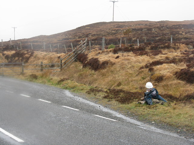
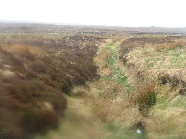
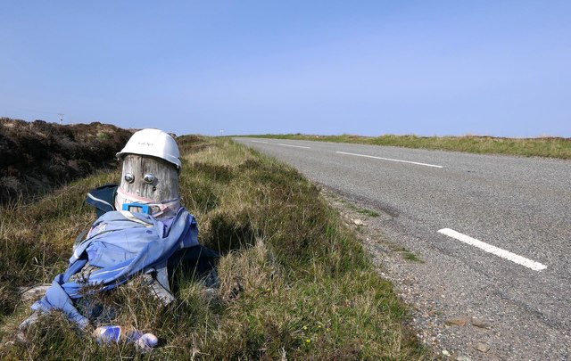
Heisgeir Images

Images are sourced within 2km of 58.308853/-6.2395444 or Grid Reference NB5143. Thanks to Geograph Open Source API. All images are credited.

Weary worker by the B895 In fact just a boulder dressed up with helmet and overalls. A bit of light relief in this moorland landscape on a cold, wet, windy May day. Five years later, and still there <a href="https://www.geograph.org.uk/photo/5802841">NB4943 : Weary worker still by the B895 near Griais, Isle of Lewis</a>.
Weary worker by the B895
In fact just a boulder dressed up with helmet and overalls. A bit of light relief in this moorland landscape on a cold, wet, windy May day. Five years later, and still there NB4943 : Weary worker still by the B895 near Griais, Isle of Lewis.
Moorland on the flanks of Beinn Iobheir An uninspiring view of the Lewis landscape on a cold, wet, windy day.
Moorland on the flanks of Beinn Iobheir
An uninspiring view of the Lewis landscape on a cold, wet, windy day.
Weary worker still by the B895 near Griais, Isle of Lewis He's been hard at work for over five years now: <a href="https://www.geograph.org.uk/photo/3467875">NB4943 : Weary worker by the B895</a>.

The B895 runs between the A857, to the north of Stornoway, and New Tolsta.
Weary worker still by the B895 near Griais, Isle of Lewis
He's been hard at work for over five years now: NB4943 : Weary worker by the B895. The B895 runs between the A857, to the north of Stornoway, and New Tolsta.
Geo below Cnoc nan Caorach, Isle of Lewis The oil rig in the distance is the Transocean Winner which ran aground on the west side of Lewis.  It is shown in Broad Bay/Loch a Tuath to where it has been towed for assessment before transportation to a repair yard.
Geo below Cnoc nan Caorach, Isle of Lewis
The oil rig in the distance is the Transocean Winner which ran aground on the west side of Lewis. It is shown in Broad Bay/Loch a Tuath to where it has been towed for assessment before transportation to a repair yard.
Coastline, Bearn Iorach an Toa, Isle of Lewis The Eye Peninsula can be seen along the horizon.
Coastline, Bearn Iorach an Toa, Isle of Lewis
The Eye Peninsula can be seen along the horizon.
Sron Garadh Ruairidh, Isle of Lewis The OS Name Book of 1848-1852's entry for Sron Garadh Ruairidh reads, "a small but bold and steep headland on the sea shore. Signifies Nose of Roderick's Dyke".  The 1st Edition OS map of 1853 shows a dyke running from Loch Ben Tearabert to the edge of the cliff above Sron Garadh Ruairidh.
Sron Garadh Ruairidh, Isle of Lewis
The OS Name Book of 1848-1852's entry for Sron Garadh Ruairidh reads, "a small but bold and steep headland on the sea shore. Signifies Nose of Roderick's Dyke". The 1st Edition OS map of 1853 shows a dyke running from Loch Ben Tearabert to the edge of the cliff above Sron Garadh Ruairidh.
Coastline, Bearn Iorach an Toa, Isle of Lewis The Eye Peninsula can be seen along the horizon.
Coastline, Bearn Iorach an Toa, Isle of Lewis
The Eye Peninsula can be seen along the horizon.
Peat cutting, Bhinndean, Isle of Lewis Looking across Broad Bay/Loch a Tuath towards the Eye Peninsula.
Peat cutting, Bhinndean, Isle of Lewis
Looking across Broad Bay/Loch a Tuath towards the Eye Peninsula.
Cattle Grid at Gress This cattle grid is on the B895 between Gress and Tolsta. On the horizon is the Eye Peninsula across Broad Bay. The grid may look sheep proof but they have been known to cross them by staying on the edge.
Cattle Grid at Gress
This cattle grid is on the B895 between Gress and Tolsta. On the horizon is the Eye Peninsula across Broad Bay. The grid may look sheep proof but they have been known to cross them by staying on the edge.
Old Tolsta Road This is the old road between Gress and Tolsta. Due to the low level of roadside development in some areas many sections of road are simply left intact when they are replaced by wider, straighter roads. However, they are not normally maintained afterwards so fall into a state of disrepair as you can see from the grass growing through the centre of the bitmac.
Old Tolsta Road
This is the old road between Gress and Tolsta. Due to the low level of roadside development in some areas many sections of road are simply left intact when they are replaced by wider, straighter roads. However, they are not normally maintained afterwards so fall into a state of disrepair as you can see from the grass growing through the centre of the bitmac.
The old single-track road to Tolsta This road was formerly the main road to the village of Tolsta. It has been bypassed by the new double-track B895 and has fallen into disrepair. To the left are the electric pylons which carry the power supply to the village and behind them a more ancient source of power in the form of some disused peatbanks.
The old single-track road to Tolsta
This road was formerly the main road to the village of Tolsta. It has been bypassed by the new double-track B895 and has fallen into disrepair. To the left are the electric pylons which carry the power supply to the village and behind them a more ancient source of power in the form of some disused peatbanks.
Peat track leading into moorland east of B895 This is a section of peat track used to give tractors access to the peatbanks to collect the dried peats. Tractors are only used to transport the peats home, no other machines are traditionally used in cutting peats. On the horizon is the Eye Peninsula or Point as it is locally known.
Peat track leading into moorland east of B895
This is a section of peat track used to give tractors access to the peatbanks to collect the dried peats. Tractors are only used to transport the peats home, no other machines are traditionally used in cutting peats. On the horizon is the Eye Peninsula or Point as it is locally known.
Passing places on old Tolsta road This photo shows a section of the disused Gress-Tolsta road. It is a great detour from the main road to Tolsta and a wide variety of wildlife can be observed from it. It is a popular location for over night stays in motorhomes and caravans.
Passing places on old Tolsta road
This photo shows a section of the disused Gress-Tolsta road. It is a great detour from the main road to Tolsta and a wide variety of wildlife can be observed from it. It is a popular location for over night stays in motorhomes and caravans.
Glen Tolsta The valley leading into the sea here is Glen Tolsta. The house is one of the few houses in the village of Glen Tolsta, although several new houses are being built there at the moment. The small beach is very pleasant and there are several interesting ruins to explore.
Glen Tolsta
The valley leading into the sea here is Glen Tolsta. The house is one of the few houses in the village of Glen Tolsta, although several new houses are being built there at the moment. The small beach is very pleasant and there are several interesting ruins to explore.
Loch Bacabhat
Loch Bacabhat
Sialabhig Mor From Seaward
Sialabhig Mor
From Seaward
Port Bun a' Ghlinne Glen Tolsta from seaward
Port Bun a' Ghlinne
Glen Tolsta from seaward
Three Caves This coast has numerous caves, but it is unusual to see three side by side in this location near to Creag Fhraoich. (Heather Crag)
Three Caves
This coast has numerous caves, but it is unusual to see three side by side in this location near to Creag Fhraoich. (Heather Crag)
Show me another place!

Heisgeir is located at Grid Ref: NB5143 (Lat: 58.308853, Lng: -6.2395444)

Unitary Authority: Na h-Eileanan an Iar

Police Authority: Highlands and Islands

What 3 Words

///section.shippers.casual. Near North Tolsta, Na h-Eileanan Siar

Related Wikis

Gress

Gress (Scottish Gaelic: Griais), a hamlet on the Isle of Lewis in Scotland, is adjacent to the larger village of Back. Gress is within the parish of Stornoway...

Back, Lewis

Back (Scottish Gaelic: Am Bac) is a district and a village on the east coast of the Isle of Lewis in the Outer Hebrides, Scotland, situated on a coastal...

North Tolsta

North Tolsta (Scottish Gaelic: Tolastadh bho Thuath) is a village in the Scottish Outer Hebrides, on the east side of the Isle of Lewis. North Tolsta is...

New Tolsta

New Tolsta (Scottish Gaelic: Baile Ùr Tholastaidh) is a village on the Isle of Lewis in the Outer Hebrides, Scotland. New Tolsta is within the parish of...

Breivig

Breivig (Scottish Gaelic: Brèibhig) is a village on Lewis in the Outer Hebrides, Scotland. Breivig is within the parish of Stornoway.According to Magne...

Coll, Lewis

Coll (Scottish Gaelic: Col) is a farming settlement near Stornoway, on the Isle of Lewis in the Outer Hebrides, Scotland. Coll is situated on the B895...

Broad Bay, Lewis

Broad Bay (Scottish Gaelic: Loch a Tuath, meaning "north loch") is a bay which is situated on the coast of Isle of Lewis, and separates Back and Point...

Portnaguran

Portnaguran (Scottish Gaelic: Port nan Giùran) is a settlement situated within Point, on the Isle of Lewis, in the Outer Hebrides, Scotland. Portnaguran...

Have you been to Heisgeir?

Leave your review of Heisgeir below (or comments, questions and feedback).