Earabhaig

Coastal Feature, Headland, Point in Ross-shire

Scotland

Earabhaig

Geo below Cnoc nan Caorach, Isle of Lewis The oil rig in the distance is the Transocean Winner which ran aground on the west side of Lewis.  It is shown in Broad Bay/Loch a Tuath to where it has been towed for assessment before transportation to a repair yard.
Geo below Cnoc nan Caorach, Isle of Lewis Credit: Claire Pegrum

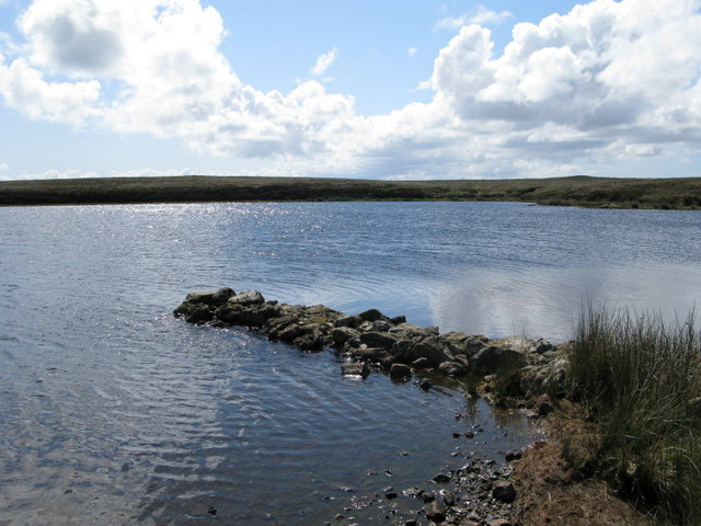
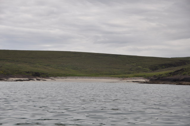
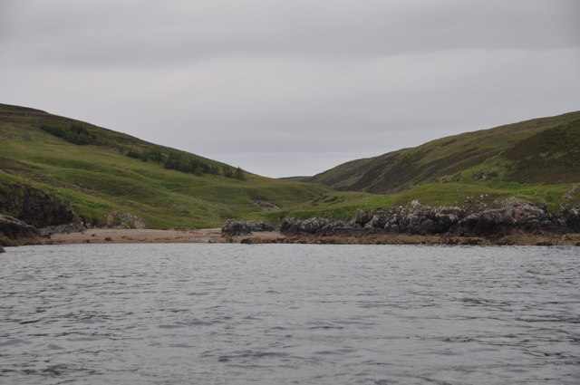
Earabhaig is a prominent coastal feature located in Ross-shire, Scotland. It is a headland or point that stretches out into the North Atlantic Ocean, offering breathtaking views of the surrounding landscape and sea. Situated on the western coast of Scotland, this area is known for its rugged beauty and dramatic cliffs.

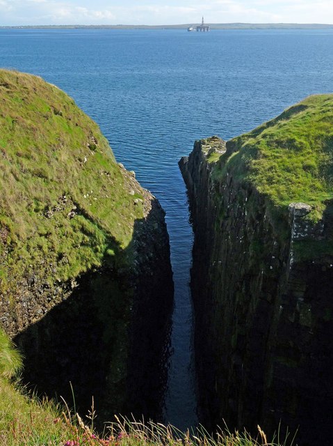
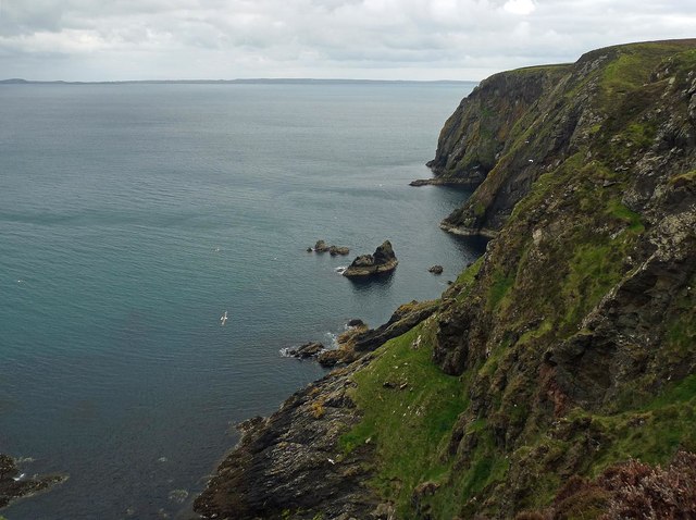
The headland of Earabhaig is characterized by its rocky terrain, with steep slopes leading down to the shoreline. The cliffs are comprised of various types of rock, including sandstone and granite, which have been shaped by the relentless force of the ocean over thousands of years. These geological formations provide a natural habitat for a variety of seabirds, making it a popular spot for birdwatching enthusiasts.

The location of Earabhaig also offers a vantage point to witness the power of the North Atlantic Ocean. Waves crash against the cliffs, sending sprays of water high into the air. This spectacle, coupled with the distant horizon stretching out to the endless sea, creates a sense of awe and wonder.

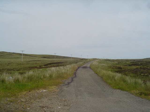
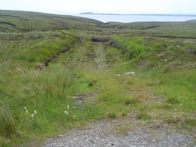
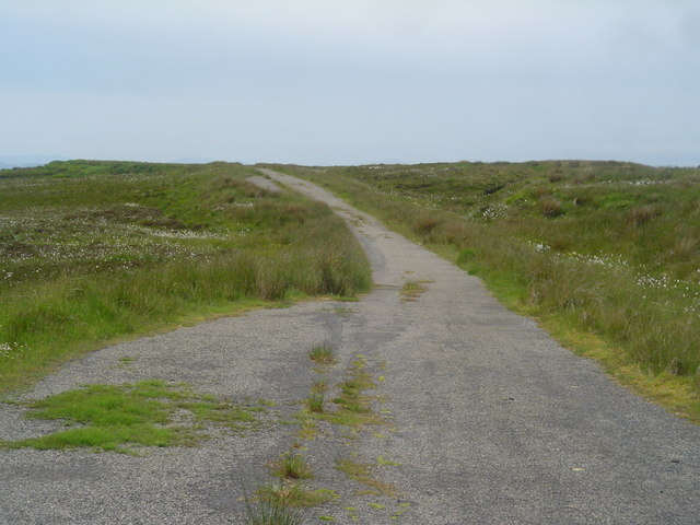
Access to Earabhaig is facilitated by a well-maintained footpath that winds its way along the coastline. Visitors can enjoy a leisurely walk, taking in the stunning views and breathing in the fresh sea air. It is important to note that caution should be exercised when exploring the headland, as the terrain can be treacherous, particularly during stormy weather.

In conclusion, Earabhaig is a captivating coastal feature in Ross-shire, Scotland. With its striking cliffs, abundant wildlife, and panoramic vistas, it offers a memorable experience for nature lovers and those seeking a connection with the untamed beauty of the North Atlantic Ocean.

If you have any feedback on the listing, please let us know in the comments section below.

Earabhaig Images

Images are sourced within 2km of 58.313327/-6.2377568 or Grid Reference NB5143. Thanks to Geograph Open Source API. All images are credited.

Geo below Cnoc nan Caorach, Isle of Lewis The oil rig in the distance is the Transocean Winner which ran aground on the west side of Lewis.  It is shown in Broad Bay/Loch a Tuath to where it has been towed for assessment before transportation to a repair yard.
Geo below Cnoc nan Caorach, Isle of Lewis
The oil rig in the distance is the Transocean Winner which ran aground on the west side of Lewis. It is shown in Broad Bay/Loch a Tuath to where it has been towed for assessment before transportation to a repair yard.
Coastline, Bearn Iorach an Toa, Isle of Lewis The Eye Peninsula can be seen along the horizon.
Coastline, Bearn Iorach an Toa, Isle of Lewis
The Eye Peninsula can be seen along the horizon.
Sron Garadh Ruairidh, Isle of Lewis The OS Name Book of 1848-1852's entry for Sron Garadh Ruairidh reads, "a small but bold and steep headland on the sea shore. Signifies Nose of Roderick's Dyke".  The 1st Edition OS map of 1853 shows a dyke running from Loch Ben Tearabert to the edge of the cliff above Sron Garadh Ruairidh.
Sron Garadh Ruairidh, Isle of Lewis
The OS Name Book of 1848-1852's entry for Sron Garadh Ruairidh reads, "a small but bold and steep headland on the sea shore. Signifies Nose of Roderick's Dyke". The 1st Edition OS map of 1853 shows a dyke running from Loch Ben Tearabert to the edge of the cliff above Sron Garadh Ruairidh.
Coastline, Bearn Iorach an Toa, Isle of Lewis The Eye Peninsula can be seen along the horizon.
Coastline, Bearn Iorach an Toa, Isle of Lewis
The Eye Peninsula can be seen along the horizon.
Peat cutting, Bhinndean, Isle of Lewis Looking across Broad Bay/Loch a Tuath towards the Eye Peninsula.
Peat cutting, Bhinndean, Isle of Lewis
Looking across Broad Bay/Loch a Tuath towards the Eye Peninsula.
Former peat cutting area above Gleann Tholastaidh, Isle of Lewis Looking towards the Tolsta community wind turbine.
Former peat cutting area above Gleann Tholastaidh, Isle of Lewis
Looking towards the Tolsta community wind turbine.
Abandoned car on peat cutting area above Gleann Tholastaidh, Isle of Lewis Gleann Tholastaidh is the name of a glen which runs between Loch Ionadagro and the sea.  It is also the name of a hamlet of houses at the seaward end of the glen.  The house in the photo is one of those houses.
Abandoned car on peat cutting area above Gleann Tholastaidh, Isle of Lewis
Gleann Tholastaidh is the name of a glen which runs between Loch Ionadagro and the sea. It is also the name of a hamlet of houses at the seaward end of the glen. The house in the photo is one of those houses.
The B895 at Gleann Tholastaidh, Isle of Lewis Anyone mislaid some trainers?  Size 13.

Looking towards the Tolsta community wind turbine.

The B895 runs between the A857, to the north of Stornoway, and New Tolsta.
The B895 at Gleann Tholastaidh, Isle of Lewis
Anyone mislaid some trainers? Size 13. Looking towards the Tolsta community wind turbine. The B895 runs between the A857, to the north of Stornoway, and New Tolsta.
B895 and Tolsta Filter Station This shows the main road to Tolsta climbing out of Glen Tolsta towards the village. The slightly oriental looking building nestled into the hillside is the tolsta filter station which provides high quality drinking water to the surrounding area and is fed by Loch Ionadagro <a href="https://www.geograph.org.uk/gridref/NB5146">NB5146</a>.
B895 and Tolsta Filter Station
This shows the main road to Tolsta climbing out of Glen Tolsta towards the village. The slightly oriental looking building nestled into the hillside is the tolsta filter station which provides high quality drinking water to the surrounding area and is fed by Loch Ionadagro NB5146.
Old Tolsta Road This is the old road between Gress and Tolsta. Due to the low level of roadside development in some areas many sections of road are simply left intact when they are replaced by wider, straighter roads. However, they are not normally maintained afterwards so fall into a state of disrepair as you can see from the grass growing through the centre of the bitmac.
Old Tolsta Road
This is the old road between Gress and Tolsta. Due to the low level of roadside development in some areas many sections of road are simply left intact when they are replaced by wider, straighter roads. However, they are not normally maintained afterwards so fall into a state of disrepair as you can see from the grass growing through the centre of the bitmac.
The old single-track road to Tolsta This road was formerly the main road to the village of Tolsta. It has been bypassed by the new double-track B895 and has fallen into disrepair. To the left are the electric pylons which carry the power supply to the village and behind them a more ancient source of power in the form of some disused peatbanks.
The old single-track road to Tolsta
This road was formerly the main road to the village of Tolsta. It has been bypassed by the new double-track B895 and has fallen into disrepair. To the left are the electric pylons which carry the power supply to the village and behind them a more ancient source of power in the form of some disused peatbanks.
Peat track leading into moorland east of B895 This is a section of peat track used to give tractors access to the peatbanks to collect the dried peats. Tractors are only used to transport the peats home, no other machines are traditionally used in cutting peats. On the horizon is the Eye Peninsula or Point as it is locally known.
Peat track leading into moorland east of B895
This is a section of peat track used to give tractors access to the peatbanks to collect the dried peats. Tractors are only used to transport the peats home, no other machines are traditionally used in cutting peats. On the horizon is the Eye Peninsula or Point as it is locally known.
Passing places on old Tolsta road This photo shows a section of the disused Gress-Tolsta road. It is a great detour from the main road to Tolsta and a wide variety of wildlife can be observed from it. It is a popular location for over night stays in motorhomes and caravans.
Passing places on old Tolsta road
This photo shows a section of the disused Gress-Tolsta road. It is a great detour from the main road to Tolsta and a wide variety of wildlife can be observed from it. It is a popular location for over night stays in motorhomes and caravans.
Glen Tolsta The valley leading into the sea here is Glen Tolsta. The house is one of the few houses in the village of Glen Tolsta, although several new houses are being built there at the moment. The small beach is very pleasant and there are several interesting ruins to explore.
Glen Tolsta
The valley leading into the sea here is Glen Tolsta. The house is one of the few houses in the village of Glen Tolsta, although several new houses are being built there at the moment. The small beach is very pleasant and there are several interesting ruins to explore.
Loch Bacabhat
Loch Bacabhat
New Moorland Road to Loch Ionadagro Tolsta Glen main road in distance
New Moorland Road to Loch Ionadagro
Tolsta Glen main road in distance
Sialabhig Mor From Seaward
Sialabhig Mor
From Seaward
Port Bun a' Ghlinne Glen Tolsta from seaward
Port Bun a' Ghlinne
Glen Tolsta from seaward
Show me another place!

Earabhaig is located at Grid Ref: NB5143 (Lat: 58.313327, Lng: -6.2377568)

Unitary Authority: Na h-Eileanan an Iar

Police Authority: Highlands and Islands

What 3 Words

///prestige.moats.hiked. Near North Tolsta, Na h-Eileanan Siar

Related Wikis

Nearby Amenities

Located within 500m of 58.313327,-6.2377568
Created By: dmgroom_coastlines
Lat/Long: 58.31458/-6.23384
The data included in this document is from www.openstreetmap.org. The data is made available under ODbL.

Have you been to Earabhaig?

Leave your review of Earabhaig below (or comments, questions and feedback).