Eilean Bhrìde

Island in Argyllshire

Scotland

Eilean Bhrìde

Garbh-sgeir Mhor This skerry guards the southern entrance to the Ardmore Islands inshore passage.
Garbh-sgeir Mhor Credit: Gordon Brown

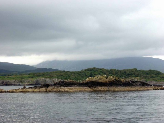
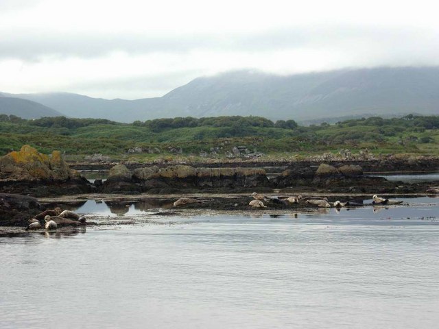
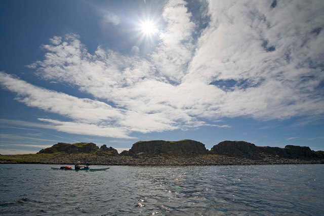
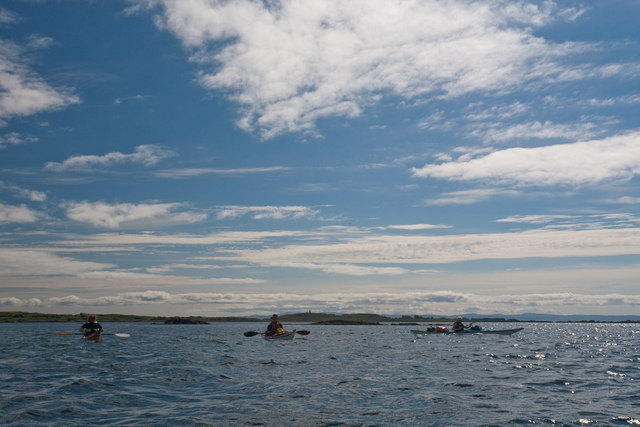
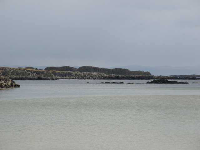
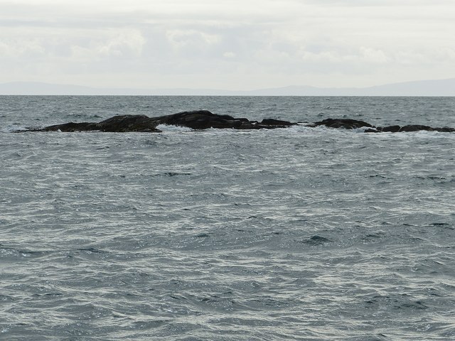
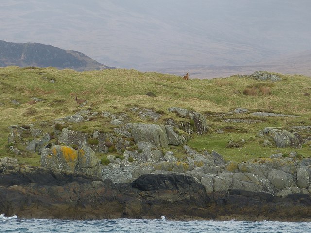
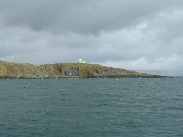
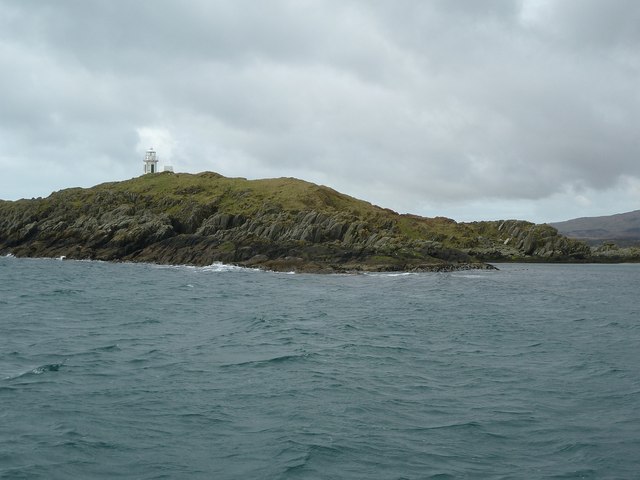
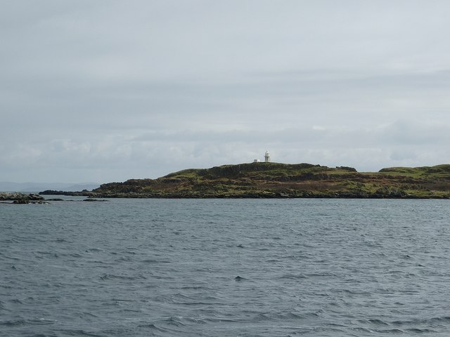
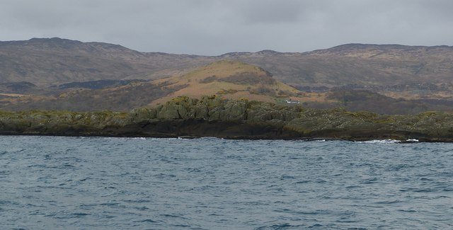
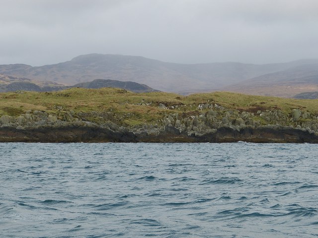
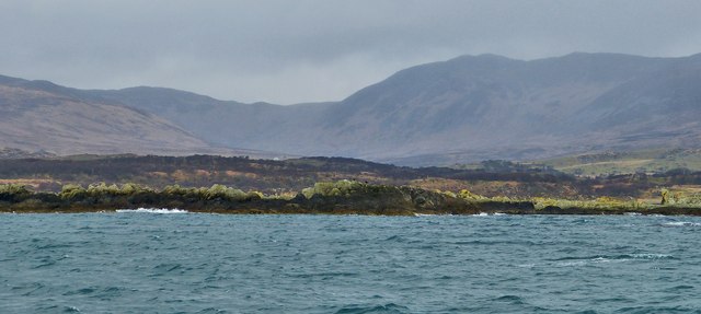
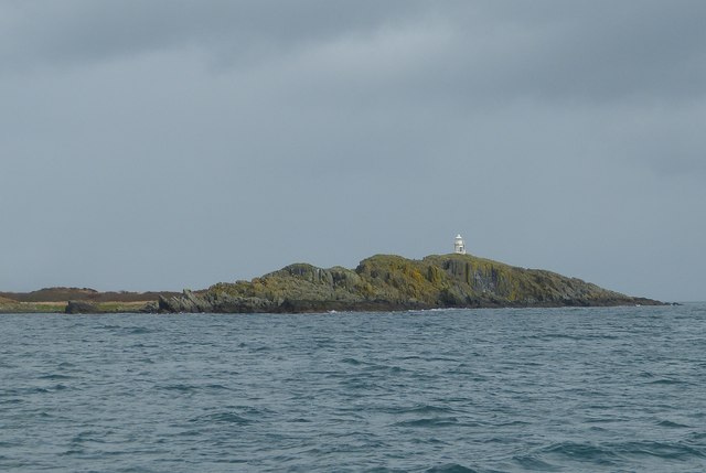
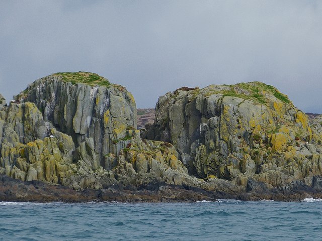
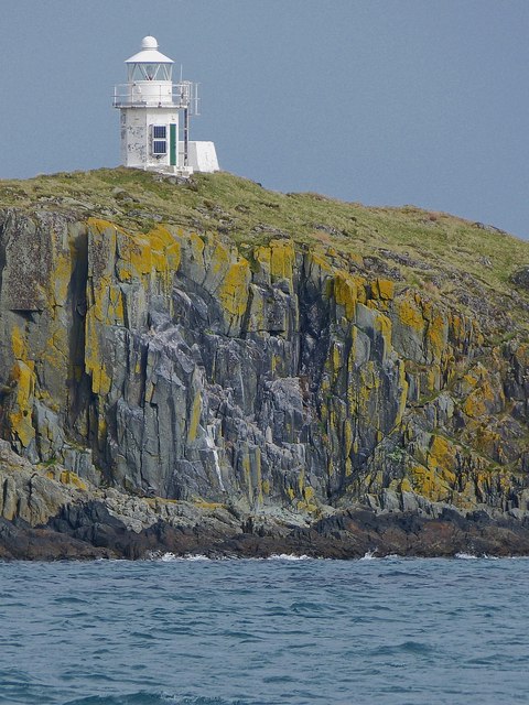
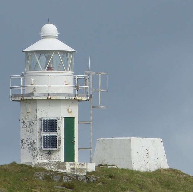
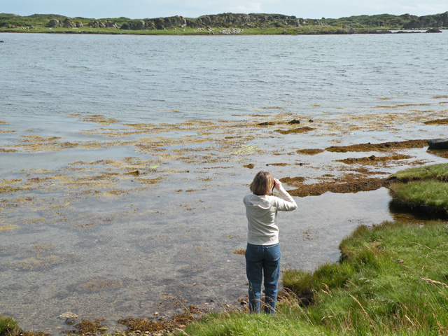
Eilean Bhrìde is a small island located in Argyllshire, Scotland. It is situated in the Inner Hebrides, off the western coast of the Scottish mainland. The island is known for its rugged and picturesque landscape, characterized by rocky cliffs, pristine beaches, and lush greenery.

Eilean Bhrìde is home to a small population of residents, who primarily make a living through fishing and tourism. The island is a popular destination for visitors looking to experience the natural beauty and tranquility of the Scottish countryside.

The island is also known for its historic sites, including the ruins of a medieval castle and a 12th-century chapel dedicated to Saint Brigid, from whom the island takes its name. These ancient structures offer a glimpse into the island's rich history and cultural heritage.

Eilean Bhrìde is a peaceful and secluded retreat for those seeking a break from the hustle and bustle of modern life. With its stunning scenery and fascinating history, it is a must-visit destination for anyone exploring the Scottish islands.

If you have any feedback on the listing, please let us know in the comments section below.

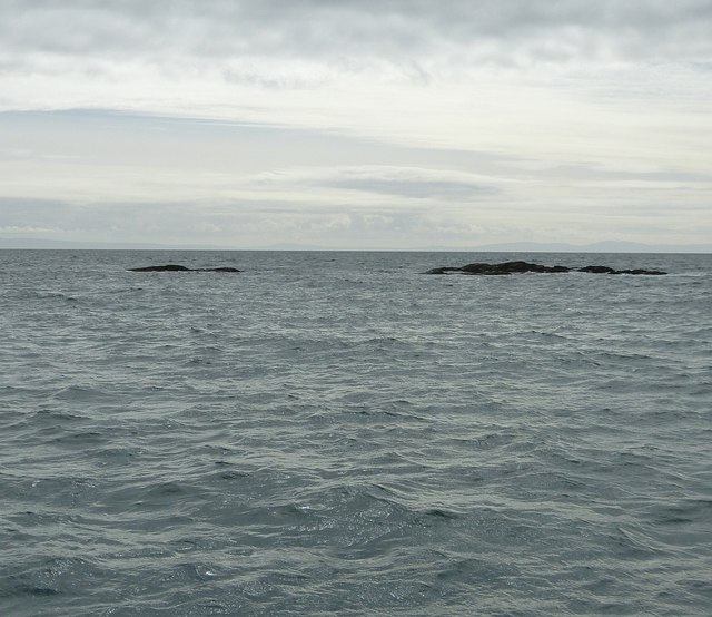
Eilean Bhrìde Images

Images are sourced within 2km of 55.657241/-6.0399357 or Grid Reference NR4547. Thanks to Geograph Open Source API. All images are credited.

Garbh-sgeir Mhor This skerry guards the southern entrance to the Ardmore Islands inshore passage.
Garbh-sgeir Mhor
This skerry guards the southern entrance to the Ardmore Islands inshore passage.
Seals in the Ardmore Islands
Eilean Mhic Mhaolmhoire The tide hadn't quite come in enough so we had to portage the kayaks over a sandbar a little to the NE.
Eilean Mhic Mhaolmhoire
The tide hadn't quite come in enough so we had to portage the kayaks over a sandbar a little to the NE.
Plod Sgeirean Coming through these reefs is fun in a kayak but scary in a yacht, especially if a fog rolls in. Beyond the light beacon on Eilean a' Chuirn and the distant Kintyre peninsula you can see the tops of the Arran Hills.
Plod Sgeirean
Coming through these reefs is fun in a kayak but scary in a yacht, especially if a fog rolls in. Beyond the light beacon on Eilean a' Chuirn and the distant Kintyre peninsula you can see the tops of the Arran Hills.
Eilean na Banaraich from Loch a' Chnuic
Sgeirean Dearga - southwestern rocks These rocks which only just break the surface of the sea are the southwestern part of Sgeirean Dearga which comprises two small groups of rocks. They lie a few hundred metres to the southeast of the islet of Ceann nan Sgeirean, itself off the southern coast of the Isle of Islay. See also <a href="https://www.geograph.org.uk/photo/3930341">NR4547 : Sgeirean Dearga - northeastern rocks</a>
Sgeirean Dearga - southwestern rocks
These rocks which only just break the surface of the sea are the southwestern part of Sgeirean Dearga which comprises two small groups of rocks. They lie a few hundred metres to the southeast of the islet of Ceann nan Sgeirean, itself off the southern coast of the Isle of Islay. See also NR4547 : Sgeirean Dearga - northeastern rocks
Deer on Eilean Bhrìde Eilean Bhrìde is a small island off the southern coast of Islay. Part of its southeastern flank is seen here with two deer on its slopes. These deer are the losers of the rutting season that have been chased off the main island (Islay) and have swum out to this remote and uninhabited islet. The swim out to here can not have been easy across at least half a mile of cold choppy sea. Whether they ever return to the main island I don't know. Apparently there are at least four stags currently on Eilean Bhrìde.
Deer on Eilean Bhrìde
Eilean Bhrìde is a small island off the southern coast of Islay. Part of its southeastern flank is seen here with two deer on its slopes. These deer are the losers of the rutting season that have been chased off the main island (Islay) and have swum out to this remote and uninhabited islet. The swim out to here can not have been easy across at least half a mile of cold choppy sea. Whether they ever return to the main island I don't know. Apparently there are at least four stags currently on Eilean Bhrìde.
Eilean a'Chùirn - Southeastern flank A view of the southeastern flank of the substantial Eilean a'Chùirn, which translates from the Gaelic as Island of the cairn. The lighthouse that can be seen here is at NR47134900 i.e. right on the northern gridline of this square.
The northeastern point of this island is in the adjacent square to the north (see <a href="https://www.geograph.org.uk/photo/3930109">NR4749 : Northeastern tip of Eilean a'Chùirn</a>)
Eilean a'Chùirn - Southeastern flank
A view of the southeastern flank of the substantial Eilean a'Chùirn, which translates from the Gaelic as Island of the cairn. The lighthouse that can be seen here is at NR47134900 i.e. right on the northern gridline of this square. The northeastern point of this island is in the adjacent square to the north (see NR4749 : Northeastern tip of Eilean a'Chùirn)
Northeastern tip of Eilean a'Chùirn Coming around the top of Eilean a'Chùirn this is the view back to its northeastern tip. The lighthouse seen peeping over the hill is on the gridline between this square and the one to its south. Eilean a'Chùirn means "island of the cairn" in Gaelic, though no cairn is shown on  the current OS maps.
Northeastern tip of Eilean a'Chùirn
Coming around the top of Eilean a'Chùirn this is the view back to its northeastern tip. The lighthouse seen peeping over the hill is on the gridline between this square and the one to its south. Eilean a'Chùirn means "island of the cairn" in Gaelic, though no cairn is shown on the current OS maps.
Eilean a'Chùirn from enclosed bay An inner area of sea is formed by the chain of islands of the Ardmore peninsula off the coast of Islay. Although this is the southern coast of the main island, the land here faces predominantly southeastwards with a fragmented clutch of islands, islets and rocks forming a barrier about a kilometre out from the coast, and creating an almost enclosed bay. 
The view in this photo is looking ENE towards the southwestern shore of one of the major islands at the top of the group, Eilean a'Chùirn.
Eilean a'Chùirn from enclosed bay
An inner area of sea is formed by the chain of islands of the Ardmore peninsula off the coast of Islay. Although this is the southern coast of the main island, the land here faces predominantly southeastwards with a fragmented clutch of islands, islets and rocks forming a barrier about a kilometre out from the coast, and creating an almost enclosed bay. The view in this photo is looking ENE towards the southwestern shore of one of the major islands at the top of the group, Eilean a'Chùirn.
Ceann nan Sgeirean Ceann nan Sgeirean is a long low-lying islet and group of rocks lying off the southeastern coast of Islay. The lumpy hill in the background is, I think, Cnoc Rhaonastil (109m) on Islay.
Ceann nan Sgeirean
Ceann nan Sgeirean is a long low-lying islet and group of rocks lying off the southeastern coast of Islay. The lumpy hill in the background is, I think, Cnoc Rhaonastil (109m) on Islay.
Sgeirean Dearga - northeastern rocks These rocks are the northeastern pair of rocks which form the outliers called Sgeirean Dearga with <a href="https://www.geograph.org.uk/photo/3930084">NR4547 : Sgeirean Dearga - southwestern rocks</a>
Sgeirean Dearga - northeastern rocks
These rocks are the northeastern pair of rocks which form the outliers called Sgeirean Dearga with NR4547 : Sgeirean Dearga - southwestern rocks
Eilean Bhrìde - southeastern flank A section of the southeastern flank of Eilean Bhrìde, a substantial islet off the coast of Islay. This little island currently supports at least four deer who swam here from the main island. Two of them can be seen here <a href="https://www.geograph.org.uk/photo/3930090">NR4647 : Deer on Eilean Bhrìde</a>
Eilean Bhrìde - southeastern flank
A section of the southeastern flank of Eilean Bhrìde, a substantial islet off the coast of Islay. This little island currently supports at least four deer who swam here from the main island. Two of them can be seen here NR4647 : Deer on Eilean Bhrìde
Outram from the seaward side Outram is a collection of dozens of rocks and tiny islets - or is the name of the largest of these. They lie immediately to the southwest of the far more substantial Eilean a'Chùirn. They form part of the natural barrier around an almost enclosed bay south of Ardmore on Islay. The mountains of eastern Islay are prominent in the background.
Outram from the seaward side
Outram is a collection of dozens of rocks and tiny islets - or is the name of the largest of these. They lie immediately to the southwest of the far more substantial Eilean a'Chùirn. They form part of the natural barrier around an almost enclosed bay south of Ardmore on Islay. The mountains of eastern Islay are prominent in the background.
Eilean a'Chùirn from the south This view shows the entire southeastern side of Eilean a'Chùirn as seen from the sea to the south of the island.
Eilean a'Chùirn from the south
This view shows the entire southeastern side of Eilean a'Chùirn as seen from the sea to the south of the island.
Section of coast of Eilean a'Chùirn This section of the coast of Eilean a'Chùirn shows the rugged chunky coastline that faces the sea on the little island's southeastern side.
Section of coast of Eilean a'Chùirn
This section of the coast of Eilean a'Chùirn shows the rugged chunky coastline that faces the sea on the little island's southeastern side.
Eilean a' Chùirn lighthouse The little lighthouse sits astride the 4900 gridline on Eilean a' Chùirn, a small island off Islay, with all the land seen in front of it being in this gridsquare. The tower of the lighthouse is only 17m tall, but the light is at an elevation of about 35m due to the height of the cliffs on which it stands. It shines three white flashes every 18 seconds as an active aid to navigation. There has been a light here since 1907, though the one seen here may well be a more recent replacement.
Eilean a' Chùirn lighthouse
The little lighthouse sits astride the 4900 gridline on Eilean a' Chùirn, a small island off Islay, with all the land seen in front of it being in this gridsquare. The tower of the lighthouse is only 17m tall, but the light is at an elevation of about 35m due to the height of the cliffs on which it stands. It shines three white flashes every 18 seconds as an active aid to navigation. There has been a light here since 1907, though the one seen here may well be a more recent replacement.
The Lighthouse, Eilean a'Chùirn A zoomed view of the little lighthouse which straddles the 4900 gridline on the small island of Eilean a'Chùirn. To see it in context see <a href="https://www.geograph.org.uk/photo/3930401">NR4748 : Eilean a' Chùirn lighthouse</a> and <a href="https://www.geograph.org.uk/photo/3930374">NR4748 : Eilean a'Chùirn from the south</a>.
The Lighthouse, Eilean a'Chùirn
A zoomed view of the little lighthouse which straddles the 4900 gridline on the small island of Eilean a'Chùirn. To see it in context see NR4748 : Eilean a' Chùirn lighthouse and NR4748 : Eilean a'Chùirn from the south.
Show me another place!

Eilean Bhrìde is located at Grid Ref: NR4547 (Lat: 55.657241, Lng: -6.0399357)

Unitary Authority: Argyll and Bute

Police Authority: Argyll and West Dunbartonshire

What 3 Words

///justifies.exacts.skinning. Near Port Ellen, Argyll & Bute

Related Wikis

Kildalton Castle

Kildalton Castle is a ruined Victorian country house near Port Ellen on the island of Islay in the Inner Hebrides, Argyll, Scotland. It was built in ashlar...

Kildalton Cross

The Kildalton Cross is a monolithic high cross in Celtic cross form in the churchyard of the former parish church of Kildalton (from Scottish Gaelic Cill...

Ardilistry

Ardilistry is a settlement in Argyll and Bute, Scotland. == References ==

Loch an t-Sailein

Loch an t-Sailein is a sea loch at the southeast coast of Islay, Scotland. European seals frequently visit the shallow waters of this loch. A number of...

Nearby Amenities

Located within 500m of 55.657241,-6.0399357
Created By: dmgroom_coastlines
Source: PGS
Lat/Long: 55.65415/-6.04568
Created By: dmgroom_coastlines
Source: PGS
Lat/Long: 55.65567/-6.04488
Created By: dmgroom_coastlines
Source: PGS
Lat/Long: 55.65618/-6.04462
Created By: dmgroom_coastlines
Source: PGS
Lat/Long: 55.65628/-6.04371
Created By: dmgroom_coastlines
Source: PGS
Lat/Long: 55.65653/-6.04323
Created By: dmgroom_coastlines
Source: PGS
Lat/Long: 55.65652/-6.04278
Created By: dmgroom_coastlines
Source: PGS
Lat/Long: 55.65664/-6.04209
Source: PGS
Lat/Long: 55.6573125/-6.0414867
Source: PGS
Lat/Long: 55.6578174/-6.0420362
Created By: dmgroom_coastlines
Source: PGS
Lat/Long: 55.65769/-6.04337
Created By: dmgroom_coastlines
Source: PGS
Lat/Long: 55.65793/-6.0429
Source: PGS
Lat/Long: 55.6589456/-6.0424903
Created By: dmgroom_coastlines
Source: PGS
Lat/Long: 55.65944/-6.04165
Source: PGS
Lat/Long: 55.6598108/-6.0413418
Source: PGS
Lat/Long: 55.660045/-6.0408227
Created By: dmgroom_coastlines
Source: PGS
Lat/Long: 55.65942/-6.04075
Source: PGS
Lat/Long: 55.6596178/-6.0403919
Source: PGS
Lat/Long: 55.6599737/-6.0397671
Created By: dmgroom_coastlines
Source: PGS
Lat/Long: 55.66002/-6.03934
Created By: dmgroom_coastlines
Source: PGS
Lat/Long: 55.6591/-6.03873
Source: PGS
Lat/Long: 55.6580695/-6.0384058
Source: PGS
Lat/Long: 55.6575737/-6.0384901
Created By: dmgroom_coastlines
Source: PGS
Lat/Long: 55.65755/-6.03772
The data included in this document is from www.openstreetmap.org. The data is made available under ODbL.

Have you been to Eilean Bhrìde?

Leave your review of Eilean Bhrìde below (or comments, questions and feedback).