Dubh Sgeir nan Sgarbh

Island in Argyllshire

Scotland

Dubh Sgeir nan Sgarbh

A' Ghlasaird
A' Ghlasaird Credit: John Allan

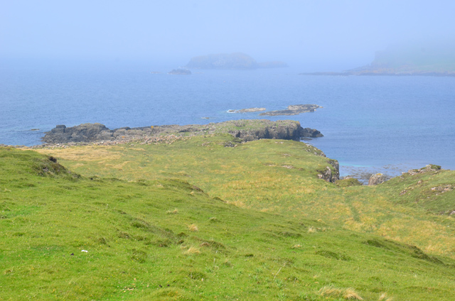
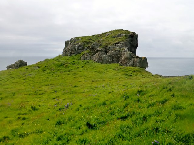
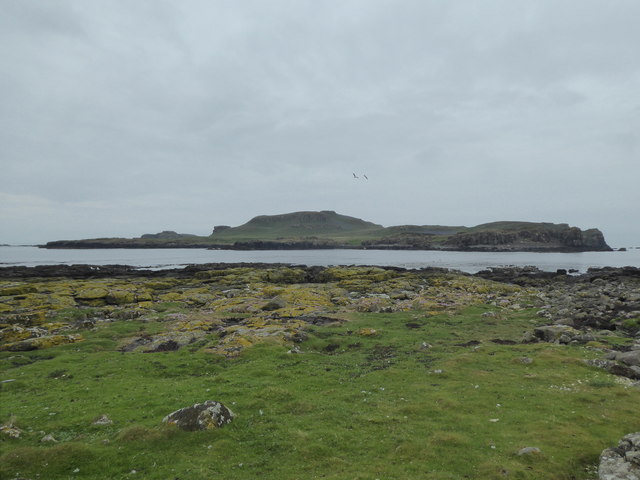
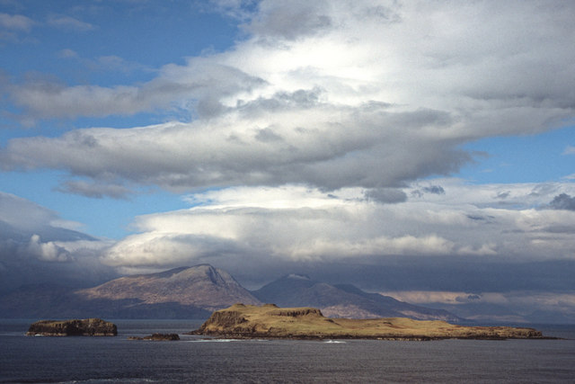
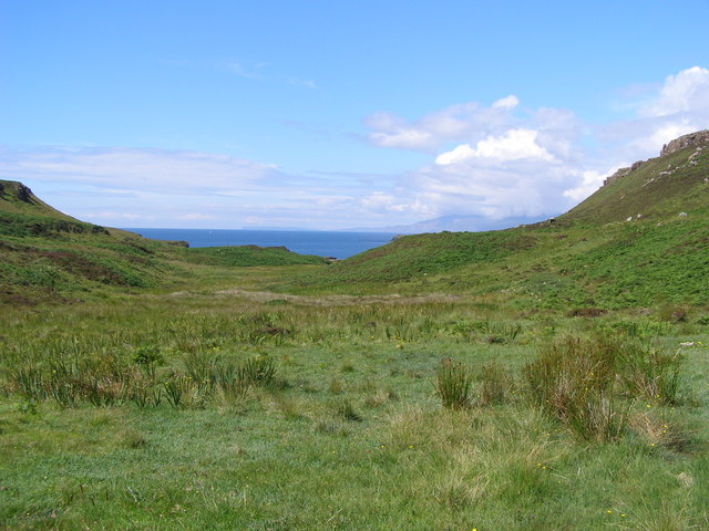
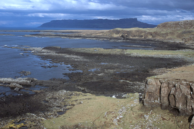
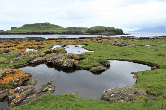
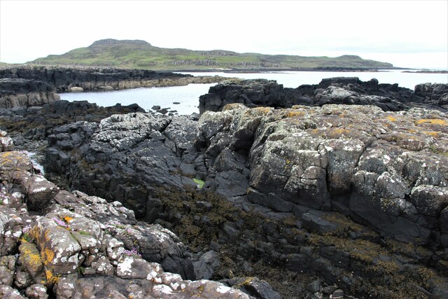
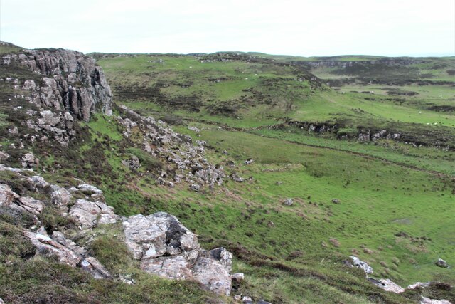
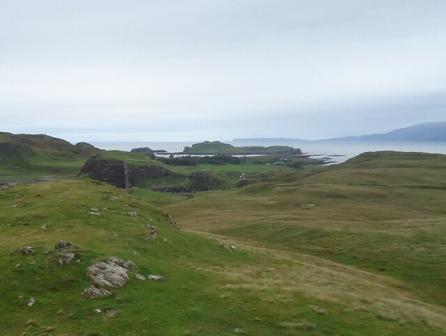
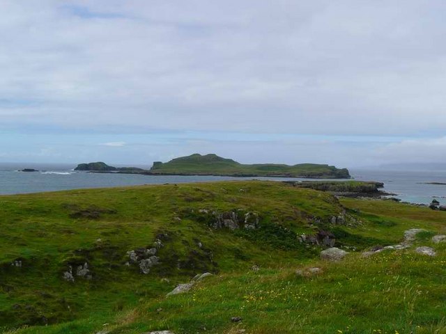
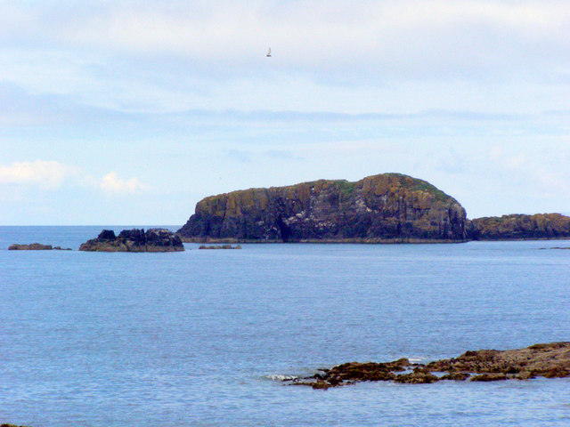
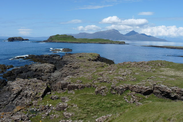
Dubh Sgeir nan Sgarbh is a small island located in Argyllshire, Scotland. Situated in the Inner Hebrides, it is a part of the picturesque archipelago known as the Garvellachs. The island is uninhabited and covers a land area of approximately 6 hectares.

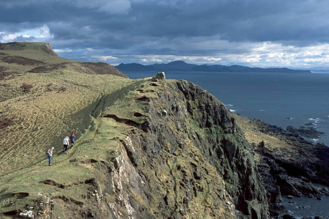
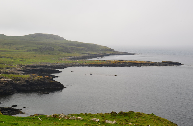
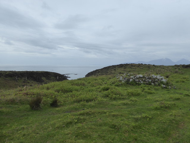
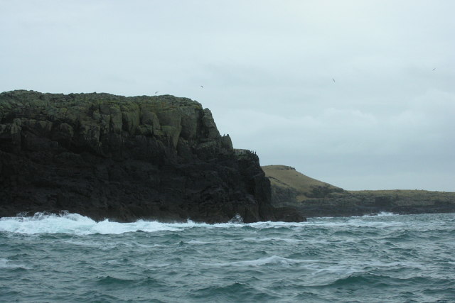
The name Dubh Sgeir nan Sgarbh translates to "Black Skerry of the Cormorants" in English, aptly describing its characteristic black rocks and the abundance of cormorants that inhabit the area. The island is primarily composed of rugged cliffs and rocky outcrops, with no significant vegetation present.

Being a remote and isolated location, Dubh Sgeir nan Sgarbh is a haven for various seabird species, including puffins, guillemots, and razorbills. The island's cliffs provide nesting sites for these birds, making it an important breeding ground. In addition to the birdlife, the surrounding waters are teeming with marine life, offering opportunities for snorkeling and diving enthusiasts to explore the rich underwater ecosystem.

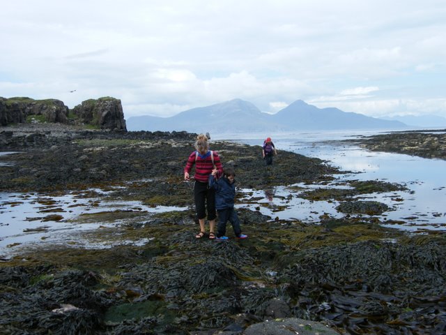
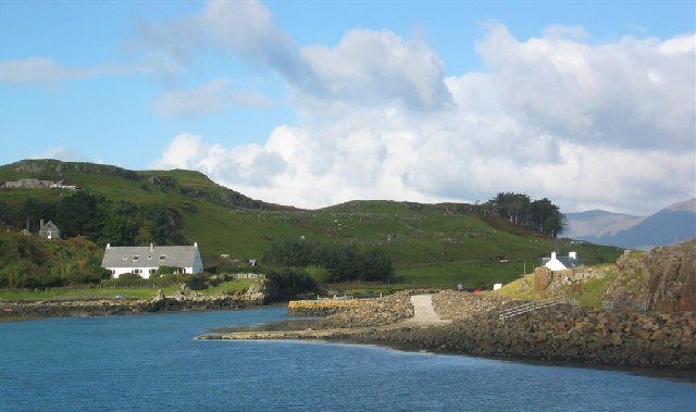
Access to Dubh Sgeir nan Sgarbh is limited due to its remote location and lack of infrastructure. However, it can be reached by boat from nearby islands or coastal areas. Visitors are advised to check weather conditions and plan accordingly, as the area can experience rough seas and strong currents.

Dubh Sgeir nan Sgarbh is a hidden gem for nature lovers and birdwatchers, offering a unique opportunity to witness the untouched beauty of the Inner Hebrides.

If you have any feedback on the listing, please let us know in the comments section below.

Dubh Sgeir nan Sgarbh Images

Images are sourced within 2km of 56.846768/-6.2799529 or Grid Reference NM3980. Thanks to Geograph Open Source API. All images are credited.

A' Ghlasaird
A' Ghlasaird
Aird an Eilean Twelve were landed on Eilean nan Each by Coastal Connections after a RIB ride out from Oban on a sunny, calm day.
Name: Aird an Eilean
Hill number: 10510
Height: 54m / 177ft
Parent (Ma/M): none
Section: 17D: Canna, Rhum and Eigg
County/UA: Highland (UA)
Maritime Area: Ardnamurchan to Sound of Sleat
Class: Tump (0-99m), SIB
Grid ref: NM 39217 81422
Summit feature: no feature: adjacent to overgrown cairn and cliff edge
Drop: 54m
Col: Sea
Aird an Eilean
Twelve were landed on Eilean nan Each by Coastal Connections after a RIB ride out from Oban on a sunny, calm day. Name: Aird an Eilean Hill number: 10510 Height: 54m / 177ft Parent (Ma/M): none Section: 17D: Canna, Rhum and Eigg County/UA: Highland (UA) Maritime Area: Ardnamurchan to Sound of Sleat Class: Tump (0-99m), SIB Grid ref: NM 39217 81422 Summit feature: no feature: adjacent to overgrown cairn and cliff edge Drop: 54m Col: Sea
Eilean nan Each
Eilean nan Each
Eilean nan Each and Eagamol As seen from the north coast of Muck with the mountains of Sgurr nan Gillean and Askival on Rum dominating the distance.
Eilean nan Each and Eagamol
As seen from the north coast of Muck with the mountains of Sgurr nan Gillean and Askival on Rum dominating the distance.
Southwest coast of Isle of Muck Muck may be a small island but to walk its entire coastline gives a glorious range of views of the island, the neighbouring islands and mainland.  Beinn Airean the highest point of Muck is visible from this viewpoint as well as the mainland around Ardnamurchan Point.
Southwest coast of Isle of Muck
Muck may be a small island but to walk its entire coastline gives a glorious range of views of the island, the neighbouring islands and mainland. Beinn Airean the highest point of Muck is visible from this viewpoint as well as the mainland around Ardnamurchan Point.
Gleann Mhairtein Gleann Mhairtein, Isle of Muck, looking north-west. The islands of Canna and Rum can be seen on the horizon.
Gleann Mhairtein
Gleann Mhairtein, Isle of Muck, looking north-west. The islands of Canna and Rum can be seen on the horizon.
Coastline at the foot of Gleann Mhàirteinn
Ruin on the west side of Muck
North coast of Muck Eigg prominent in the distance.
North coast of Muck
Eigg prominent in the distance.
Brackish pools and Eilean nan Each
A' Ghlasaird The west part of Muck.
A' Ghlasaird
The west part of Muck.
Gleann Mhairtein
Gleann Mhairtein
Eilean nan Each Seen from Fionn-aird on the Isle of Muck.

The island is in the exact centre of the photo. In the distance are the rather flat island of Canna and the much hillier west corner of Rum at the right.
Eilean nan Each
Seen from Fionn-aird on the Isle of Muck. The island is in the exact centre of the photo. In the distance are the rather flat island of Canna and the much hillier west corner of Rum at the right.
Eilean nan Each
Eilean nan Each
Eagamol A small rocky island close to the Isle of Muck. Photo taken from Muck.
Eagamol
A small rocky island close to the Isle of Muck. Photo taken from Muck.
Crossing from Horse Island to Muck Seaweed covered rocks between Horse Island (Eilean nan Each) and Lamb Island (Eilean Aird nan Uan). It is possible to walk across the strait at low spring tides. Lamb Island is connected to Muck at all but the highest tides. Behind are the mountains of Rum and (in the distance on the right) Skye.
Crossing from Horse Island to Muck
Seaweed covered rocks between Horse Island (Eilean nan Each) and Lamb Island (Eilean Aird nan Uan). It is possible to walk across the strait at low spring tides. Lamb Island is connected to Muck at all but the highest tides. Behind are the mountains of Rum and (in the distance on the right) Skye.
A' Ghlasaird headland Isle of Muck Looking NNW from Muck acrosslocally named "Horse Island" to Rum in the distance
A' Ghlasaird headland Isle of Muck
Looking NNW from Muck acrosslocally named "Horse Island" to Rum in the distance
The Southern headlands of Eagamol with Eilean nan Each in the background Eagamol in one of several outliers located around Muck. The result of volcanic activity, they're made of basalt.
The Southern headlands of Eagamol with Eilean nan Each in the background
Eagamol in one of several outliers located around Muck. The result of volcanic activity, they're made of basalt.
Show me another place!

Dubh Sgeir nan Sgarbh is located at Grid Ref: NM3980 (Lat: 56.846768, Lng: -6.2799529)

Unitary Authority: Highland

Police Authority: Highlands and Islands

What 3 Words

///wallet.moral.exhaling. Near Kilchoan, Highland

Related Wikis

Muck, Scotland

Muck (; Scottish Gaelic: Eilean nam Muc) is the smallest of four main islands in the Small Isles, part of the Inner Hebrides of Scotland. Today, much of...

Port Mòr

Port Mòr is a harbour and settlement on the Isle of Muck in the Inner Hebrides off the west coast of Scotland.Port Mòr is the most populated settlement...

An Sgùrr (Eigg)

An Sgùrr is the highest hill on the Inner Hebridean island of Eigg, Lochaber, Highland, Scotland. It was formed 58.72 ± 0.07 million years ago; the result...

Eigg

Eigg ( eg; Scottish Gaelic: Eige; Scots: Eigg) is one of the Small Isles in the Scottish Inner Hebrides. It lies to the south of the Isle of Skye and to...

Galmisdale

Galmisdale is the main port of the island of Eigg, one of the Small Isles of the Inner Hebrides. It is in the Scottish council area of Highland. ��2�...

Eilean Chathastail

Eilean Chathastail (Eng: Castle Island) is one of the Small Isles in the Inner Hebrides of Scotland. == Geography == Eilean Chathastail...

Nearby Amenities

Located within 500m of 56.846768,-6.2799529
Àird an Eilean
Corbett: no
Ele: 50
Graham: no
Munro: no
Natural: peak
Lat/Long: 56.850896/-6.2782323
The data included in this document is from www.openstreetmap.org. The data is made available under ODbL.

Have you been to Dubh Sgeir nan Sgarbh?

Leave your review of Dubh Sgeir nan Sgarbh below (or comments, questions and feedback).