Bogha Philip

Island in Argyllshire

Scotland

Bogha Philip

A' Ghlasaird
A' Ghlasaird Credit: John Allan

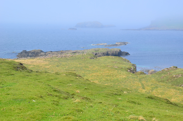
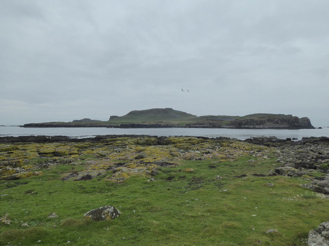
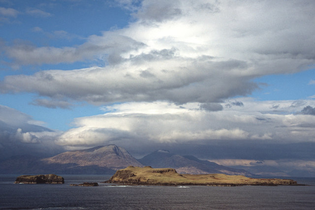
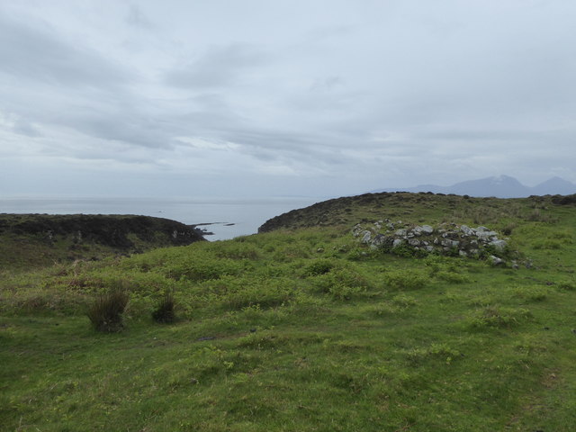
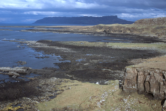
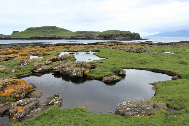
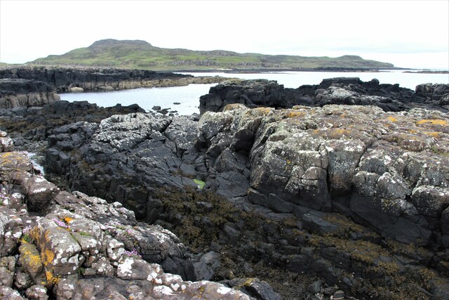
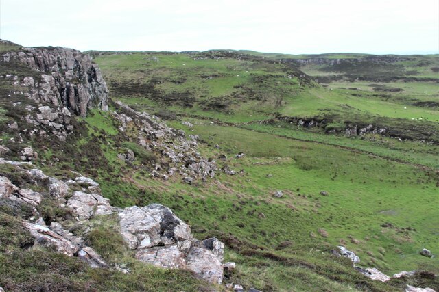
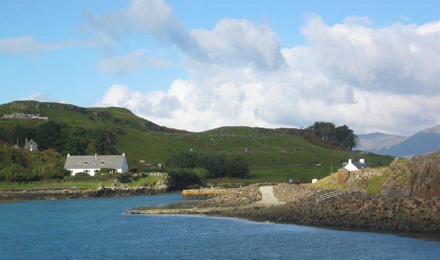
Bogha Philip is a small island located in Argyllshire, off the west coast of Scotland. It is situated in the Sound of Jura, a narrow stretch of water between the mainland and the Isle of Jura. The island covers an area of approximately 0.3 square kilometers and is uninhabited.

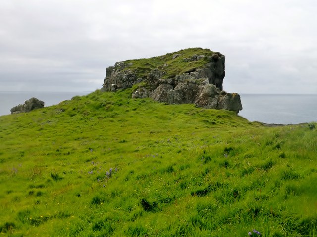
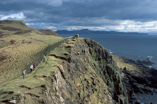
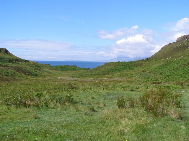
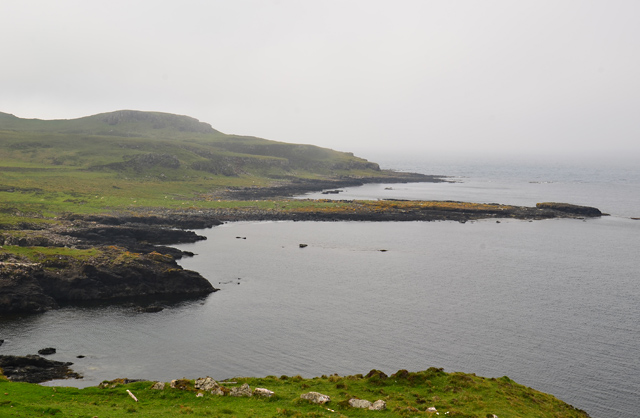
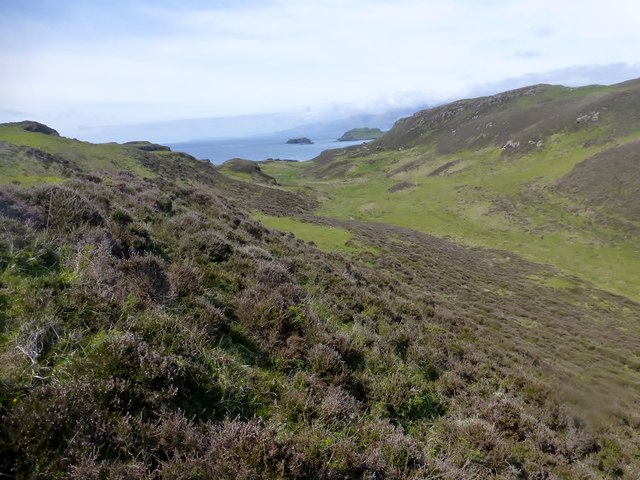
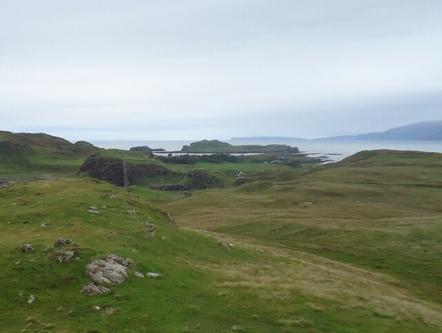
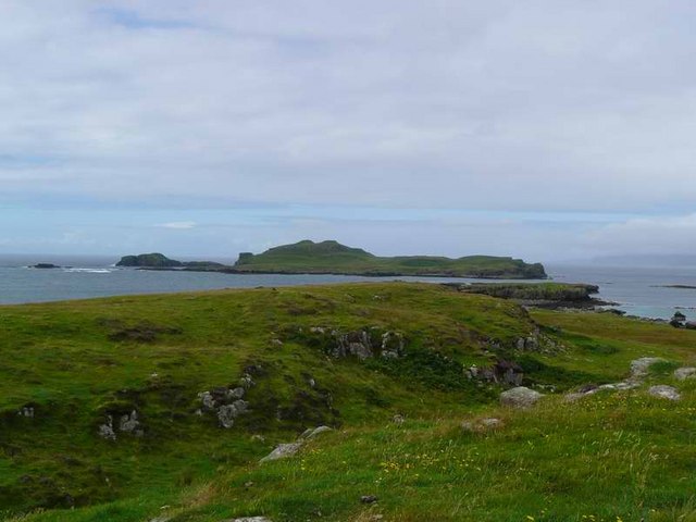
Bogha Philip is known for its rugged and picturesque landscape, characterized by rocky cliffs, heather-covered hills, and pristine sandy beaches. It offers breathtaking views of the surrounding seascape and attracts visitors who appreciate the tranquility and natural beauty of the area.

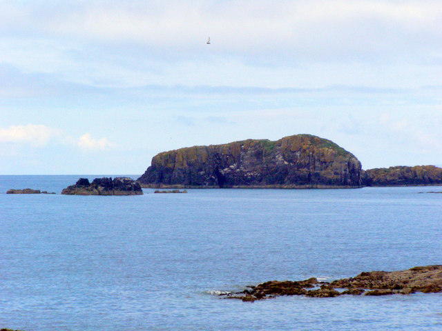
The island is home to a variety of wildlife, including seabirds, seals, and otters. It is a popular spot for birdwatching, with species such as puffins, guillemots, and razorbills often seen nesting along the cliffs. The surrounding waters provide a rich habitat for marine life, making it a haven for divers and snorkelers.

Access to Bogha Philip is primarily by boat, with regular ferry services available from nearby towns on the mainland. Visitors can explore the island on foot, taking in the stunning vistas and enjoying the solitude of its untouched landscapes. Camping is permitted on the island, allowing visitors to fully immerse themselves in the natural surroundings.

Overall, Bogha Philip offers a unique and unspoiled wilderness experience, appealing to nature lovers and outdoor enthusiasts seeking an escape from the hustle and bustle of everyday life.

If you have any feedback on the listing, please let us know in the comments section below.

Bogha Philip Images

Images are sourced within 2km of 56.846042/-6.2759639 or Grid Reference NM3980. Thanks to Geograph Open Source API. All images are credited.

A' Ghlasaird
A' Ghlasaird
Aird an Eilean Twelve were landed on Eilean nan Each by Coastal Connections after a RIB ride out from Oban on a sunny, calm day.
Name: Aird an Eilean
Hill number: 10510
Height: 54m / 177ft
Parent (Ma/M): none
Section: 17D: Canna, Rhum and Eigg
County/UA: Highland (UA)
Maritime Area: Ardnamurchan to Sound of Sleat
Class: Tump (0-99m), SIB
Grid ref: NM 39217 81422
Summit feature: no feature: adjacent to overgrown cairn and cliff edge
Drop: 54m
Col: Sea
Aird an Eilean
Twelve were landed on Eilean nan Each by Coastal Connections after a RIB ride out from Oban on a sunny, calm day. Name: Aird an Eilean Hill number: 10510 Height: 54m / 177ft Parent (Ma/M): none Section: 17D: Canna, Rhum and Eigg County/UA: Highland (UA) Maritime Area: Ardnamurchan to Sound of Sleat Class: Tump (0-99m), SIB Grid ref: NM 39217 81422 Summit feature: no feature: adjacent to overgrown cairn and cliff edge Drop: 54m Col: Sea
Eilean nan Each
Eilean nan Each
Eilean nan Each and Eagamol As seen from the north coast of Muck with the mountains of Sgurr nan Gillean and Askival on Rum dominating the distance.
Eilean nan Each and Eagamol
As seen from the north coast of Muck with the mountains of Sgurr nan Gillean and Askival on Rum dominating the distance.
Southwest coast of Isle of Muck Muck may be a small island but to walk its entire coastline gives a glorious range of views of the island, the neighbouring islands and mainland.  Beinn Airean the highest point of Muck is visible from this viewpoint as well as the mainland around Ardnamurchan Point.
Southwest coast of Isle of Muck
Muck may be a small island but to walk its entire coastline gives a glorious range of views of the island, the neighbouring islands and mainland. Beinn Airean the highest point of Muck is visible from this viewpoint as well as the mainland around Ardnamurchan Point.
Gleann Mhairtein Gleann Mhairtein, Isle of Muck, looking north-west. The islands of Canna and Rum can be seen on the horizon.
Gleann Mhairtein
Gleann Mhairtein, Isle of Muck, looking north-west. The islands of Canna and Rum can be seen on the horizon.
Coastline at the foot of Gleann Mhàirteinn
Beinn Airein West Top The beauty of a boat trip is that you can start away from the pier where all the Calmac trippers land and then bag the island's four TUMPs in a linear walk.
Name: Beinn Airein West Top
Hill number: 10447
Height: 80m / 262ft
Parent (Ma/M): none
Section: 17D: Canna, Rhum and Eigg
County/UA: Highland (UA)
Maritime Area: Ardnamurchan to Sound of Sleat
Class: Tump (0-99m)
Grid ref: NM 39762 78999
Summit feature: vegetated outcrop
Drop: 32m
Col: 48m  NM399790
Beinn Airein West Top
The beauty of a boat trip is that you can start away from the pier where all the Calmac trippers land and then bag the island's four TUMPs in a linear walk. Name: Beinn Airein West Top Hill number: 10447 Height: 80m / 262ft Parent (Ma/M): none Section: 17D: Canna, Rhum and Eigg County/UA: Highland (UA) Maritime Area: Ardnamurchan to Sound of Sleat Class: Tump (0-99m) Grid ref: NM 39762 78999 Summit feature: vegetated outcrop Drop: 32m Col: 48m NM399790
View Towards Eilean nan Each A view from the slopes of Beinn Airein West Top towards Eilean nan Each.
View Towards Eilean nan Each
A view from the slopes of Beinn Airein West Top towards Eilean nan Each.
Ruin on the west side of Muck
North coast of Muck Eigg prominent in the distance.
North coast of Muck
Eigg prominent in the distance.
Brackish pools and Eilean nan Each
A' Ghlasaird The west part of Muck.
A' Ghlasaird
The west part of Muck.
Gleann Mhairtein
Gleann Mhairtein
Eilean nan Each Seen from Fionn-aird on the Isle of Muck.

The island is in the exact centre of the photo. In the distance are the rather flat island of Canna and the much hillier west corner of Rum at the right.
Eilean nan Each
Seen from Fionn-aird on the Isle of Muck. The island is in the exact centre of the photo. In the distance are the rather flat island of Canna and the much hillier west corner of Rum at the right.
Beinn Airean West Top, Isle of Muck This top is just 80m high, and we are looking towards the main summit of Beinn Airean, 137m.
Beinn Airean West Top, Isle of Muck
This top is just 80m high, and we are looking towards the main summit of Beinn Airean, 137m.
Eilean nan Each
Eilean nan Each
Eagamol A small rocky island close to the Isle of Muck. Photo taken from Muck.
Eagamol
A small rocky island close to the Isle of Muck. Photo taken from Muck.
Show me another place!

Bogha Philip is located at Grid Ref: NM3980 (Lat: 56.846042, Lng: -6.2759639)

Unitary Authority: Highland

Police Authority: Highlands and Islands

What 3 Words

///buffoon.walked.deciding. Near Kilchoan, Highland

Related Wikis

Muck, Scotland

Muck (; Scottish Gaelic: Eilean nam Muc) is the smallest of four main islands in the Small Isles, part of the Inner Hebrides of Scotland. Today, much of...

Port Mòr

Port Mòr is a harbour and settlement on the Isle of Muck in the Inner Hebrides off the west coast of Scotland.Port Mòr is the most populated settlement...

An Sgùrr (Eigg)

An Sgùrr is the highest hill on the Inner Hebridean island of Eigg, Lochaber, Highland, Scotland. It was formed 58.72 ± 0.07 million years ago; the result...

Eigg

Eigg ( eg; Scottish Gaelic: Eige; Scots: Eigg) is one of the Small Isles in the Scottish Inner Hebrides. It lies to the south of the Isle of Skye and to...

Have you been to Bogha Philip?

Leave your review of Bogha Philip below (or comments, questions and feedback).