Hairsgeir

Island in Ross-shire

Scotland

Hairsgeir

Stac an Tùill of Bearasaigh Returning from Seanna Chnoc on our way to Bostadh, the most interesting route seemed to be to thread the Caolas Stac an Tùill on the west side of Bearasaigh. This 43m high stack is prominent in the view from Bostadh, and is scarcely less in height than the island of Bearasaigh itself (58m). However, there are other skerries (off to the right of the view) providing some shelter here, so the swell as we came into the channel was quite a bit less than it had been earlier in our trip, and towards the southeastern end, the water was almost calm.
Stac an Tùill of Bearasaigh Credit: Andy Waddington

The requested URL returned error: 429 Too Many Requests

If you have any feedback on the listing, please let us know in the comments section below.
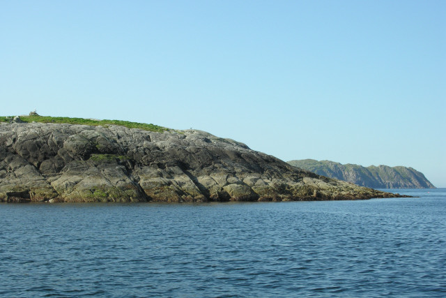
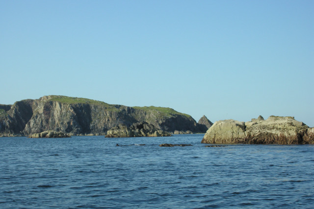
Hairsgeir Images

Images are sourced within 2km of 58.261356/-6.9296649 or Grid Reference NB1040. Thanks to Geograph Open Source API. All images are credited.
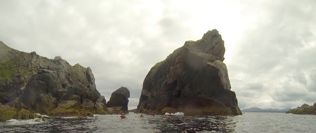
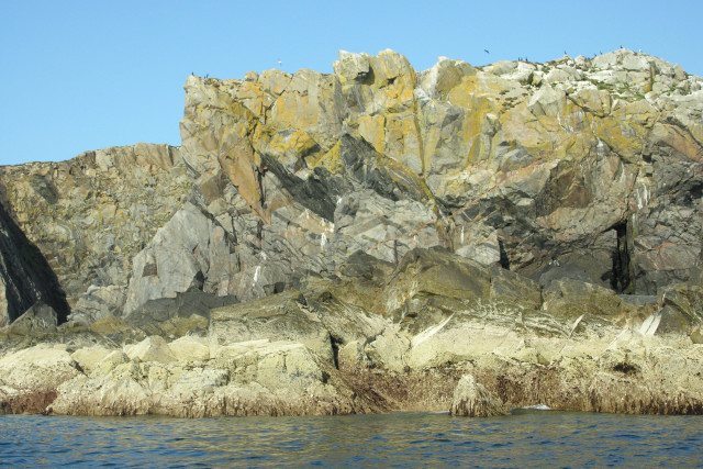
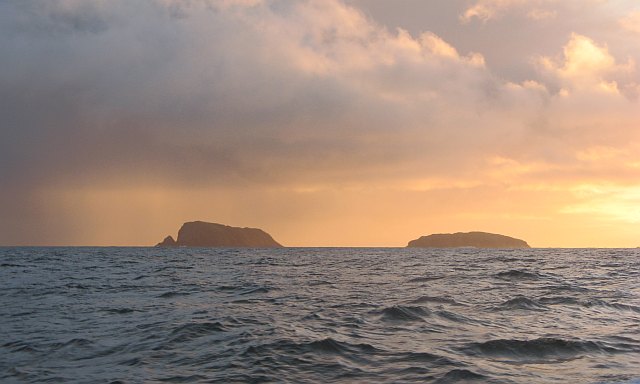
Stac an Tùill of Bearasaigh Returning from Seanna Chnoc on our way to Bostadh, the most interesting route seemed to be to thread the Caolas Stac an Tùill on the west side of Bearasaigh. This 43m high stack is prominent in the view from Bostadh, and is scarcely less in height than the island of Bearasaigh itself (58m). However, there are other skerries (off to the right of the view) providing some shelter here, so the swell as we came into the channel was quite a bit less than it had been earlier in our trip, and towards the southeastern end, the water was almost calm.
Stac an Tùill of Bearasaigh
Returning from Seanna Chnoc on our way to Bostadh, the most interesting route seemed to be to thread the Caolas Stac an Tùill on the west side of Bearasaigh. This 43m high stack is prominent in the view from Bostadh, and is scarcely less in height than the island of Bearasaigh itself (58m). However, there are other skerries (off to the right of the view) providing some shelter here, so the swell as we came into the channel was quite a bit less than it had been earlier in our trip, and towards the southeastern end, the water was almost calm.
Threading the channel past Flodaigh On our return from Seanna Chnoc via Bearasaigh, we'd just passed Sgeir nan Saoidhean and were now skirting the west side of Flodaigh (which offered more interesting paddling than the east side in the prevailing weather). Sea kayakers cannot resist narrow channels between skerries, especially with a bit of swell, and this was almost the last bit of excitement in our trip as we headed into more sheltered waters on our last day of a week exploring islands, stacks and sea caves.
Threading the channel past Flodaigh
On our return from Seanna Chnoc via Bearasaigh, we'd just passed Sgeir nan Saoidhean and were now skirting the west side of Flodaigh (which offered more interesting paddling than the east side in the prevailing weather). Sea kayakers cannot resist narrow channels between skerries, especially with a bit of swell, and this was almost the last bit of excitement in our trip as we headed into more sheltered waters on our last day of a week exploring islands, stacks and sea caves.
In the shelter of Stac an Tùill at Bearasaigh On our return from Seanna Chnoc, we passed close west of Bearasiagh, threading the gap between it and Stac an Tùill, to enter this sheltered lagoon. This was part of a day trip (a bit over ten miles, not counting all the excursions in and out of the indented coastlines), starting from and returning to Bostadh, exploring the cliffs, coves and sea caves of several of the small rocky islands north of Great Bernera, made interesting by wind and swell from the southwest.
In the shelter of Stac an Tùill at Bearasaigh
On our return from Seanna Chnoc, we passed close west of Bearasiagh, threading the gap between it and Stac an Tùill, to enter this sheltered lagoon. This was part of a day trip (a bit over ten miles, not counting all the excursions in and out of the indented coastlines), starting from and returning to Bostadh, exploring the cliffs, coves and sea caves of several of the small rocky islands north of Great Bernera, made interesting by wind and swell from the southwest.
Paddling over reefs on the south end of Flodaigh Towards the end of a day trip out from Bostadh on Great Bernera, exploring the cliffs, coves and sea caves of several of the small islands, we skirted down the west side of Flodaigh and then threaded our way through shallow and quite sheltered water between Flodaigh and Tamna (joined at low tide) before the final short crossing back to our starting point.
Paddling over reefs on the south end of Flodaigh
Towards the end of a day trip out from Bostadh on Great Bernera, exploring the cliffs, coves and sea caves of several of the small islands, we skirted down the west side of Flodaigh and then threaded our way through shallow and quite sheltered water between Flodaigh and Tamna (joined at low tide) before the final short crossing back to our starting point.
Stac an Tùill This remarkably lumpy little stack is Stac an Tùill, it lies immediately to the southwest of Bearasaigh (<a href="https://www.geograph.org.uk/photo/2646866">NB1242 : Bearasaigh in front of Seanna Chnoc</a>). I can't find a definitive height for it, but as Bearasaigh's highest point is 58m I would estimate that Stac an Tùill achieves about 40m (c. 130ft)
[Edit] The latest OS map gives a height of 43m
Stac an Tùill
This remarkably lumpy little stack is Stac an Tùill, it lies immediately to the southwest of Bearasaigh (NB1242 : Bearasaigh in front of Seanna Chnoc). I can't find a definitive height for it, but as Bearasaigh's highest point is 58m I would estimate that Stac an Tùill achieves about 40m (c. 130ft) [Edit] The latest OS map gives a height of 43m
Bearsaigh and  Seanna Chnoc from Bosta Beach
Bearsaigh and Seanna Chnoc from Bosta Beach
Hairsgeir, An Caolas This low lying skerry is composed of Lewisian Gneiss.
Hairsgeir, An Caolas
This low lying skerry is composed of Lewisian Gneiss.
Hairsgeir, Isle of Lewis Low lying Hairsgeir is composed of Lewisian Gneiss. Bearasaigh can be seen in the right-hand distance.
Hairsgeir, Isle of Lewis
Low lying Hairsgeir is composed of Lewisian Gneiss. Bearasaigh can be seen in the right-hand distance.
North-west skerries, Flodaigh The foreground rocks make up the North-west skerries of Flodaigh. The island in the far distance is Bearasaigh.
North-west skerries, Flodaigh
The foreground rocks make up the North-west skerries of Flodaigh. The island in the far distance is Bearasaigh.
Stac an Tuill, Bearasaigh, Isle of Lewis Stac an Tuill is a Lewisian Gneiss sea stack to the South-west of Bearasaigh.
Stac an Tuill, Bearasaigh, Isle of Lewis
Stac an Tuill is a Lewisian Gneiss sea stack to the South-west of Bearasaigh.
Show me another place!

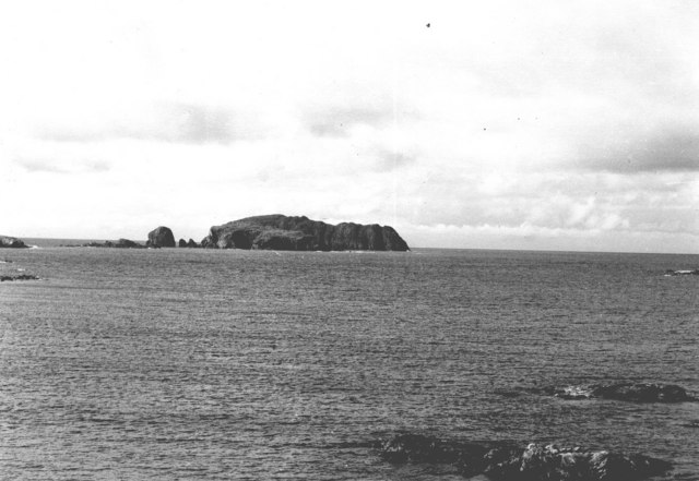
Hairsgeir is located at Grid Ref: NB1040 (Lat: 58.261356, Lng: -6.9296649)

Unitary Authority: Na h-Eileanan an Iar

Police Authority: Highlands and Islands

What 3 Words

///bunch.domain.efficient. Near Carloway, Na h-Eileanan Siar

Nearby Locations

Hairsgeir

Related Wikis

Flodaigh (Outer Loch Ròg)

Flodaigh is an islet in outer Loch Ròg, Lewis, Scotland. It lies north west of Great Bernera and Little Bernera, south of Bearasaigh and Seanna Chnoc and...

Bearasaigh

Bearasaigh or Bearasay (and sometimes Berisay) is an islet in outer Loch Ròg, Lewis, Scotland. During the late 16th and early 17th centuries it was used...

Seanna Chnoc

Seanna Chnoc (English: "old hill"), correctly known as Seana Bheinn is an islet in outer Loch Ròg, Lewis, Scotland. It lies north west of Great Bernera...

Pabaigh Mòr

Pabay Mòr or Pabaigh Mòr is an uninhabited island in the Outer Hebrides of Scotland. == History == The island's name comes from papey, an Old Norse name...

Have you been to Hairsgeir?

Leave your review of Hairsgeir below (or comments, questions and feedback).