Lipson

Settlement in Devon

England

Lipson

Laira Bridge
Laira Bridge Credit: Matthew Chadwick

Lipson is a small village located in the county of Devon, England. Situated on the southern coast of the county, it is part of the South Hams district. The village is positioned on a gentle slope overlooking the Plymouth Sound and the English Channel, offering stunning panoramic views of the surrounding area.

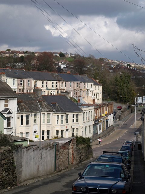
With a population of around 500 residents, Lipson maintains a close-knit community atmosphere. The village is predominantly residential, characterized by charming cottages and houses that reflect its rich history. The architecture often varies from traditional thatched roofs to more modern designs.

Lipson benefits from its proximity to nearby amenities and attractions. The bustling city of Plymouth is just a short distance away, offering a wide range of shopping, dining, and entertainment options. The village is also within easy reach of beautiful sandy beaches, such as Bovisand Beach and Kingsand Beach, making it an ideal location for those who enjoy coastal activities.

In terms of transportation, Lipson is well-connected. The A379 road passes through the village, providing convenient access to other parts of Devon and beyond. Public transportation, including buses and trains, are also readily available, connecting Lipson to surrounding towns and cities.

The village boasts a strong sense of community spirit, with various local events and activities taking place throughout the year, such as summer fairs and charity fundraisers. Additionally, Lipson benefits from a number of amenities, including a village hall, a primary school, and a local pub, providing essential services and gathering places for residents.

In conclusion, Lipson is a picturesque village in Devon, known for its beautiful coastal views, friendly community, and convenient location.

If you have any feedback on the listing, please let us know in the comments section below.
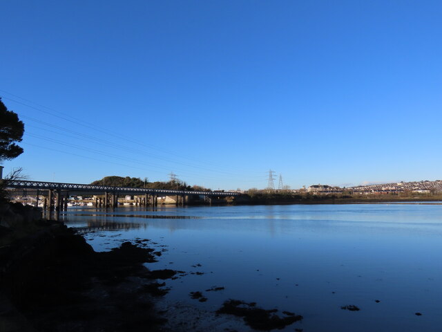
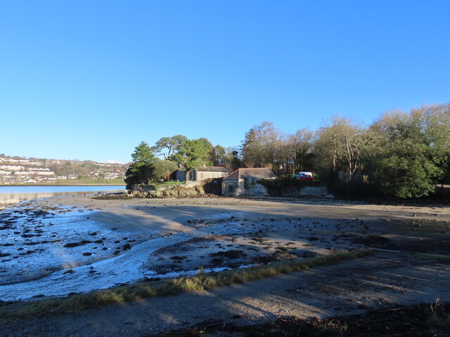
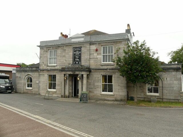
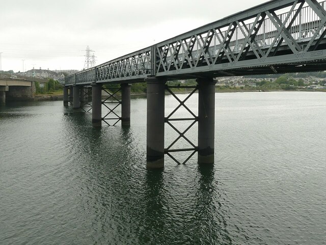
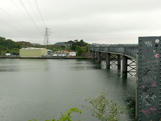
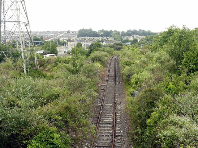
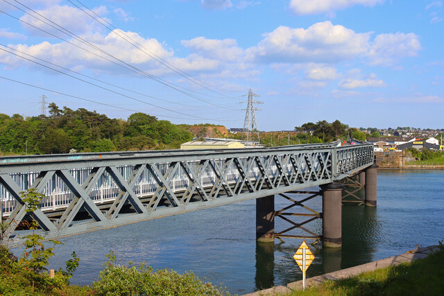
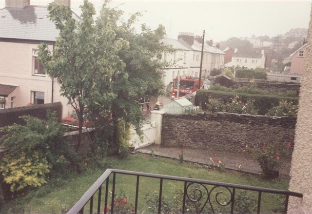
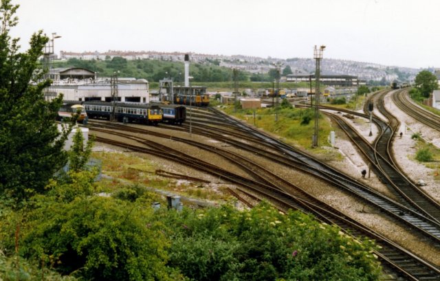
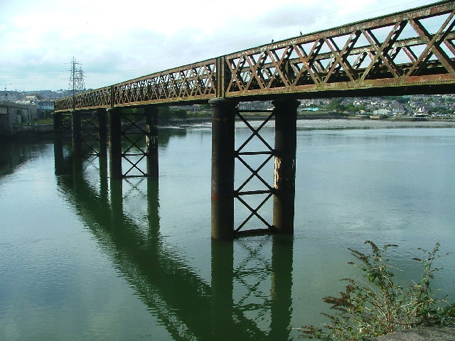
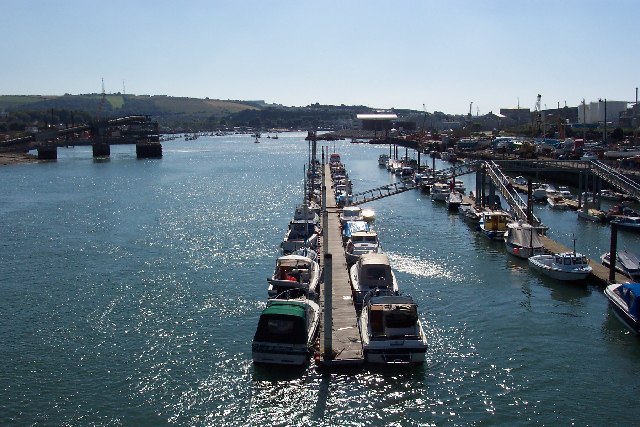
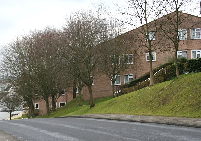
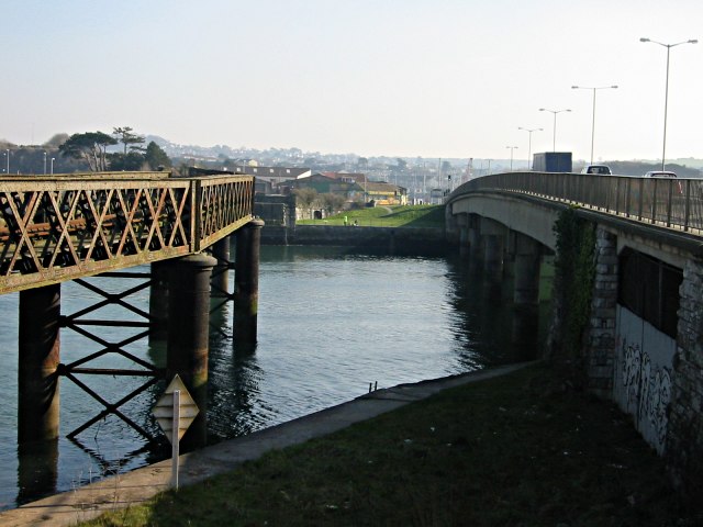
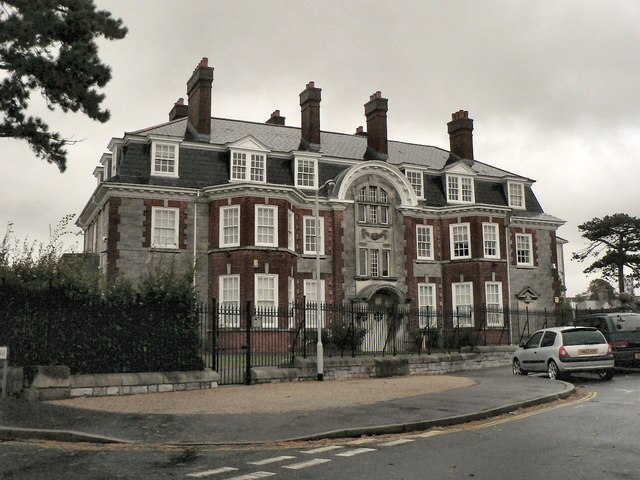
Lipson Images

Images are sourced within 2km of 50.379268/-4.124745 or Grid Reference SX4955. Thanks to Geograph Open Source API. All images are credited.

Laira Bridge
Laira Bridge
Saltram Point
Saltram Point
The Morley Arms, Pomphlett Early 19th century inn, probably as part of the improvements to the road towards Kingsbridge which included the building of the first road bridge at Laira in 1827. Listed Grade II.
The Morley Arms, Pomphlett
Early 19th century inn, probably as part of the improvements to the road towards Kingsbridge which included the building of the first road bridge at Laira in 1827. Listed Grade II.
Laira Bridge, Plymouth Recreating this 'First' for the square <a title="https://www.geograph.org.uk/photo/58416" href="https://www.geograph.org.uk/photo/58416">Link</a> .

The misgivings about its future have since been allayed with its conversion to a foot and cycle route.
Laira Bridge, Plymouth
Recreating this 'First' for the square Link . The misgivings about its future have since been allayed with its conversion to a foot and cycle route.
Eastern abutment of the old Laira road bridge The bridge was a 5-arch iron bridge designed by J M Rendel, opened in 1827. It was replaced by the present bridge (in picture, left) in 1962. The plaque is in Latin and English and probably dates from the original building.
Eastern abutment of the old Laira road bridge
The bridge was a 5-arch iron bridge designed by J M Rendel, opened in 1827. It was replaced by the present bridge (in picture, left) in 1962. The plaque is in Latin and English and probably dates from the original building.
Refurbished Laira Bridge Showing the cycle- and footway inserted into the original girders. See <a title="https://www.geograph.org.uk/photo/1555849" href="https://www.geograph.org.uk/photo/1555849">Link</a> for comparison.
Refurbished Laira Bridge
Showing the cycle- and footway inserted into the original girders. See Link for comparison.
River Plym estuary Looking upstream from Laira Railway Bridge.
River Plym estuary
Looking upstream from Laira Railway Bridge.
An odd plaque on the refurbished Laira Bridge Railway enthusiasts will recognise this as a traditional railway milepost representing a distance of zero miles and three (III) quarters from the start of the branch, at a junction just outside the former Plymouth Friary Station.
An odd plaque on the refurbished Laira Bridge
Railway enthusiasts will recognise this as a traditional railway milepost representing a distance of zero miles and three (III) quarters from the start of the branch, at a junction just outside the former Plymouth Friary Station.
Refurbished Laira Bridge Looking along the bridge from the western end.
Refurbished Laira Bridge
Looking along the bridge from the western end.
Disused railway The branch to the Cattewater quays. Historically this was the Plymouth and Dartmoor Tramway, the first railway to be built in the area, the Laira section opening in 1825. It was horse drawn and built to a gauge of 4ft 6in. It continued as such until some time in the late 19th century when the Cattewater wharves section was incorporated into the London and South Western Railway.
Disused railway
The branch to the Cattewater quays. Historically this was the Plymouth and Dartmoor Tramway, the first railway to be built in the area, the Laira section opening in 1825. It was horse drawn and built to a gauge of 4ft 6in. It continued as such until some time in the late 19th century when the Cattewater wharves section was incorporated into the London and South Western Railway.
Old Laira Bridge Former railway bridge, now a footpath and cyclepath.
Old Laira Bridge
Former railway bridge, now a footpath and cyclepath.
Laira Avenue My sister's dog, a  Labrador/ Alsatian mix, sitting in the back of my sister's car in 1990. Taken from the upstairs balcony.
Laira Avenue
My sister's dog, a Labrador/ Alsatian mix, sitting in the back of my sister's car in 1990. Taken from the upstairs balcony.
Flooding response in Laira Avenue, 1990 Taken from parents' house, Laira Avenue, after severe flooding in our road.
Flooding response in Laira Avenue, 1990
Taken from parents' house, Laira Avenue, after severe flooding in our road.
Laira Depot The line to the right is the West of England Main Line.  The one curving to the left is the Sutton Harbour branch.
Laira Depot
The line to the right is the West of England Main Line. The one curving to the left is the Sutton Harbour branch.
Laira Bridge, Plymouth Lying adjacent to the busy Plymouth-Plymstock main road, as it crosses the Plym, is the neglected railway bridge. How long it will remain, with discussions on-going over a second road cross and/or a light railway replacement remains to be seen.
Laira Bridge, Plymouth
Lying adjacent to the busy Plymouth-Plymstock main road, as it crosses the Plym, is the neglected railway bridge. How long it will remain, with discussions on-going over a second road cross and/or a light railway replacement remains to be seen.
The Cattewater Looking south along the Cattewater from the Laira Road Bridge.
The Cattewater
Looking south along the Cattewater from the Laira Road Bridge.
New Housing on a Northern Slope Many of the northern slopes of Plymouth's valleys have been left to woodland but there is now an increasing amount of new housing being built on these slopes.
New Housing on a Northern Slope
Many of the northern slopes of Plymouth's valleys have been left to woodland but there is now an increasing amount of new housing being built on these slopes.
Two Bridges Cross The Laira The Laira is the name for the estuarine stretch of the River Plym above The Cattewater.  Here it's at its narrowest.  On the left is an old decaying railway bridge and on the right, the four lane road bridge taking traffic between Plymouth and the large suburb of Plymstock.
Two Bridges Cross The Laira
The Laira is the name for the estuarine stretch of the River Plym above The Cattewater. Here it's at its narrowest. On the left is an old decaying railway bridge and on the right, the four lane road bridge taking traffic between Plymouth and the large suburb of Plymstock.
Show me another place!

Lipson is located at Grid Ref: SX4955 (Lat: 50.379268, Lng: -4.124745)

Unitary Authority: Plymouth

Police Authority: Devon and Cornwall

What 3 Words

///bottom.punt.give. Near Plymouth, Devon

Related Wikis

Michael Foot memorial

A memorial to Michael Foot is situated in Freedom Fields Park in Plymouth, Devon. Foot was born in Plymouth, and served as Member of Parliament for Plymouth...

Freedom Fields Hospital

Freedom Fields Hospital was an acute hospital in Plymouth that closed in 1998. The site formerly occupied by the hospital has now been largely redeveloped...

Lipson

Lipson is a ward in the city of Plymouth, England. It is an area with mixed terraced housing, some subdivided into bedsits and flats and a public open...

Salisbury Road Primary School

Salisbury Road Primary School is a coeducational primary school located on Salisbury Road in Plymouth, Devon, England. The school served as a major military...

Nearby Amenities

Located within 500m of 50.379268,-4.124745
Traffic Signals
Lat/Long: 50.3818331/-4.1248137
Spar
Addr Street: Mount Gould Road
Brand: Spar
Brand Wikidata: Q610492
Brand Wikipedia: en:Spar (retailer)
Operator: Spar
Shop: convenience
Lat/Long: 50.3779819/-4.121308
Co-op Food
Brand: Co-op Food
Brand Wikidata: Q3277439
Brand Wikipedia: en:Co-op Food
Operator: The Co-operative Group
Operator Wikidata: Q117202
Shop: convenience
Website: https://www.coop.co.uk/store-finder/PL4-8SY/56-salisbury-road
Lat/Long: 50.3758947/-4.1228004
Veterinary
Lat/Long: 50.3759856/-4.1277298
Post Box
Collection Times: Mo-Fr 09:00; Sa 07:00
Ref: PL4 69D
Royal Cypher: EIIR
Royal Cypher Wikidata: Q33102113
Lat/Long: 50.3780245/-4.1212787
Bus Stop
Channel View Terrace
Bench: yes
Bus: yes
Lit: yes
Naptan AtcoCode: 1180PLB11903
Naptan Bearing: W
Naptan CommonName: Channel View Terrace
Naptan Indicator: W-bound
Naptan NaptanCode: plygwpw
Naptan PlusbusZoneRef: PLYMTH
Naptan Street: Mount Gold Road
Naptan Verified: no
Public Transport: platform
Shelter: yes
Tactile Paving: no
Lat/Long: 50.3779392/-4.1222311
Post Box
Brand: Royal Mail
Brand Wikidata: Q638098
Collection Times: Mo-Fr 09:00; Sa 07:00
Mapillary: 831034844944295
Operator: Royal Mail
Operator Wikidata: Q638098
Post Box Type: pillar
Ref: PL4 100D
Royal Cypher: VR
Royal Cypher Wikidata: Q33102356
Survey Date: 2022-08-21
Lat/Long: 50.3748231/-4.1252545
Created By: Potlatch 0.10f
Laundry Service: no
Opening Hours: Last Wash - 20:30 Close - 21:00
Self Service: yes
Shop: laundry
Survey Date: 2022-03-08
Lat/Long: 50.376096/-4.1226363
Fast Food
St.Judes Grill
Indoor Seating: no
Outdoor Seating: no
Survey Date: 2022-03-08
Takeaway: only
Lat/Long: 50.3760042/-4.1229967
Bus Stop
Channel View Terrace
Bench: no
Bin: no
Bus: yes
Departures Board: timetable
Lit: yes
Mapillary: 478450037249275
Naptan AtcoCode: 1180PLB11904
Naptan Bearing: E
Naptan CommonName: Channel View Terrace
Naptan Indicator: E-bound
Naptan NaptanCode: plygwtg
Naptan PlusbusZoneRef: PLYMTH
Naptan Street: Mount Gould Road
Public Transport: platform
Shelter: no
Survey Date: 2022-09-11
Tactile Paving: no
Lat/Long: 50.3780611/-4.1219653
Bus Stop
Lipson Terrace
Bench: no
Bin: no
Bus: yes
Lit: yes
Mapillary: 453455576382173
Naptan AtcoCode: 1180PLB11902
Naptan Bearing: SE
Naptan CommonName: Lipson Terrace
Naptan Indicator: SE-bound
Naptan NaptanCode: plygwdm
Naptan PlusbusZoneRef: PLYMTH
Naptan Street: Mount Gould Road
Public Transport: platform
Shelter: no
Survey Date: 2021-12-10
Tactile Paving: no
Lat/Long: 50.3781441/-4.1240673
Bus Stop
Sea View Avenue
Bus: yes
Fixme: very wrong location
Naptan AtcoCode: 1180PLB11901
Naptan Bearing: SW
Naptan CommonName: Sea View Avenue
Naptan Indicator: SW-bound
Naptan NaptanCode: plygwaj
Naptan PlusbusZoneRef: PLYMTH
Naptan Street: Lipson Road
Public Transport: platform
Survey Date: 2022-03-08
Lat/Long: 50.3778108/-4.1252842
Civil War
Historic: memorial
Memorial: war_memorial
Lat/Long: 50.3783673/-4.1266347
Cafe
Lat/Long: 50.3782843/-4.1274725
Pharmacy
Boots
Brand Wikidata: Q6123139
Operator: Alliance Pharmacy
Lat/Long: 50.3759868/-4.1225364
Telephone
Booth: KX100
Check Date: 2022-03-08
Covered: booth
Operator: BT
Lat/Long: 50.3759136/-4.1227326
Post Box
Collection Times: Mo-Fr 09:00; Sa 07:00
Post Box Type: wall
Ref: PL4 99D
Royal Cypher: GR
Royal Cypher Wikidata: Q33102273
Survey Date: 2022-03-08
Lat/Long: 50.3761253/-4.1224583
Atm
Check Date: 2022-03-08
Created By: Potlatch 0.10f
Survey Date: 2022-03-08
Lat/Long: 50.3759198/-4.1228384
Bus Stop
Seymour Road
Bus: yes
Naptan AtcoCode: 1180PLB11900
Naptan Bearing: SW
Naptan CommonName: Seymour Road
Naptan Indicator: SW-bound
Naptan NaptanCode: plygtjt
Naptan PlusbusZoneRef: PLYMTH
Naptan Street: Lipson Road
Naptan Verified: no
Public Transport: platform
Lat/Long: 50.3770031/-4.1262481
Bus Stop
Freedom Park
Bus: yes
Naptan AtcoCode: 1180PLB11899
Naptan Bearing: NE
Naptan CommonName: Freedom Park
Naptan Indicator: NE-bound
Naptan NaptanCode: plygtgd
Naptan PlusbusZoneRef: PLYMTH
Naptan Street: Lipson Road
Naptan Verified: no
Public Transport: platform
Lat/Long: 50.3768413/-4.1266433
Lipson
Created By: Potlatch 0.10f
Is In: Plymouth
Place: suburb
Wikidata: Q6557057
Lat/Long: 50.3789342/-4.1215455
Bus Stop
Queens Road Triangle
Bench: no
Bus: yes
Lit: yes
Naptan AtcoCode: 1180PLB11710
Naptan Bearing: W
Naptan CommonName: Queens Road Triangle
Naptan Indicator: W-bound
Naptan NaptanCode: plygptp
Naptan PlusbusZoneRef: PLYMTH
Naptan Street: Queens Road
Naptan Verified: no
Public Transport: platform
Shelter: no
Tactile Paving: yes
Lat/Long: 50.3793932/-4.1287636
Post Box
Check Date Collection Times: 2022-10-18
Collection Times: Mo-Fr 09:00; Sa 07:00
Ref: PL4 230
Royal Cypher: GR
Royal Cypher Wikidata: Q33102273
Lat/Long: 50.3799763/-4.1275064
Lipson Vale
Place: suburb
Lat/Long: 50.3827554/-4.1219191
Crossing
Crossing: uncontrolled
Crossing Island: no
Crossing Markings: zebra
Kerb: flush
Tactile Paving: yes
Lat/Long: 50.3788771/-4.1310711
Bench
Lat/Long: 50.3778897/-4.1263208
Generator Method: photovoltaic
Generator Output Electricity: yes
Generator Source: solar
Generator Type: solar_photovoltaic_panel
Location: roof
Power: generator
Lat/Long: 50.3831638/-4.1215548
Generator Method: photovoltaic
Generator Output Electricity: yes
Generator Source: solar
Generator Type: solar_photovoltaic_panel
Location: roof
Power: generator
Lat/Long: 50.3831176/-4.122397
Generator Method: photovoltaic
Generator Output Electricity: yes
Generator Source: solar
Generator Type: solar_photovoltaic_panel
Location: roof
Power: generator
Lat/Long: 50.3830954/-4.1224614
Generator Method: photovoltaic
Generator Output Electricity: yes
Generator Source: solar
Generator Type: solar_photovoltaic_panel
Location: roof
Power: generator
Lat/Long: 50.3833126/-4.1229227
Generator Method: photovoltaic
Generator Output Electricity: yes
Generator Source: solar
Generator Type: solar_photovoltaic_panel
Location: roof
Power: generator
Lat/Long: 50.3827448/-4.1233251
Generator Method: photovoltaic
Generator Output Electricity: yes
Generator Source: solar
Generator Type: solar_photovoltaic_panel
Location: roof
Power: generator
Lat/Long: 50.3803346/-4.1236846
Generator Method: photovoltaic
Generator Output Electricity: yes
Generator Source: solar
Generator Type: solar_photovoltaic_panel
Location: roof
Power: generator
Lat/Long: 50.3799398/-4.1236898
Generator Method: photovoltaic
Generator Output Electricity: yes
Generator Source: solar
Generator Type: solar_photovoltaic_panel
Location: roof
Power: generator
Lat/Long: 50.3808565/-4.1188028
Generator Method: photovoltaic
Generator Output Electricity: yes
Generator Source: solar
Generator Type: solar_photovoltaic_panel
Location: roof
Power: generator
Lat/Long: 50.3794423/-4.1194669
Generator Method: photovoltaic
Generator Output Electricity: yes
Generator Source: solar
Generator Type: solar_photovoltaic_panel
Location: roof
Power: generator
Lat/Long: 50.3794161/-4.1196513
Generator Method: photovoltaic
Generator Output Electricity: yes
Generator Source: solar
Generator Type: solar_photovoltaic_panel
Location: roof
Power: generator
Lat/Long: 50.379767/-4.117738
Generator Method: photovoltaic
Generator Output Electricity: yes
Generator Source: solar
Generator Type: solar_photovoltaic_panel
Location: roof
Power: generator
Lat/Long: 50.3767155/-4.1194117
Generator Method: photovoltaic
Generator Output Electricity: yes
Generator Source: solar
Generator Type: solar_photovoltaic_panel
Location: roof
Power: generator
Lat/Long: 50.3767651/-4.120329
Generator Method: photovoltaic
Generator Output Electricity: yes
Generator Source: solar
Generator Type: solar_photovoltaic_panel
Location: roof
Power: generator
Lat/Long: 50.3776033/-4.1185529
Noexit: yes
Lat/Long: 50.3779371/-4.1293114
Noexit: yes
Lat/Long: 50.3779796/-4.1288079
Direction: S
Generator Method: photovoltaic
Generator Output Electricity: yes
Generator Solar Modules: 16
Generator Source: solar
Generator Type: solar_photovoltaic_panel
Location: roof
Power: generator
Lat/Long: 50.3821465/-4.1279568
Direction: S
Generator Method: photovoltaic
Generator Output Electricity: yes
Generator Solar Modules: 16
Generator Source: solar
Generator Type: solar_photovoltaic_panel
Location: roof
Power: generator
Lat/Long: 50.3821435/-4.1280676
Direction: S
Generator Method: photovoltaic
Generator Output Electricity: yes
Generator Solar Modules: 16
Generator Source: solar
Generator Type: solar_photovoltaic_panel
Location: roof
Power: generator
Lat/Long: 50.3821413/-4.1281783
Direction: S
Generator Method: photovoltaic
Generator Output Electricity: yes
Generator Solar Modules: 16
Generator Source: solar
Generator Type: solar_photovoltaic_panel
Location: roof
Power: generator
Lat/Long: 50.3821366/-4.1278624
Direction: S
Generator Method: photovoltaic
Generator Output Electricity: yes
Generator Solar Modules: 14
Generator Source: solar
Generator Type: solar_photovoltaic_panel
Location: roof
Power: generator
Lat/Long: 50.3816685/-4.1277096
Direction: S
Generator Method: photovoltaic
Generator Output Electricity: yes
Generator Solar Modules: 16
Generator Source: solar
Generator Type: solar_photovoltaic_panel
Location: roof
Power: generator
Lat/Long: 50.3821424/-4.1276391
Direction: 185
Generator Method: photovoltaic
Generator Output Electricity: yes
Generator Solar Modules: 16
Generator Source: solar
Generator Type: solar_photovoltaic_panel
Location: roof
Power: generator
Lat/Long: 50.3828519/-4.1259857
Direction: S
Generator Method: photovoltaic
Generator Output Electricity: yes
Generator Solar Modules: 16
Generator Source: solar
Generator Type: solar_photovoltaic_panel
Location: roof
Power: generator
Lat/Long: 50.3821384/-4.1275392
Direction: S
Generator Method: photovoltaic
Generator Output Electricity: yes
Generator Solar Modules: 16
Generator Source: solar
Generator Type: solar_photovoltaic_panel
Location: roof
Power: generator
Lat/Long: 50.382143/-4.1277498
Direction: S
Generator Method: photovoltaic
Generator Output Electricity: yes
Generator Solar Modules: 16
Generator Source: solar
Generator Type: solar_photovoltaic_panel
Location: roof
Power: generator
Lat/Long: 50.382136/-4.1282936
Direction: 175
Generator Method: photovoltaic
Generator Output Electricity: yes
Generator Solar Modules: 8
Generator Source: solar
Generator Type: solar_photovoltaic_panel
Location: roof
Power: generator
Lat/Long: 50.377638/-4.1313016
Direction: SE
Generator Method: photovoltaic
Generator Output Electricity: yes
Generator Solar Modules: 9
Generator Source: solar
Generator Type: solar_photovoltaic_panel
Location: roof
Power: generator
Lat/Long: 50.380261/-4.1308896
Direction: SW
Generator Method: photovoltaic
Generator Output Electricity: yes
Generator Solar Modules: 200
Generator Source: solar
Generator Type: solar_photovoltaic_panel
Location: roof
Power: generator
Lat/Long: 50.3794724/-4.1311664
Direction: SSW
Generator Method: photovoltaic
Generator Output Electricity: yes
Generator Solar Modules: 10
Generator Source: solar
Generator Type: solar_photovoltaic_panel
Location: roof
Power: generator
Lat/Long: 50.3798519/-4.126579
Direction: SE
Generator Method: photovoltaic
Generator Output Electricity: yes
Generator Solar Modules: 16
Generator Source: solar
Generator Type: solar_photovoltaic_panel
Location: roof
Power: generator
Lat/Long: 50.3808261/-4.1304537
Direction: 175
Generator Method: photovoltaic
Generator Output Electricity: yes
Generator Solar Modules: 8
Generator Source: solar
Generator Type: solar_photovoltaic_panel
Location: roof
Power: generator
Lat/Long: 50.3779319/-4.1314557
Direction: 175
Generator Method: photovoltaic
Generator Output Electricity: yes
Generator Solar Modules: 8
Generator Source: solar
Generator Type: solar_photovoltaic_panel
Location: roof
Power: generator
Lat/Long: 50.3779378/-4.1313032
Direction: SE
Generator Method: photovoltaic
Generator Output Electricity: yes
Generator Solar Modules: 12
Generator Source: solar
Generator Type: solar_photovoltaic_panel
Location: roof
Power: generator
Lat/Long: 50.3807746/-4.130554
Direction: SE
Generator Method: photovoltaic
Generator Output Electricity: yes
Generator Solar Modules: 6
Generator Source: solar
Generator Type: solar_photovoltaic_panel
Location: roof
Power: generator
Lat/Long: 50.3802437/-4.1309142
Direction: 175
Generator Method: photovoltaic
Generator Output Electricity: yes
Generator Solar Modules: 8
Generator Source: solar
Generator Type: solar_photovoltaic_panel
Location: roof
Power: generator
Lat/Long: 50.3779293/-4.1313686
Direction: 145
Generator Method: photovoltaic
Generator Output Electricity: yes
Generator Solar Modules: 14
Generator Source: solar
Generator Type: solar_photovoltaic_panel
Location: roof
Power: generator
Lat/Long: 50.3815769/-4.1295905
Generator Method: photovoltaic
Generator Output Electricity: yes
Generator Source: solar
Generator Type: solar_photovoltaic_panel
Power: generator
Lat/Long: 50.3833762/-4.1258885
Generator Method: photovoltaic
Generator Output Electricity: yes
Generator Source: solar
Generator Type: solar_photovoltaic_panel
Power: generator
Lat/Long: 50.3799787/-4.1291023
Bus Stop
Greenbank Road
Bench: yes
Bin: no
Bus: yes
Departures Board: timetable
Lit: yes
Naptan AtcoCode: 1180PLB11892
Naptan Bearing: SW
Naptan CommonName: Greenbank Road
Naptan Indicator: SW-bound
Naptan NaptanCode: plygpdj
Naptan PlusbusZoneRef: PLYMTH
Naptan Verified: no
Public Transport: platform
Shelter: yes
Tactile Paving: no
Lat/Long: 50.378184/-4.1305585
Bus Stop
Queens Road Triangle
Bench: no
Bin: no
Bus: yes
Departures Board: timetable
Lit: yes
Mapillary: 486813126059435
Naptan AtcoCode: 1180PCX38469
Naptan Bearing: E
Naptan CommonName: Queens Road Triangle
Naptan Indicator: E-bound
Naptan NaptanCode: plygptj
Naptan PlusbusZoneRef: PLYMTH
Naptan Street: Kensington Road
Public Transport: platform
Shelter: no
Survey Date: 2021-12-10
Tactile Paving: no
Lat/Long: 50.3794948/-4.1287576
Street Lamp
Lat/Long: 50.3793477/-4.1294368
Street Lamp
Lat/Long: 50.3792952/-4.1295914
Street Lamp
Lat/Long: 50.3788571/-4.1289809
Street Lamp
Lat/Long: 50.3788005/-4.128962
Street Lamp
Lat/Long: 50.3790176/-4.1290163
Street Lamp
Lat/Long: 50.3791548/-4.1290773
Street Lamp
Lat/Long: 50.3792877/-4.129125
Street Lamp
Lat/Long: 50.3790285/-4.1287254
Street Lamp
Lat/Long: 50.3789882/-4.1284373
Street Lamp
Lat/Long: 50.37883/-4.1282378
Street Lamp
Lat/Long: 50.3787171/-4.128237
Street Lamp
Lat/Long: 50.3784792/-4.128261
Street Lamp
Lat/Long: 50.3782885/-4.1282637
Crossing
Lat/Long: 50.3790747/-4.129048
Crossing
Lat/Long: 50.3790393/-4.1284269
Crossing
Lat/Long: 50.378986/-4.1285641
Street Lamp
Lat/Long: 50.3783363/-4.1289144
Street Lamp
Lat/Long: 50.3781341/-4.1290508
Street Lamp
Lat/Long: 50.3782374/-4.1291826
Street Lamp
Lat/Long: 50.378252/-4.1295268
Street Lamp
Lat/Long: 50.3783209/-4.129986
Street Lamp
Lat/Long: 50.3781787/-4.1296755
Street Lamp
Lat/Long: 50.3779789/-4.1296994
Street Lamp
Lat/Long: 50.3779665/-4.1295401
Street Lamp
Lat/Long: 50.3778243/-4.129664
Street Lamp
Lat/Long: 50.3779648/-4.1298861
Street Lamp
Lat/Long: 50.3781279/-4.1301426
Street Lamp
Lat/Long: 50.3783619/-4.1295434
Street Lamp
Lat/Long: 50.3785757/-4.1296399
Street Lamp
Lat/Long: 50.3784902/-4.1299438
Street Lamp
Lat/Long: 50.3786457/-4.1297842
Street Lamp
Lat/Long: 50.3787819/-4.1296592
Street Lamp
Lat/Long: 50.378123/-4.1287217
Street Lamp
Lat/Long: 50.3781068/-4.1285125
Street Lamp
Lat/Long: 50.3780948/-4.1281732
Bicycle Parking
Bicycle Parking: stands
Capacity: 6
Covered: no
Lat/Long: 50.3779355/-4.1279686
Bench
Backrest: yes
Lat/Long: 50.3779556/-4.1279055
Bench
Backrest: yes
Lat/Long: 50.3779776/-4.1278252
Bench
Backrest: yes
Lat/Long: 50.3779977/-4.127749
Street Lamp
Lat/Long: 50.377824/-4.1284219
Street Lamp
Lat/Long: 50.3778026/-4.1286566
Street Lamp
Lat/Long: 50.377988/-4.1287776
Crossing
Crossing: marked
Crossing Island: no
Crossing Markings: yes
Tactile Paving: yes
Lat/Long: 50.3778382/-4.1306881
Crossing
Crossing: unmarked
Crossing Markings: no
Lat/Long: 50.3787719/-4.1282315
Crossing
Crossing: unmarked
Crossing Markings: no
Lat/Long: 50.3783411/-4.1282474
Crossing
Crossing: unmarked
Crossing Markings: no
Lat/Long: 50.3781316/-4.1297827
Generator Method: photovoltaic
Generator Output Electricity: yes
Generator Source: solar
Generator Type: solar_photovoltaic_panel
Power: generator
Lat/Long: 50.3767914/-4.1290266
Generator Method: photovoltaic
Generator Output Electricity: yes
Generator Source: solar
Generator Type: solar_photovoltaic_panel
Power: generator
Lat/Long: 50.3767975/-4.1289856
Barrier: bollard
Bollard: fixed
Foot: yes
Lat/Long: 50.3817389/-4.1264694
Advertising: billboard
Lit: yes
Lat/Long: 50.3821982/-4.1201873
Advertising: billboard
Lit: yes
Lat/Long: 50.382201/-4.1200787
Advertising: billboard
Lit: yes
Lat/Long: 50.3822137/-4.1199751
Bus Stop
Lipson Vale
Bench: no
Bin: no
Bus: yes
Departures Board: timetable
Lit: yes
Mapillary: 448274550347689
Naptan AtcoCode: 1180PLB11701
Naptan Bearing: E
Naptan CommonName: Lipson Vale
Naptan Indicator: E-bound
Naptan NaptanCode: plyjajd
Naptan PlusbusZoneRef: PLYMTH
Naptan Street: Lipson Vale
Public Transport: platform
Shelter: no
Survey Date: 2021-12-26
Tactile Paving: yes
Lat/Long: 50.3821224/-4.1204116
Bus Stop
Lipson Vale Park
Bench: yes
Bin: yes
Bus: yes
Lit: yes
Naptan AtcoCode: 1180PLB11702
Naptan Bearing: W
Naptan CommonName: Lipson Vale
Naptan Indicator: W-bound
Naptan NaptanCode: plyjajg
Naptan PlusbusZoneRef: PLYMTH
Naptan Street: Lipson Vale
Naptan Verified: no
Public Transport: platform
Shelter: yes
Tactile Paving: yes
Lat/Long: 50.38198/-4.1203458
Bus Stop
Crozier Road
Bench: no
Bin: no
Bus: yes
Lit: yes
Naptan AtcoCode: 1180PLB11697
Naptan Bearing: E
Naptan CommonName: Crozier Road
Naptan Indicator: E-bound
Naptan NaptanCode: plygpwg
Naptan PlusbusZoneRef: PLYMTH
Naptan Street: Alexandra Road
Naptan Verified: no
Public Transport: platform
Shelter: no
Tactile Paving: no
Lat/Long: 50.3818631/-4.1284406
Bus Stop
Ashford Hill
Bench: no
Bin: no
Bus: yes
Lit: yes
Mapillary: 1152782885469715
Naptan AtcoCode: 1180PLB11699
Naptan Bearing: E
Naptan CommonName: Ashford Hill
Naptan Indicator: E-bound
Naptan NaptanCode: plygtpg
Naptan PlusbusZoneRef: PLYMTH
Naptan Street: Alexandra Road
Public Transport: platform
Shelter: no
Survey Date: 2021-12-26
Tactile Paving: no
Lat/Long: 50.3818681/-4.1259244
Bus Stop
Ashford Hill
Bench: yes
Bin: no
Bus: yes
Lit: yes
Mapillary: 360616905754066
Naptan AtcoCode: 1180PLB11700
Naptan Bearing: W
Naptan CommonName: Ashford Hill
Naptan Indicator: W-bound
Naptan NaptanCode: plygwdt
Naptan PlusbusZoneRef: PLYMTH
Naptan Street: Alexandra Road
Public Transport: platform
Shelter: yes
Survey Date: 2022-03-06
Tactile Paving: no
Lat/Long: 50.3817143/-4.1239785
Bus Stop
West Hill Road
Bench: no
Bin: no
Bus: yes
Lit: yes
Naptan AtcoCode: 1180PLB11698
Naptan Bearing: W
Naptan CommonName: West Hill Road
Naptan Indicator: W-bound
Naptan NaptanCode: plygtda
Naptan PlusbusZoneRef: PLYMTH
Naptan Street: Alexandra Road
Naptan Verified: no
Public Transport: platform
Shelter: no
Tactile Paving: no
Lat/Long: 50.3817733/-4.1268087
Recycling
Recycling Type: centre
Lat/Long: 50.3819774/-4.1199524
Crossing
Crossing: traffic_signals
Crossing Island: no
Tactile Paving: yes
Lat/Long: 50.3818421/-4.1213241
Learning Academies Trust
Addr City: Plymouth
Addr Housename: Learning Academies Trust
Addr Postcode: PL4 8QZ
Addr Street: Salisbury Road
Email: info@learningat.uk
Office: educational_institution
Opening Hours: Mo-Fr 08:00-16:00
Phone: +44 1752 938028
Website: https://www.learningat.uk
Lat/Long: 50.3754383/-4.123233
Post Box
Collection Times: Mo-Fr 09:00; Sa 07:00
Mapillary: 302677475093088
Post Box Type: pillar
Ref: PL4 70D
Royal Cypher: GR
Royal Cypher Wikidata: Q33102273
Lat/Long: 50.3784234/-4.1245759
Post Box
Collection Times: Mo-Fr 09:00; Sa 07:00
Mapillary: 139440791801066
Post Box Type: pillar
Ref: PL4 78D
Royal Cypher: GR
Royal Cypher Wikidata: Q33102273
Survey Date: 2022-03-08
Lat/Long: 50.3782567/-4.1307912
Bus Stop
Hill Park Crescent
Bench: yes
Bin: no
Bus: yes
Departures Board: timetable
Lit: yes
Mapillary: 139440791801066
Naptan AtcoCode: 1180PLB11893
Naptan Bearing: N
Naptan CommonName: Hill Park Crescent
Naptan Indicator: N-bound
Naptan NaptanCode: plygpda
Naptan PlusbusZoneRef: PLYMTH
Public Transport: platform
Shelter: yes
Survey Date: 2022-03-08
Tactile Paving: no
Lat/Long: 50.3781943/-4.1308231
Post Box
Collection Times: Mo-Fr 09:00; Sa 07:00
Mapillary: 287410699855604
Post Box Type: pillar
Ref: PL4 183D
Royal Cypher: EIIR
Royal Cypher Wikidata: Q33102113
Lat/Long: 50.3795365/-4.1217921
Fire Hydrant
Emergency: fire_hydrant
Fire Hydrant Diameter: 90
Fire Hydrant Position: lane
Fire Hydrant Type: underground
Survey Date: 2022-03-06
Lat/Long: 50.3816604/-4.1245069
Man Made: street_cabinet
Survey Date: 2022-03-08
Lat/Long: 50.3762369/-4.1219405
Fire Hydrant
Emergency: fire_hydrant
Fire Hydrant Type: underground
Survey Date: 2022-03-08
Lat/Long: 50.376597/-4.1208054
Fire Hydrant
Emergency: fire_hydrant
Fire Hydrant Type: underground
Survey Date: 2022-03-08
Lat/Long: 50.3779223/-4.1224733
Fire Hydrant
Emergency: fire_hydrant
Fire Hydrant Type: underground
Survey Date: 2022-03-08
Lat/Long: 50.3774364/-4.1257662
Post Box
Collection Times: Mo-Fr 09:00; Sa 07:00
Post Box Type: pillar
Ref: PL4 89D
Royal Cypher: GVIR
Royal Cypher Wikidata: Q33102169
Survey Date: 2022-03-08
Lat/Long: 50.3766404/-4.1262101
Bench
Backrest: yes
Survey Date: 2022-03-08
Lat/Long: 50.3770858/-4.1273939
Fire Hydrant
Emergency: fire_hydrant
Fire Hydrant Type: underground
Survey Date: 2022-03-08
Lat/Long: 50.3750847/-4.1245037
Fire Hydrant
Emergency: fire_hydrant
Fire Hydrant Position: sidewalk
Fire Hydrant Type: underground
Survey Date: 2022-03-08
Lat/Long: 50.3759323/-4.1234793
Waste Basket
Survey Date: 2022-03-08
Lat/Long: 50.3759124/-4.1229098
Street Lamp
Survey Date: 2022-03-08
Lat/Long: 50.3763213/-4.1216492
Fire Hydrant
Emergency: fire_hydrant
Fire Hydrant Type: underground
Survey Date: 2022-03-08
Lat/Long: 50.3768581/-4.1197429
Fire Hydrant
Emergency: fire_hydrant
Fire Hydrant Position: sidewalk
Fire Hydrant Type: underground
Survey Date: 2022-03-08
Lat/Long: 50.378542/-4.117961
Fire Hydrant
Emergency: fire_hydrant
Fire Hydrant Position: sidewalk
Fire Hydrant Type: underground
Survey Date: 2022-03-08
Lat/Long: 50.378047/-4.1215876
Fire Hydrant
Emergency: fire_hydrant
Fire Hydrant Type: underground
Survey Date: 2022-03-08
Lat/Long: 50.3778543/-4.1252512
Man Made: street_cabinet
Survey Date: 2022-03-08
Lat/Long: 50.376812/-4.1264219
Bench
Backrest: yes
Survey Date: 2022-03-08
Lat/Long: 50.3767332/-4.1272474
Street Lamp
Survey Date: 2022-03-08
Lat/Long: 50.3769471/-4.1272125
Street Lamp
Survey Date: 2022-03-08
Lat/Long: 50.377369/-4.1275465
Bench
Survey Date: 2022-03-08
Lat/Long: 50.3778234/-4.1275968
Bench
Survey Date: 2022-03-08
Lat/Long: 50.3778653/-4.1275192
Grit Bin
Seasonal: no
Survey Date: 2022-03-08
Lat/Long: 50.3777919/-4.128481
Fire Hydrant
Emergency: fire_hydrant
Fire Hydrant Diameter: 90
Fire Hydrant Position: sidewalk
Fire Hydrant Type: underground
Survey Date: 2022-03-08
Lat/Long: 50.3775794/-4.1291474
Fire Hydrant
Emergency: fire_hydrant
Fire Hydrant Diameter: 6"
Fire Hydrant Position: sidewalk
Fire Hydrant Type: underground
Survey Date: 2022-03-08
Lat/Long: 50.3774969/-4.1292071
Fire Hydrant
Emergency: fire_hydrant
Fire Hydrant Type: underground
Survey Date: 2022-03-08
Lat/Long: 50.3752479/-4.1246643
Fire Hydrant
Emergency: fire_hydrant
Fire Hydrant Type: underground
Survey Date: 2022-03-08
Lat/Long: 50.3758788/-4.1229918
Recycling
Recycling Type: container
Survey Date: 2022-03-08
Lat/Long: 50.3759025/-4.1229189
Fire Hydrant
Emergency: fire_hydrant
Fire Hydrant Type: underground
Survey Date: 2022-03-08
Lat/Long: 50.3760457/-4.1227199
Fire Hydrant
Emergency: fire_hydrant
Fire Hydrant Position: sidewalk
Fire Hydrant Type: underground
Survey Date: 2022-03-08
Lat/Long: 50.3755172/-4.124022
Fire Hydrant
Emergency: fire_hydrant
Fire Hydrant Type: underground
Survey Date: 2022-03-08
Lat/Long: 50.376246/-4.1221055
Fire Hydrant
Emergency: fire_hydrant
Fire Hydrant Diameter: 150
Fire Hydrant Position: sidewalk
Fire Hydrant Type: underground
Survey Date: 2022-03-08
Lat/Long: 50.3780929/-4.1308472
Fire Hydrant
Emergency: fire_hydrant
Fire Hydrant Type: underground
Survey Date: 2022-03-08
Lat/Long: 50.3764566/-4.1215045
Fire Hydrant
Emergency: fire_hydrant
Survey Date: 2022-03-08
Lat/Long: 50.3768439/-4.1197068
Fire Hydrant
Emergency: fire_hydrant
Fire Hydrant Diameter Signed: no
Fire Hydrant Position: sidewalk
Fire Hydrant Type: underground
Survey Date: 2022-03-08
Lat/Long: 50.3780651/-4.1204516
Atm
Operator: Cash Zone
Survey Date: 2022-03-08
Lat/Long: 50.3780835/-4.1214048
Waste Basket
Survey Date: 2022-03-08
Lat/Long: 50.3765936/-4.1271096
Street Lamp
Survey Date: 2022-03-08
Lat/Long: 50.3772134/-4.1273894
Street Lamp
Survey Date: 2022-03-08
Lat/Long: 50.3776358/-4.1275906
Crossing
Crossing: marked
Crossing Markings: yes
Mapillary: 637034397348395
Survey Date: 2021-12-27
Tactile Paving: yes
Lat/Long: 50.3781725/-4.1249574
Crossing
Crossing: unmarked
Crossing Markings: no
Mapillary: 631557735004235
Survey Date: 2022-09-23
Lat/Long: 50.3782607/-4.1247326
Street Lamp
Survey Date: 2022-03-16
Lat/Long: 50.3833903/-4.1228632
Fire Hydrant
Emergency: fire_hydrant
Survey Date: 2022-03-16
Lat/Long: 50.383393/-4.1229145
Fire Hydrant
Emergency: fire_hydrant
Fire Hydrant Type: underground
Survey Date: 2022-03-16
Lat/Long: 50.3836162/-4.1265205
Street Lamp
Survey Date: 2022-03-16
Lat/Long: 50.3833925/-4.1223495
Street Lamp
Ref: 3
Survey Date: 2022-03-16
Lat/Long: 50.3835529/-4.1233805
Man Made: utility_pole
Survey Date: 2022-03-16
Lat/Long: 50.3837339/-4.1243337
Street Lamp
Ref: 2
Survey Date: 2022-03-16
Lat/Long: 50.3835175/-4.1244556
Man Made: street_cabinet
Survey Date: 2022-03-16
Lat/Long: 50.3834597/-4.1247669
Street Lamp
Ref: 10
Survey Date: 2022-03-16
Lat/Long: 50.3833893/-4.1249449
Street Lamp
Ref: 2
Survey Date: 2022-03-16
Lat/Long: 50.3833615/-4.1245174
Grit Bin
Survey Date: 2022-03-16
Lat/Long: 50.383537/-4.1255737
Man Made: street_cabinet
Survey Date: 2022-03-16
Lat/Long: 50.3835358/-4.1257694
Fire Hydrant
Emergency: fire_hydrant
Fire Hydrant Type: underground
Survey Date: 2022-03-16
Lat/Long: 50.3834381/-4.124671
Post Box
Collection Times: Mo-Fr 09:00, Sa 07:00
Post Box Type: pillar
Ref: PL4 76D
Royal Cypher: VR
Royal Cypher Wikidata: Q33102356
Survey Date: 2022-03-16
Lat/Long: 50.3834524/-4.1250044
Fire Hydrant
Emergency: fire_hydrant
Fire Hydrant Type: underground
Survey Date: 2022-03-16
Lat/Long: 50.3835349/-4.1256609
Street Lamp
Survey Date: 2022-03-16
Lat/Long: 50.3835224/-4.1257449
Bus Stop
Bus: yes
Fixme: sign is old, may not be in use
Public Transport: platform
Survey Date: 2022-03-21
Lat/Long: 50.380014/-4.1196683
Street Lamp
Survey Date: 2022-03-21
Lat/Long: 50.3797604/-4.1198773
Fire Hydrant
Emergency: fire_hydrant
Fire Hydrant Type: underground
Survey Date: 2022-03-21
Lat/Long: 50.3797244/-4.1228029
Fire Hydrant
Emergency: fire_hydrant
Fire Hydrant Diameter: 90
Fire Hydrant Position: lane
Fire Hydrant Type: underground
Survey Date: 2022-03-21
Lat/Long: 50.3800721/-4.1233041
Fire Hydrant
Emergency: fire_hydrant
Fire Hydrant Diameter: 225
Fire Hydrant Position: sidewalk
Fire Hydrant Type: underground
Survey Date: 2022-03-21
Lat/Long: 50.3805331/-4.1225211
Fire Hydrant
Emergency: fire_hydrant
Fire Hydrant Diameter: 225
Fire Hydrant Position: sidewalk
Fire Hydrant Type: underground
Survey Date: 2022-03-21
Lat/Long: 50.3817742/-4.1249429
Fire Hydrant
Emergency: fire_hydrant
Fire Hydrant Type: underground
Survey Date: 2022-03-21
Lat/Long: 50.3817901/-4.1296467
Fire Hydrant
Emergency: fire_hydrant
Fire Hydrant Type: underground
Survey Date: 2022-03-21
Lat/Long: 50.3803623/-4.1182697
Grit Bin
Survey Date: 2022-03-21
Lat/Long: 50.3804587/-4.1193697
Fire Hydrant
Emergency: fire_hydrant
Fire Hydrant Diameter: 150
Fire Hydrant Position: lane
Fire Hydrant Type: underground
Survey Date: 2022-03-21
Lat/Long: 50.3799849/-4.1232391
Post Box
Collection Times: Mo-Fr 09:00; Sa 07:00
Mapillary: 353398136998400
Post Box Type: lamp
Ref: PL4 77D
Royal Cypher: EIIR
Royal Cypher Wikidata: Q33102113
Source Position: Mapillary 2022-08-21
Survey Date: 2022-08-05
Lat/Long: 50.3819537/-4.1206284
Waste Basket
Survey Date: 2022-03-21
Lat/Long: 50.3820456/-4.1202262
Fire Hydrant
Emergency: fire_hydrant
Fire Hydrant Diameter: 6"
Fire Hydrant Position: sidewalk
Fire Hydrant Type: underground
Survey Date: 2022-03-21
Lat/Long: 50.3818527/-4.1273559
Post Box
Collection Times: Mo-Fr 09:00; Sa 07:00
Post Box Type: wall
Ref: PL4 72D
Royal Cypher: EIIR
Royal Cypher Wikidata: Q33102113
Survey Date: 2022-03-21
Lat/Long: 50.3818071/-4.127379
Fire Hydrant
Emergency: fire_hydrant
Fire Hydrant Diameter: 125
Fire Hydrant Type: underground
Survey Date: 2022-03-21
Lat/Long: 50.381862/-4.128496
Waste Basket
Survey Date: 2022-03-21
Lat/Long: 50.3793092/-4.1211722
Fire Hydrant
Emergency: fire_hydrant
Fire Hydrant Type: underground
Survey Date: 2022-03-21
Lat/Long: 50.3794894/-4.1222358
Street Lamp
Survey Date: 2022-03-21
Lat/Long: 50.3820461/-4.1192203
Fire Hydrant
Emergency: fire_hydrant
Fire Hydrant Type: underground
Survey Date: 2022-03-21
Lat/Long: 50.3809949/-4.1223727
Fire Hydrant
Emergency: fire_hydrant
Fire Hydrant Diameter: 225
Fire Hydrant Position: sidewalk
Fire Hydrant Type: underground
Survey Date: 2022-03-21
Lat/Long: 50.3816602/-4.1221727
Fire Hydrant
Emergency: fire_hydrant
Fire Hydrant Diameter: 150
Fire Hydrant Position: sidewalk
Fire Hydrant Type: underground
Survey Date: 2022-03-21
Lat/Long: 50.3817579/-4.1242788
Fire Hydrant
Emergency: fire_hydrant
Fire Hydrant Diameter: 100
Fire Hydrant Position: sidewalk
Fire Hydrant Type: underground
Survey Date: 2023-02-17
Lat/Long: 50.3817254/-4.1243951
Fire Hydrant
Emergency: fire_hydrant
Fire Hydrant Diameter: 4"
Fire Hydrant Position: sidewalk
Fire Hydrant Type: underground
Survey Date: 2022-03-21
Lat/Long: 50.381791/-4.1262436
Fire Hydrant
Emergency: fire_hydrant
Fire Hydrant Type: underground
Survey Date: 2022-03-21
Lat/Long: 50.3803801/-4.1195423
Fire Hydrant
Emergency: fire_hydrant
Fire Hydrant Type: underground
Survey Date: 2022-03-21
Lat/Long: 50.3814253/-4.1225164
Fire Hydrant
Emergency: fire_hydrant
Fire Hydrant Diameter: 100
Fire Hydrant Position: sidewalk
Fire Hydrant Type: underground
Survey Date: 2022-03-21
Lat/Long: 50.3813848/-4.1307239
Fire Hydrant
Emergency: fire_hydrant
Fire Hydrant Type: underground
Survey Date: 2022-03-21
Lat/Long: 50.3796681/-4.1199961
Fire Hydrant
Emergency: fire_hydrant
Fire Hydrant Diameter: 4"
Fire Hydrant Position: sidewalk
Fire Hydrant Type: underground
Survey Date: 2022-03-21
Lat/Long: 50.3817731/-4.1214147
Street Lamp
Ref: 15A
Survey Date: 2022-04-05
Lat/Long: 50.378456/-4.1306876
Street Lamp
Survey Date: 2022-04-05
Lat/Long: 50.3783201/-4.1309525
Bus Stop
Hospital Road
Bench: no
Bin: no
Bus: yes
Lit: yes
Naptan AtcoCode: 1180PLB11894
Naptan Bearing: S
Naptan CommonName: Hospital Road
Naptan Indicator: S-bound
Naptan NaptanCode: plygpdp
Naptan PlusbusZoneRef: PLYMTH
Naptan Street: Greenbank Road
Public Transport: platform
Shelter: no
Survey Date: 2022-04-05
Tactile Paving: no
Lat/Long: 50.376952/-4.1304687
Fire Hydrant
Emergency: fire_hydrant
Fire Hydrant Diameter: 150
Fire Hydrant Position: sidewalk
Fire Hydrant Type: underground
Survey Date: 2022-04-05
Lat/Long: 50.3774078/-4.1305678
Fire Hydrant
Emergency: fire_hydrant
Fire Hydrant Diameter Signed: no
Fire Hydrant Position: sidewalk
Fire Hydrant Type: underground
Survey Date: 2022-04-05
Lat/Long: 50.3779828/-4.1306414
Street Lamp
Ref: 15
Survey Date: 2022-04-05
Lat/Long: 50.3787396/-4.1308891
Fire Hydrant
Emergency: fire_hydrant
Fire Hydrant Diameter: 80
Fire Hydrant Position: sidewalk
Fire Hydrant Type: underground
Survey Date: 2022-04-05
Lat/Long: 50.3795169/-4.131761
Street Lamp
Survey Date: 2022-04-05
Lat/Long: 50.3795733/-4.1316574
Street Lamp
Survey Date: 2022-04-05
Lat/Long: 50.3793137/-4.1313569
Fire Hydrant
Emergency: fire_hydrant
Fire Hydrant Diameter Signed: no
Fire Hydrant Position: sidewalk
Fire Hydrant Type: underground
Survey Date: 2022-04-05
Lat/Long: 50.3789112/-4.1311631
Street Lamp
Survey Date: 2022-04-05
Lat/Long: 50.3783954/-4.1307692
Street Lamp
Survey Date: 2022-04-05
Lat/Long: 50.3791215/-4.1313581
Communication Mobile Phone: yes
Man Made: mast
Survey Date: 2022-04-05
Tower Type: communication
Lat/Long: 50.3788446/-4.1309739
Fire Hydrant
Emergency: fire_hydrant
Fire Hydrant Diameter: 100
Fire Hydrant Position: sidewalk
Fire Hydrant Type: underground
Survey Date: 2022-04-05
Lat/Long: 50.378379/-4.1308954
Fire Hydrant
Emergency: fire_hydrant
Fire Hydrant Diameter: 150
Fire Hydrant Position: sidewalk
Fire Hydrant Type: underground
Survey Date: 2022-04-05
Lat/Long: 50.3773173/-4.1306834
Fire Hydrant
Emergency: fire_hydrant
Fire Hydrant Position: sidewalk
Fire Hydrant Type: underground
Survey Date: 2022-09-23
Lat/Long: 50.3759561/-4.1280021
Fire Hydrant
Emergency: fire_hydrant
Fire Hydrant Type: underground
Survey Date: 2022-09-29
Lat/Long: 50.3802244/-4.1316325
Fire Hydrant
Emergency: fire_hydrant
Fire Hydrant Diameter: 4"
Fire Hydrant Position: sidewalk
Fire Hydrant Type: underground
Survey Date: 2022-09-29
Lat/Long: 50.3795581/-4.1316715
Telephone
Booth: KX100
Survey Date: 2022-10-18
Lat/Long: 50.3791082/-4.1297516
Fire Hydrant
Emergency: fire_hydrant
Fire Hydrant Type: underground
Survey Date: 2022-10-18
Lat/Long: 50.3795359/-4.1239085
Fire Hydrant
Emergency: fire_hydrant
Fire Hydrant Type: underground
Survey Date: 2022-10-18
Lat/Long: 50.3799166/-4.1256852
Fire Hydrant
Emergency: fire_hydrant
Fire Hydrant Type: underground
Survey Date: 2022-10-18
Lat/Long: 50.3791893/-4.129812
Fire Hydrant
Emergency: fire_hydrant
Fire Hydrant Type: underground
Survey Date: 2022-10-18
Lat/Long: 50.3798458/-4.1306926
Fire Hydrant
Emergency: fire_hydrant
Fire Hydrant Type: underground
Survey Date: 2022-10-18
Lat/Long: 50.380008/-4.1309651
Fire Hydrant
Emergency: fire_hydrant
Fire Hydrant Type: underground
Survey Date: 2022-10-18
Lat/Long: 50.3813317/-4.1234663
Fire Hydrant
Emergency: fire_hydrant
Fire Hydrant Type: underground
Survey Date: 2022-10-18
Lat/Long: 50.3797212/-4.1248168
Fire Hydrant
Emergency: fire_hydrant
Fire Hydrant Type: underground
Survey Date: 2022-10-18
Lat/Long: 50.3797922/-4.1279991
Fire Hydrant
Emergency: fire_hydrant
Fire Hydrant Type: underground
Survey Date: 2022-10-18
Lat/Long: 50.3796332/-4.1285355
Michael Foot Memorial
Historic: memorial
Lat/Long: 50.3780351/-4.1269048
Bicycle Parking
Covered: yes
Survey Date: 2023-03-02
Lat/Long: 50.3790308/-4.1307757
Bicycle Rental
Bicycle Rental: docking_station
Brand: Beryl
Brand Wikidata: Q106575365
Capacity: 6
Fee: yes
Network: Beryl
Network Wikidata: Q106575365
Operator: Beryl
Operator Type: business
Operator Wikidata: Q106575369
Lat/Long: 50.3784631/-4.1306105
Fire Hydrant
Emergency: fire_hydrant
Fire Hydrant Type: underground
Survey Date: 2023-05-05
Lat/Long: 50.3781393/-4.1289067
Bench
Backrest: yes
Survey Date: 2023-05-05
Lat/Long: 50.3781289/-4.1263721
Waste Basket
Survey Date: 2023-05-05
Lat/Long: 50.3783118/-4.1249994
Fire Hydrant
Emergency: fire_hydrant
Fire Hydrant Type: underground
Survey Date: 2023-05-05
Lat/Long: 50.3781228/-4.1288772
Waste Basket
Survey Date: 2023-05-05
Lat/Long: 50.3779431/-4.127678
Bench
Backrest: yes
Survey Date: 2023-05-05
Lat/Long: 50.3779801/-4.127144
Bench
Backrest: yes
Survey Date: 2023-05-05
Lat/Long: 50.3780222/-4.1268678
Bench
Backrest: yes
Survey Date: 2023-05-05
Lat/Long: 50.3782251/-4.125543
Bench
Backrest: yes
Survey Date: 2023-05-05
Lat/Long: 50.3781759/-4.1262721
Bench
Backrest: yes
Survey Date: 2023-05-05
Lat/Long: 50.3781826/-4.125795
Fire Hydrant
Emergency: fire_hydrant
Fire Hydrant Type: underground
Survey Date: 2023-05-05
Lat/Long: 50.3767596/-4.1240938
Fire Hydrant
Emergency: fire_hydrant
Fire Hydrant Diameter: 4"
Fire Hydrant Type: underground
Lat/Long: 50.3764973/-4.128977
Charging Station
Survey Date: 2023-08-17
Lat/Long: 50.376957/-4.1307589
Waste Basket
Survey Date: 2023-08-17
Lat/Long: 50.3782036/-4.127371
Recycling
Recycling Type: container
Survey Date: 2023-08-17
Lat/Long: 50.3782012/-4.1273548
Bench
Survey Date: 2023-08-17
Lat/Long: 50.378669/-4.1269013
Bench
Survey Date: 2023-08-17
Lat/Long: 50.3785368/-4.1262406
Bench
Survey Date: 2023-08-17
Lat/Long: 50.378414/-4.1255124
Fire Hydrant
Emergency: fire_hydrant
Survey Date: 2023-08-17
Lat/Long: 50.3786231/-4.1179838
Addr Housename: Onward House
Addr Street: Greenbank Road
Entrance: yes
Lat/Long: 50.3770345/-4.1307143
Fire Hydrant
Emergency: fire_hydrant
Survey Date: 2023-08-31
Lat/Long: 50.3808892/-4.1279573
Fire Hydrant
Emergency: fire_hydrant
Survey Date: 2023-08-31
Lat/Long: 50.3814612/-4.127369
Grit Bin
Survey Date: 2023-08-31
Lat/Long: 50.3817792/-4.1264117
Fire Hydrant
Emergency: fire_hydrant
Survey Date: 2023-08-31
Lat/Long: 50.3821854/-4.1240426
Fire Hydrant
Emergency: fire_hydrant
Survey Date: 2023-08-31
Lat/Long: 50.382096/-4.1228955
Fire Hydrant
Emergency: fire_hydrant
Survey Date: 2023-08-31
Lat/Long: 50.3820491/-4.1218029
Fire Hydrant
Emergency: fire_hydrant
Fire Hydrant Position: sidewalk
Fire Hydrant Type: underground
Survey Date: 2023-09-01
Lat/Long: 50.3749778/-4.1263602
Fire Hydrant
Emergency: fire_hydrant
Fire Hydrant Position: sidewalk
Fire Hydrant Type: underground
Survey Date: 2023-09-01
Lat/Long: 50.3751835/-4.1256203
Fire Hydrant
Emergency: fire_hydrant
Survey Date: 2023-09-01
Lat/Long: 50.3752892/-4.1253037
Fire Hydrant
Emergency: fire_hydrant
Survey Date: 2023-09-01
Lat/Long: 50.3755454/-4.122285
Bicycle Rental
Bicycle Rental: docking_station
Brand: Beryl
Brand Wikidata: Q106575365
Capacity: 6
Fee: yes
Network: Beryl Plymouth
Operator: Beryl
Operator Type: business
Operator Wikidata: Q106575369
Lat/Long: 50.3782626/-4.1250093
Fire Hydrant
Emergency: fire_hydrant
Fire Hydrant Type: underground
Survey Date: 2023-09-08
Lat/Long: 50.3812087/-4.1204154
Bicycle Rental
Bicycle Rental: docking_station
Brand: Beryl
Brand Wikidata: Q106575365
Capacity: 5
Fee: yes
Network: Beryl Plymouth
Operator: Beryl
Operator Type: business
Operator Wikidata: Q106575369
Lat/Long: 50.3812947/-4.1205039
Fire Hydrant
Emergency: fire_hydrant
Fire Hydrant Type: underground
Survey Date: 2023-11-02
Lat/Long: 50.3761388/-4.1277177
Fire Hydrant
Emergency: fire_hydrant
Survey Date: 2023-11-02
Lat/Long: 50.3771467/-4.1284682
Addr Housenumber: 20
Addr Street: Woodside
Entrance: yes
Lat/Long: 50.3770877/-4.1284735
Addr Housenumber: 3
Addr Street: Ashford Close
Lat/Long: 50.3829184/-4.1218671
Addr Housenumber: 2
Addr Street: Ashford Close
Lat/Long: 50.3829601/-4.1219159
Addr Housenumber: 5
Addr Street: Ashford Close
Lat/Long: 50.3828221/-4.1216462
Addr Housenumber: 4
Addr Street: Ashford Close
Lat/Long: 50.3828671/-4.1217371
Addr Housenumber: 1
Addr Street: Ashford Close
Lat/Long: 50.3829865/-4.1220053
Addr Housenumber: 7
Addr Street: Ashford Close
Lat/Long: 50.3827827/-4.1215651
Addr Housenumber: 8
Addr Street: Ashford Close
Lat/Long: 50.3827517/-4.1214984
Addr Housenumber: 6
Addr Street: Ashford Close
Lat/Long: 50.382799/-4.1216211
Addr Housenumber: 12
Addr Street: Ashford Close
Lat/Long: 50.3828793/-4.1212717
Fire Hydrant
Emergency: fire_hydrant
Fire Hydrant Position: sidewalk
Fire Hydrant Type: underground
Survey Date: 2024-04-19
Lat/Long: 50.3779011/-4.1310431
The data included in this document is from www.openstreetmap.org. The data is made available under ODbL.

Have you been to Lipson?

Leave your review of Lipson below (or comments, questions and feedback).