Lippitts Hill

Settlement in Essex Epping Forest

England

Lippitts Hill

Chingford Station
Chingford Station Credit: Mark Percy

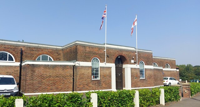
Lippitts Hill is a small residential area located in Essex, England. Situated within the Epping Forest district, it is part of the larger town of Highams Park. Lippitts Hill is known for its picturesque surroundings, offering residents a blend of urban convenience and natural beauty.

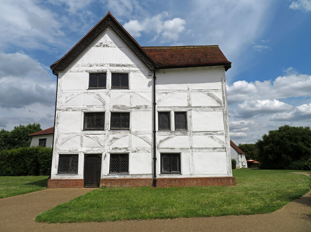
The area is predominantly residential, with a mix of detached and semi-detached houses. Many of these properties boast spacious gardens and are surrounded by lush greenery, providing a peaceful and tranquil atmosphere. The architecture in Lippitts Hill is varied, ranging from classic Edwardian and Victorian styles to more contemporary designs.

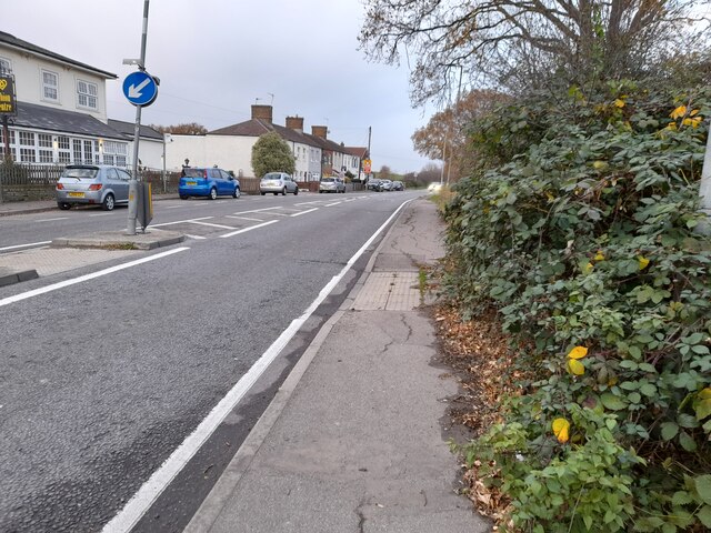
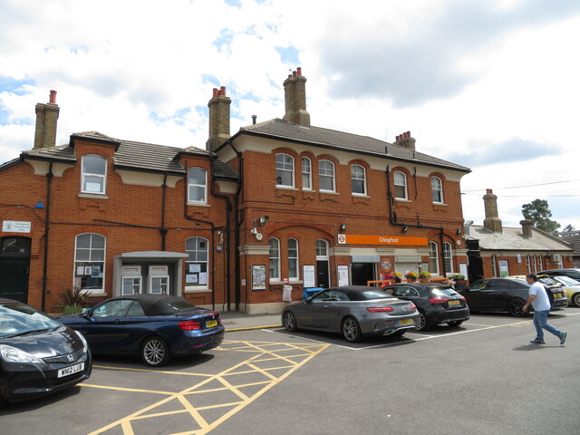
Residents of Lippitts Hill benefit from its ideal location. The area is well-connected to nearby towns and cities, with Highams Park train station offering regular services to London Liverpool Street, making it a popular choice for commuters. There are also several bus routes that serve the area, providing convenient transportation options.

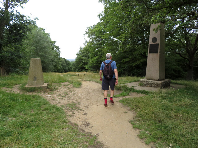
One of the key attractions of Lippitts Hill is its close proximity to Epping Forest. This ancient woodland is a designated Site of Special Scientific Interest and offers a range of recreational activities, including walking, cycling, and horse riding. The forest is home to diverse wildlife and features many scenic trails, making it an ideal escape for nature enthusiasts.

In terms of amenities, Lippitts Hill benefits from being close to the bustling Highams Park town center. Here, residents can find a variety of shops, supermarkets, cafes, and restaurants, catering to their everyday needs.

Overall, Lippitts Hill offers a peaceful and idyllic living environment, combined with easy access to both urban amenities and the natural beauty of Epping Forest.

If you have any feedback on the listing, please let us know in the comments section below.

Lippitts Hill Images

Images are sourced within 2km of 51.645625/0.00756074 or Grid Reference TQ3996. Thanks to Geograph Open Source API. All images are credited.
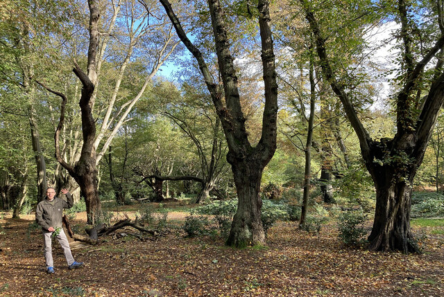
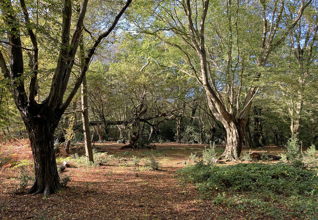
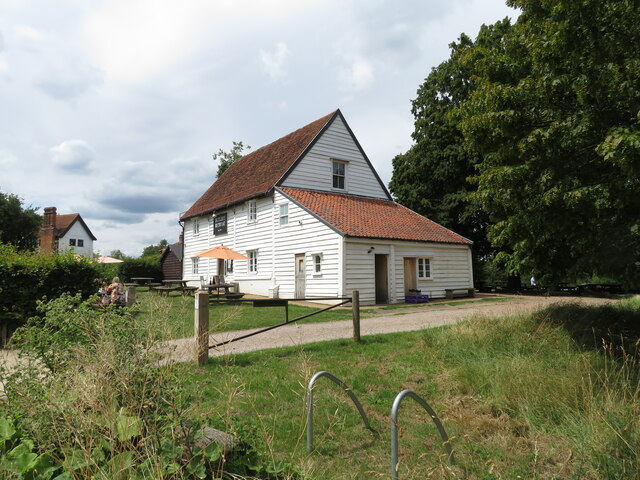
Chingford Station
Chingford Station
Bury Wood, Epping Forest (1)
Bury Wood, Epping Forest (2)
North Chingford Methodist Church
Small woodland by Sewardstone Road
Sewardstone Road, Chingford This is the part of Chingford which is outside London despite the postcode.
Sewardstone Road, Chingford
This is the part of Chingford which is outside London despite the postcode.
Sewardstone Road, Chingford
Small woodland by Baden Drive, Sewardstone
Baden Drive, Sewardstone
Small woodland by Baden Drive, Sewardstone
Looking to Waltham Cross from Lippitts Hill Epping Forest (formerly known as Waltham Forest) is an ancient woodland north-east of London. As a former royal forest dating from the 12th century, it is managed by the City of London Corporation.

The forest is 2,476 hectares in area, comprising woodland, grassland and open heath, forming a 19km long green corridor. 

[abstract from Wikipedia article: <span class="nowrap"><a title="http://en.wikipedia.org/wiki/Epping_Forest" rel="nofollow ugc noopener" href="http://en.wikipedia.org/wiki/Epping_Forest">Link</a><img style="margin-left:2px;" alt="External link" title="External link - shift click to open in new window" src="https://s1.geograph.org.uk/img/external.png" width="10" height="10"/></span> ]
Looking to Waltham Cross from Lippitts Hill
Epping Forest (formerly known as Waltham Forest) is an ancient woodland north-east of London. As a former royal forest dating from the 12th century, it is managed by the City of London Corporation. The forest is 2,476 hectares in area, comprising woodland, grassland and open heath, forming a 19km long green corridor. [abstract from Wikipedia article: LinkExternal link ]
Chingford Station On the London Overground.
Chingford Station
On the London Overground.
Butler's Retreat, Chingford A coffee shop on the edge of Epping Forest. Listed Grade II. The building on the extreme left is Queen Elizabeth's Hunting Lodge.
Butler's Retreat, Chingford
A coffee shop on the edge of Epping Forest. Listed Grade II. The building on the extreme left is Queen Elizabeth's Hunting Lodge.
Queen Elizabeth's Hunting Lodge, Chingford Now a museum and Listed Grade II*. This is an early 16th century hunting lodge and is also a Scheduled Ancient Monument.
Queen Elizabeth's Hunting Lodge, Chingford
Now a museum and Listed Grade II*. This is an early 16th century hunting lodge and is also a Scheduled Ancient Monument.
Public house and hotel The Royal Forest public house and a Premier Inn are co-located here.
Public house and hotel
The Royal Forest public house and a Premier Inn are co-located here.
The Owl public house, Loughton Visited during a walk in Epping Forest. A nice setting and fine inside but not the most architecturally distinguished building.
The Owl public house, Loughton
Visited during a walk in Epping Forest. A nice setting and fine inside but not the most architecturally distinguished building.
Pole Hill, Chingford Green There is a trig point on the left and the obelisk on the right was a sighting point due north of Greenwich observatory. However, following a readjustment of the prime meridian it is now 19' to the east of it. The lower plaque refers to its geographical function and the upper plaque reveals that the land here was once owned by T E Lawrence. This is part of Epping Forest.
Pole Hill, Chingford Green
There is a trig point on the left and the obelisk on the right was a sighting point due north of Greenwich observatory. However, following a readjustment of the prime meridian it is now 19' to the east of it. The lower plaque refers to its geographical function and the upper plaque reveals that the land here was once owned by T E Lawrence. This is part of Epping Forest.
Chingford Masonic Hall The hall was built in the 1930s and features a banqueting hall which can accommodate up to 120 guests.

<span class="nowrap"><a title="https://www.chingfordmasonichall.co.uk/about" rel="nofollow ugc noopener" href="https://www.chingfordmasonichall.co.uk/about">Link</a><img style="margin-left:2px;" alt="External link" title="External link - shift click to open in new window" src="https://s1.geograph.org.uk/img/external.png" width="10" height="10"/></span>
Chingford Masonic Hall
The hall was built in the 1930s and features a banqueting hall which can accommodate up to 120 guests. LinkExternal link
Show me another place!

Lippitts Hill is located at Grid Ref: TQ3996 (Lat: 51.645625, Lng: 0.00756074)

Administrative County: Essex

District: Epping Forest

Police Authority: Essex

What 3 Words

///puns.reform.risk. Near Buckhurst Hill, Essex

Related Wikis

Gilwell Park

Gilwell Park is a camp site and activity centre in East London located in the Sewardstonebury area of Waltham Abbey, within Epping Forest, near the border...

Gilwell Oak

The Gilwell Oak is an oak tree on the grounds of The Scout Association's headquarters at Gilwell Park, Essex. It is reputed to have been used as a hiding...

Hawkwood, London

Hawkwood is a 25-acre estate in North Chingford, London Borough of Waltham Forest, North East London, England. It is about nine miles from central London...

Chingford Green (ward)

Chingford Green Ward is a political division of the London Borough of Waltham Forest and is one of the six Waltham Forest wards of the Chingford and Woodford...

Pole Hill

Pole Hill is a hill in Chingford, East London, on the border between Greater London and Essex. From its summit there is an extensive view over much of...

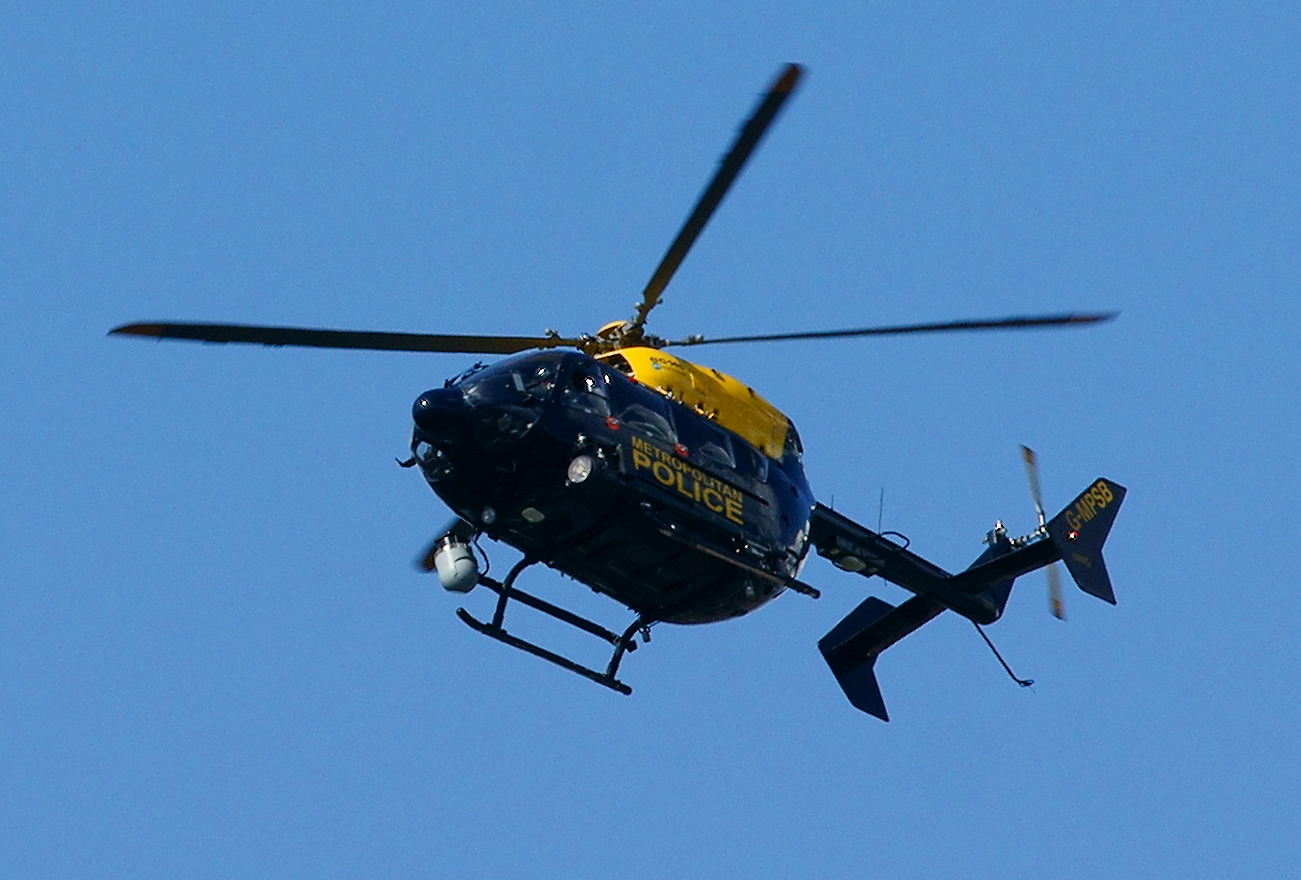
Air Support Unit (Metropolitan Police)

The Air Support Unit (ASU) was a Central Operations branch of London's Metropolitan Police Service. The main responsibility of the unit was to provide...

Lippitts Hill

Lippitts Hill is a hill located in Epping Forest at High Beach, Waltham Abbey. It has played several historic roles in the defence and policing of London...

Babes in the Wood murders (Epping Forest)

The Babes in the Wood murders are the murders of two children which occurred in a copse in Sewardstone, Essex on 31 March 1970. The victims, Susan Muriel...

Nearby Amenities

Located within 500m of 51.645625,0.00756074
Sewardstonebury
Created By: Potlatch 0.10
Place: village
Lat/Long: 51.6452142/0.0101532
Post Box
Brand: Royal Mail
Brand Wikidata: Q638098
Collection Times: Mo-Fr 17:30; Sa 11:30
Drive Through: no
Operator: Royal Mail
Operator Wikidata: Q638098
Post Box Type: pillar
Ref: E4 31
Royal Cypher: GR
Royal Cypher Wikidata: Q33102273
Lat/Long: 51.643549/0.0112242
Barrier: stile
Lat/Long: 51.6446155/0.0137907
Man Made: tower
Tower Type: communication
Lat/Long: 51.6479728/0.0024319
The Hawk Wood
Place: locality
Lat/Long: 51.6425652/0.0036945
Give Way
Direction: forward
Lat/Long: 51.6434386/0.0112708
Historic: yes
Man Made: sewer_vent
Material: cast_iron
Lat/Long: 51.6490173/0.0044305
Barrier: swing_gate
Lat/Long: 51.6484354/0.0031001
Drinking Water
Man Made: water_tap
Lat/Long: 51.6478354/0.0016532
Drinking Water
Man Made: water_tap
Lat/Long: 51.6480951/0.0021491
Man Made: manhole
Lat/Long: 51.6493156/0.0057885
Man Made: manhole
Manhole: drain
Lat/Long: 51.6498197/0.0055884
Man Made: manhole
Lat/Long: 51.6493133/0.0057514
Man Made: manhole
Lat/Long: 51.649609/0.0048332
Man Made: manhole
Manhole: drain
Lat/Long: 51.64957/0.0054652
Māori Arch
Artwork Type: sculpture
Tourism: artwork
Lat/Long: 51.6476285/0.0024602
Man Made: manhole
Lat/Long: 51.647596/0.0015551
Man Made: street_cabinet
Lat/Long: 51.6487129/0.0023467
Man Made: street_cabinet
Lat/Long: 51.6481743/0.0016144
Man Made: street_cabinet
Lat/Long: 51.6484584/0.0020236
Waste Basket
Lat/Long: 51.6484129/0.0028085
Man Made: street_cabinet
Lat/Long: 51.6480445/0.0020869
Golf: pin
Lat/Long: 51.6482496/0.0100354
Golf: pin
Lat/Long: 51.6474433/0.012751
Golf: pin
Lat/Long: 51.6448168/0.0118716
Golf: pin
Lat/Long: 51.6449747/0.0134453
Golf: pin
Lat/Long: 51.6459287/0.0121059
Golf: pin
Lat/Long: 51.6492685/0.0117
The data included in this document is from www.openstreetmap.org. The data is made available under ODbL.

Have you been to Lippitts Hill?

Leave your review of Lippitts Hill below (or comments, questions and feedback).