Lipyeate

Settlement in Somerset Mendip

England

Lipyeate

House near Charlton This house sits right on the junction where the minor road the B3139 from Charlton meets the minor road from Kilmersdon to Holcombe.
House near Charlton Credit: Nigel Mykura

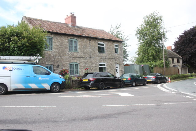
Lipyeate is a small village located in the county of Somerset, England. Situated approximately 5 miles southeast of the town of Taunton, it is nestled in the beautiful countryside of the Taunton Deane district. The village is situated on the eastern edge of the Blackdown Hills, an Area of Outstanding Natural Beauty.

Lipyeate is a historic settlement that dates back to medieval times. It is known for its charming thatched cottages and picturesque landscapes, which attract visitors seeking a tranquil and scenic retreat. The village is surrounded by rolling hills, lush green fields, and wooded areas, offering plenty of opportunities for outdoor activities such as hiking, cycling, and horseback riding.

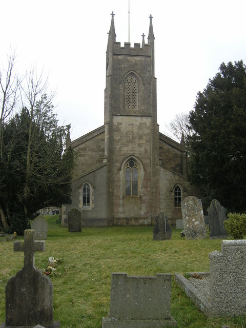
Despite its small size, Lipyeate has a strong sense of community. The village boasts a local pub, The Black Horse, which serves traditional British food and drinks, and is a popular spot for locals and visitors alike. The village also has a small church, St. Peter's, which adds to its quaint and historic charm.

Lipyeate is well-connected to nearby towns and cities. The village is accessible via the A358 road, which connects it to Taunton and other major roads in the region. Taunton railway station is also conveniently located nearby, providing easy access to other parts of the country.

Overall, Lipyeate offers a peaceful and idyllic countryside experience, making it a desirable destination for those seeking a retreat from the hustle and bustle of city life.

If you have any feedback on the listing, please let us know in the comments section below.

Lipyeate Images

Images are sourced within 2km of 51.250916/-2.458481 or Grid Reference ST6850. Thanks to Geograph Open Source API. All images are credited.

House near Charlton This house sits right on the junction where the minor road the B3139 from Charlton meets the minor road from Kilmersdon to Holcombe.
House near Charlton
This house sits right on the junction where the minor road the B3139 from Charlton meets the minor road from Kilmersdon to Holcombe.
The church of St Andrew, Holcombe
Ordnance Survey Cut Mark This mark can be found on the wall of St Andrew's Church.
For more detail see : <span class="nowrap"><a title="http://www.bench-marks.org.uk/bm47754" rel="nofollow ugc noopener" href="http://www.bench-marks.org.uk/bm47754">Link</a><img style="margin-left:2px;" alt="External link" title="External link - shift click to open in new window" src="https://s1.geograph.org.uk/img/external.png" width="10" height="10"/></span>
Ordnance Survey Cut Mark
This mark can be found on the wall of St Andrew's Church. For more detail see : LinkExternal link
South porch of Old St Andrew's Church, Holcombe The late Lella Raymond, in her 1996 guide written for the Churches Conservation Trust, tells us that "the south porch holds fascinating evidence of antiquity.  The cut stone is Doulting limestone, used for Bath, Glastonbury and Wells.  The gable incorporates a Norman arch, with zigzag around it and short rolls inserted at intervals in the hollow beneath the hood.  Above the arch, in place of the keystone, is a 16th-century carved angel with wings outstretched and arms folded.  The chevron at the apex of the gable could have been carved from the tympanum ...  The walls of the porch are blind, with plain stone benches each side, one inscribed D C 1743.  The inner doorway was continuous quarter-round moulding round a four-centred arch. The door itself is a fine medieval example."

Arthur Mee in 1941 remarked "It is the magnificent doorway that enchants us as we come, for it is pure and noble Norman with carved shafts and capitals, a little rope round the cushion of each capital, and deep zigzags round the arch, with a lovely stone angel above it all.   She has been watching in this place for centuries. One of the old stones in the arch below her has a curious inscription upside down which nobody can understand."
South porch of Old St Andrew's Church, Holcombe
The late Lella Raymond, in her 1996 guide written for the Churches Conservation Trust, tells us that "the south porch holds fascinating evidence of antiquity. The cut stone is Doulting limestone, used for Bath, Glastonbury and Wells. The gable incorporates a Norman arch, with zigzag around it and short rolls inserted at intervals in the hollow beneath the hood. Above the arch, in place of the keystone, is a 16th-century carved angel with wings outstretched and arms folded. The chevron at the apex of the gable could have been carved from the tympanum ... The walls of the porch are blind, with plain stone benches each side, one inscribed D C 1743. The inner doorway was continuous quarter-round moulding round a four-centred arch. The door itself is a fine medieval example." Arthur Mee in 1941 remarked "It is the magnificent doorway that enchants us as we come, for it is pure and noble Norman with carved shafts and capitals, a little rope round the cushion of each capital, and deep zigzags round the arch, with a lovely stone angel above it all. She has been watching in this place for centuries. One of the old stones in the arch below her has a curious inscription upside down which nobody can understand."
Old St Andrew's Church, Holcombe In parkland a mile north of the village, the old church ceased to be used for regular worship when the new church in the village centre <a href="https://www.geograph.org.uk/photo/137605">ST6749 : Holcombe St Andrew</a> was opened in 1884.  It is now vested in the Churches Conservation Trust.  The 14th-century west tower shows the emerging Perpendicular style and is unbuttressed. To its west can be seen one of an avenue of Lawson cypresses.
Old St Andrew's Church, Holcombe
In parkland a mile north of the village, the old church ceased to be used for regular worship when the new church in the village centre ST6749 : Holcombe St Andrew was opened in 1884. It is now vested in the Churches Conservation Trust. The 14th-century west tower shows the emerging Perpendicular style and is unbuttressed. To its west can be seen one of an avenue of Lawson cypresses.
Humped zebra Not a cross of some African animals but a speed-reducing measure along Anchor Road in Highbury.
Humped zebra
Not a cross of some African animals but a speed-reducing measure along Anchor Road in Highbury.
The Crossways garage is crushed No more petrol at this station. Having been declared redundant it has been demolished to make room for a new store and a house.
The Crossways garage is crushed
No more petrol at this station. Having been declared redundant it has been demolished to make room for a new store and a house.
A village that remembers Coleford's village signpost also provides room for a silhouette of a soldier. See <a href="https://www.geograph.org.uk/photo/7059790">ST6849 : Welcome to Coleford</a> for a better look at the hanpainted sign. The bench seat beyond marks the  Queen's Diamond Jubilee, 2012.
A village that remembers
Coleford's village signpost also provides room for a silhouette of a soldier. See ST6849 : Welcome to Coleford for a better look at the hanpainted sign. The bench seat beyond marks the Queen's Diamond Jubilee, 2012.
Welcome to Coleford A hand-painted village sign; pity the elements have taken the shine off it as it looks rather fetching. See <a href="https://www.geograph.org.uk/photo/7059781">ST6849 : A village that remembers</a> for a wider view of the roadside position.
Welcome to Coleford
A hand-painted village sign; pity the elements have taken the shine off it as it looks rather fetching. See ST6849 : A village that remembers for a wider view of the roadside position.
A post box remains The village post office was here up until quite recently, but the premises are now a piano shop. However, the postbox and a notice board remain on site.
A post box remains
The village post office was here up until quite recently, but the premises are now a piano shop. However, the postbox and a notice board remain on site.
Coleford Royal British Legion hall The hall was built in 1956, with later extensions. See <a href="https://www.geograph.org.uk/photo/7059810">ST6849 : The Legion scroll</a> for a look at the front sign and legend.
Coleford Royal British Legion hall
The hall was built in 1956, with later extensions. See ST6849 : The Legion scroll for a look at the front sign and legend.
The Legion scroll Coleford Royal British Legion hall has this stone plaque on the front that records the fallen of both world wars. It seems such an obvious place to have a war memorial, yet not many do. See <a href="https://www.geograph.org.uk/photo/7059804">ST6849 : Coleford Royal British Legion hall</a> for a location view.
The Legion scroll
Coleford Royal British Legion hall has this stone plaque on the front that records the fallen of both world wars. It seems such an obvious place to have a war memorial, yet not many do. See ST6849 : Coleford Royal British Legion hall for a location view.
Coleford Gospel Hall The village had held some meetings in various places before a worshipper, Harry Beer, drove a horse and cart to Devizes to purchase an old army hut. The corrugated hut became the first hall for the community by 1920. Later meetings were also held under canvas as the needs outgrew. Today this spacious modern hall welcomes all.
Coleford Gospel Hall
The village had held some meetings in various places before a worshipper, Harry Beer, drove a horse and cart to Devizes to purchase an old army hut. The corrugated hut became the first hall for the community by 1920. Later meetings were also held under canvas as the needs outgrew. Today this spacious modern hall welcomes all.
Coleford and Highbury signpost At the junction of Anchor Road and Church Street. Coleford is nowhere near the sea but presumably Anchor Road is named after the Anchor Inn further up the way.
Coleford and Highbury signpost
At the junction of Anchor Road and Church Street. Coleford is nowhere near the sea but presumably Anchor Road is named after the Anchor Inn further up the way.
Coleford pharmacy At the top of Church Street. Prior to this it was the village fish and chip shop.
Coleford pharmacy
At the top of Church Street. Prior to this it was the village fish and chip shop.
Coleford's K6 This telephone box is now a library and second-hand outlet.
Coleford's K6
This telephone box is now a library and second-hand outlet.
The old Miners Arms Naturally, a mining village would have a pub of this name; sadly, it stood almost opposite another, the Eagle, and lost that battle for customers. Today it has been redeveloped as a small group of apartments with original features and even includes a bar area.
The old Miners Arms
Naturally, a mining village would have a pub of this name; sadly, it stood almost opposite another, the Eagle, and lost that battle for customers. Today it has been redeveloped as a small group of apartments with original features and even includes a bar area.
The Eagle Inn, Coleford This pub has had to bear the brunt of the Covid problem and hence was closed for quite some time as staff were unavailable. It remains in a parlous financial state and there are worries it too will be lost - as was the Miners Arms opposite.

The building is nineteenth century with some unusual additions.
The Eagle Inn, Coleford
This pub has had to bear the brunt of the Covid problem and hence was closed for quite some time as staff were unavailable. It remains in a parlous financial state and there are worries it too will be lost - as was the Miners Arms opposite. The building is nineteenth century with some unusual additions.
Show me another place!

Lipyeate is located at Grid Ref: ST6850 (Lat: 51.250916, Lng: -2.458481)

Administrative County: Somerset

District: Mendip

Police Authority: Avon and Somerset

What 3 Words

///summaries.chaos.napped. Near Chilcompton, Somerset

Nearby Locations

Lipyeate

Related Wikis

Coleford, Somerset

Coleford is a village and civil parish in Somerset, England, situated on the Mells River in the Mendip Hills five miles west of Frome. The parish has a...

Holcombe, Somerset

Holcombe is a small village and civil parish (population 936) in the Mendip local government district of Somerset, England. The parish contains the hamlets...

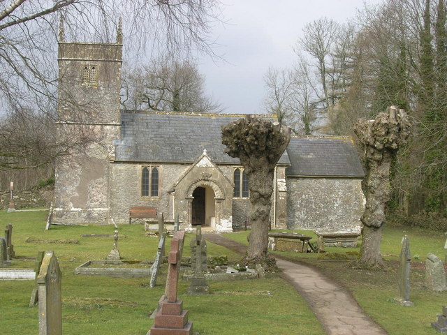
Church of St Andrew, Holcombe

The Church of St. Andrew close to Downside Abbey in Holcombe, Somerset, England has late Saxon-early Norman origins and was rebuilt in the 16th century...

Newbury Manor School

Newbury Manor School is a specialist education school for pupils with an autistic spectrum diagnosis, situated in Newbury, near Mells, seven miles from...
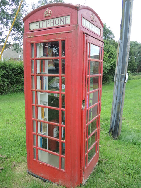
Nearby Amenities

Located within 500m of 51.250916,-2.458481
Hill House
Place: hamlet
Source: NPE
Lat/Long: 51.252638/-2.4580305
Power: pole
Lat/Long: 51.2512825/-2.4646604
Power: pole
Lat/Long: 51.2514554/-2.4629492
Power: pole
Lat/Long: 51.2509014/-2.4616751
Power: pole
Lat/Long: 51.250344/-2.460385
Power: pole
Lat/Long: 51.2491755/-2.4612138
Power: pole
Lat/Long: 51.2490983/-2.4599397
Power: pole
Lat/Long: 51.2490177/-2.4586523
Power: pole
Lat/Long: 51.2489623/-2.4573085
Power: pole
Lat/Long: 51.2507386/-2.4555972
Power: pole
Lat/Long: 51.2470567/-2.4551654
Power: pole
Lat/Long: 51.2479348/-2.455278
Power: pole
Lat/Long: 51.2488448/-2.45538
Power: pole
Lat/Long: 51.2498102/-2.4554873
Power: pole
Lat/Long: 51.2493334/-2.458148
Power: pole
Lat/Long: 51.2495113/-2.4550366
Power: pole
Lat/Long: 51.2495936/-2.4533066
Power: pole
Lat/Long: 51.2496658/-2.4516249
Bus Stop
Coleford Road
Bus: yes
Naptan AtcoCode: 3600SOB21885
Naptan Bearing: S
Naptan CommonName: Coleford Road
Naptan Indicator: S-bound
Naptan NaptanCode: sotdjgpj
Naptan Street: Anchor Road
Naptan Verified: no
Public Transport: platform
Lat/Long: 51.2497711/-2.4567082
Bus Stop
Coleford Road
Bus: yes
Naptan AtcoCode: 3600SOB21884
Naptan Bearing: N
Naptan CommonName: Coleford Road
Naptan Indicator: N-bound
Naptan NaptanCode: sotdjgpg
Naptan Street: Anchor Road
Naptan Verified: no
Public Transport: platform
Lat/Long: 51.2497651/-2.4567771
The data included in this document is from www.openstreetmap.org. The data is made available under ODbL.

Have you been to Lipyeate?

Leave your review of Lipyeate below (or comments, questions and feedback).