Gairbh-eilean Beag

Island in Inverness-shire

Scotland

Gairbh-eilean Beag

Small bay on east coast of Ronay Small bay backed by a shallow valley, close to the headland of Rubha Creag Mhic Fhionnlaidh.
Small bay on east coast of Ronay Credit: Gordon Hatton

Gairbh-eilean Beag is a small island located in Inverness-shire, Scotland. Situated in the Inner Hebrides, it lies just off the west coast of the Scottish mainland, near the town of Mallaig. The island is part of a group of islands known as the Small Isles, which also include Rum, Eigg, and Muck.

Covering an area of approximately 3.5 square kilometers, Gairbh-eilean Beag is predominantly composed of rugged, rocky terrain with a few grassy areas. The island is uninhabited and lacks any significant permanent structures or facilities. Its isolation and untouched natural beauty make it a popular destination for nature enthusiasts, hikers, and birdwatchers.

Gairbh-eilean Beag is home to a diverse range of flora and fauna. The island's coastal cliffs provide nesting sites for various seabird species, including puffins, guillemots, and razorbills. Visitors can also spot seals and dolphins swimming in the surrounding waters. The island's vegetation consists of heather, grasses, and wildflowers, adding to its picturesque landscape.

Access to Gairbh-eilean Beag is mainly by boat, with regular ferry services operating from Mallaig and other nearby ports. There are no accommodation or tourist facilities on the island, so visitors are advised to come prepared with food, water, and camping equipment if planning an overnight stay.

Overall, Gairbh-eilean Beag offers a serene and unspoiled natural environment that allows visitors to experience the tranquility and beauty of the Scottish wilderness.

If you have any feedback on the listing, please let us know in the comments section below.

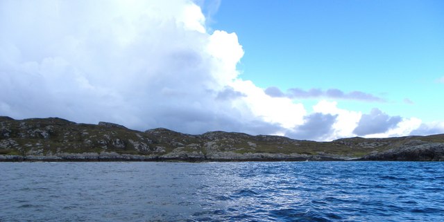
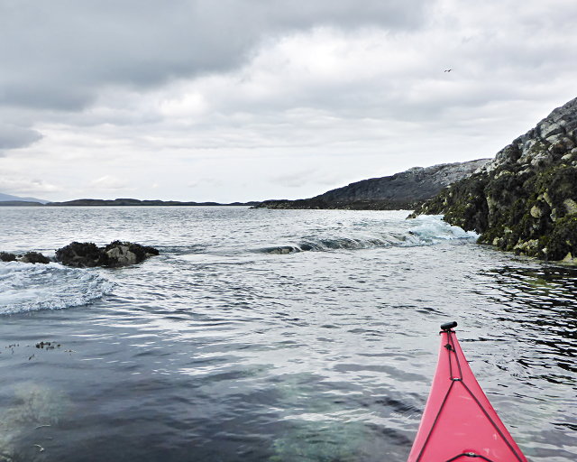
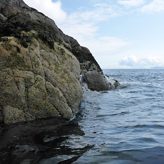
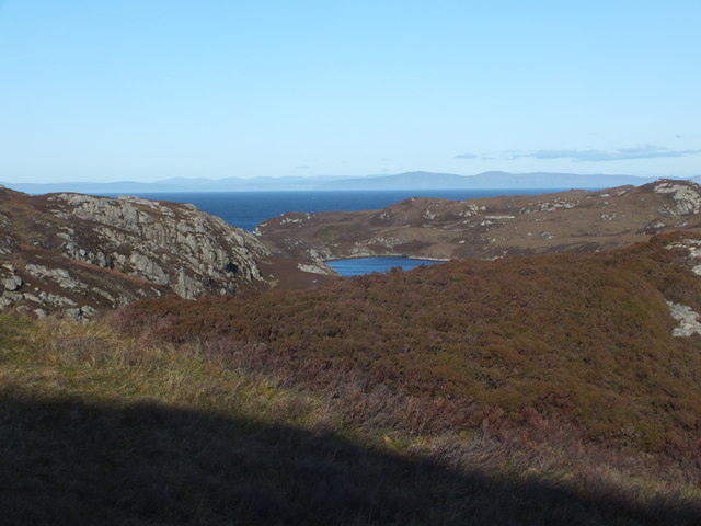
Gairbh-eilean Beag Images

Images are sourced within 2km of 57.479425/-7.2021216 or Grid Reference NF8855. Thanks to Geograph Open Source API. All images are credited.

Small bay on east coast of Ronay Small bay backed by a shallow valley, close to the headland of Rubha Creag Mhic Fhionnlaidh.
Small bay on east coast of Ronay
Small bay backed by a shallow valley, close to the headland of Rubha Creag Mhic Fhionnlaidh.
A small tide-race by Rònaigh The flow here was slightly intimidating to me in a kayak, but I made it through without harm.
A small tide-race by Rònaigh
The flow here was slightly intimidating to me in a kayak, but I made it through without harm.
Rubha na Rodagrich I'm not sure of the correct spelling of the island's name - the spelling given by the OS is inconsistent with conventional Gaelic orthography.
Rubha na Rodagrich
I'm not sure of the correct spelling of the island's name - the spelling given by the OS is inconsistent with conventional Gaelic orthography.
Ruined buildings at Buaile-mhòr
Loch na Faoileag Cairn A small cairn situated at the south-eastern end of Loch na Faoileag.
Loch na Faoileag Cairn
A small cairn situated at the south-eastern end of Loch na Faoileag.
Bagh Sgotbheinn Not all Hebridean buildings fall into disrepair. I note that Dave Fergusson's 2007 photograph includes this small building, but now, twelve years later it has a new roof and is looking well cared for.
Bagh Sgotbheinn
Not all Hebridean buildings fall into disrepair. I note that Dave Fergusson's 2007 photograph includes this small building, but now, twelve years later it has a new roof and is looking well cared for.
Kallin Harbour, Grimsay
Old harbour, Grimsay A crofthouse sitting on a reclaimed piece of land at Baymore (Bagh mor) which was the main harbour on the island before the Kallin (Ceallan) development.  The harbour is littered with lots of old creels and other flotsam and there are many old stone piers.
Old harbour, Grimsay
A crofthouse sitting on a reclaimed piece of land at Baymore (Bagh mor) which was the main harbour on the island before the Kallin (Ceallan) development. The harbour is littered with lots of old creels and other flotsam and there are many old stone piers.
Kallin Harbour The smaller vessels in the harbour are inshore lobster boats which use creels to trap crabs and lobsters.  The larger vessels are offshore prawn boats which use trawl nets to catch the shellfish.
Kallin Harbour
The smaller vessels in the harbour are inshore lobster boats which use creels to trap crabs and lobsters. The larger vessels are offshore prawn boats which use trawl nets to catch the shellfish.
Cottage on Ronay Ronay
Cottage on Ronay
Ronay
Isle of Ronay View of the Isle of Skye across the Minch.
Isle of Ronay
View of the Isle of Skye across the Minch.
Vallastrome, Kallin The view along the Vallastrome channel towards the biggest hill on the island of Ronaigh. The trig point at 115m can just be seen.
Vallastrome, Kallin
The view along the Vallastrome channel towards the biggest hill on the island of Ronaigh. The trig point at 115m can just be seen.
Coming in to harbour Small fishing boat entering Kallin harbour on a summer evening. This little boat has a 'FY' registration for Fowey in Cornwall, but arrived at Kallin on the back of a lorry. The 'Stelimar'is a local boat based here.
Coming in to harbour
Small fishing boat entering Kallin harbour on a summer evening. This little boat has a 'FY' registration for Fowey in Cornwall, but arrived at Kallin on the back of a lorry. The 'Stelimar'is a local boat based here.
Baymore: postbox № HS6 15 One of four postboxes on the island of Grimsay. Apart from the one on the main road close to the post office, they are emptied at 11:45am on weekdays and at 9:30am on Saturdays.
Baymore: postbox № HS6 15
One of four postboxes on the island of Grimsay. Apart from the one on the main road close to the post office, they are emptied at 11:45am on weekdays and at 9:30am on Saturdays.
Kallin: postbox № HS6 25 One of four postboxes on the island of Grimsay. Apart from the one on the main road close to the post office, they are emptied at 11:45am on weekdays and at 9:30am on Saturdays.
Kallin: postbox № HS6 25
One of four postboxes on the island of Grimsay. Apart from the one on the main road close to the post office, they are emptied at 11:45am on weekdays and at 9:30am on Saturdays.
Kallin: a deer He spotted me as soon as I spotted him!
Kallin: a deer
He spotted me as soon as I spotted him!
Kallin: the harbour Looking across the harbour from the road above.
Kallin: the harbour
Looking across the harbour from the road above.
Kallin: open-air phone box This telephone box is missing two glass panels and also its roof panel, which is leaning against the wall behind the box.
Kallin: open-air phone box
This telephone box is missing two glass panels and also its roof panel, which is leaning against the wall behind the box.
Show me another place!

Gairbh-eilean Beag is located at Grid Ref: NF8855 (Lat: 57.479425, Lng: -7.2021216)

Unitary Authority: Na h-Eileanan an Iar

Police Authority: Highlands and Islands

What 3 Words

///dirt.evaporate.womanly. Near Balivanich, Na h-Eileanan Siar

Related Wikis

Ronay

Ronay (Scottish Gaelic: Rònaigh) is an island in the Outer Hebrides of Scotland, which lies a short distance off the east coast of Grimsay. == Geography... ==

Grimsay

Grimsay (Scottish Gaelic: Griomasaigh) is a tidal island in the Outer Hebrides of Scotland. == Geography == Grimsay is the largest of the low-lying stepping...

Flodaigh

Flodaigh is a tidal island lying to the north of Benbecula and south of Grimsay in the Outer Hebrides, Scotland. It is connected to Benbecula by a causeway...

Flodaigh Mòr

Flodaigh Mòr (or Floddaymore) is an uninhabited island in the Outer Hebrides of Scotland. == Geography and geology == Flodaigh Mòr lies east of North Uist...

Nearby Amenities

Located within 500m of 57.479425,-7.2021216
Created By: dmgroom_coastlines
Lat/Long: 57.48254/-7.20191
Created By: dmgroom_coastlines
Lat/Long: 57.48047/-7.20645
Bus Stop
Grimsay Island
Naptan AtcoCode: 6010731676
Naptan Bearing: NW
Naptan CommonName: Grimsay Island
Naptan Indicator: Kallin
Naptan Landmark: Kallin
Naptan NaptanCode: 94723498
Naptan Street: Kallin
Naptan Verified: no
Source: naptan_import
Lat/Long: 57.4810779/-7.2060117
Passing Place
Lat/Long: 57.4785401/-7.2080637
Seamark Light Category: vertical
Seamark Light Character: F
Seamark Light Colour: red
Seamark Light Height: 6
Seamark Light Multiple: 2
Seamark Light Range: 5
Seamark Light Reference: A 3999.5
Seamark Type: light_minor
Source: US NGA Pub. 114. 2011-05-26.
Lat/Long: 57.4814369/-7.2048776
Passing Place
Lat/Long: 57.4774803/-7.2042931
Passing Place
Lat/Long: 57.481967/-7.2074424
Turning Circle
Turning Circle: knuckle
Lat/Long: 57.4824202/-7.2061075
Ceallan
Alt Name: Na Ceallan
Name En: Kallin
Name Gd: Ceallan
Place: village
Source Name: OS OpenData StreetView
Lat/Long: 57.4810147/-7.2062588
Kallin Harbour
Addr City: Uibhist a Tuath
Addr City En: Isle of North Uist
Addr Country: GB
Addr Postcode: HS6 5HY
Addr Suburb: Grimsay
Alt Name: Calla nan Ceallan
Harbour: yes
Name En: Kallin Harbour
Name Gd: Cala na Ceallan
Seamark Harbour Category: fishing
Seamark Type: harbour
Website: https://www.cne-siar.gov.uk/roads-travel-and-parking/ports-piers-and-harbours
Lat/Long: 57.4820211/-7.2043329
Lady Anne Boat Trips
Facebook: https://www.facebook.com/Lady-Anne-Boat-Trips-150460248330309/
Information: board
Opening Hours: "Dates in April- September by appointment"
Tourism: information
Website: http://www.uistboattrips.com/
Lat/Long: 57.4811676/-7.2045609
Historic: memorial
Memorial: blue_plaque
Lat/Long: 57.4807688/-7.2046404
Kallin Shellfish Shop
Addr City: Uibhist a Tuath
Addr City En: Isle of North Uist
Addr Country: GB
Addr Housenumber: 8
Addr Postcode: HS6 5HY
Addr Suburb: Grimsay
Opening Hours: Mo-Fr 09:00-16:00; Sa 10:00-15:00
Shop: seafood
Website: http://www.kallinshellfish.co.uk
Lat/Long: 57.4783071/-7.2053153
Board Type: notice
Description: Local Notices
Information: board
Tourism: information
Lat/Long: 57.4810003/-7.2053602
Telephone
Booth: KX100
Covered: booth
Mapillary: 426170049394145
Survey Date: 2022-06-20
Lat/Long: 57.4809963/-7.2053254
Cafe
Seafood Cafe
Fhrs Id: 1025638
Lat/Long: 57.4808195/-7.204158
Caolas Bhalastrom
Name En: Vallastrome
Name Gd: Caolas Bhalastrom
Natural: strait
Lat/Long: 57.4822778/-7.2035659
Harbour: yes
Port Of Entry: no
Seamark Type: harbour
Lat/Long: 57.4782923/-7.2034371
Seamark Rock Water Level: submerged
Seamark Type: rock
Lat/Long: 57.4796305/-7.1961844
Seamark Rock Water Level: submerged
Seamark Type: rock
Lat/Long: 57.478673/-7.2028685
Seamark Rock Water Level: submerged
Seamark Type: rock
Lat/Long: 57.4787047/-7.2013503
Power: pole
Lat/Long: 57.4776054/-7.2047432
Power: pole
Lat/Long: 57.4774598/-7.2058596
Power: pole
Lat/Long: 57.4773041/-7.2069452
Power: pole
Lat/Long: 57.4779275/-7.2079651
Power: pole
Lat/Long: 57.4783691/-7.2087266
Power: pole
Lat/Long: 57.4788848/-7.2095993
Power: pole
Lat/Long: 57.4768993/-7.2076452
Power: pole
Lat/Long: 57.4766145/-7.2081254
Power: pole
Lat/Long: 57.4800889/-7.2102391
Power: pole
Lat/Long: 57.4807326/-7.2099707
Power: pole
Lat/Long: 57.4816399/-7.2059877
Power: pole
Lat/Long: 57.4818922/-7.2075259
Barrier: cattle_grid
Lat/Long: 57.4825134/-7.2077184
Barrier: cattle_grid
Lat/Long: 57.477455/-7.2044891
Passing Place
Lat/Long: 57.4785153/-7.208948
Generator Method: photovoltaic
Generator Output Electricity: small_installation
Generator Source: solar
Generator Type: solar_photovoltaic_panel
Power: generator
Lat/Long: 57.4778105/-7.2063548
Turning Circle
Turning Circle: knuckle
Lat/Long: 57.476268/-7.2075604
The data included in this document is from www.openstreetmap.org. The data is made available under ODbL.

Have you been to Gairbh-eilean Beag?

Leave your review of Gairbh-eilean Beag below (or comments, questions and feedback).