Garbh Eilean Mòr

Island in Inverness-shire

Scotland

Garbh Eilean Mòr

Small bay on east coast of Ronay Small bay backed by a shallow valley, close to the headland of Rubha Creag Mhic Fhionnlaidh.
Small bay on east coast of Ronay Credit: Gordon Hatton

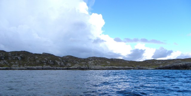
Garbh Eilean Mòr, located in Inverness-shire, is a small island situated off the west coast of Scotland. It is part of the Inner Hebrides archipelago and lies within the Inner Sound, separating the Isle of Skye from the mainland. The island covers an area of approximately 70 hectares and is mostly uninhabited.

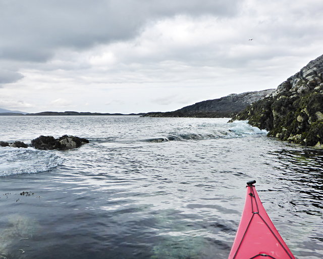
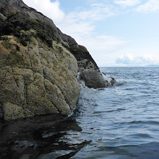
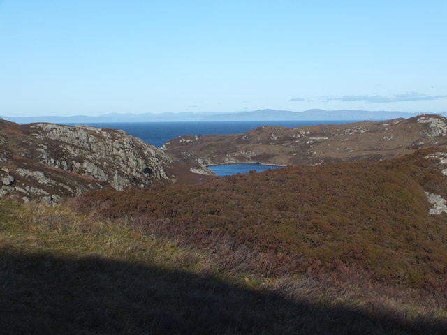
Garbh Eilean Mòr boasts stunning natural beauty, with its rugged cliffs, pristine beaches, and lush greenery. The island is home to a diverse range of wildlife, including various bird species, seals, and otters. It offers a tranquil and idyllic setting for nature enthusiasts and photographers.

The island's history is also intriguing, with evidence of human activity dating back to prehistoric times. There are remnants of ancient settlements, burial mounds, and standing stones that provide a glimpse into the island's past. Additionally, Garbh Eilean Mòr played a role in the Viking era, serving as a strategic location for their seafaring activities.

Visitors can access the island by boat, either through private charters or organized tours. Once on the island, there are opportunities for hiking, birdwatching, and exploring the historical sites. However, it is important to note that as an uninhabited island, there are no facilities or accommodations available on Garbh Eilean Mòr.

Overall, Garbh Eilean Mòr is a hidden gem in Inverness-shire, offering visitors a chance to immerse themselves in the unspoiled beauty of Scotland's west coast while delving into its rich history.

If you have any feedback on the listing, please let us know in the comments section below.

Garbh Eilean Mòr Images

Images are sourced within 2km of 57.482212/-7.1989269 or Grid Reference NF8855. Thanks to Geograph Open Source API. All images are credited.

Small bay on east coast of Ronay Small bay backed by a shallow valley, close to the headland of Rubha Creag Mhic Fhionnlaidh.
Small bay on east coast of Ronay
Small bay backed by a shallow valley, close to the headland of Rubha Creag Mhic Fhionnlaidh.
A small tide-race by Rònaigh The flow here was slightly intimidating to me in a kayak, but I made it through without harm.
A small tide-race by Rònaigh
The flow here was slightly intimidating to me in a kayak, but I made it through without harm.
Rubha na Rodagrich I'm not sure of the correct spelling of the island's name - the spelling given by the OS is inconsistent with conventional Gaelic orthography.
Rubha na Rodagrich
I'm not sure of the correct spelling of the island's name - the spelling given by the OS is inconsistent with conventional Gaelic orthography.
Ruined buildings at Buaile-mhòr
Rubh' an t-Sagairt
Rubh' an t-Sagairt
Loch na Faoileag Cairn A small cairn situated at the south-eastern end of Loch na Faoileag.
Loch na Faoileag Cairn
A small cairn situated at the south-eastern end of Loch na Faoileag.
Bagh Sgotbheinn Not all Hebridean buildings fall into disrepair. I note that Dave Fergusson's 2007 photograph includes this small building, but now, twelve years later it has a new roof and is looking well cared for.
Bagh Sgotbheinn
Not all Hebridean buildings fall into disrepair. I note that Dave Fergusson's 2007 photograph includes this small building, but now, twelve years later it has a new roof and is looking well cared for.
Kallin Harbour, Grimsay
Old harbour, Grimsay A crofthouse sitting on a reclaimed piece of land at Baymore (Bagh mor) which was the main harbour on the island before the Kallin (Ceallan) development.  The harbour is littered with lots of old creels and other flotsam and there are many old stone piers.
Old harbour, Grimsay
A crofthouse sitting on a reclaimed piece of land at Baymore (Bagh mor) which was the main harbour on the island before the Kallin (Ceallan) development. The harbour is littered with lots of old creels and other flotsam and there are many old stone piers.
Kallin Harbour The smaller vessels in the harbour are inshore lobster boats which use creels to trap crabs and lobsters.  The larger vessels are offshore prawn boats which use trawl nets to catch the shellfish.
Kallin Harbour
The smaller vessels in the harbour are inshore lobster boats which use creels to trap crabs and lobsters. The larger vessels are offshore prawn boats which use trawl nets to catch the shellfish.
Cottage on Ronay Ronay
Cottage on Ronay
Ronay
Isle of Ronay View of the Isle of Skye across the Minch.
Isle of Ronay
View of the Isle of Skye across the Minch.
Isle of Ronay View towards North Uist
Isle of Ronay
View towards North Uist
Vallastrome, Kallin The view along the Vallastrome channel towards the biggest hill on the island of Ronaigh. The trig point at 115m can just be seen.
Vallastrome, Kallin
The view along the Vallastrome channel towards the biggest hill on the island of Ronaigh. The trig point at 115m can just be seen.
Coming in to harbour Small fishing boat entering Kallin harbour on a summer evening. This little boat has a 'FY' registration for Fowey in Cornwall, but arrived at Kallin on the back of a lorry. The 'Stelimar'is a local boat based here.
Coming in to harbour
Small fishing boat entering Kallin harbour on a summer evening. This little boat has a 'FY' registration for Fowey in Cornwall, but arrived at Kallin on the back of a lorry. The 'Stelimar'is a local boat based here.
Baymore: postbox № HS6 15 One of four postboxes on the island of Grimsay. Apart from the one on the main road close to the post office, they are emptied at 11:45am on weekdays and at 9:30am on Saturdays.
Baymore: postbox № HS6 15
One of four postboxes on the island of Grimsay. Apart from the one on the main road close to the post office, they are emptied at 11:45am on weekdays and at 9:30am on Saturdays.
Kallin: postbox № HS6 25 One of four postboxes on the island of Grimsay. Apart from the one on the main road close to the post office, they are emptied at 11:45am on weekdays and at 9:30am on Saturdays.
Kallin: postbox № HS6 25
One of four postboxes on the island of Grimsay. Apart from the one on the main road close to the post office, they are emptied at 11:45am on weekdays and at 9:30am on Saturdays.
Kallin: a deer He spotted me as soon as I spotted him!
Kallin: a deer
He spotted me as soon as I spotted him!
Show me another place!

Garbh Eilean Mòr is located at Grid Ref: NF8855 (Lat: 57.482212, Lng: -7.1989269)

Unitary Authority: Na h-Eileanan an Iar

Police Authority: Highlands and Islands

What 3 Words

///profiled.lifted.ribcage. Near Balivanich, Na h-Eileanan Siar

Related Wikis

Ronay

Ronay (Scottish Gaelic: Rònaigh) is an island in the Outer Hebrides of Scotland, which lies a short distance off the east coast of Grimsay. == Geography... ==

Grimsay

Grimsay (Scottish Gaelic: Griomasaigh) is a tidal island in the Outer Hebrides of Scotland. == Geography == Grimsay is the largest of the low-lying stepping...

Flodaigh Mòr

Flodaigh Mòr (or Floddaymore) is an uninhabited island in the Outer Hebrides of Scotland. == Geography and geology == Flodaigh Mòr lies east of North Uist...

Fraoch-Eilean

Fraoch-eilean is a small island with an uncertain population north of Benbecula in the Outer Hebrides of Scotland. It is about 55 hectares (140 acres...

Nearby Amenities

Located within 500m of 57.482212,-7.1989269
Created By: dmgroom_coastlines
Lat/Long: 57.48254/-7.20191
Created By: dmgroom_coastlines
Lat/Long: 57.48011/-7.19298
Created By: dmgroom_coastlines
Lat/Long: 57.48012/-7.19347
Created By: dmgroom_coastlines
Lat/Long: 57.48037/-7.19346
Created By: dmgroom_coastlines
Lat/Long: 57.48036/-7.19298
Created By: dmgroom_coastlines
Lat/Long: 57.47985/-7.19253
Created By: dmgroom_coastlines
Lat/Long: 57.4801/-7.19252
Created By: dmgroom_coastlines
Lat/Long: 57.4801/-7.19204
Created By: dmgroom_coastlines
Lat/Long: 57.47984/-7.19206
Created By: dmgroom_coastlines
Lat/Long: 57.47935/-7.19351
Created By: dmgroom_coastlines
Lat/Long: 57.4796/-7.19349
Created By: dmgroom_coastlines
Lat/Long: 57.4796/-7.19302
Created By: dmgroom_coastlines
Lat/Long: 57.47934/-7.19303
Created By: dmgroom_coastlines
Lat/Long: 57.48047/-7.20645
Bus Stop
Grimsay Island
Naptan AtcoCode: 6010731676
Naptan Bearing: NW
Naptan CommonName: Grimsay Island
Naptan Indicator: Kallin
Naptan Landmark: Kallin
Naptan NaptanCode: 94723498
Naptan Street: Kallin
Naptan Verified: no
Source: naptan_import
Lat/Long: 57.4810779/-7.2060117
Seamark Light Category: vertical
Seamark Light Character: F
Seamark Light Colour: red
Seamark Light Height: 6
Seamark Light Multiple: 2
Seamark Light Range: 5
Seamark Light Reference: A 3999.5
Seamark Type: light_minor
Source: US NGA Pub. 114. 2011-05-26.
Lat/Long: 57.4814369/-7.2048776
Turning Circle
Turning Circle: knuckle
Lat/Long: 57.4824202/-7.2061075
Ceallan
Alt Name: Na Ceallan
Name En: Kallin
Name Gd: Ceallan
Place: village
Source Name: OS OpenData StreetView
Lat/Long: 57.4810147/-7.2062588
Kallin Harbour
Addr City: Uibhist a Tuath
Addr City En: Isle of North Uist
Addr Country: GB
Addr Postcode: HS6 5HY
Addr Suburb: Grimsay
Alt Name: Calla nan Ceallan
Harbour: yes
Name En: Kallin Harbour
Name Gd: Cala na Ceallan
Seamark Harbour Category: fishing
Seamark Type: harbour
Website: https://www.cne-siar.gov.uk/roads-travel-and-parking/ports-piers-and-harbours
Lat/Long: 57.4820211/-7.2043329
Lady Anne Boat Trips
Facebook: https://www.facebook.com/Lady-Anne-Boat-Trips-150460248330309/
Information: board
Opening Hours: "Dates in April- September by appointment"
Tourism: information
Website: http://www.uistboattrips.com/
Lat/Long: 57.4811676/-7.2045609
Historic: memorial
Memorial: blue_plaque
Lat/Long: 57.4807688/-7.2046404
Board Type: notice
Description: Local Notices
Information: board
Tourism: information
Lat/Long: 57.4810003/-7.2053602
Telephone
Booth: KX100
Covered: booth
Mapillary: 426170049394145
Survey Date: 2022-06-20
Lat/Long: 57.4809963/-7.2053254
Cafe
Seafood Cafe
Fhrs Id: 1025638
Lat/Long: 57.4808195/-7.204158
Caolas Bhalastrom
Name En: Vallastrome
Name Gd: Caolas Bhalastrom
Natural: strait
Lat/Long: 57.4822778/-7.2035659
Bàgh Clann Nèill
Natural: bay
Lat/Long: 57.4852364/-7.1978474
Seamark Rock Water Level: submerged
Seamark Type: rock
Lat/Long: 57.4796305/-7.1961844
Seamark Rock Water Level: submerged
Seamark Type: rock
Lat/Long: 57.478673/-7.2028685
Seamark Rock Water Level: submerged
Seamark Type: rock
Lat/Long: 57.4787047/-7.2013503
Rubha Clann Nèill
Natural: cape
Lat/Long: 57.483852/-7.1928625
Power: pole
Lat/Long: 57.4816399/-7.2059877
Bàgh an Taigh Ravich
Natural: bay
Lat/Long: 57.4813584/-7.1907602
The data included in this document is from www.openstreetmap.org. The data is made available under ODbL.

Have you been to Garbh Eilean Mòr?

Leave your review of Garbh Eilean Mòr below (or comments, questions and feedback).