Bàgh Clann Nèill

Bay in Inverness-shire

Scotland

Bàgh Clann Nèill

Small bay on east coast of Ronay Small bay backed by a shallow valley, close to the headland of Rubha Creag Mhic Fhionnlaidh.
Small bay on east coast of Ronay Credit: Gordon Hatton

Bàgh Clann Nèill, also known as the Bay of Clann Nèill, is a picturesque bay located in Inverness-shire, Scotland. Situated on the west coast of the country, it is renowned for its stunning natural beauty and rich historical significance.

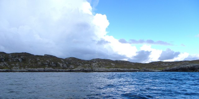
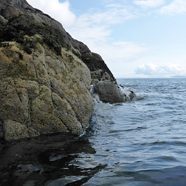
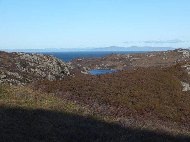
The bay is nestled between towering cliffs and rolling hills, offering breathtaking views of the surrounding landscape. Its pristine sandy beaches and crystal-clear waters make it a haven for outdoor enthusiasts and nature lovers alike. The bay is also home to a diverse range of wildlife, including seals, dolphins, and various bird species.

In addition to its natural wonders, Bàgh Clann Nèill holds great historical importance. It is believed to have been a significant Viking port during the medieval period, with remnants of their presence still visible today. The bay's name itself is derived from the Gaelic term for "Bay of the Clan Nèill," referring to the Norse-Gaelic descendants of the Vikings who once inhabited the area.

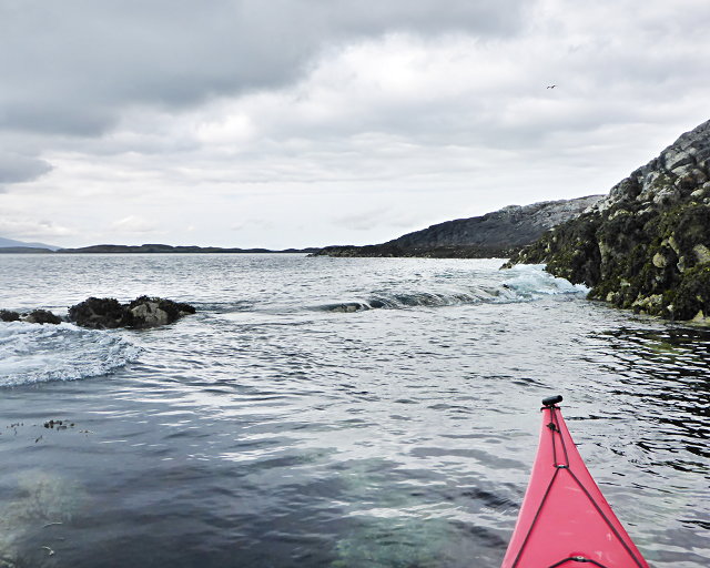
Visitors to Bàgh Clann Nèill can explore its historical sites, such as the ruins of old Viking settlements and ancient burial grounds. The bay also offers opportunities for water activities, including sailing, kayaking, and fishing. With its tranquil atmosphere and stunning scenery, Bàgh Clann Nèill is a true gem of Inverness-shire, inviting visitors to immerse themselves in its natural wonders and connect with its rich historical heritage.

If you have any feedback on the listing, please let us know in the comments section below.

Bàgh Clann Nèill Images

Images are sourced within 2km of 57.48327/-7.1970561 or Grid Reference NF8855. Thanks to Geograph Open Source API. All images are credited.

Small bay on east coast of Ronay Small bay backed by a shallow valley, close to the headland of Rubha Creag Mhic Fhionnlaidh.
Small bay on east coast of Ronay
Small bay backed by a shallow valley, close to the headland of Rubha Creag Mhic Fhionnlaidh.
A small tide-race by Rònaigh The flow here was slightly intimidating to me in a kayak, but I made it through without harm.
A small tide-race by Rònaigh
The flow here was slightly intimidating to me in a kayak, but I made it through without harm.
Rubha na Rodagrich I'm not sure of the correct spelling of the island's name - the spelling given by the OS is inconsistent with conventional Gaelic orthography.
Rubha na Rodagrich
I'm not sure of the correct spelling of the island's name - the spelling given by the OS is inconsistent with conventional Gaelic orthography.
Ruined buildings at Buaile-mhòr
Rubh' an t-Sagairt
Rubh' an t-Sagairt
Loch na Faoileag Cairn A small cairn situated at the south-eastern end of Loch na Faoileag.
Loch na Faoileag Cairn
A small cairn situated at the south-eastern end of Loch na Faoileag.
Kallin Harbour, Grimsay
Old harbour, Grimsay A crofthouse sitting on a reclaimed piece of land at Baymore (Bagh mor) which was the main harbour on the island before the Kallin (Ceallan) development.  The harbour is littered with lots of old creels and other flotsam and there are many old stone piers.
Old harbour, Grimsay
A crofthouse sitting on a reclaimed piece of land at Baymore (Bagh mor) which was the main harbour on the island before the Kallin (Ceallan) development. The harbour is littered with lots of old creels and other flotsam and there are many old stone piers.
Kallin Harbour The smaller vessels in the harbour are inshore lobster boats which use creels to trap crabs and lobsters.  The larger vessels are offshore prawn boats which use trawl nets to catch the shellfish.
Kallin Harbour
The smaller vessels in the harbour are inshore lobster boats which use creels to trap crabs and lobsters. The larger vessels are offshore prawn boats which use trawl nets to catch the shellfish.
Cottage on Ronay Ronay
Cottage on Ronay
Ronay
Isle of Ronay View of the Isle of Skye across the Minch.
Isle of Ronay
View of the Isle of Skye across the Minch.
Isle of Ronay View towards North Uist
Isle of Ronay
View towards North Uist
Vallastrome, Kallin The view along the Vallastrome channel towards the biggest hill on the island of Ronaigh. The trig point at 115m can just be seen.
Vallastrome, Kallin
The view along the Vallastrome channel towards the biggest hill on the island of Ronaigh. The trig point at 115m can just be seen.
Coming in to harbour Small fishing boat entering Kallin harbour on a summer evening. This little boat has a 'FY' registration for Fowey in Cornwall, but arrived at Kallin on the back of a lorry. The 'Stelimar'is a local boat based here.
Coming in to harbour
Small fishing boat entering Kallin harbour on a summer evening. This little boat has a 'FY' registration for Fowey in Cornwall, but arrived at Kallin on the back of a lorry. The 'Stelimar'is a local boat based here.
Baymore: postbox № HS6 15 One of four postboxes on the island of Grimsay. Apart from the one on the main road close to the post office, they are emptied at 11:45am on weekdays and at 9:30am on Saturdays.
Baymore: postbox № HS6 15
One of four postboxes on the island of Grimsay. Apart from the one on the main road close to the post office, they are emptied at 11:45am on weekdays and at 9:30am on Saturdays.
Kallin: postbox № HS6 25 One of four postboxes on the island of Grimsay. Apart from the one on the main road close to the post office, they are emptied at 11:45am on weekdays and at 9:30am on Saturdays.
Kallin: postbox № HS6 25
One of four postboxes on the island of Grimsay. Apart from the one on the main road close to the post office, they are emptied at 11:45am on weekdays and at 9:30am on Saturdays.
Kallin: a deer He spotted me as soon as I spotted him!
Kallin: a deer
He spotted me as soon as I spotted him!
Kallin: the harbour Looking across the harbour from the road above.
Kallin: the harbour
Looking across the harbour from the road above.
Show me another place!

Bàgh Clann Nèill is located at Grid Ref: NF8855 (Lat: 57.48327, Lng: -7.1970561)

Unitary Authority: Na h-Eileanan an Iar

Police Authority: Highlands and Islands

What 3 Words

///horseshoe.coping.fillers. Near Balivanich, Na h-Eileanan Siar

Related Wikis

Ronay

Ronay (Scottish Gaelic: Rònaigh) is an island in the Outer Hebrides of Scotland, which lies a short distance off the east coast of Grimsay. == Geography... ==

Grimsay

Grimsay (Scottish Gaelic: Griomasaigh) is a tidal island in the Outer Hebrides of Scotland. == Geography == Grimsay is the largest of the low-lying stepping...

Flodaigh Mòr

Flodaigh Mòr (or Floddaymore) is an uninhabited island in the Outer Hebrides of Scotland. == Geography and geology == Flodaigh Mòr lies east of North Uist...

Fraoch-Eilean

Fraoch-eilean is a small island with an uncertain population north of Benbecula in the Outer Hebrides of Scotland. It is about 55 hectares (140 acres...

Nearby Amenities

Located within 500m of 57.48327,-7.1970561
Created By: dmgroom_coastlines
Lat/Long: 57.48254/-7.20191
Created By: dmgroom_coastlines
Lat/Long: 57.48011/-7.19298
Created By: dmgroom_coastlines
Lat/Long: 57.48012/-7.19347
Created By: dmgroom_coastlines
Lat/Long: 57.48037/-7.19346
Created By: dmgroom_coastlines
Lat/Long: 57.48036/-7.19298
Created By: dmgroom_coastlines
Lat/Long: 57.47985/-7.19253
Created By: dmgroom_coastlines
Lat/Long: 57.4801/-7.19252
Created By: dmgroom_coastlines
Lat/Long: 57.4801/-7.19204
Created By: dmgroom_coastlines
Lat/Long: 57.47984/-7.19206
Created By: dmgroom_coastlines
Lat/Long: 57.47935/-7.19351
Created By: dmgroom_coastlines
Lat/Long: 57.4796/-7.19349
Created By: dmgroom_coastlines
Lat/Long: 57.4796/-7.19302
Created By: dmgroom_coastlines
Lat/Long: 57.47934/-7.19303
Kallin Harbour
Addr City: Uibhist a Tuath
Addr City En: Isle of North Uist
Addr Country: GB
Addr Postcode: HS6 5HY
Addr Suburb: Grimsay
Alt Name: Calla nan Ceallan
Harbour: yes
Name En: Kallin Harbour
Name Gd: Cala na Ceallan
Seamark Harbour Category: fishing
Seamark Type: harbour
Website: https://www.cne-siar.gov.uk/roads-travel-and-parking/ports-piers-and-harbours
Lat/Long: 57.4820211/-7.2043329
Caolas Bhalastrom
Name En: Vallastrome
Name Gd: Caolas Bhalastrom
Natural: strait
Lat/Long: 57.4822778/-7.2035659
Bàgh Clann Nèill
Natural: bay
Lat/Long: 57.4852364/-7.1978474
Seamark Rock Water Level: submerged
Seamark Type: rock
Lat/Long: 57.4796305/-7.1961844
Rubha Clann Nèill
Natural: cape
Lat/Long: 57.483852/-7.1928625
Bàgh an Taigh Ravich
Natural: bay
Lat/Long: 57.4813584/-7.1907602
The data included in this document is from www.openstreetmap.org. The data is made available under ODbL.

Have you been to Bàgh Clann Nèill?

Leave your review of Bàgh Clann Nèill below (or comments, questions and feedback).