Barton Bendish

Settlement in Norfolk King's Lynn and West Norfolk

England

Barton Bendish

Organ in St Andrew's Church The instrument occupying the 14th-century west tower arch is a rare survival of the work of Joseph Halmshaw & Sons, organ builders of Birmingham, who were active in the later 19th century and at the beginning of the 20th. For two Lincolnshire examples of their work see <a href="https://www.geograph.org.uk/photo/5911089">SK9364 : Organ, St Michael's church, South Hykeham</a> and <a href="https://www.geograph.org.uk/photo/2982696">SK9760 : Organ in All Saints' church, Coleby</a>.
Organ in St Andrew's Church Credit: Tiger

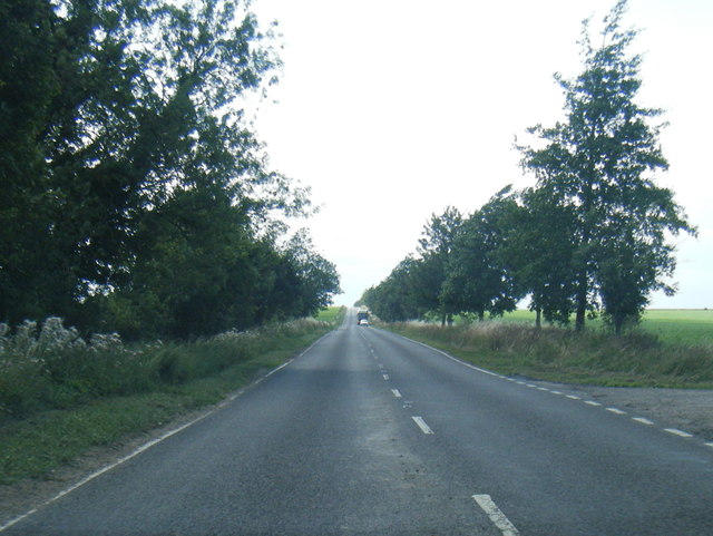
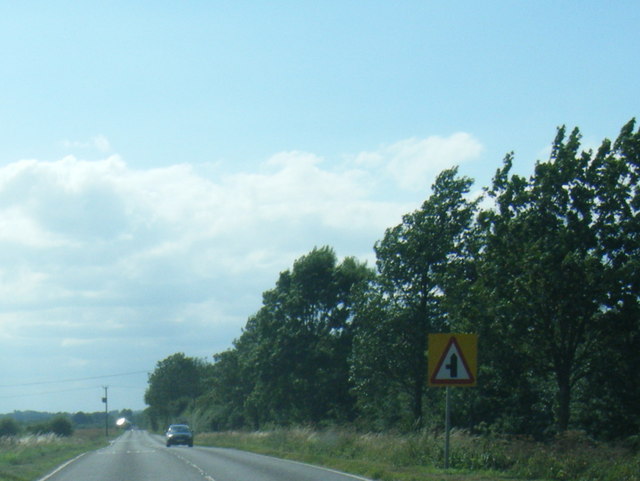
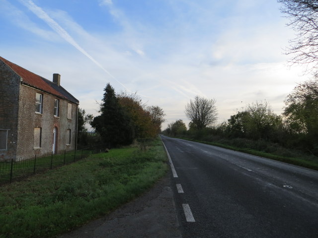
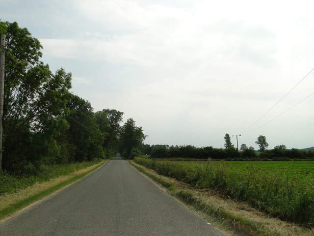
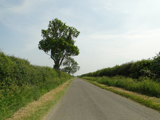
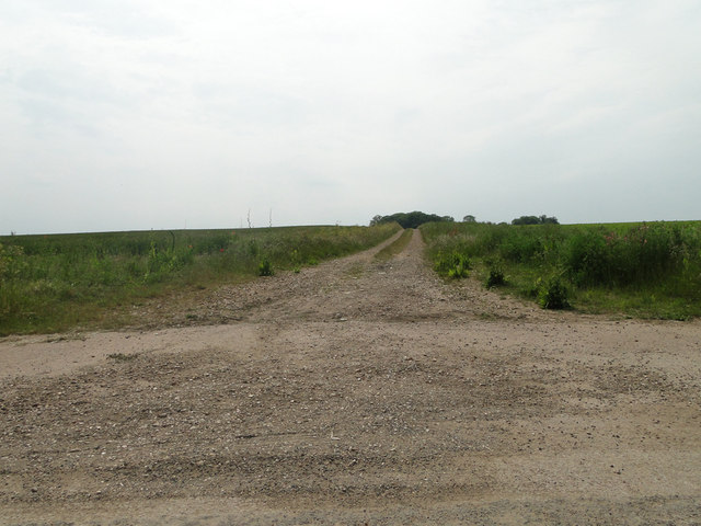
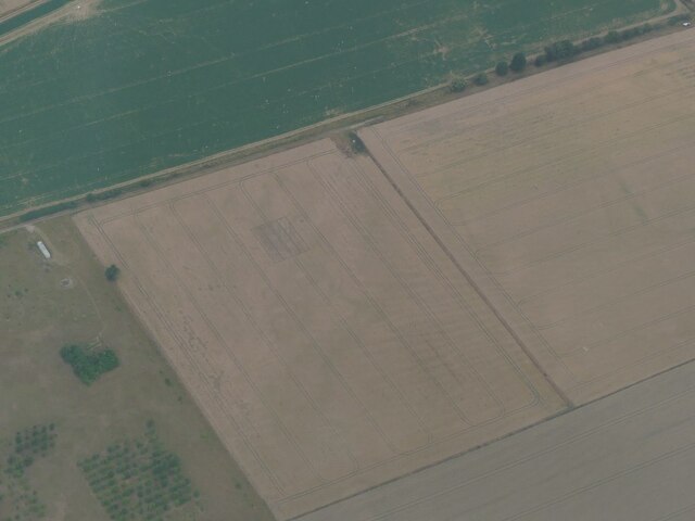
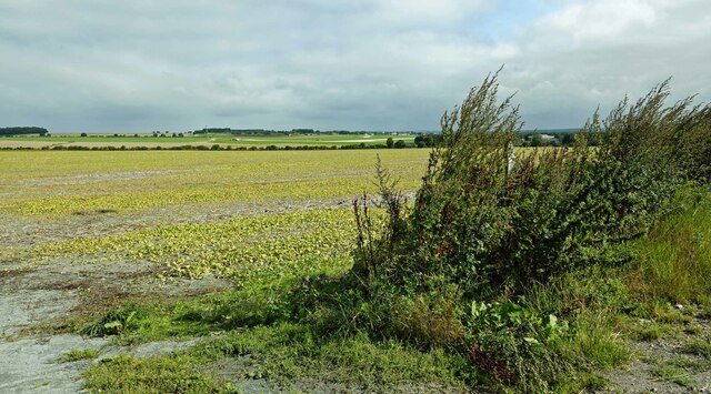
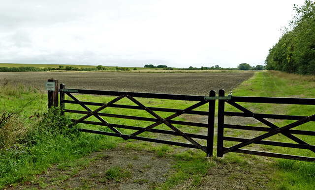
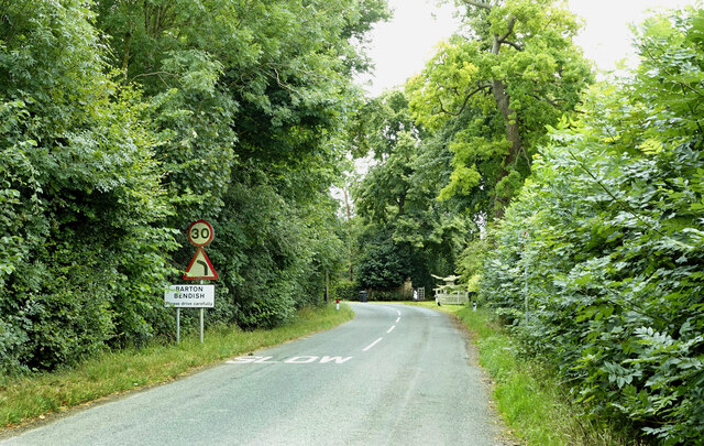
Barton Bendish is a small village located in the county of Norfolk, England. Situated approximately 12 miles southeast of King's Lynn, it falls within the district of King's Lynn and West Norfolk. The village is nestled in the picturesque countryside, surrounded by fields and farmland, creating a peaceful and idyllic setting.

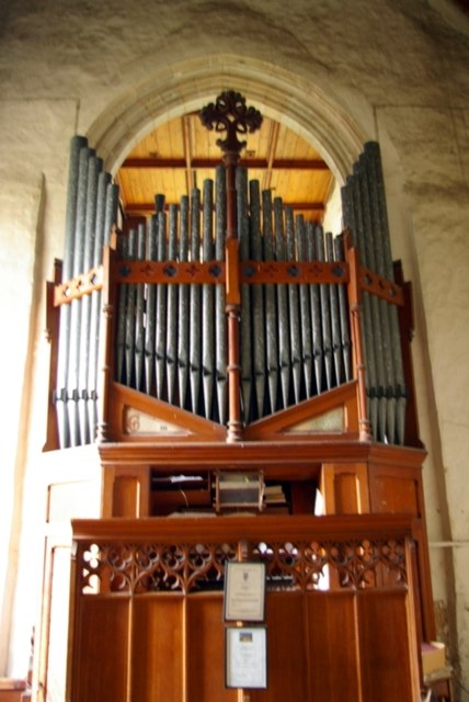
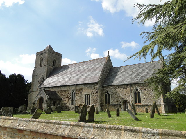
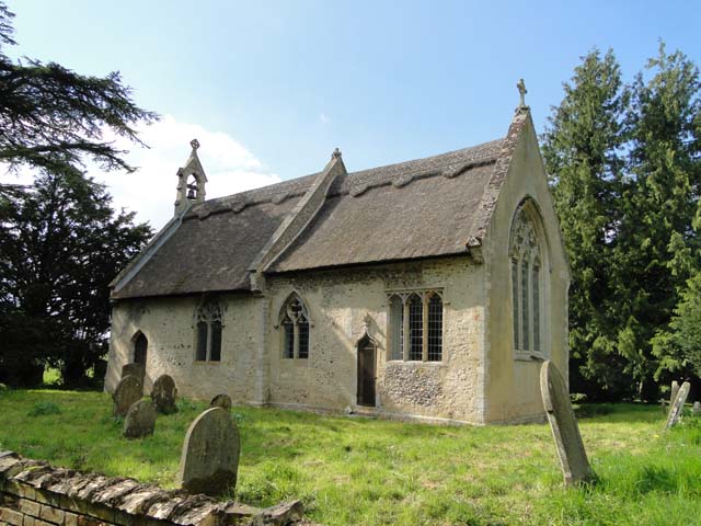
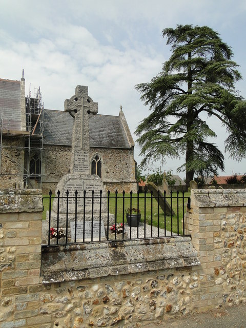
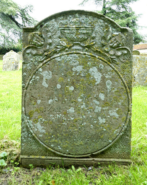
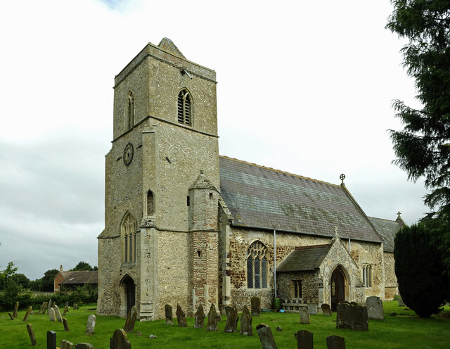
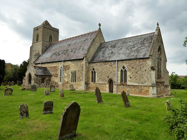
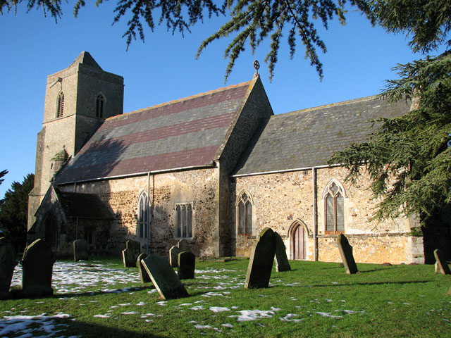
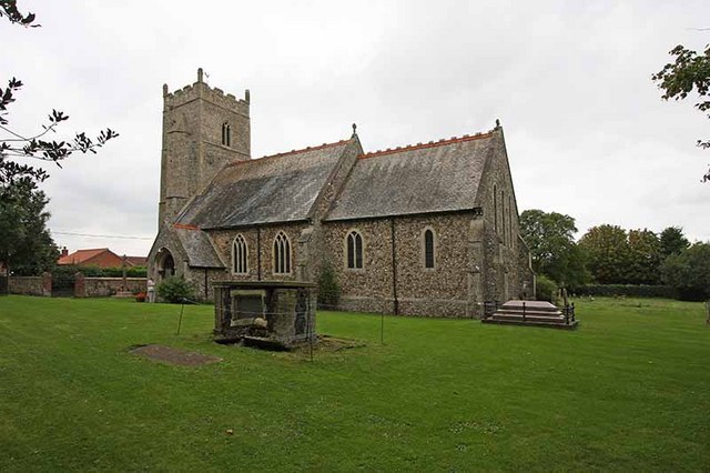
Barton Bendish is known for its rich history, with evidence of human settlement dating back to the Roman period. The village itself features several historic buildings, including the Grade I listed St. Mary's Church, which dates back to the 14th century. The church showcases stunning architecture and is a notable attraction for visitors.

The village is home to a close-knit community, with a population of around 200 residents. It boasts a strong sense of community spirit and hosts various events throughout the year, including fêtes and village gatherings. The local pub, The Berney Arms, serves as a popular meeting place for both residents and visitors.

Surrounding Barton Bendish are beautiful walking trails and nature reserves, allowing visitors to explore the stunning Norfolk countryside. The area is known for its diverse wildlife, making it a haven for nature enthusiasts and birdwatchers.

Although Barton Bendish is a small village, it offers a tranquil and charming escape from the hustle and bustle of city life. With its rich history, friendly community, and picturesque surroundings, it is a hidden gem in the Norfolk countryside.

If you have any feedback on the listing, please let us know in the comments section below.

Barton Bendish Images

Images are sourced within 2km of 52.621052/0.526309 or Grid Reference TF7105. Thanks to Geograph Open Source API. All images are credited.

Organ in St Andrew's Church The instrument occupying the 14th-century west tower arch is a rare survival of the work of Joseph Halmshaw & Sons, organ builders of Birmingham, who were active in the later 19th century and at the beginning of the 20th. For two Lincolnshire examples of their work see <a href="https://www.geograph.org.uk/photo/5911089">SK9364 : Organ, St Michael's church, South Hykeham</a> and <a href="https://www.geograph.org.uk/photo/2982696">SK9760 : Organ in All Saints' church, Coleby</a>.
Organ in St Andrew's Church
The instrument occupying the 14th-century west tower arch is a rare survival of the work of Joseph Halmshaw & Sons, organ builders of Birmingham, who were active in the later 19th century and at the beginning of the 20th. For two Lincolnshire examples of their work see SK9364 : Organ, St Michael's church, South Hykeham and SK9760 : Organ in All Saints' church, Coleby.
A1122 westbound near RAF Marham
A1122 nears Fincham Road
St. Andrew's church, Barton Bendish This is an interesting little church with some unusual features. The 15th c. porch has flushwork depicting the cross of St Andrew. A stair turret ascends the 14th c. tower on the south side, above the parapet is a pyramidal cap. In my opinion the late Norman doorway has at some time been made narrower which has created a point to the once rounded top, there is a detached column either side. Inside the nave are box pews dated 1623 and a small coeval poor box. Behind the pulpit is a small 14th c. niche and in the north wall are the old rood stairs. The chancel, to my mind is the most interesting part of the church just below the 14th c. piscina are two unique additional drains set into the floor which is covered with 14th c. patterned tiles. Adjacent to it is a graduated dropped sill sedilia.
St. Andrew's church, Barton Bendish
This is an interesting little church with some unusual features. The 15th c. porch has flushwork depicting the cross of St Andrew. A stair turret ascends the 14th c. tower on the south side, above the parapet is a pyramidal cap. In my opinion the late Norman doorway has at some time been made narrower which has created a point to the once rounded top, there is a detached column either side. Inside the nave are box pews dated 1623 and a small coeval poor box. Behind the pulpit is a small 14th c. niche and in the north wall are the old rood stairs. The chancel, to my mind is the most interesting part of the church just below the 14th c. piscina are two unique additional drains set into the floor which is covered with 14th c. patterned tiles. Adjacent to it is a graduated dropped sill sedilia.
Barton Bendish St. Mary's church The church had a tower which fell in 1421 and lasted until 1710. An attractive crocketted ogee hood-mould over the chancel door. The west Norman door has unusual banding around the columns of the jamb, the inner columns are an unusual bobbin design, with four orders of decoration above. It was salvaged from All Saints when it was demolished. Inside next to the south door is a painting of a wheel with a figure of Catherine, beneath her, a coffin on a bier. On the end of one of the Carolean benches is carved 1637; only slightly later that the Holy table which has ‘EL 1633’ carved on the front. High on the east wall hang two worm-eaten angels seemingly from the screen. A dropped-sill sedilia with quatrefoil decoration below. The piscina may be below floor level if it was similar to the one at Barton Bendish St Andrew’s.
Barton Bendish St. Mary's church
The church had a tower which fell in 1421 and lasted until 1710. An attractive crocketted ogee hood-mould over the chancel door. The west Norman door has unusual banding around the columns of the jamb, the inner columns are an unusual bobbin design, with four orders of decoration above. It was salvaged from All Saints when it was demolished. Inside next to the south door is a painting of a wheel with a figure of Catherine, beneath her, a coffin on a bier. On the end of one of the Carolean benches is carved 1637; only slightly later that the Holy table which has ‘EL 1633’ carved on the front. High on the east wall hang two worm-eaten angels seemingly from the screen. A dropped-sill sedilia with quatrefoil decoration below. The piscina may be below floor level if it was similar to the one at Barton Bendish St Andrew’s.
Road (A1122) at Cherry Tree Farm Looking north-eastward.
Road (A1122) at Cherry Tree Farm
Looking north-eastward.
Ordnance Survey Flush Bracket G2955 This can be found on the wall of a house at Cherry Tree Farm.
For more detail see : <span class="nowrap"><a title="http://www.bench-marks.org.uk/bm10915" rel="nofollow ugc noopener" href="http://www.bench-marks.org.uk/bm10915">Link</a><img style="margin-left:2px;" alt="External link" title="External link - shift click to open in new window" src="https://s1.geograph.org.uk/img/external.png" width="10" height="10"/></span>
Ordnance Survey Flush Bracket G2955
This can be found on the wall of a house at Cherry Tree Farm. For more detail see : LinkExternal link
Fincham Road, Barton Bendish
Eastmoor Road, south of Barton Bendish
Farm track to Field Barn off Eastmoor Road
Barton Bendish War Memorial The Memorial bears 17 names and an additional six on a small marble making a total of 23 for WW1, with WW2 having claimed four lives.
Barton Bendish War Memorial
The Memorial bears 17 names and an additional six on a small marble making a total of 23 for WW1, with WW2 having claimed four lives.
Cropmark on field near Fincham: aerial 2022
Towards RAF Marham A well-known plane-spotting site where vehicles can be pulled safely off the busy A1122. RAF Marham is shown in the background.
Towards RAF Marham
A well-known plane-spotting site where vehicles can be pulled safely off the busy A1122. RAF Marham is shown in the background.
Private land near Barton Bendish New gates and an explanatory sign should keep people out of these fields near Barton Bendish. Viewed from Fincham Road.
Private land near Barton Bendish
New gates and an explanatory sign should keep people out of these fields near Barton Bendish. Viewed from Fincham Road.
Approaching Barton Bendish Approaching Barton Bendish on a dull summer morning. The entrance to Barton Hall is on the corner and in the next square.
Approaching Barton Bendish
Approaching Barton Bendish on a dull summer morning. The entrance to Barton Hall is on the corner and in the next square.
In St Andrew's graveyard This gravestone at St Andrew’s in Barton Bendish, dated 1793, shows some symbolic carving across the top. The large vase in the centre is flanked by two winged souls that indicate the rise of the deceased’s soul to Heaven. I found a few examples of this style in other Norfolk graveyards.
In St Andrew's graveyard
This gravestone at St Andrew’s in Barton Bendish, dated 1793, shows some symbolic carving across the top. The large vase in the centre is flanked by two winged souls that indicate the rise of the deceased’s soul to Heaven. I found a few examples of this style in other Norfolk graveyards.
St Andrew's church St Andrew’s church, Barton Bendish. For information on this interesting old building, see <a href="https://www.geograph.org.uk/photo/3914239">TF7105 : St. Andrew's church, Barton Bendish</a>
St Andrew's church
St Andrew’s church, Barton Bendish. For information on this interesting old building, see TF7105 : St. Andrew's church, Barton Bendish
Church of St Andrew The porch front has several embedded masonry saltires as decoration
Church of St Andrew
The porch front has several embedded masonry saltires as decoration
Show me another place!

Barton Bendish is located at Grid Ref: TF7105 (Lat: 52.621052, Lng: 0.526309)

Administrative County: Norfolk

District: King's Lynn and West Norfolk

Police Authority: Norfolk

What 3 Words

///securing.squish.digests. Near Stoke Ferry, Norfolk

Nearby Locations

Barton Bendish

Related Wikis

Barton Bendish

Barton Bendish is a civil parish and small ancient village in the English county of Norfolk located 10 miles (16 km) south of King's Lynn and 90 miles...

St Andrew's Church, Barton Bendish

St Andrew's Church is a medieval Anglican parish church in the village of Barton Bendish, Norfolk, England. This village used to have two more parish churches...

St Mary's Church, Barton Bendish

St Mary's Church is a redundant medieval Anglican church in the village of Barton Bendish, Norfolk, England. This village had two more parish churches...

RAF Barton Bendish

RAF Barton Bendish was an airfield for the Royal Air Force located on the far side of the Downham Market to Swaffham road from its parent station, RAF...

Fincham

Fincham is a village and civil parish the English county of Norfolk. The village is located 9.4 miles (15.1 km) south of King's Lynn and 34 miles (55 km...

Winnold House

Winnold House, formerly the Benedictine Priory of St Winwaloe, is a country house in the parish of Wereham in Norfolk, England. The house is constructed...

RAF Marham

Royal Air Force Marham, commonly abbreviated RAF Marham (IATA: KNF, ICAO: EGYM) is a Royal Air Force station and military airbase near the village of Marham...

Boughton, Norfolk

Boughton is a village and a civil parish in the English county of Norfolk. The village is 44.4 miles (71.5 km) west of Norwich, 15.1 miles (24.3 km) south...

Nearby Amenities

Located within 500m of 52.621052,0.526309
Barton Bendish
Is In District: King's Lynn and West Norfolk
Place: village
Lat/Long: 52.619845/0.529439
Give Way
Lat/Long: 52.6199914/0.5300046
Fixme: There should be another Public Footpath that heads WSW from here.
Lat/Long: 52.619595/0.5240179
Fixme: What happens to Public Highway here, and what pedestrian rights are thre heading NNW and WNW?
Lat/Long: 52.6195591/0.5252913
Power: pole
Lat/Long: 52.6228261/0.5247131
Power: pole
Lat/Long: 52.6228528/0.5233922
Power: pole
Lat/Long: 52.6230067/0.5223199
Power: pole
Lat/Long: 52.6231631/0.521285
Power: pole
Lat/Long: 52.6231918/0.5265575
Power: pole
Lat/Long: 52.6233498/0.5202294
Power: pole
Lat/Long: 52.6238322/0.5299077
Power: pole
Lat/Long: 52.6241426/0.531527
Historic: memorial
Memorial: war_memorial
Website: https://www.warmemorialsonline.org.uk/memorial/232965/
Lat/Long: 52.6217979/0.5281736
Entrance: main
Lat/Long: 52.6218877/0.5279383
Defibrillator
Access: yes
Defibrillator Location: AB84 Fixed to outside wall at front of Barton Bendish Village Hall.
Emergency: defibrillator
Opening Hours: 24/7
Ref GB The Circuit: 621644BC-D525-4C52-A45D-ADDE00E8497D
Lat/Long: 52.6218819/0.5293173
Village Pump
Description: Cast Iron pump by village hall.
Historic: yes
Inscription: This pump provided water for 13 families untill the late 1950s. They lived in or near a row of cottages known as The Barracks which were sited behind The Spread Eagle.
Man Made: water_well
Pump: manual
Ruins: yes
Lat/Long: 52.6218999/0.5293668
Entrance: main
Lat/Long: 52.6197893/0.5241301
Entrance: yes
Lat/Long: 52.6219795/0.5281461
Give Way
Lat/Long: 52.6199288/0.529688
Give Way
Direction: backward
Lat/Long: 52.6217937/0.5285501
Grit Bin
Colour: yellow
Lat/Long: 52.6189119/0.5257545
Give Way
Lat/Long: 52.6187786/0.5257835
Give Way
Lat/Long: 52.6189336/0.5259663
Board Type: notice
Information: board
Tourism: information
Lat/Long: 52.6216121/0.5285507
Telephone
Booth: K6
Covered: booth
Listed Status: Grade II
Man Made: telephone_box
Lat/Long: 52.6215946/0.5285521
Grit Bin
Colour: yellow
Lat/Long: 52.6216321/0.5285789
Barton Bendish
Inscription: ER II / 1990
Man Made: village_sign
Material: wood
Start Date: 1990
Lat/Long: 52.6217131/0.5284797
Bench
Backrest: yes
Colour: brown
Inscription: yes
Material: wood
Seats: 3
Lat/Long: 52.6217257/0.5284891
Post Box
Operator: Royal Mail
Post Box Mounting: wooden_post
Post Box Type: lamp
Lat/Long: 52.6218372/0.5284515
Generator Source: solar
Location: roof
Power: generator
Lat/Long: 52.6214318/0.5262239
Generator Source: solar
Location: roof
Power: generator
Lat/Long: 52.6215026/0.5262306
The data included in this document is from www.openstreetmap.org. The data is made available under ODbL.

Have you been to Barton Bendish?

Leave your review of Barton Bendish below (or comments, questions and feedback).