Fodragaigh

Island in Inverness-shire

Scotland

Fodragaigh

Tidal rock near Cleit Steiseigh
Tidal rock near Cleit Steiseigh Credit: Toby Speight

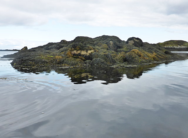
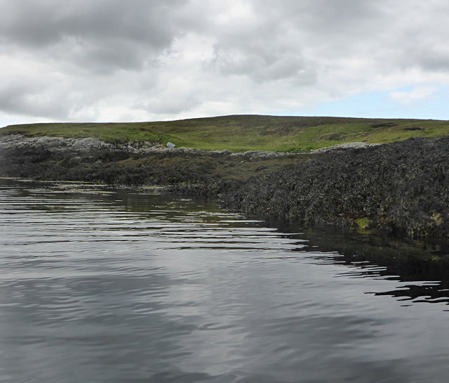
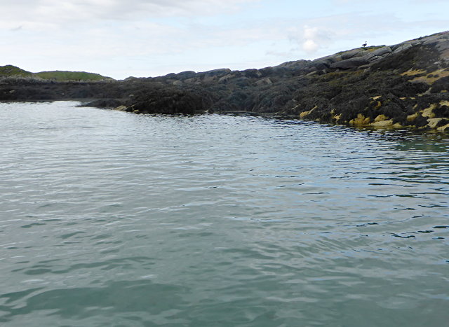
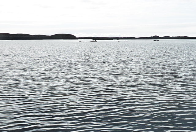
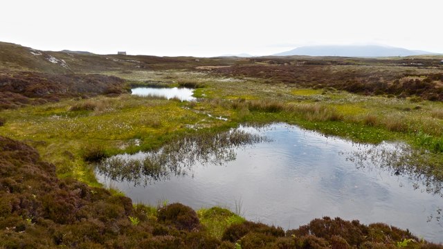
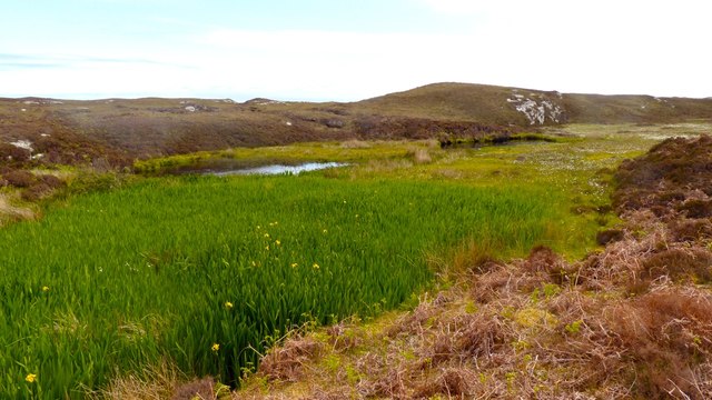
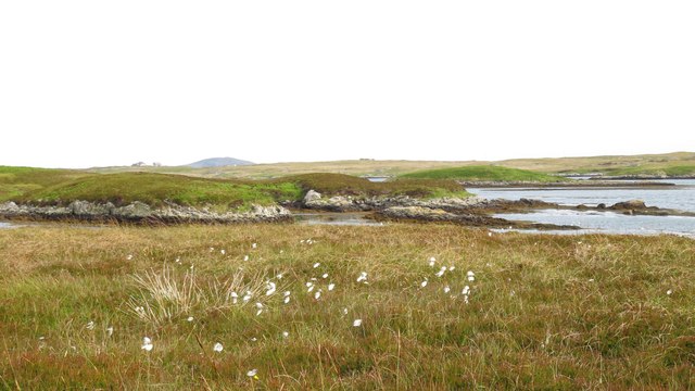
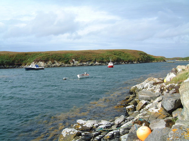
Fodragaigh is a small island located in Inverness-shire, Scotland. Situated in the western region of the Highlands, the island is enveloped by the vast waters of the Atlantic Ocean. With an area spanning approximately 2 square kilometers, Fodragaigh is known for its rugged and picturesque landscapes, making it a popular destination for nature enthusiasts and outdoor adventurers.

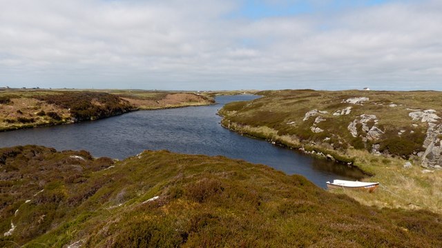
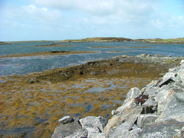
The island's terrain is characterized by rolling hills, heather moorlands, and stunning coastal cliffs that offer breathtaking views of the surrounding sea. Fodragaigh is also home to a diverse range of flora and fauna, including various bird species, seals, and occasional sightings of dolphins and whales.

Despite its small size, Fodragaigh boasts a rich history. The island is believed to have been inhabited since prehistoric times, with evidence of ancient settlements and standing stones found throughout the area. Visitors can explore these historical remnants, offering a glimpse into the island's past.

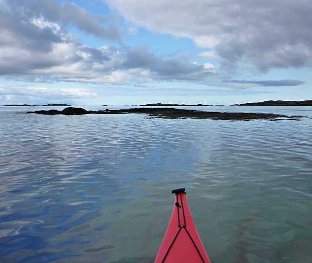
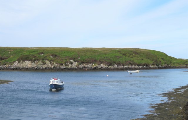
Due to its remote location, Fodragaigh provides a tranquil and secluded environment for those seeking solitude and relaxation. The lack of permanent residents and infrastructure adds to the island's untouched charm. However, it is important to note that visitors should come prepared with provisions, as there are no amenities available on the island.

Accessible by boat from the mainland, Fodragaigh offers a serene retreat for those wanting to escape the hustle and bustle of everyday life. Whether it be hiking along its scenic trails, observing the abundant wildlife, or simply soaking in the peaceful ambiance, Fodragaigh provides a unique and unforgettable experience for all who venture to its shores.

If you have any feedback on the listing, please let us know in the comments section below.

Fodragaigh Images

Images are sourced within 2km of 57.392688/-7.2577407 or Grid Reference NF8445. Thanks to Geograph Open Source API. All images are credited.
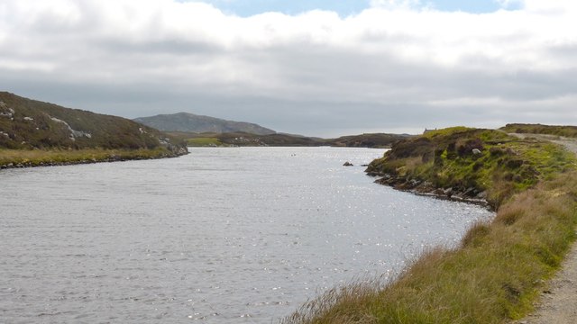
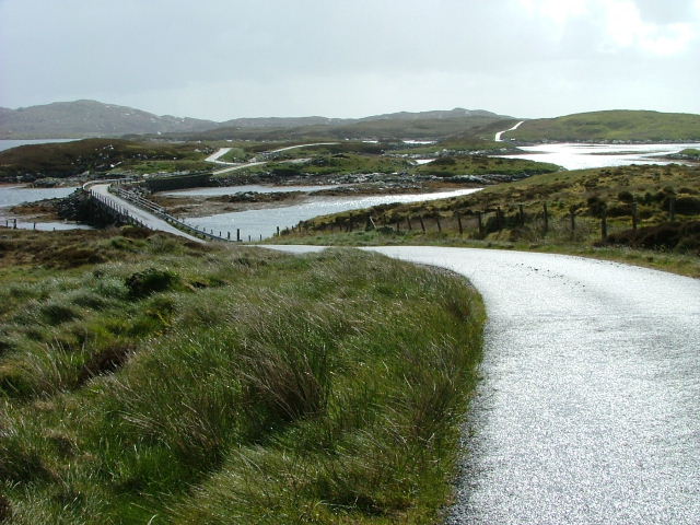
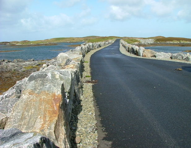
Tidal rock near Cleit Steiseigh
Cràraigh Mhor
Cràraigh Mhor
Eileanan Stafa
Eileanan Stafa
Bàgh nam Faoileann Very shallow tidal waters separate South Uist and Benbecula.
Bàgh nam Faoileann
Very shallow tidal waters separate South Uist and Benbecula.
Steiseigh and nearby rocks This is a wide, shallow sea, with a big difference in what's visible at high and low tide.  Here, we're somewhere between the two, and a few rocks are already showing.
Steiseigh and nearby rocks
This is a wide, shallow sea, with a big difference in what's visible at high and low tide. Here, we're somewhere between the two, and a few rocks are already showing.
New track on Benbecula Neither the OS maps nor Google Earth show this track  alongside Loch an Droma bho Dheas. It seems to have been constructed to gain access to a building which looked to be in the process of renovation.
New track on Benbecula
Neither the OS maps nor Google Earth show this track alongside Loch an Droma bho Dheas. It seems to have been constructed to gain access to a building which looked to be in the process of renovation.
Loch an Droma bho Deas This is the continuation of the track shown in <a href="https://www.geograph.org.uk/photo/5018122">NF8447 : New track on Benbecula</a>  The chimneys of the house under restoration can just be seen on the skyline on the right at the end on the loch.
Loch an Droma bho Deas
This is the continuation of the track shown in NF8447 : New track on Benbecula The chimneys of the house under restoration can just be seen on the skyline on the right at the end on the loch.
Extreme weather precautions on Benbecula This belt and braces job speaks volumes about the anticipated wind conditions on Benbecula ....and, yes, the other side is just the same.  The loch is loch an Droma bho Deas.
Extreme weather precautions on Benbecula
This belt and braces job speaks volumes about the anticipated wind conditions on Benbecula ....and, yes, the other side is just the same. The loch is loch an Droma bho Deas.
Loch an Droma bho Deas, Benbecula The colour of the water is misleading. Unlike nearby lochs, this one has a fringe of unpleasant filamentous algae and the water itself is quite turbid.  This reason for this could be the presence of a large number of geese and swans with their resultant deposits.  This would be made worse by the lack of meaningful rain for about two months. A pity as it's in a lovely setting.
Loch an Droma bho Deas, Benbecula
The colour of the water is misleading. Unlike nearby lochs, this one has a fringe of unpleasant filamentous algae and the water itself is quite turbid. This reason for this could be the presence of a large number of geese and swans with their resultant deposits. This would be made worse by the lack of meaningful rain for about two months. A pity as it's in a lovely setting.
Dying loch, Benbecula This loch is near the end of its life. What was once open water has gone through a series of changes, each of which alters the habitat, allowing other plant types to become established. As the submerged plants die each year, for example, their remains accumulate, making the water shallower allowing emergent species e.g. bogbean to grow. These changes are known as a hydrosere and will eventually result in a flat area which will support the climax community for the area, often woodland.
Dying loch, Benbecula
This loch is near the end of its life. What was once open water has gone through a series of changes, each of which alters the habitat, allowing other plant types to become established. As the submerged plants die each year, for example, their remains accumulate, making the water shallower allowing emergent species e.g. bogbean to grow. These changes are known as a hydrosere and will eventually result in a flat area which will support the climax community for the area, often woodland.
Dying loch, Benbecula This shows the next stage of succession after that shown in <a href="https://www.geograph.org.uk/photo/5018170">NF8447 : Dying loch, Benbecula</a> The flag iris bases would certainly allow someone to walk across what had been open water. The time taken for these changes to occur can vary greatly. In some circumstances, the habitat can reach this stage in as little as twenty years.
Dying loch, Benbecula
This shows the next stage of succession after that shown in NF8447 : Dying loch, Benbecula The flag iris bases would certainly allow someone to walk across what had been open water. The time taken for these changes to occur can vary greatly. In some circumstances, the habitat can reach this stage in as little as twenty years.
Causeway by Loch Chill Eireabhaigh Compare with this similar view in 2008 [<a title="https://www.geograph.org.uk/photo/855856" href="https://www.geograph.org.uk/photo/855856">Link</a>].
Causeway by Loch Chill Eireabhaigh
Compare with this similar view in 2008 [Link].
Cotton grass and tidal inlets Looking north from one of the tiny islets connected by causeways on the B891 towards Eilean Dubh Fo Thuath and the distant hill of Ruabhal.
Cotton grass and tidal inlets
Looking north from one of the tiny islets connected by causeways on the B891 towards Eilean Dubh Fo Thuath and the distant hill of Ruabhal.
Small boats at rest, Port Pheadair Small boats at anchor in the channel between Eilean na Cille and Fodragaigh. Would I be able to add the latter island to my growing list of island 'bags'? Not with the tide coming in and areas of exposed slippery rocks covered in weed.
Small boats at rest, Port Pheadair
Small boats at anchor in the channel between Eilean na Cille and Fodragaigh. Would I be able to add the latter island to my growing list of island 'bags'? Not with the tide coming in and areas of exposed slippery rocks covered in weed.
Port Pheadair Fodragaigh and sheltered moorings at the end of the B891, south-east Benbecula.
Port Pheadair
Fodragaigh and sheltered moorings at the end of the B891, south-east Benbecula.
Road and Causeway to Fodragaigh There are a number of causeways on this road to Fodragaigh and Port Pheadair.
Road and Causeway to Fodragaigh
There are a number of causeways on this road to Fodragaigh and Port Pheadair.
Causeway on Loch Chill Eireabhaigh One of a number of causeways on the road to Port Pheadair.
Causeway on Loch Chill Eireabhaigh
One of a number of causeways on the road to Port Pheadair.
Loch Chill Eireabhaigh From the causeway
Loch Chill Eireabhaigh
From the causeway
Show me another place!

Fodragaigh is located at Grid Ref: NF8445 (Lat: 57.392688, Lng: -7.2577407)

Unitary Authority: Na h-Eileanan an Iar

Police Authority: Highlands and Islands

What 3 Words

///speedily.index.belts. Near Balivanich, Na h-Eileanan Siar

Related Wikis

Eilean na Cille

Eilean na Cille, south east of Benbecula is an island of the Outer Hebrides connected to Grimsay (South) by a causeway which carries the B891. The road...

Grimsay (South East Benbecula)

Grimsay, south east of Benbecula is a tidal island of the Outer Hebrides. It is connected to Benbecula by a causeway which carries the B891. In the 2001...

Wiay, Outer Hebrides

Wiay (Scottish Gaelic: Bhuia or Fuidheigh) is an uninhabited island in the Outer Hebrides. It lies south-east of Benbecula and measures approximately...

Eileanan Chearabhaigh

Eileanan Chearabhaigh is a collection of small uninhabited tidal islands off the south east coast of Benbecula in the Outer Hebrides of Scotland. The English...

Nearby Amenities

Located within 500m of 57.392688,-7.2577407
Passing Place
Lat/Long: 57.3947905/-7.2517458
Passing Place
Lat/Long: 57.3937415/-7.2498656
Passing Place
Lat/Long: 57.3959192/-7.2521177
The data included in this document is from www.openstreetmap.org. The data is made available under ODbL.

Have you been to Fodragaigh?

Leave your review of Fodragaigh below (or comments, questions and feedback).