Eilean na Cloiche

Island in Inverness-shire

Scotland

Eilean na Cloiche

Pony and ruin, Carinish
Pony and ruin, Carinish Credit: Hugh Venables

Eilean na Cloiche is a small island located in the Scottish Highlands, specifically in the Inverness-shire region. Situated in Loch Ewe, the island is approximately 1 acre in size and boasts stunning natural beauty and historical significance.

The island's name, Eilean na Cloiche, translates to "Island of the Stone" in Gaelic, which is fitting as it is home to a prominent stone tower. This tower, known as the Eilean na Cloiche Lighthouse, was constructed in 1908 and served as a vital navigational aid for ships traversing the waters around the island. The lighthouse stands at an impressive height of 21 meters and is a prominent landmark in the area.

In addition to its lighthouse, Eilean na Cloiche is known for its diverse wildlife and picturesque scenery. The island provides a habitat for numerous bird species, including gulls, cormorants, and oystercatchers. The surrounding waters are often frequented by seals, dolphins, and even whales, making it a popular destination for wildlife enthusiasts.

Access to Eilean na Cloiche is mainly by boat, and visitors can explore the island's rugged coastline and enjoy its peaceful atmosphere. The island offers stunning panoramic views of the surrounding Loch Ewe and the nearby mountains, making it a popular spot for photographers and nature lovers.

Overall, Eilean na Cloiche is a charming and historically significant island that offers visitors a chance to immerse themselves in Scotland's rich natural beauty and maritime heritage.

If you have any feedback on the listing, please let us know in the comments section below.

Eilean na Cloiche Images

Images are sourced within 2km of 57.50676/-7.2763042 or Grid Reference NF8458. Thanks to Geograph Open Source API. All images are credited.

Pony and ruin, Carinish
End of the road at Àird Mhòr
Ocean on the west side of the causeway to North Uist
NCN780 on Grimsay Looking east, Loch an Fhaing on the left and Eaval, North Uist, in the distance.
NCN780 on Grimsay
Looking east, Loch an Fhaing on the left and Eaval, North Uist, in the distance.
Signpost on Grimsay The house beyond the end of Loch an Fhaing is marked as a Post Office on the map, but the may not be up to date information.
Signpost on Grimsay
The house beyond the end of Loch an Fhaing is marked as a Post Office on the map, but the may not be up to date information.
Bus stop and post box on Grimsay At the road-end of a loop that leaves the main road [A865].
Bus stop and post box on Grimsay
At the road-end of a loop that leaves the main road [A865].
House on Grimsay Looking across Bog Cotton from the A865.
House on Grimsay
Looking across Bog Cotton from the A865.
Near Gearraidh Dubh
Near Gearraidh Dubh
Gairbh-eilean
Gairbh-eilean
Oitir Mhòr
Oitir Mhòr
Barp Hacklett Cairn One cannot be absolutely sure if this is the cairn as the OS map doesn't give a detailed site, but as it is the only pile of stones on a green protuberance on an otherwise rather squelchy moor, then one would suggest that this is it.
Barp Hacklett Cairn
One cannot be absolutely sure if this is the cairn as the OS map doesn't give a detailed site, but as it is the only pile of stones on a green protuberance on an otherwise rather squelchy moor, then one would suggest that this is it.
Moorcroft Campsite at low tide
Eilean an t-Seagail Seating located at a parking spot just off the A865 near Baile Glas on Benbecula.
Eilean an t-Seagail
Seating located at a parking spot just off the A865 near Baile Glas on Benbecula.
Caravat Barp chambered cairn and shieling Large Neolithic long cairn and later historic shieling or shelter (Scale 1m). <span class="nowrap"><a title="https://canmore.org.uk/site/10254/north-uist-carinish-caravat-barp" rel="nofollow ugc noopener" href="https://canmore.org.uk/site/10254/north-uist-carinish-caravat-barp">Link</a><img style="margin-left:2px;" alt="External link" title="External link - shift click to open in new window" src="https://s1.geograph.org.uk/img/external.png" width="10" height="10"/></span>
Caravat Barp chambered cairn and shieling
Large Neolithic long cairn and later historic shieling or shelter (Scale 1m). LinkExternal link
Carinish stone circle Sadly the road cuts through this stone circle. <span class="nowrap"><a title="https://canmore.org.uk/site/10249/north-uist-carinish" rel="nofollow ugc noopener" href="https://canmore.org.uk/site/10249/north-uist-carinish">Link</a><img style="margin-left:2px;" alt="External link" title="External link - shift click to open in new window" src="https://s1.geograph.org.uk/img/external.png" width="10" height="10"/></span>
Carinish stone circle
Sadly the road cuts through this stone circle. LinkExternal link
Thatch at Cladach Chairinis
Road on Eilean na h-Airigh Leaving the causeway from Benbecula and heading for Grimsay and North Uist. Eaval / Eabhal is the North Uist mountain in the distance.
<span class="nowrap"><a title="http://www.isle-of-benbecula.co.uk/" rel="nofollow ugc noopener" href="http://www.isle-of-benbecula.co.uk/">Link</a><img style="margin-left:2px;" alt="External link" title="External link - shift click to open in new window" src="https://s1.geograph.org.uk/img/external.png" width="10" height="10"/></span>
Road on Eilean na h-Airigh
Leaving the causeway from Benbecula and heading for Grimsay and North Uist. Eaval / Eabhal is the North Uist mountain in the distance. LinkExternal link
Baile Glas, Grimsay Hamlet on the causewayed road between Benbecula and North Uist.
<span class="nowrap"><a title="http://www.isle-of-benbecula.co.uk/" rel="nofollow ugc noopener" href="http://www.isle-of-benbecula.co.uk/">Link</a><img style="margin-left:2px;" alt="External link" title="External link - shift click to open in new window" src="https://s1.geograph.org.uk/img/external.png" width="10" height="10"/></span>
Baile Glas, Grimsay
Hamlet on the causewayed road between Benbecula and North Uist. LinkExternal link
Show me another place!

Eilean na Cloiche is located at Grid Ref: NF8458 (Lat: 57.50676, Lng: -7.2763042)

Unitary Authority: Na h-Eileanan an Iar

Police Authority: Highlands and Islands

What 3 Words

///grab.qualified.clattered. Near Balivanich, Na h-Eileanan Siar

Related Wikis

Baile Glas

Baile Glas or Ballaglasa (Scottish Gaelic: Am Baile Glas) is a settlement on Grimsay in the Outer Hebrides, Scotland. Ballaglasa is within the parish of...

Fraoch-Eilean

Fraoch-eilean is a small island with an uncertain population north of Benbecula in the Outer Hebrides of Scotland. It is about 55 hectares (140 acres...

Grimsay

Grimsay (Scottish Gaelic: Griomasaigh) is a tidal island in the Outer Hebrides of Scotland. == Geography == Grimsay is the largest of the low-lying stepping...

Bail' Iochdrach

Bail' Iochdrach or Baliochrach (Scottish Gaelic: Am Baile Ìochdrach) is a village on Benbecula in the Outer Hebrides, Scotland. Baliochrach is within the...

Related Videos

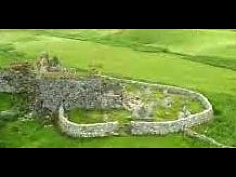
Trinity Temple On Visit To Carinish Island Of North Uist Outer Hebrides Scotland

Tour Scotland travel video clip, with Scottish music, of Trinity Temple on visit to Carinish on the Island of North Uist in the Outer ...

Teampull na Trionaid On Visit To Carinish Island Of North Uist Outer Hebrides Scotland

Tour Scotland travel video, with Scottish music, of Teampull na Trionaid on visit to Carinish on the Island of North Uist in the Outer ...

Have you been to Eilean na Cloiche?

Leave your review of Eilean na Cloiche below (or comments, questions and feedback).