Eilean Mòr

Island in Inverness-shire

Scotland

Eilean Mòr

Loch Trosaraidh
Loch Trosaraidh Credit: Alpin Stewart

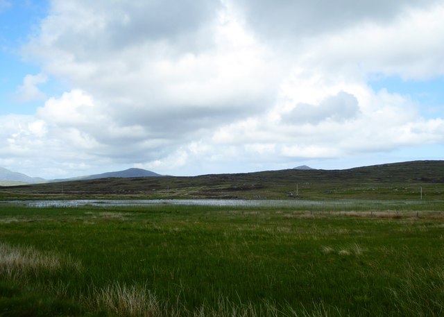
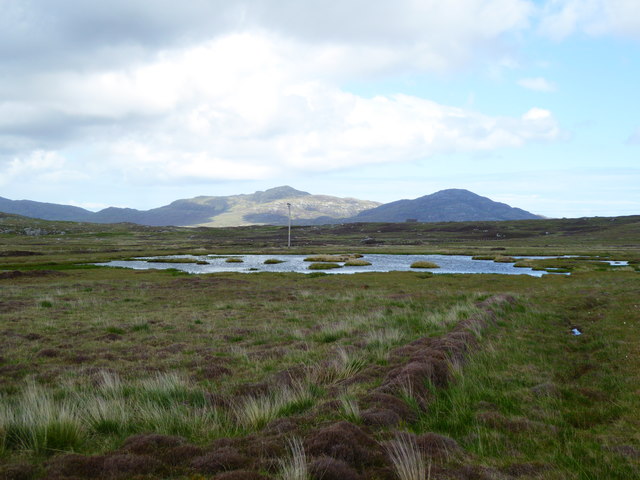
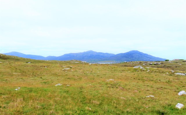
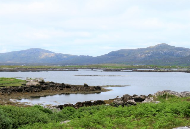
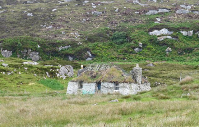
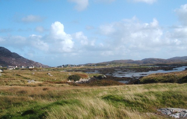
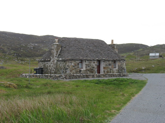
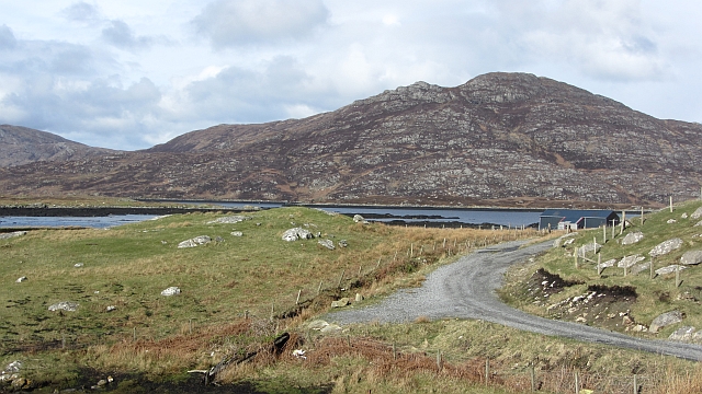
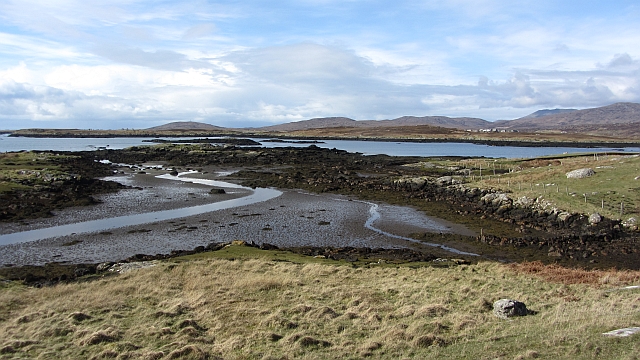
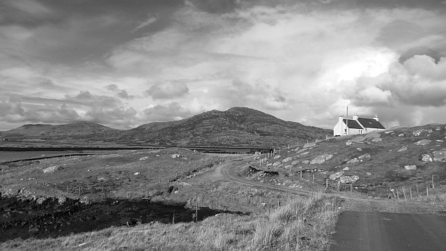
Eilean Mòr is a small island located in the Inverness-shire region of Scotland. It is situated in the Inner Hebrides, off the west coast of Scotland. The island is known for its rugged terrain and stunning coastal views.

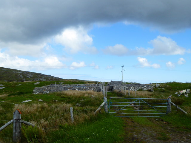
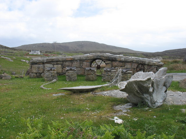
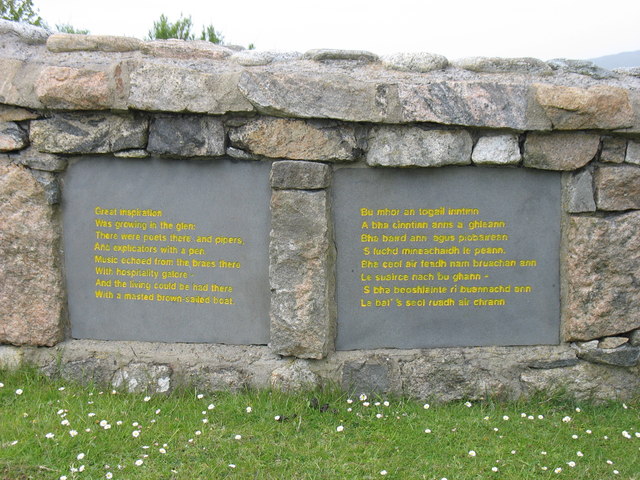
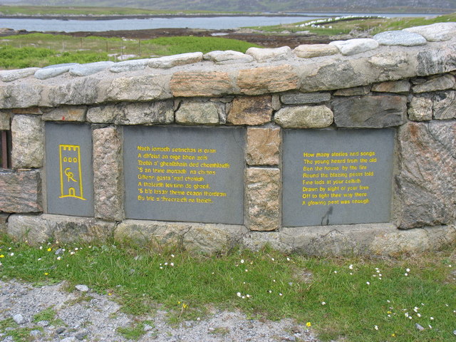
Eilean Mòr has a rich history, with evidence of human settlement dating back thousands of years. The island is home to several archaeological sites, including ancient stone circles and burial mounds. It was also once a stronghold of the Clan Maclean.

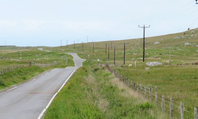
Today, Eilean Mòr is a popular destination for tourists looking to explore the natural beauty of the Scottish Highlands. Visitors can enjoy hiking along the island's coastal paths, birdwatching, and taking in the breathtaking views of the surrounding sea and mountains.

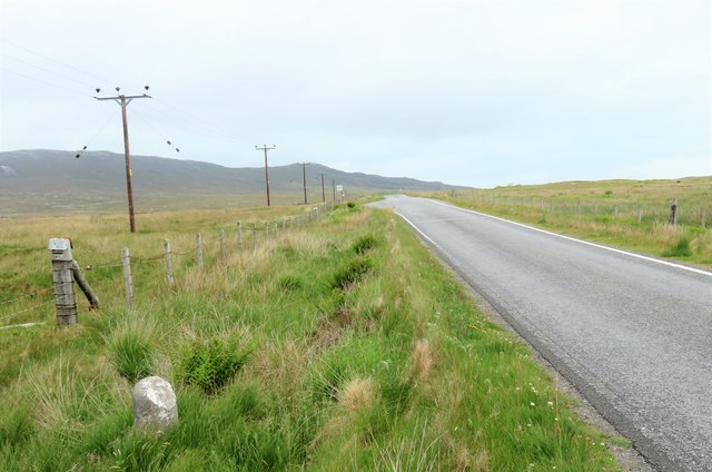
The island is accessible by ferry from the mainland, making it a convenient day trip or overnight destination for travelers. Eilean Mòr offers a peaceful retreat from the hustle and bustle of city life, with its tranquil atmosphere and unspoiled landscapes.

If you have any feedback on the listing, please let us know in the comments section below.

Eilean Mòr Images

Images are sourced within 2km of 57.142429/-7.336767 or Grid Reference NF7718. Thanks to Geograph Open Source API. All images are credited.

Loch Trosaraidh
Loch Trosaraidh
Fank at Càireasbhal
Fank at Càireasbhal
Dubh-lochan, a small moorland loch
Royal Mail road transport workshop, Lochboisdale
Old Milestone by the B888, by crossroads, in South Uist Parish Granite column by the B888, in parish of South Uist (South Uist District), 100m South of crossroads for roads to North Boisdale and South Lochboisdale, on verge.

Inscription reads:- : 5 : (To Lochboisdale Pier) 

Surveyed

Milestone Society National ID: WI_SULBS05
Old Milestone by the B888, by crossroads, in South Uist Parish
Granite column by the B888, in parish of South Uist (South Uist District), 100m South of crossroads for roads to North Boisdale and South Lochboisdale, on verge. Inscription reads:- : 5 : (To Lochboisdale Pier) Surveyed Milestone Society National ID: WI_SULBS05
Milestone by the B888 A rather basic milestone with no discernible inscription. Looking south along the road to Eriskay.
Milestone by the B888
A rather basic milestone with no discernible inscription. Looking south along the road to Eriskay.
North along the B888 The main spine road running south to north along South Uist. The B888 becomes the A865 from the junction at Daliburgh.
North along the B888
The main spine road running south to north along South Uist. The B888 becomes the A865 from the junction at Daliburgh.
Rough grazing on the slopes of Carrisaval Looking north of east across some rather uninspiring rough grassland with a sliver of water in the distance and the hills to the north east of Lochboisdale on the horizon.
Rough grazing on the slopes of Carrisaval
Looking north of east across some rather uninspiring rough grassland with a sliver of water in the distance and the hills to the north east of Lochboisdale on the horizon.
Poll Creadha Small inlet on the fretted coastline near Lochboisdale.
Poll Creadha
Small inlet on the fretted coastline near Lochboisdale.
Awaiting restoration There are several photos taken in this square showing restored blackhouses. This one is in an unrestored state. In ten year's time it could have a new roof, wood burning stove and smart 4WD parked outside.
Awaiting restoration
There are several photos taken in this square showing restored blackhouses. This one is in an unrestored state. In ten year's time it could have a new roof, wood burning stove and smart 4WD parked outside.
Bagh Mhic Gille Chothain Bay and houses from the road leaving Lochboisdale
Bagh Mhic Gille Chothain
Bay and houses from the road leaving Lochboisdale
A restored Black House The thatch appears to be in very good condition.
A restored Black House
The thatch appears to be in very good condition.
The end of the road at South Lochboisdale, South Uist Here, at Gleann dail bho Tuath, is one of the four 'Roadends sculptures'. This one is called "The Listening Space" and the five tractor seats on which one is encouraged to sit and listen are seen. See also <a href="https://www.geograph.org.uk/photo/2538598">NF7917 : Roadends sculpture verses (1)</a> and <a href="https://www.geograph.org.uk/photo/2538605">NF7917 : Roadends sculpture verses (2)</a>.
The end of the road at South Lochboisdale, South Uist
Here, at Gleann dail bho Tuath, is one of the four 'Roadends sculptures'. This one is called "The Listening Space" and the five tractor seats on which one is encouraged to sit and listen are seen. See also NF7917 : Roadends sculpture verses (1) and NF7917 : Roadends sculpture verses (2).
Roadends sculpture verses (1) The first set of verses at "The Listening Space" Roadends sculpture at South Lochboisdale. See also <a href="https://www.geograph.org.uk/photo/2538583">NF7917 : The end of the road at South Lochboisdale, South Uist</a> (taken from the other side) and <a href="https://www.geograph.org.uk/photo/2538605">NF7917 : Roadends sculpture verses (2)</a> showing the second stanza.
Roadends sculpture verses (1)
The first set of verses at "The Listening Space" Roadends sculpture at South Lochboisdale. See also NF7917 : The end of the road at South Lochboisdale, South Uist (taken from the other side) and NF7917 : Roadends sculpture verses (2) showing the second stanza.
Roadends sculpture verses (2) The second set of verses at "The Listening Space" Roadends sculpture at South Lochboisdale. See also <a href="https://www.geograph.org.uk/photo/2538583">NF7917 : The end of the road at South Lochboisdale, South Uist</a> (taken from the other side) and <a href="https://www.geograph.org.uk/photo/2538598">NF7917 : Roadends sculpture verses (1)</a> showing the first stanza.
Roadends sculpture verses (2)
The second set of verses at "The Listening Space" Roadends sculpture at South Lochboisdale. See also NF7917 : The end of the road at South Lochboisdale, South Uist (taken from the other side) and NF7917 : Roadends sculpture verses (1) showing the first stanza.
Gleann Dail Bho Tuath / North Glendale On the southern shore of Loch Boisdale / Loch Baghasdail  with a view of Beinn Ruigh Choinnich on the far side.
Gleann Dail Bho Tuath / North Glendale
On the southern shore of Loch Boisdale / Loch Baghasdail with a view of Beinn Ruigh Choinnich on the far side.
Gleann Dail Bho Tuath / North Glendale A tidal inlet on the southern side of Loch Baghasdail.
Gleann Dail Bho Tuath / North Glendale
A tidal inlet on the southern side of Loch Baghasdail.
Gleann Dail Bho Tuath / North Glendale The end of the public road on the southern side of Loch Baghasdail.
Gleann Dail Bho Tuath / North Glendale
The end of the public road on the southern side of Loch Baghasdail.
Show me another place!

Eilean Mòr is located at Grid Ref: NF7718 (Lat: 57.142429, Lng: -7.336767)

Unitary Authority: Na h-Eileanan an Iar

Police Authority: Highlands and Islands

What 3 Words

///gallons.exporters.incur. Near Lochboisdale, Na h-Eileanan Siar

Related Wikis

Papar

The Papar (Icelandic pronunciation: [ˈpʰaːpar̥]; from Latin papa, via Old Irish, meaning "father" or "pope") were, according to early Icelandic sagas,...

Eileanan Iasgaich

Na h-Eileanan Iasgaich comprise a small uninhabited archipelago in Loch Boisdale, in the south east of the island of South Uist, in the Outer Hebrides...

Lochboisdale

Lochboisdale (Scottish Gaelic: Loch Baghasdail [ɫ̪ɔx ˈbɤːs̪t̪ɪl]) is the main village and port on the island of South Uist, Outer Hebrides, Scotland. Lochboisdale...

Easaval

Easaval (Scottish Gaelic: Easabhal) is one of the smallest hills on the island of South Uist in the Outer Hebrides of Scotland, with a height of 243 metres...

Have you been to Eilean Mòr?

Leave your review of Eilean Mòr below (or comments, questions and feedback).