Lineholt Common

Settlement in Worcestershire Wychavon

England

Lineholt Common

Footpath through the Bluebells, Shrawley Woods
Footpath through the Bluebells, Shrawley Woods Credit: Jeff Gogarty

Lineholt Common is a picturesque nature reserve located in Worcestershire, England. Spread over an area of approximately 100 acres, it offers a diverse range of habitats, making it an important site for wildlife conservation. The common is situated near the village of Belbroughton, about 10 miles southwest of the city of Birmingham.

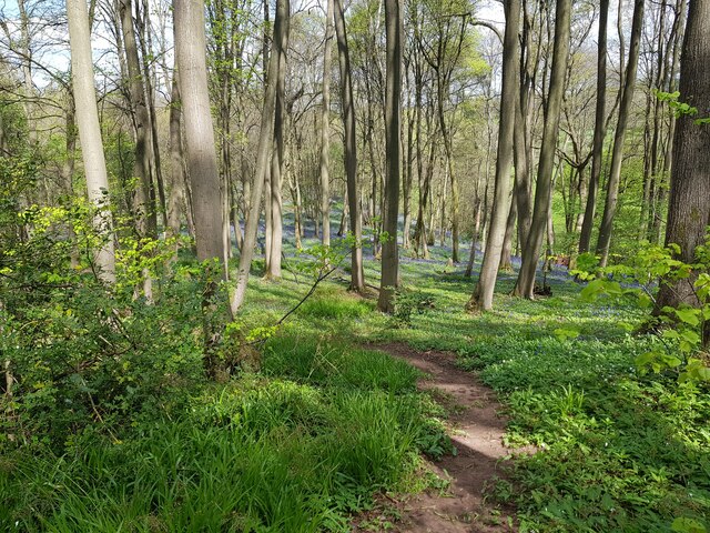
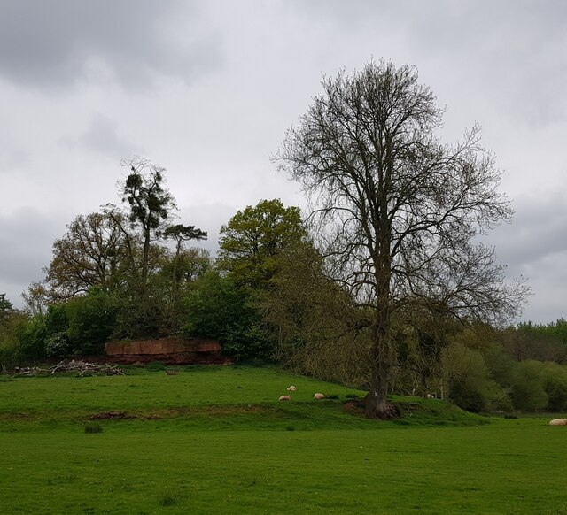
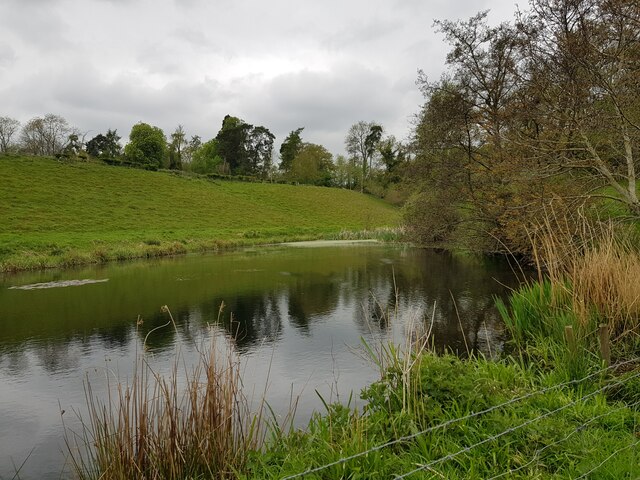
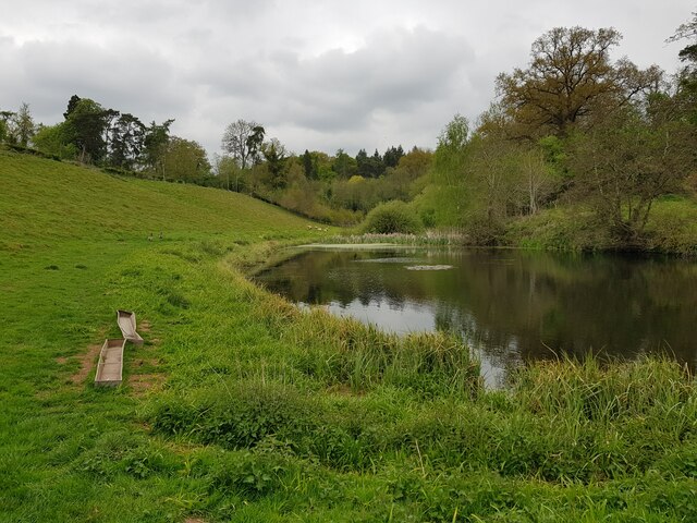
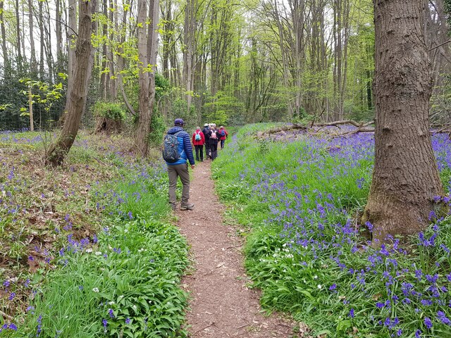
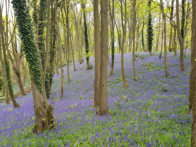
The landscape of Lineholt Common is characterized by a mix of woodland, heathland, and wetland areas. The woodland consists primarily of oak and birch trees, creating a dense and peaceful atmosphere. The heathland is covered with heather and gorse, providing a vibrant burst of color during the summer months. The wetland areas are home to several species of water-loving plants and attract a variety of birdlife.

The common is famous for its rich biodiversity, hosting a wide range of flora and fauna. Visitors can spot various bird species, including woodpeckers, warblers, and waterfowl, while walking along the well-maintained trails. The common is also home to small mammals like rabbits, foxes, and badgers. It is a popular destination for nature enthusiasts, birdwatchers, and photographers.

Lineholt Common is managed by the Worcestershire Wildlife Trust, which works to protect and enhance the natural environment. The trust organizes educational events and guided walks to promote awareness about the local wildlife and conservation efforts. With its beautiful landscapes and abundant wildlife, Lineholt Common provides a tranquil retreat for visitors seeking to explore the wonders of nature in Worcestershire.

If you have any feedback on the listing, please let us know in the comments section below.

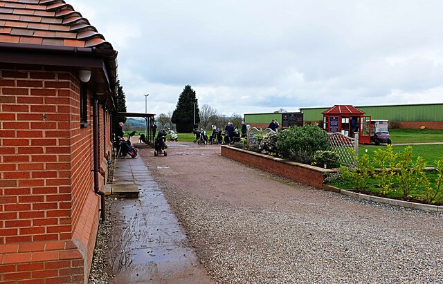
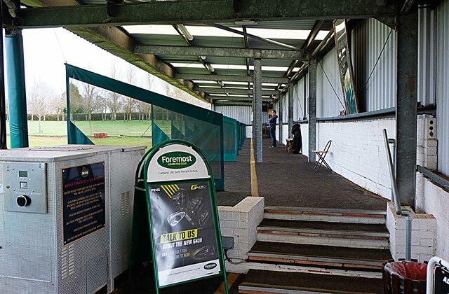
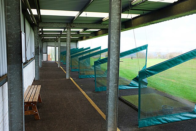
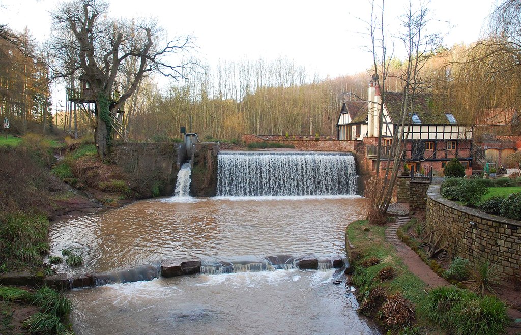
Lineholt Common Images

Images are sourced within 2km of 52.300824/-2.2653848 or Grid Reference SO8267. Thanks to Geograph Open Source API. All images are credited.

Footpath through the Bluebells, Shrawley Woods
Minor path in Shrawley woods with Bluebells and Ramsons
Oliver's Mound, Shrawley Woods
Pond near Oliver's Mound, Shrawley Woods
Pond near Oliver's Mound, Shrawley Woods (2)
New Pool, Shrawley Woods
Walkers in Shrawley Woods admiring the bluebells
Bluebells in Shrawley Woods
Walkers amongst the bluebells, Shrawley Wood
Slope of bluebells, Shrawley Woods
Sequoiadendron Wellingtonia At a crossroads of trails in Shrawley Woods.
Sequoiadendron Wellingtonia
At a crossroads of trails in Shrawley Woods.
Ombersley Golf Club Clubhouse (1), Bishops Wood Road, near Ombersley, Worcs The club was developed by a local farming family who continue to run it. The course opened in late 1991. The impressive Clubhouse includes a bar and restaurant which is open to the public, including those who do not play golf.  There is a large car park in front with access from Bishops Wood Road.

<a href="https://www.geograph.org.uk/photo/7436394">SO8267 : Ombersley Golf Club Clubhouse (2), Bishops Wood Road, near Ombersley, Worcs</a>.
Ombersley Golf Club Clubhouse (1), Bishops Wood Road, near Ombersley, Worcs
The club was developed by a local farming family who continue to run it. The course opened in late 1991. The impressive Clubhouse includes a bar and restaurant which is open to the public, including those who do not play golf. There is a large car park in front with access from Bishops Wood Road. SO8267 : Ombersley Golf Club Clubhouse (2), Bishops Wood Road, near Ombersley, Worcs.
Plough in front of Clubhouse, Ombersley Golf Club, near Ombersley, Worcs The Ombersley Golf Club is located in a very rural area and on former farmland. The plough is a symbol of this.

<a href="https://www.geograph.org.uk/photo/7436273">SO8367 : Ombersley Golf Club Clubhouse (1), Bishops Wood Road, near Ombersley, Worcs</a>.
<a href="https://www.geograph.org.uk/photo/7436394">SO8267 : Ombersley Golf Club Clubhouse (2), Bishops Wood Road, near Ombersley, Worcs</a>.
Plough in front of Clubhouse, Ombersley Golf Club, near Ombersley, Worcs
The Ombersley Golf Club is located in a very rural area and on former farmland. The plough is a symbol of this. SO8367 : Ombersley Golf Club Clubhouse (1), Bishops Wood Road, near Ombersley, Worcs. SO8267 : Ombersley Golf Club Clubhouse (2), Bishops Wood Road, near Ombersley, Worcs.
Ombersley Golf Club Clubhouse (2), Bishops Wood Road, near Ombersley, Worcs The clubhouse includes a bar and restaurant and an extensively stocked golf shop.

<a href="https://www.geograph.org.uk/photo/7436273">SO8367 : Ombersley Golf Club Clubhouse (1), Bishops Wood Road, near Ombersley, Worcs</a>.
Ombersley Golf Club Clubhouse (2), Bishops Wood Road, near Ombersley, Worcs
The clubhouse includes a bar and restaurant and an extensively stocked golf shop. SO8367 : Ombersley Golf Club Clubhouse (1), Bishops Wood Road, near Ombersley, Worcs.
Path by Ombersley Golf Course Clubhouse to Driving Range, near Ombersley, Worcs The path leads to the Driving Range, which is the green building in the distance.
Path by Ombersley Golf Course Clubhouse to Driving Range, near Ombersley, Worcs
The path leads to the Driving Range, which is the green building in the distance.
Golf buggies at Ombersley Golf Club, Bishops Wood Road, near Ombersley, Worcs Golf buggies (a.k.a. golf carts) parked near the Clubhouse.
Golf buggies at Ombersley Golf Club, Bishops Wood Road, near Ombersley, Worcs
Golf buggies (a.k.a. golf carts) parked near the Clubhouse.
Driving range (1) at Ombersley Golf Course, near Ombersley, Worcs The driving range is a facility where golfers can practice their golf swing.

<a href="https://www.geograph.org.uk/photo/7437813">SO8267 : Driving range (2) at Ombersley Golf Course, near Ombersley, Worcs</a>.
<a href="https://www.geograph.org.uk/photo/7439298">SO8267 : Area in front of Driving Range, Ombersley Golf Course, near Ombersley, Worcs</a>.
Driving range (1) at Ombersley Golf Course, near Ombersley, Worcs
Driving range (2) at Ombersley Golf Course, near Ombersley, Worcs Part of the covered driving range at Ombersley Golf Club.

See also:-  <a href="https://www.geograph.org.uk/photo/7437795">SO8267 : Driving range (1) at Ombersley Golf Course, near Ombersley, Worcs</a>.
Driving range (2) at Ombersley Golf Course, near Ombersley, Worcs
Part of the covered driving range at Ombersley Golf Club. See also:- SO8267 : Driving range (1) at Ombersley Golf Course, near Ombersley, Worcs.
Show me another place!

Lineholt Common is located at Grid Ref: SO8267 (Lat: 52.300824, Lng: -2.2653848)

Administrative County: Worcestershire

District: Wychavon

Police Authority: West Mercia

What 3 Words

///shrubbery.tarnished.wobbling. Near Hartlebury, Worcestershire

Nearby Locations

Lineholt Common Bugle Gate

Related Wikis

Dick Brook

Dick Brook is small tributary stream of the River Severn that flows through Worcestershire, England.The brook is formed from two small unnamed streams...

Astley Burf

Astley Burf is a hamlet in the parish of Astley, Worcestershire, England, on the banks of the River Severn. Within the hamlet there is one riverside public...

Noutard's Green

Noutard's Green is a hamlet within the civil parish of Shrawley in Worcestershire, England. == References ==

Astley Hall, Stourport-on-Severn

Astley Hall is a country house in Astley near Stourport-on-Severn, Worcestershire, England. The hall was the home of Prime Minister Stanley Baldwin from...

Frog Pool

Frog Pool is a hamlet within the civil parish of Shrawley in Worcestershire, England. == References ==

Shrawley

Shrawley is a village and civil parish in the Malvern Hills District in the county of Worcestershire, England. The village is situated on the western bank...

Crossway Green

Crossway Green is a village in Worcestershire, England.

Dunhampton

Dunhampton is a village in Worcestershire, England.

Nearby Amenities

Located within 500m of 52.300824,-2.2653848
Power: tower
Lat/Long: 52.2968971/-2.2644301
Power: tower
Lat/Long: 52.2995802/-2.2639496
Power: tower
Lat/Long: 52.3018814/-2.2635105
Power: tower
Lat/Long: 52.3043494/-2.2612842
Marker: aerial
Operator: CLH
Operator Old: GPSS
Ref: MP 2999
Source: survey
Utility: oil
Lat/Long: 52.2993343/-2.2631306
Cathodic Installation No 46
Power: pole
Transformer: distribution
Voltage Primary: 11000
Lat/Long: 52.3046582/-2.2634625
Power: pole
Lat/Long: 52.2969693/-2.2689054
Power: pole
Lat/Long: 52.2969788/-2.2675328
Stone Farm
Power: pole
Transformer: distribution
Voltage Primary: 11000
Lat/Long: 52.2990251/-2.2656794
Power: pole
Lat/Long: 52.2991259/-2.2647969
Power: pole
Lat/Long: 52.2993203/-2.2630227
Power: pole
Lat/Long: 52.2994491/-2.261931
Wyneyards
Power: pole
Transformer: distribution
Voltage Primary: 11000
Lat/Long: 52.2996016/-2.2604397
Power: pole
Lat/Long: 52.2967458/-2.2623709
Power: pole
Lat/Long: 52.2969829/-2.2622797
Power: pole
Lat/Long: 52.2979859/-2.2619002
Power: pole
Lat/Long: 52.2988578/-2.2610365
Power: pole
Lat/Long: 52.2992047/-2.2606784
Power: pole
Lat/Long: 52.2996295/-2.2602211
Power: pole
Lat/Long: 52.2997197/-2.2594124
Power: pole
Lat/Long: 52.2998165/-2.258487
The data included in this document is from www.openstreetmap.org. The data is made available under ODbL.

Have you been to Lineholt Common?

Leave your review of Lineholt Common below (or comments, questions and feedback).