Ettrick Hills

Range Of Mountains, Range Of Hills in Selkirkshire

Scotland

Ettrick Hills

Single track road, Ettrickdale Complete with some very old looking passing place signs.  Ferny Hill in the background.
Single track road, Ettrickdale Credit: Alan O'Dowd

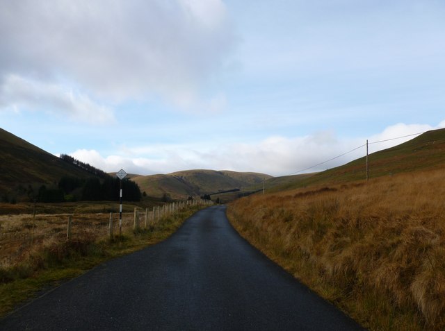
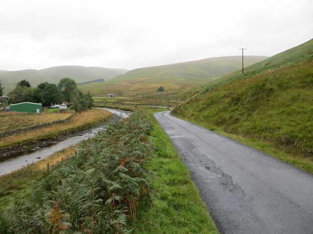
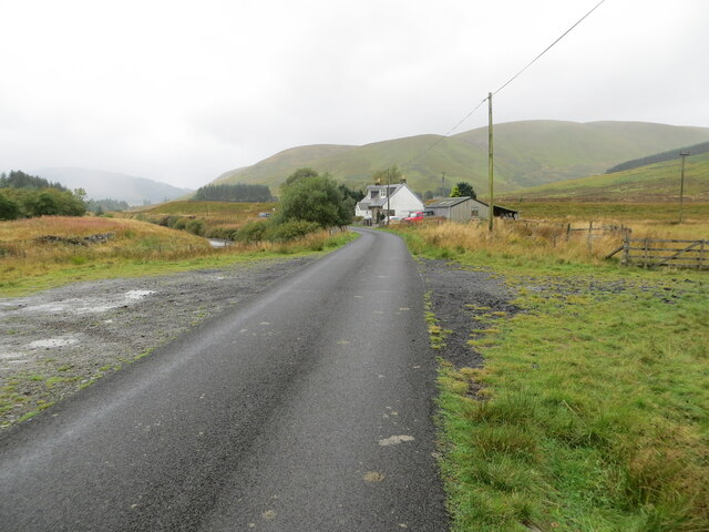
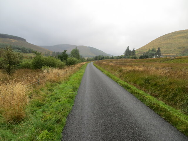
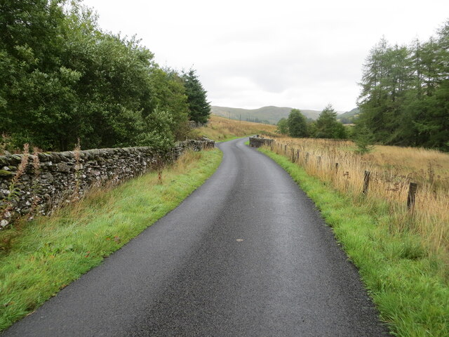
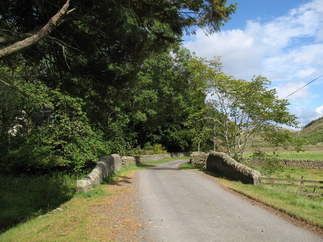
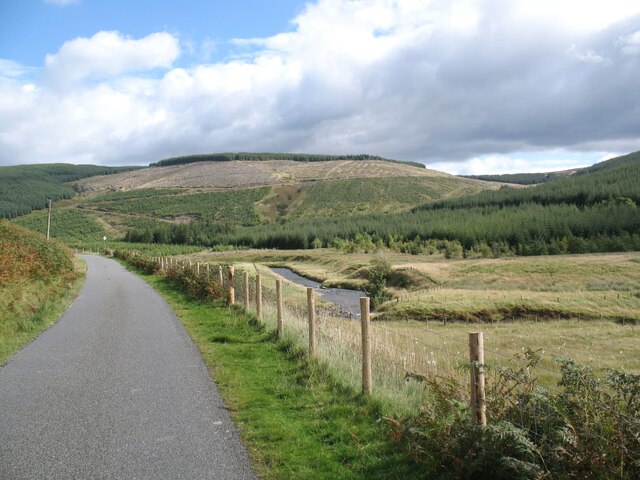
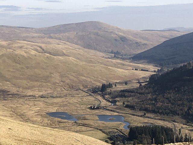
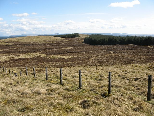
Ettrick Hills is a range of hills located in Selkirkshire, Scotland. Situated in the southern part of the country, these hills form part of the Southern Uplands, a range of mountains and hills that extend across the border between Scotland and England.

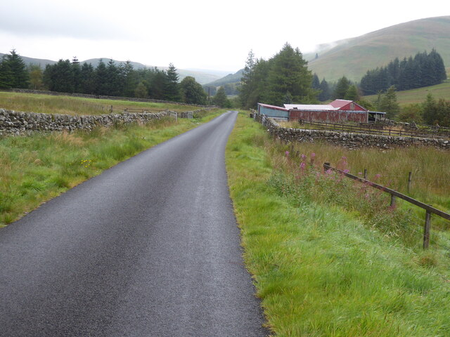
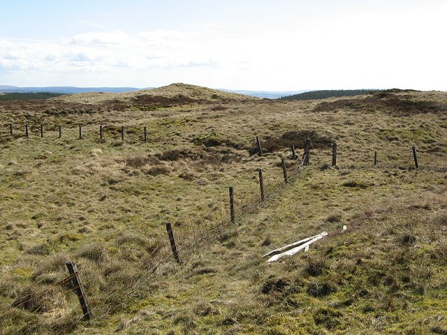
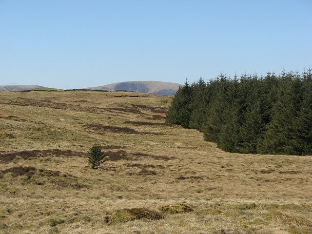
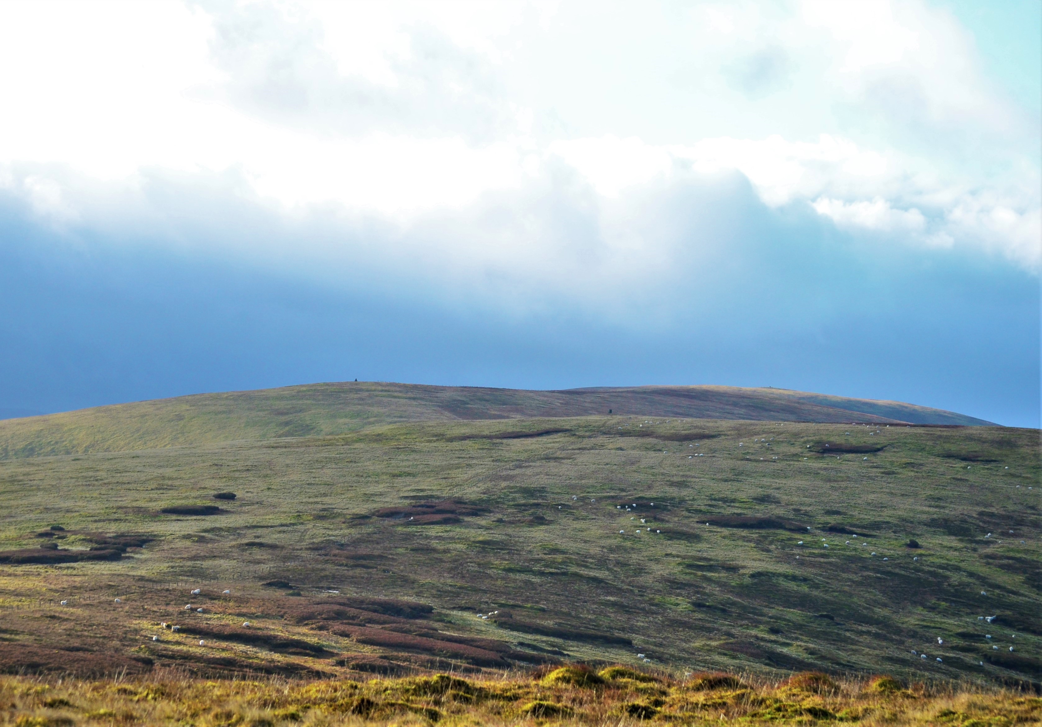
The Ettrick Hills stretch approximately 25 miles from east to west, with their highest peak, Ettrick Pen, reaching an elevation of 692 meters (2,270 feet). The range is characterized by its rolling and rounded hills, covered in heather and grasses, giving it a picturesque and scenic appearance.

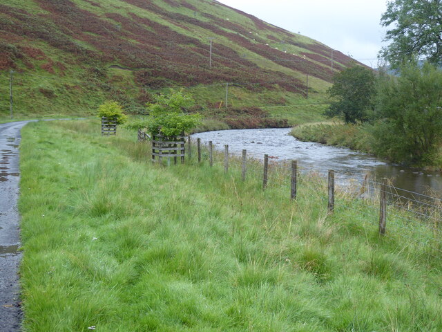
The hills are largely composed of hard sandstone, which has been shaped over millions of years through erosion by glaciers and the elements. This has resulted in the formation of deep valleys and steep crags, adding to the rugged beauty of the landscape.

Ettrick Hills is known for its rich biodiversity, with a variety of plant and animal species inhabiting the area. The hills are home to a range of upland birds, including red grouse and golden eagles, as well as various mammals such as red deer and mountain hares. The surrounding moorland and wetlands provide important habitats for these species.

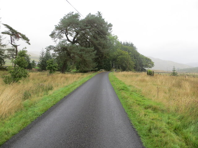
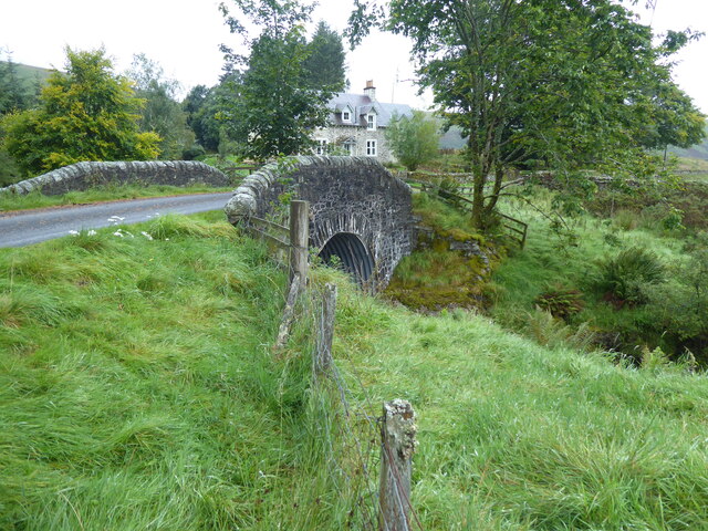
The hills are popular among outdoor enthusiasts and nature lovers, offering ample opportunities for hiking, walking, and wildlife observation. Several walking trails and paths traverse the area, allowing visitors to explore the stunning scenery and immerse themselves in the tranquility of the natural surroundings.

Overall, Ettrick Hills in Selkirkshire is a captivating range of hills, showcasing the beauty and diversity of Scotland's landscapes, and providing a haven for both wildlife and outdoor enthusiasts alike.

If you have any feedback on the listing, please let us know in the comments section below.

Ettrick Hills Images

Images are sourced within 2km of 55.385651/-3.2319447 or Grid Reference NT2210. Thanks to Geograph Open Source API. All images are credited.

Single track road, Ettrickdale Complete with some very old looking passing place signs.  Ferny Hill in the background.
Single track road, Ettrickdale
Complete with some very old looking passing place signs. Ferny Hill in the background.
Minor road beside Ettrick Water at Shorthope Looking westward.
Minor road beside Ettrick Water at Shorthope
Looking westward.
Minor road approaching Crook Cottage Looking south-westward.
Minor road approaching Crook Cottage
Looking south-westward.
Minor road and bridge near Over Kirkhope Looking north-eastward. At this point Kirkhope Burn flows beneath the road.
Minor road and bridge near Over Kirkhope
Looking north-eastward. At this point Kirkhope Burn flows beneath the road.
Minor road near to Broadgairhill Looking south-westward.
Minor road near to Broadgairhill
Looking south-westward.
Minor road and bridge near to Broadgairhill Farm Looking north-eastward. At this point Broadgairhill Burn flows beneath the road.
Minor road and bridge near to Broadgairhill Farm
Looking north-eastward. At this point Broadgairhill Burn flows beneath the road.
Bridge over Kirkhope Burn On The Southern Upland Way, the bridge is at Over Kirkhope on the minor road from Ettrick to the head of the Ettrick Valley.
Bridge over Kirkhope Burn
On The Southern Upland Way, the bridge is at Over Kirkhope on the minor road from Ettrick to the head of the Ettrick Valley.
Ettrick Valley near Shorthope The Ettrick Water is a tributary of the River Tweed.  Hope Head is in the background.
The Southern Upland Way follows the road.
Ettrick Valley near Shorthope
The Ettrick Water is a tributary of the River Tweed. Hope Head is in the background. The Southern Upland Way follows the road.
The Southern Upland Way near Broadgairhill
The Southern Upland Way near Over Kirkthorpe
The Southern Upland Way near Shorthope
Old Milestone south west of Broadgairhill By the UC road, in parish of Ettrick (Selkirk District), South of Broadgairhill, Ettrick Water, unfenced verge.

Inscription once read:-
(Selkirk)
23

Surveyed

Milestone Society National ID: BD_SKEW23.
Old Milestone south west of Broadgairhill
By the UC road, in parish of Ettrick (Selkirk District), South of Broadgairhill, Ettrick Water, unfenced verge. Inscription once read:- (Selkirk) 23 Surveyed Milestone Society National ID: BD_SKEW23.
Old Milestone above Ettrick Water, Shorthope, Ettrick Parish By the UC road, in parish of Ettrick (Selkirk District), Shorthope, above Ettrick Water, in bracken, on unfenced verge, North side of road.

Inscription once read:-
(Selkirk)
(21)
Carved bench mark on lower face.

Surveyed

Milestone Society National ID: BD_SKEW21
Old Milestone above Ettrick Water, Shorthope, Ettrick Parish
By the UC road, in parish of Ettrick (Selkirk District), Shorthope, above Ettrick Water, in bracken, on unfenced verge, North side of road. Inscription once read:- (Selkirk) (21) Carved bench mark on lower face. Surveyed Milestone Society National ID: BD_SKEW21
Old Milestone at Over Kirkhope, Ettrick parish Stone post by the UC road, in parish of Ettrick (Selkirk District), Over Kirkhope, Ettrick Water, on unfenced verge.

Inscription reads:-
22
SELK

Surveyed

Milestone Society National ID: BD_SKEW22
Old Milestone at Over Kirkhope, Ettrick parish
Stone post by the UC road, in parish of Ettrick (Selkirk District), Over Kirkhope, Ettrick Water, on unfenced verge. Inscription reads:- 22 SELK Surveyed Milestone Society National ID: BD_SKEW22
The Ettrick Valley from Nether Hill Looking downstream in the upper Ettrick Valley. The prominent hill, dead centre, is Ward Law, 594m, in <a href="https://www.geograph.org.uk/gridref/NT2615">NT2615</a>.
The Ettrick Valley from Nether Hill
Looking downstream in the upper Ettrick Valley. The prominent hill, dead centre, is Ward Law, 594m, in NT2615.
Bloodhope Head The foresters have not bothered fighting the wind by planting the ridges. This has left an area of rough land that provides grazing for the roe deer and little else. Rough but enjoyable walking, also used by riders given the odd hoof print seen.  The fence is now redundant, farming having ceased here, and roughly marks the march between Selkirkshire (PoV) and Dumfriesshire.
Bloodhope Head
The foresters have not bothered fighting the wind by planting the ridges. This has left an area of rough land that provides grazing for the roe deer and little else. Rough but enjoyable walking, also used by riders given the odd hoof print seen. The fence is now redundant, farming having ceased here, and roughly marks the march between Selkirkshire (PoV) and Dumfriesshire.
Bloodhope Head Fence junction. I am standing in Selkirkshire and in ground still grazed by sheep. The segment to the right and in the distance are ungrazed now, unplanted land in forest. The distant segment is in Dumfriesshire.
Bloodhope Head
Fence junction. I am standing in Selkirkshire and in ground still grazed by sheep. The segment to the right and in the distance are ungrazed now, unplanted land in forest. The distant segment is in Dumfriesshire.
Forest, Bloodhope Head An escapee leads the alien colonisation of Selkirkshire.  Self seeded sitka.
Forest, Bloodhope Head
An escapee leads the alien colonisation of Selkirkshire. Self seeded sitka.
Show me another place!

Ettrick Hills is located at Grid Ref: NT2210 (Lat: 55.385651, Lng: -3.2319447)

Unitary Authority: The Scottish Borders

Police Authority: The Lothians and Scottish Borders

What 3 Words

///ringside.vessel.boss. Near Ettrick, Scottish Borders

Nearby Locations

Black Knowe Ettrick Hills

Related Wikis

Andrewhinney Hill

Andrewhinney Hill is a hill in the Ettrick Hills range, part of the Southern Uplands of Scotland. It is the highest summit of a ridge that runs parallel...

Ettrick Pen

Ettrick Pen is a hill in the Ettrick Hills range, part of the Southern Uplands of Scotland. A remote peak, It lies southwest of the village of Ettrick...

Southern Uplands

The Southern Uplands (Scottish Gaelic: Na Monaidhean a Deas) are the southernmost and least populous of mainland Scotland's three major geographic areas...

Grey Mare's Tail, Moffat Hills

Grey Mare's Tail is a 60-metre (200 ft) hanging valley waterfall near to Moffat in southern Scotland. The fall is produced by the Tail Burn flowing from...

Have you been to Ettrick Hills?

Leave your review of Ettrick Hills below (or comments, questions and feedback).