Cloich Hills

Range Of Mountains, Range Of Hills in Peeblesshire

Scotland

Cloich Hills

Hillwalker in the mist on Wether Law Quite a contrast with the bright winter sunshine down in the valley.
Hillwalker in the mist on Wether Law Credit: Alan O'Dowd

Cloich Hills, located in the region of Peeblesshire in Scotland, is a stunning range of mountains that stretches across a vast area. This range, often referred to as the Cloich Hills, is a prominent feature of the landscape and offers breathtaking views of the surrounding countryside.

The Cloich Hills are part of the Southern Uplands, a range of hills and mountains that extend across southern Scotland. Rising to an average height of around 500 meters, these hills are not as tall as some of the other mountain ranges in Scotland, but they still provide an impressive backdrop to the local scenery.

The terrain of the Cloich Hills is characterized by rolling slopes, deep valleys, and craggy peaks, offering a diverse and challenging landscape for hikers and outdoor enthusiasts. The vegetation in the area is predominantly heather and grasses, with scattered patches of woodland adding to the natural beauty of the region.

The hills are home to a variety of wildlife, including deer, birds of prey, and occasional sightings of wildcats. The rivers and streams that flow through the hills provide habitat for trout and other freshwater fish, attracting anglers to the area.

The Cloich Hills are a popular destination for outdoor activities such as hiking, mountain biking, and wildlife watching. Numerous trails and paths crisscross the hills, catering to both experienced adventurers and casual walkers. The panoramic views from the hilltops, overlooking the picturesque valleys and rolling countryside, are truly awe-inspiring.

Overall, the Cloich Hills in Peeblesshire offer nature lovers and adventure seekers a chance to explore the stunning Scottish landscape and immerse themselves in the tranquility and beauty of the Southern Uplands.

If you have any feedback on the listing, please let us know in the comments section below.
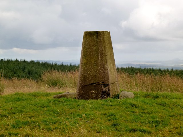
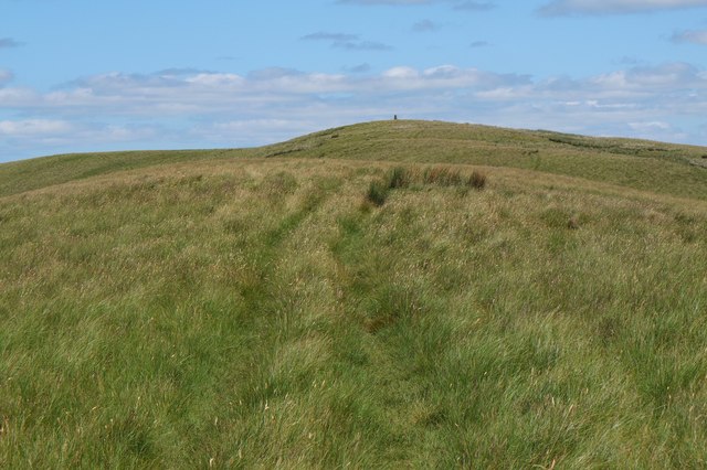
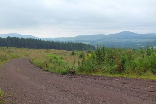
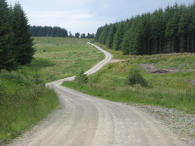
Cloich Hills Images

Images are sourced within 2km of 55.724976/-3.2662535 or Grid Reference NT2048. Thanks to Geograph Open Source API. All images are credited.

Hillwalker in the mist on Wether Law Quite a contrast with the bright winter sunshine down in the valley.
Hillwalker in the mist on Wether Law
Quite a contrast with the bright winter sunshine down in the valley.
Urinals in Progress Judging by the timber these two urinals will be plumbed in at some point - otherwise a pointless exercise. There are acres and acres of open countryside here in which men can relieve themselves, thereby dissipating the smell! 
I took the picture because it was such a strange site - Northern European pissoirs in the middle of nowhere. This area is just North of a large forest and, whilst the track serves as a through road to the handful of houses further North at Ruddenleys, at this point it is/was occasionally in use as some kind of outdoor activities centre. There were signs up and I forget the business name, but considering I was here on an unusually hot Sunday afternoon in July it is odd that there were no activities taking place. Maybe it has gone bust, or maybe the owners are enjoying a holiday somewhere even warmer...
Urinals in Progress
Judging by the timber these two urinals will be plumbed in at some point - otherwise a pointless exercise. There are acres and acres of open countryside here in which men can relieve themselves, thereby dissipating the smell! I took the picture because it was such a strange site - Northern European pissoirs in the middle of nowhere. This area is just North of a large forest and, whilst the track serves as a through road to the handful of houses further North at Ruddenleys, at this point it is/was occasionally in use as some kind of outdoor activities centre. There were signs up and I forget the business name, but considering I was here on an unusually hot Sunday afternoon in July it is odd that there were no activities taking place. Maybe it has gone bust, or maybe the owners are enjoying a holiday somewhere even warmer...
Grassfield This has to be one of the most precarious ruins I have ever come across. Thankfully it is nowhere near civilization; otherwise it would have been demolished, or fenced off awaiting a decision on demolition! Stones - if pushed - just fall off the walls, the far gable end is leaning at a worrying angle, and there is one squarish stone over the main arched doorway into the old house (which may or may not once have formed part of a lintel - the building  is so far gone it is by no means certain that the arched-looking doorway always looked this way) which pretty much defines the word 'precarious'!
The 1850s OS naming book (these were written up mainly to establish agreed-upon spellings for everything that got namechecked on the first OS maps of an area) for here describes Grassfield as a "one storey cottage with garden attached". This suggests, surprisingly, that this large building wasn't a proper farm, though the crumbling remains of a low wall in front of its entrance indicates that there must have once been animals around, belonging to other farms, or, more likely, a small number belonging to the occupants of this rather large 'cottage'.
The grass field that must have once been a big garden is now a nettlefield. Long trousers are required to get this close if you are a normal person.
Grassfield
This has to be one of the most precarious ruins I have ever come across. Thankfully it is nowhere near civilization; otherwise it would have been demolished, or fenced off awaiting a decision on demolition! Stones - if pushed - just fall off the walls, the far gable end is leaning at a worrying angle, and there is one squarish stone over the main arched doorway into the old house (which may or may not once have formed part of a lintel - the building is so far gone it is by no means certain that the arched-looking doorway always looked this way) which pretty much defines the word 'precarious'! The 1850s OS naming book (these were written up mainly to establish agreed-upon spellings for everything that got namechecked on the first OS maps of an area) for here describes Grassfield as a "one storey cottage with garden attached". This suggests, surprisingly, that this large building wasn't a proper farm, though the crumbling remains of a low wall in front of its entrance indicates that there must have once been animals around, belonging to other farms, or, more likely, a small number belonging to the occupants of this rather large 'cottage'. The grass field that must have once been a big garden is now a nettlefield. Long trousers are required to get this close if you are a normal person.
Grassfield Hill
Grassfield Hill
Wether Law
Wether Law
Wether Law Revisited to celebrate Colin's 600th Marilyn (second round) "Hall of Mirrors" and Rick Salter's 700th Marilyn, with Colin Crawford, Bernie Hughes, Jenny Hatfield, Rick Salter and Alan Dawson from Newlands Church, via sub-Hump Drum Maw on an initially grey day, improving to good visibility and sunshine. A fine summit party was had due to goods found in Colin's rucksack. Then onto a sub Marilyn and a P30.
Name: Wether Law
Hill number: 1817
Height: 479m / 1572ft
Area: 28A: Firth of Forth to the River Tweed
Class: Ma
Grid ref: NT 19467 48374
Summit feature: trig point
Drop: 212m
Col: 267m  NT252549
Wether Law
Revisited to celebrate Colin's 600th Marilyn (second round) "Hall of Mirrors" and Rick Salter's 700th Marilyn, with Colin Crawford, Bernie Hughes, Jenny Hatfield, Rick Salter and Alan Dawson from Newlands Church, via sub-Hump Drum Maw on an initially grey day, improving to good visibility and sunshine. A fine summit party was had due to goods found in Colin's rucksack. Then onto a sub Marilyn and a P30. Name: Wether Law Hill number: 1817 Height: 479m / 1572ft Area: 28A: Firth of Forth to the River Tweed Class: Ma Grid ref: NT 19467 48374 Summit feature: trig point Drop: 212m Col: 267m NT252549
Wether Law Looking along the summit ridge.
Wether Law
Looking along the summit ridge.
Cloich Forest Open moorland on Hag Law and Wether Law contrast with the dense plantations to the east.
Cloich Forest
Open moorland on Hag Law and Wether Law contrast with the dense plantations to the east.
The summit in view, Wether Law An easy climb on the grassy ridge to the trig point at 479m.
The summit in view, Wether Law
An easy climb on the grassy ridge to the trig point at 479m.
Summit trig point, Wether Law The Pentland Hills and Arthur's Seat from the summit, seen across the plain of Auchencorth Moss and Deepsyke Forest, with Grassfield Forest in the foreground. The Fife coast was also visible.
Summit trig point, Wether Law
The Pentland Hills and Arthur's Seat from the summit, seen across the plain of Auchencorth Moss and Deepsyke Forest, with Grassfield Forest in the foreground. The Fife coast was also visible.
West Linton from Wether Law The village of West Linton seen over the ridge of Broomlee Hill.
West Linton from Wether Law
The village of West Linton seen over the ridge of Broomlee Hill.
Southwest from Wether Law A view over the neighbouring top of Drum Maw (445m) to the distant Tinto (707m).
Southwest from Wether Law
A view over the neighbouring top of Drum Maw (445m) to the distant Tinto (707m).
Plantation on Deans Hill Young trees after replanting between Deans Hill and Kelly Heads in the upper catchment of the Fingland Burn.
Plantation on Deans Hill
Young trees after replanting between Deans Hill and Kelly Heads in the upper catchment of the Fingland Burn.
Track in Grassfield Forest Plantations at different stages of maturity, with Mendick Hill (451m) prominent on the skyline.
Track in Grassfield Forest
Plantations at different stages of maturity, with Mendick Hill (451m) prominent on the skyline.
Shooting hide, Grassfield Forest A shooting hide on a platform in a replanted forest area.
Shooting hide, Grassfield Forest
A shooting hide on a platform in a replanted forest area.
Upper reaches of the Fingland Burn Hill pasture and forestry seen from the Cross Borders Drove Road.
Upper reaches of the Fingland Burn
Hill pasture and forestry seen from the Cross Borders Drove Road.
Road, Cloich Forest Logging road crossing the Middle Burn.
Road, Cloich Forest
Logging road crossing the Middle Burn.
Rough grazing, Grassfield View from the edge of the forest. The fields here are used for recreational  driving of all terrain vehicles, but all was quiet today.
Rough grazing, Grassfield
View from the edge of the forest. The fields here are used for recreational driving of all terrain vehicles, but all was quiet today.
Show me another place!

Cloich Hills is located at Grid Ref: NT2048 (Lat: 55.724976, Lng: -3.2662535)

Unitary Authority: The Scottish Borders

Police Authority: The Lothians and Scottish Borders

What 3 Words

///energy.character.brass. Near West Linton, Scottish Borders

Nearby Locations

Cloich Hills Peat Hill

Related Wikis

Tweeddale

Tweeddale (Scottish Gaelic: Srath Thuaidh/Tuaidhdail) is a committee area and lieutenancy area in the Scottish Borders council area in south-eastern Scotland...

Black Barony

Barony Castle, also and formerly known as Black Barony, and Darnhall, is a historic house at Eddleston in the Scottish Borders area of Scotland. The house...

Great Polish Map of Scotland

The Great Polish Map of Scotland is a large (50 m x 40 m) three-dimensional, outdoor concrete scale model of Scotland, located in the grounds of the Barony...

Darnhall Mains

Darnhall Mains is a farm and settlement off the A703, near Eddleston and the Eddleston Water in the Scottish Borders area of Scotland, in the former Peeblesshire...

Nearby Amenities

Located within 500m of 55.724976,-3.2662535
Cloich Hills
Place: locality
Lat/Long: 55.7219399/-3.2660307
Peat Hill
Ele: 464
Natural: peak
Lat/Long: 55.7243593/-3.2632841
The data included in this document is from www.openstreetmap.org. The data is made available under ODbL.

Have you been to Cloich Hills?

Leave your review of Cloich Hills below (or comments, questions and feedback).