Beinn a' Bhùird

Range Of Mountains, Range Of Hills in Aberdeenshire

Scotland

Beinn a' Bhùird

Granite outcrop on Cnap a' Chleirich With A' Chioch in mist on the right.
Granite outcrop on Cnap a' Chleirich Credit: Russel Wills

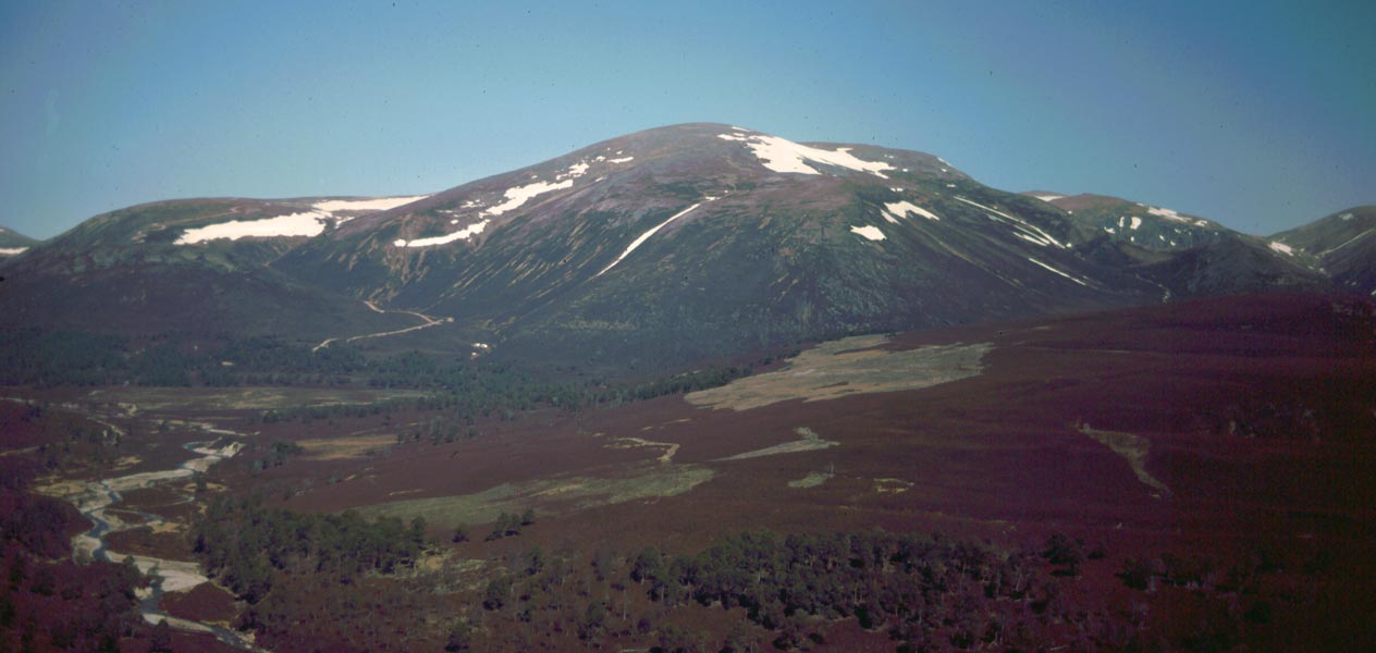
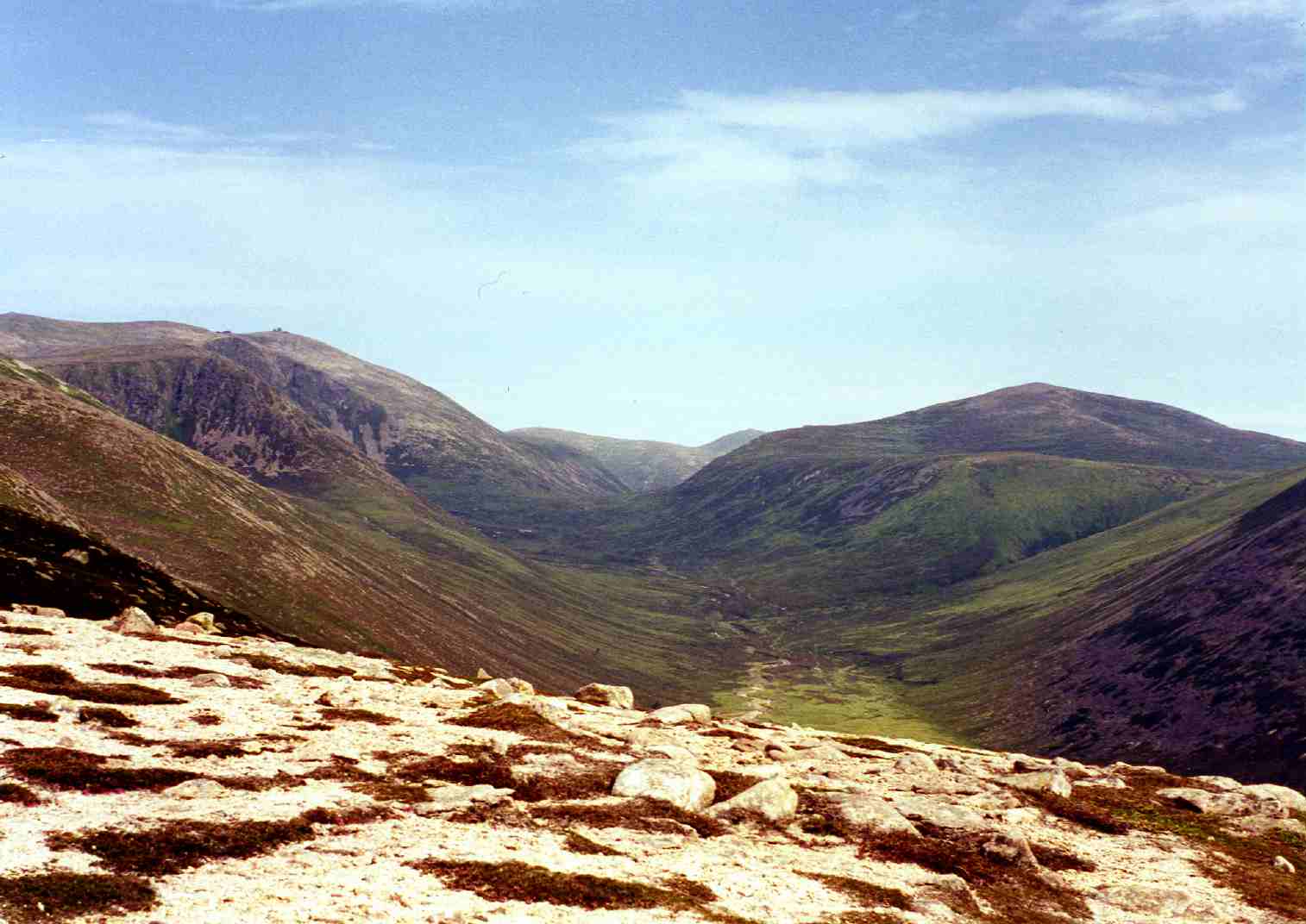
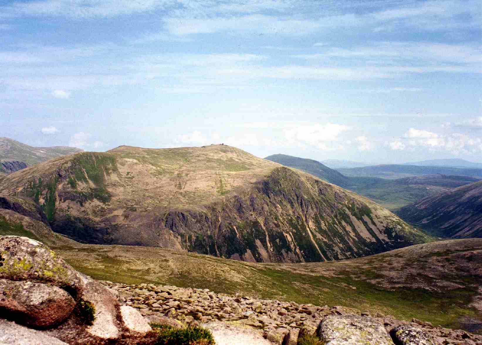
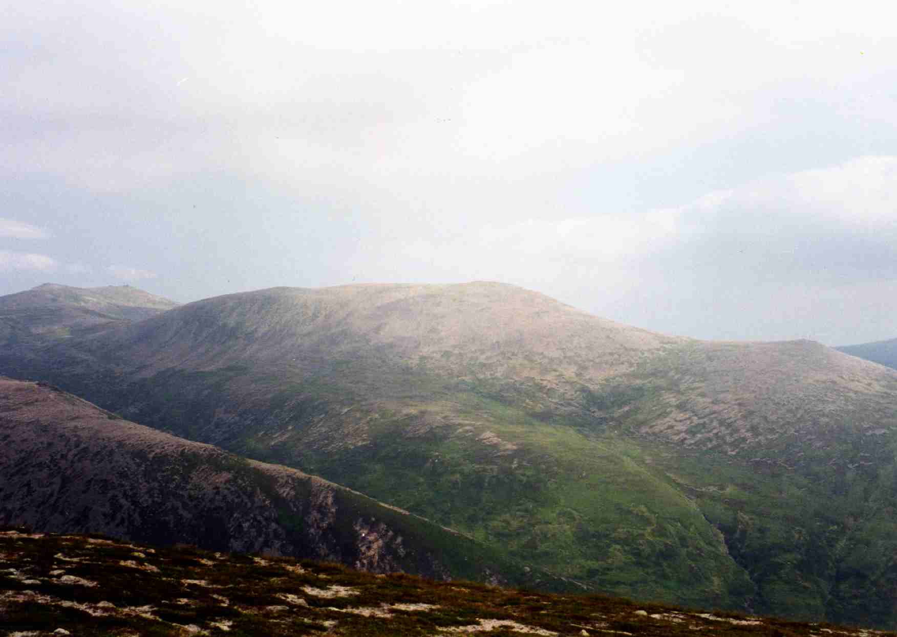
Beinn a' Bhùird is a prominent mountain range located in Aberdeenshire, Scotland. It is part of the Cairngorms National Park and lies within the eastern section of the Grampian Mountains. The range is characterized by its rugged and dramatic landscape, making it a popular destination for outdoor enthusiasts.

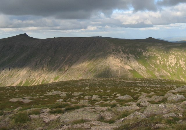
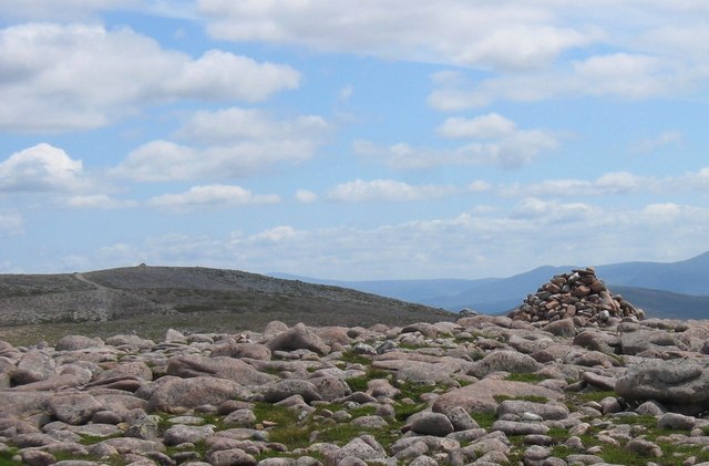
The highest peak in the range, also named Beinn a' Bhùird, stands at an impressive 1,197 meters (3,927 feet) above sea level. Its distinctive shape, with steep cliffs and deep corries, adds to the allure of the area. The summit offers breathtaking panoramic views of the surrounding countryside, including the neighboring peaks of Ben Avon and Ben Macdui.

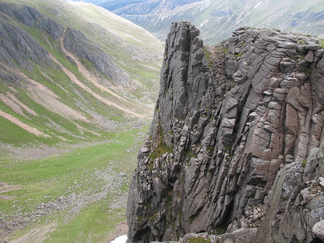
The range is home to several notable features, including the Garbh Choire and Loch Avon, which is a picturesque freshwater loch nestled in a glacial valley. The area is also renowned for its rich biodiversity, with various species of flora and fauna thriving in the diverse habitats.

Hiking and mountaineering are popular activities in Beinn a' Bhùird, with numerous trails and routes catering to different skill levels. The range offers a range of experiences, from challenging ascents to more leisurely walks through stunning moorland and woodland areas.

Visitors to Beinn a' Bhùird should come prepared with appropriate equipment and clothing, as the weather conditions can be unpredictable and change rapidly. It is advisable to check weather forecasts and carry navigation tools, as the terrain can be challenging to navigate in poor visibility.

Overall, Beinn a' Bhùird is a captivating mountain range in Aberdeenshire, offering an unforgettable outdoor experience for those seeking adventure and natural beauty.

If you have any feedback on the listing, please let us know in the comments section below.

Beinn a' Bhùird Images

Images are sourced within 2km of 57.083373/-3.4960653 or Grid Reference NJ0900. Thanks to Geograph Open Source API. All images are credited.

Granite outcrop on Cnap a' Chleirich With A' Chioch in mist on the right.
Granite outcrop on Cnap a' Chleirich
With A' Chioch in mist on the right.
Garbh Choire The Sneck, the low point between Beinn a' Bhuird and Ben Avon, just right of centre.
Garbh Choire
The Sneck, the low point between Beinn a' Bhuird and Ben Avon, just right of centre.
Summit tor of Cnap à Chlèirich
Late-lying snowfield on approach to Cnap a' Chleirich Huge granite boulders and tors litter the plateau
Late-lying snowfield on approach to Cnap a' Chleirich
Huge granite boulders and tors litter the plateau
View across The Sneck to Ben Avon A flat gravelly area on this high wind-swept plateau before the descent into the narrow neck called The Sneck
View across The Sneck to Ben Avon
A flat gravelly area on this high wind-swept plateau before the descent into the narrow neck called The Sneck
East side of Cnap a' Chleirich Viewed from The Sneck
East side of Cnap a' Chleirich
Viewed from The Sneck
Ben a' Bhuird Plateau Sparse vegetation over a vast area of this high plateau. Poor visibility due to cloud and the same view in all directions required good navigation.
Ben a' Bhuird Plateau
Sparse vegetation over a vast area of this high plateau. Poor visibility due to cloud and the same view in all directions required good navigation.
Garbh Choire and The Mitre Ridge
The Mitre Ridge With the massive bowl of Garbh Choire below.
The Mitre Ridge
With the massive bowl of Garbh Choire below.
Summit of Cnap a' Chleirich
Ben Avon across the Sneck
Beinn a' Bhuird from the Sneck The ridge from the Sneck leading up to the Beinn a' Bhuird plateau, with Garbh Choire on the right
Beinn a' Bhuird from the Sneck
The ridge from the Sneck leading up to the Beinn a' Bhuird plateau, with Garbh Choire on the right
Granite outcrops on Cnap a' Chleirich Looking down the long spur of Cnap a' Chleirich.
Granite outcrops on Cnap a' Chleirich
Looking down the long spur of Cnap a' Chleirich.
Deer on mountainside Just above the small coire at the head of the Glas Allt Mor, with a herd of deer running off. Upper part of the Sneck to the top mid-left & the steep walls running up to Ben Avon, which the deer reached in about 2 minutes- all within this square.
Deer on mountainside
Just above the small coire at the head of the Glas Allt Mor, with a herd of deer running off. Upper part of the Sneck to the top mid-left & the steep walls running up to Ben Avon, which the deer reached in about 2 minutes- all within this square.
Burns meet below Cnap a' Chleirich ridge Burns meet below Cnap a' Chleirich ridge about 1km E of the North Top of Beinn a' Bhuird
Burns meet below Cnap a' Chleirich ridge
Burns meet below Cnap a' Chleirich ridge about 1km E of the North Top of Beinn a' Bhuird
Garbh Choire Looking out across the Garbh Choire from just north of the summit of Cnap a' Chlèirich.
Garbh Choire
Looking out across the Garbh Choire from just north of the summit of Cnap a' Chlèirich.
South of Cnap a' Chlèirich The terrain on Beinn a' Bhuird's extensive plateau is a sparsely vegetated grassland interspersed with gravel and rock outcrops.
Looking towards the 1123m spot height to the south of Cnap a' Chlèirich.
South of Cnap a' Chlèirich
The terrain on Beinn a' Bhuird's extensive plateau is a sparsely vegetated grassland interspersed with gravel and rock outcrops. Looking towards the 1123m spot height to the south of Cnap a' Chlèirich.
Looking towards Ben Avon Heading east across the huge plateau that forms the upper parts of Beinn a' Bhuird. The tors of Ben Avon can be seen above the Cnap a' Chleirich.
Looking towards Ben Avon
Heading east across the huge plateau that forms the upper parts of Beinn a' Bhuird. The tors of Ben Avon can be seen above the Cnap a' Chleirich.
Show me another place!

Beinn a' Bhùird is located at Grid Ref: NJ0900 (Lat: 57.083373, Lng: -3.4960653)

Unitary Authority: Aberdeenshire

Police Authority: North East

What 3 Words

///moderated.pounce.robe. Near Inverey, Aberdeenshire

Related Wikis

Beinn a' Bhùird

Beinn a' Bhùird is a Munro in the Cairngorm mountain range of Scotland. In Watson (1975) the author suggests the mountain should be named Beinn Bòrd -...

Ben Avon

Ben Avon (Scottish Gaelic: Beinn Athfhinn, 'mountain of the Avon') is a mountain in the Cairngorms of Scotland. It is a sprawling mountain with a broad...

Beinn Bhreac (Glen Derry)

Beinn Bhreac is a twin-peaked Scottish mountain located above Glen Derry in the Cairngorm Mountains approximately 11 kilometres (7 mi) north-west of Braemar...

Beinn a' Chaorainn (Cairngorms)

Beinn a' Chaorainn is a Scottish mountain in the heart of the Cairngorms range. It is quite a remote hill, being located roughly 19 kilometres south east...

Lairig an Laoigh

The Lairig an Laoigh ( LAR-ig ən LOO-ee; Scottish Gaelic: Làirig Laoigh) is a mountain pass through the Highlands of Scotland. In speech and sometimes...

Beinn Mheadhoin (Cairngorms)

Beinn Mheadhoin or Beinn Meadhain (Scottish Gaelic for 'middle mountain') is a mountain in the Highlands of Scotland. It is a Munro with a height of 1...

Derry Cairngorm

Derry Cairngorm (Scottish Gaelic: Càrn Gorm an Doire) is a Scottish mountain in the Cairngorms range, 14 kilometres (8.7 mi) north west of Braemar in the...

Bynack More

Bynack More (Scottish Gaelic: A' Bheithneag Mhòr or Beinn Bheithneag) is a Scottish Mountain that is situated in the Cairngorms range, 16 kilometres east...

Have you been to Beinn a' Bhùird?

Leave your review of Beinn a' Bhùird below (or comments, questions and feedback).