Obney Hills

Range Of Mountains, Range Of Hills in Perthshire

Scotland

Obney Hills

Stair Bridge
Stair Bridge Credit: Steven Brown

Obney Hills, located in Perthshire, Scotland, is a range of hills that stretches across the picturesque countryside. Situated within the southern part of the Scottish Highlands, it is a popular destination for nature enthusiasts and avid hikers. The hills are part of a wider range known as the Ochil Hills, which extends from the River Tay in the north to the River Forth in the south.

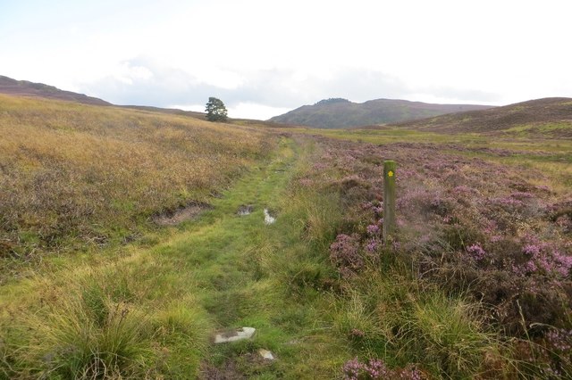
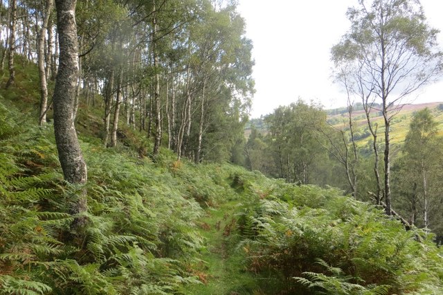
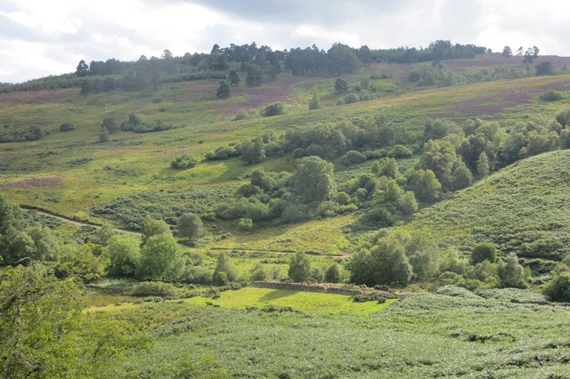
Obney Hills, with its rolling terrain and diverse landscapes, offers stunning panoramic views of the surrounding countryside. The hills are characterized by their gentle slopes and heather-covered moorlands, providing a tranquil and idyllic setting for outdoor activities such as hiking, mountain biking, and birdwatching.

At an elevation of approximately 500 meters, the highest point in Obney Hills is Ben Cleuch, which offers breathtaking vistas of the surrounding areas, including the city of Stirling. The hills are home to a variety of wildlife, including red deer, mountain hares, and several species of birds, making it a haven for nature lovers and wildlife enthusiasts.

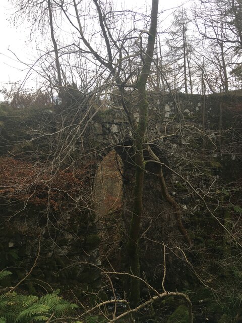
Several well-marked trails crisscross the region, catering to different skill levels and preferences. The popular Ochil Way, a long-distance footpath, passes through Obney Hills, allowing visitors to explore the area in depth. Along the way, walkers can discover the rich history and heritage of the region, with ancient ruins and historical sites dotting the landscape.

Overall, Obney Hills, with its natural beauty and recreational opportunities, is a must-visit destination for those seeking an escape into the tranquility of the Scottish countryside.

If you have any feedback on the listing, please let us know in the comments section below.

Obney Hills Images

Images are sourced within 2km of 56.529314/-3.5829515 or Grid Reference NO0238. Thanks to Geograph Open Source API. All images are credited.

Stair Bridge
Stair Bridge
Glen Garr path The path passes to the west of Obney Hill on its way to Bankfoot.
Glen Garr path
The path passes to the west of Obney Hill on its way to Bankfoot.
Path from Glen Garr Heading north towards Rumbling Bridge after climbing out of Glen Garr.
Path from Glen Garr
Heading north towards Rumbling Bridge after climbing out of Glen Garr.
Moorland on Obney Hill Heather in bloom beside the path between Obney and Rumbling Bridge.
Moorland on Obney Hill
Heather in bloom beside the path between Obney and Rumbling Bridge.
Marshy ground at the head of Glen Garr A wet hollow amongst heather covered knolls. Glen Garr falls away sharply from here.
Marshy ground at the head of Glen Garr
A wet hollow amongst heather covered knolls. Glen Garr falls away sharply from here.
Glen Garr path Near the top of the pass, under Obney Hill.
Glen Garr path
Near the top of the pass, under Obney Hill.
Obney to Rumbling Bridge path A fine path uses Glen Garr to cross the Highland Boundary fault.
Obney to Rumbling Bridge path
A fine path uses Glen Garr to cross the Highland Boundary fault.
Woodland, Glen Garr At the top of the glen, under Obney Hill.
Woodland, Glen Garr
At the top of the glen, under Obney Hill.
Glen Garr path At the top of the narrow section which is cut into the side of the glen.
Glen Garr path
At the top of the narrow section which is cut into the side of the glen.
Glen Garr The flat glen floor contrasts with rocky slopes. In common with a lot of the Highland Boundary fault there was once a slate quarry here.
Glen Garr
The flat glen floor contrasts with rocky slopes. In common with a lot of the Highland Boundary fault there was once a slate quarry here.
Glen Garr The path between Obney and Rumbling Bridge is narrow and exposed here during the very scenic climb out of Glen Garr.
Glen Garr
The path between Obney and Rumbling Bridge is narrow and exposed here during the very scenic climb out of Glen Garr.
Climb out of Glen Garr A narrow exposed path climbs out of the glen on the way to Strath Braan.
Climb out of Glen Garr
A narrow exposed path climbs out of the glen on the way to Strath Braan.
Glen Garr path The path climbing up Glen Garr between Obney and Rumbling Bridge.
Glen Garr path
The path climbing up Glen Garr between Obney and Rumbling Bridge.
Quarry, Glen Garr A small quarry on the Highland Boundary Fault.
Quarry, Glen Garr
A small quarry on the Highland Boundary Fault.
Path through Glen Garr The path can be a bit enclosed by bracken, but was quite clear on this visit.
Path through Glen Garr
The path can be a bit enclosed by bracken, but was quite clear on this visit.
Mouth of Glen Garr Glen Garr opens out into lowland Perthshire. The road was the access route to the quarry in Glen Garr and runs out to Glack.
Mouth of Glen Garr
Glen Garr opens out into lowland Perthshire. The road was the access route to the quarry in Glen Garr and runs out to Glack.
Woodland regeneration, Glen Garr Birch woods are returning to Glen Garr.
Woodland regeneration, Glen Garr
Birch woods are returning to Glen Garr.
Glen Garr path The path from Rumbling Bridge to Obney leaves the moorland here for big fields grazed by cattle. On this side of the dyke the path is somewhat hemmed in by bracken.
Glen Garr path
The path from Rumbling Bridge to Obney leaves the moorland here for big fields grazed by cattle. On this side of the dyke the path is somewhat hemmed in by bracken.
Show me another place!

Obney Hills is located at Grid Ref: NO0238 (Lat: 56.529314, Lng: -3.5829515)

Unitary Authority: Perth and Kinross

Police Authority: Tayside

What 3 Words

///create.splashes.satellite. Near Bankfoot, Perth & Kinross

Nearby Locations

Craig Obney Obney Hills

Related Wikis

River Braan

The River Braan (Scottish Gaelic: Breamhainn) is a tributary of the River Tay in Scotland. Within the county of Perth and Kinross, it flows 11 miles...

Dunkeld & Birnam railway station

Dunkeld & Birnam railway station serves the town of Dunkeld and village of Birnam in Perth and Kinross, Scotland. It is located on the Highland Main Line...

Birnam, Perth and Kinross

Birnam is a village in Perth and Kinross, Scotland. It is located 12 miles (19 km) north of Perth on the A9 road, the main tourist route through Perthshire...

Perth Road drill hall, Birnam

The Perth Road drill hall is a former military installation on Perth Road in Birnam, Perth and Kinross, Scotland. == History == The building was designed...

Nearby Amenities

Located within 500m of 56.529314,-3.5829515
Obney Hills
Place: locality
Lat/Long: 56.529672/-3.5847178
The data included in this document is from www.openstreetmap.org. The data is made available under ODbL.

Have you been to Obney Hills?

Leave your review of Obney Hills below (or comments, questions and feedback).