Cairngorm Mountains

Range Of Mountains, Range Of Hills in Banffshire

Scotland

Cairngorm Mountains

Rocky outcrop on Cnap Coire na Spreidhe
Rocky outcrop on Cnap Coire na Spreidhe Credit: David Brown

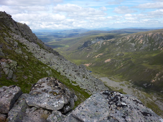
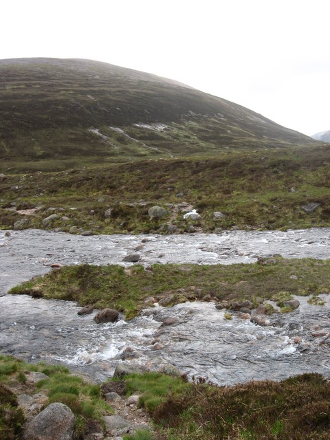
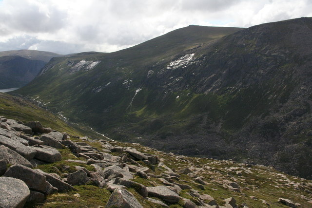
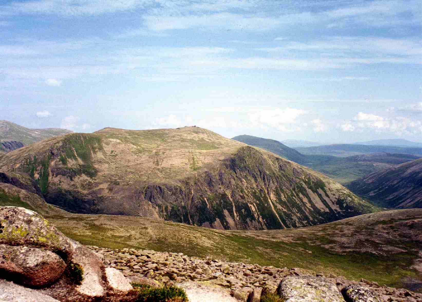
The Cairngorm Mountains, located in Banffshire, Scotland, are a stunning range of mountains that stretch across the eastern part of the Scottish Highlands. This mountain range is part of the larger Grampian Mountains and is renowned for its rugged beauty and vast wilderness.

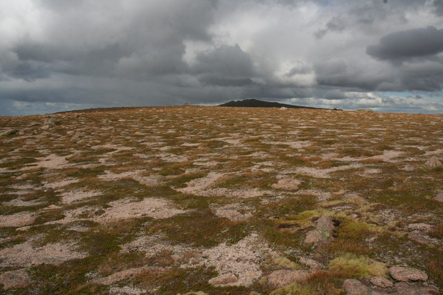
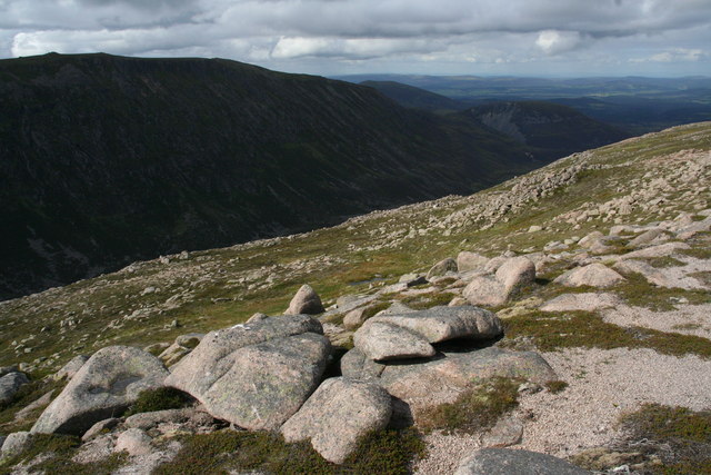
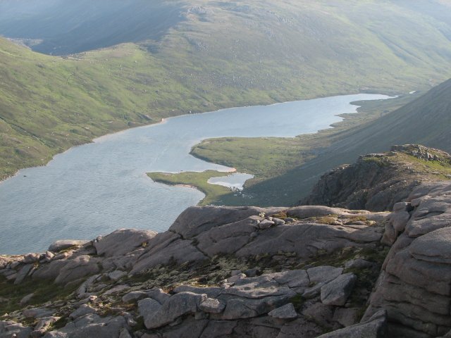
The Cairngorm Mountains are home to some of the highest peaks in the UK, with Ben Macdui standing at an impressive 1,309 meters (4,295 feet) and Cairn Gorm reaching 1,245 meters (4,084 feet). These towering peaks offer breathtaking panoramic views of the surrounding valleys, lochs, and glens.

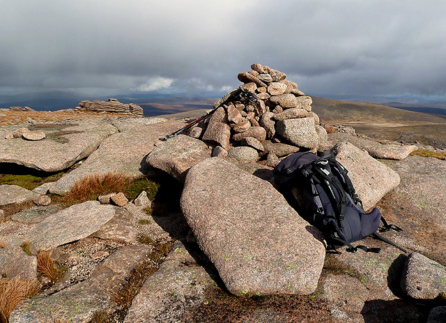
The area is a paradise for outdoor enthusiasts, offering a wide range of activities such as hiking, mountaineering, skiing, and wildlife watching. The mountains are home to a diverse range of flora and fauna, including rare species such as the Scottish wildcat and the golden eagle.

The region is also famous for its exceptional snow conditions, making it a popular destination for winter sports enthusiasts. The Cairngorms National Park, established in 2003, covers a significant portion of the mountains and provides protection for the unique ecosystems and habitats found in the area.

Visitors to the Cairngorm Mountains can explore numerous well-maintained trails, including the famous Lairig Ghru, a challenging long-distance hike that cuts through the heart of the range. There are also several mountain passes, such as the Devil's Elbow, which offer stunning vistas and thrilling driving experiences.

Overall, the Cairngorm Mountains in Banffshire are a captivating destination for nature lovers and adventure seekers alike, offering a chance to experience the untamed beauty of the Scottish Highlands.

If you have any feedback on the listing, please let us know in the comments section below.

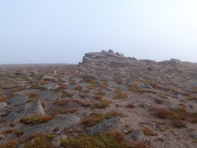
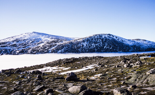
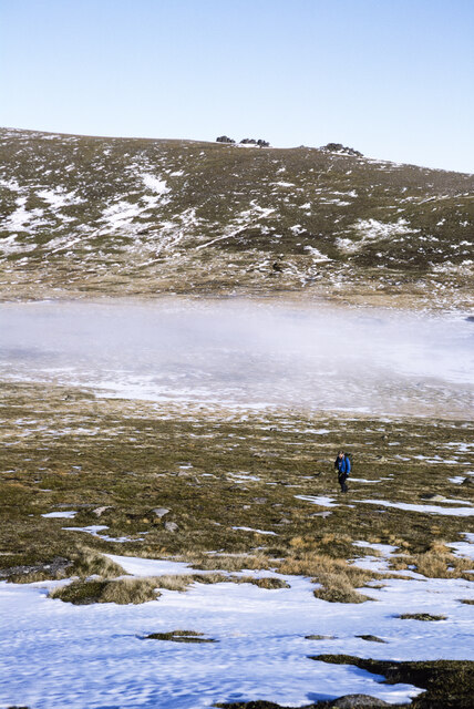
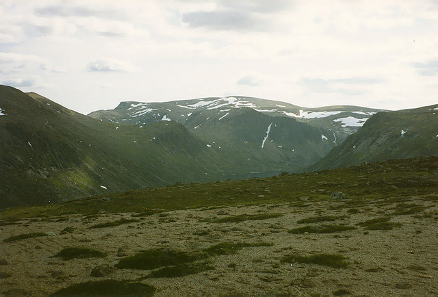
Cairngorm Mountains Images

Images are sourced within 2km of 57.116781/-3.6068421 or Grid Reference NJ0204. Thanks to Geograph Open Source API. All images are credited.

Rocky outcrop on Cnap Coire na Spreidhe
Avalanche debris below rock slabs The slabs are above a location named as The Saddle. It seems clear that deep snow lying on the angled slabs fractured and slid down in a modest-sized avalanche. Liz Gray has an image of the slabs without any snow at all - <a title="https://www.geograph.org.uk/photo/3175394" href="https://www.geograph.org.uk/photo/3175394">Link</a> .
Avalanche debris below rock slabs
The slabs are above a location named as The Saddle. It seems clear that deep snow lying on the angled slabs fractured and slid down in a modest-sized avalanche. Liz Gray has an image of the slabs without any snow at all - Link .
Rocks on south-west shoulder of A' Chòinneach The rough rockiness of the level stretch of the south-west ridge of A' Chòinneach at around 970 metres. A' Chòinneach is a subsidiary top of Bynack More.
There's a temperature inversion in the glen to the west beyond which are the peaks, Cairn Gorm and Cnap Coire na Spreidhe.
Rocks on south-west shoulder of A' Chòinneach
The rough rockiness of the level stretch of the south-west ridge of A' Chòinneach at around 970 metres. A' Chòinneach is a subsidiary top of Bynack More. There's a temperature inversion in the glen to the west beyond which are the peaks, Cairn Gorm and Cnap Coire na Spreidhe.
Col between A' Chòinneach and Bynack More A mountain walker climbing for A' Chòinneach with the col between it and Bynack More partly obscured by mist.
The Little Barns of Bynack are seen in the distance on the south ridge of Bynack More.
Col between A' Chòinneach and Bynack More
A mountain walker climbing for A' Chòinneach with the col between it and Bynack More partly obscured by mist. The Little Barns of Bynack are seen in the distance on the south ridge of Bynack More.
The path to Loch Avon The path from Strath Nethy begins its descent from the Saddle. Carn Etchachan can be seen ahead, with the distinctive Shelter Stone Crag to its right. Slopes descending from Beinn Mheadhoin can be seen on the left.
The path to Loch Avon
The path from Strath Nethy begins its descent from the Saddle. Carn Etchachan can be seen ahead, with the distinctive Shelter Stone Crag to its right. Slopes descending from Beinn Mheadhoin can be seen on the left.
Plateau south west of A' Chòinneach This almost level area is encountered high up on the south west ridge of the mountain. In the distance the crags of Carn Etchachan can be seen, with Ben Macdui rising behind.
Plateau south west of A' Chòinneach
This almost level area is encountered high up on the south west ridge of the mountain. In the distance the crags of Carn Etchachan can be seen, with Ben Macdui rising behind.
Looking  North down Strath Nethy Looking down Strath Nethy from the cliffs below point 1028. Ben Rinnes can be seen on the skyline.
Looking North down Strath Nethy
Looking down Strath Nethy from the cliffs below point 1028. Ben Rinnes can be seen on the skyline.
Cairngorm summit from Cnap Coire na Spreidhe
The Fords o' Avon
The Fords o' Avon
Patterned ground on A'Choinneach This patterning is caused by wind and frost weakening and removing vegetation, leaving granite gravel patches. The vegetation is mostly crowberry (mat-forming), three-leaved rush (turning brown as it's past summer) and the light green racomitrium moss round the stones on the right. It's all easily damaged by further trampling, grazing,etc, but the prognosis is fair. This used to be a Munro summit, but must receive fewer visits now it's been relieved of that responsibility.
Patterned ground on A'Choinneach
This patterning is caused by wind and frost weakening and removing vegetation, leaving granite gravel patches. The vegetation is mostly crowberry (mat-forming), three-leaved rush (turning brown as it's past summer) and the light green racomitrium moss round the stones on the right. It's all easily damaged by further trampling, grazing,etc, but the prognosis is fair. This used to be a Munro summit, but must receive fewer visits now it's been relieved of that responsibility.
Upper slopes of Strath Nethy The best way to see Strath Nethy is from its upper slopes. I know, having walked along its lower slopes! The gentle gradients of the plateau give way first to this relic of a shallow valley, which was probably water-worn, then suddenly to the steep glacially-eroded rock basin of the glen itself. The close proximity of these different erosion types in the Cairngorms have given rise to a proposal from the UK governemnt that it be declared a UNESCO World Heritage Site.
Upper slopes of Strath Nethy
The best way to see Strath Nethy is from its upper slopes. I know, having walked along its lower slopes! The gentle gradients of the plateau give way first to this relic of a shallow valley, which was probably water-worn, then suddenly to the steep glacially-eroded rock basin of the glen itself. The close proximity of these different erosion types in the Cairngorms have given rise to a proposal from the UK governemnt that it be declared a UNESCO World Heritage Site.
Upper Strath Nethy Strath Nethy is a glacially enlarged valley based on a former water-cut valley, but subsequently its upper end was over-run by active ice moving across it at about 45 degrees to its course. The headwaters of the Nethy have therefore been captured by the Avon, visible beyond as Loch Avon. Some divergent ice would still have funnelled down Strath Nethy, and rocks would have fallen on it from the crags opposite, then to be deposited in blocky moraines in the valley floor. The moraines and the generally poor drainage (visible in the middle distance) make this the roughest path in the Cairngorms, in my opinion. The mountain in the centre is Cairn Gorm and on the far skyline is Ben Macdui, North top.
Upper Strath Nethy
Strath Nethy is a glacially enlarged valley based on a former water-cut valley, but subsequently its upper end was over-run by active ice moving across it at about 45 degrees to its course. The headwaters of the Nethy have therefore been captured by the Avon, visible beyond as Loch Avon. Some divergent ice would still have funnelled down Strath Nethy, and rocks would have fallen on it from the crags opposite, then to be deposited in blocky moraines in the valley floor. The moraines and the generally poor drainage (visible in the middle distance) make this the roughest path in the Cairngorms, in my opinion. The mountain in the centre is Cairn Gorm and on the far skyline is Ben Macdui, North top.
North-eastern slopes of Beinn Mheadhoin Looking towards the big convex slopes of Bynack More
North-eastern slopes of Beinn Mheadhoin
Looking towards the big convex slopes of Bynack More
Cairngorm Erratic Erratic above Loch Avon/Loch A'an
Cairngorm Erratic
Erratic above Loch Avon/Loch A'an
The Saddle cliff An exposed rocky patch near to the path from Cairngorm to Bynack More via The Saddle
The Saddle cliff
An exposed rocky patch near to the path from Cairngorm to Bynack More via The Saddle
The summit cairn of Cnap Coire na Spreidhe This would appear to be the 1150m summit as marked on the Explorer map although the Landranger map shows the summit height as 1151m.
The summit cairn of Cnap Coire na Spreidhe
This would appear to be the 1150m summit as marked on the Explorer map although the Landranger map shows the summit height as 1151m.
Cnap Coire na Spreidhe This is at the north side of the summit with snow showers blowing over the hills in the distance.
Cnap Coire na Spreidhe
This is at the north side of the summit with snow showers blowing over the hills in the distance.
Cnap Coire na Spreidhe At the summit area with snow showers in the distance.
Cnap Coire na Spreidhe
At the summit area with snow showers in the distance.
Show me another place!

Cairngorm Mountains is located at Grid Ref: NJ0204 (Lat: 57.116781, Lng: -3.6068421)

Unitary Authority: Moray

Police Authority: North East

What 3 Words

///modules.slower.alley. Near Inverey, Aberdeenshire

Nearby Locations

Cairngorm Mountains

Related Wikis

Cairngorm Lochs

Cairngorm Lochs is a protected wetland area in the Cairngorms, in the Grampian and Highland regions of Scotland. With a total area of 173 hectares, it...

Loch A'an

Loch A'an is a remote freshwater loch set deep within the central Cairngorms plateau, in the Cairngorms National Park, located in the eastern Highlands...

Cairn Gorm

Cairn Gorm (Scottish Gaelic: An Càrn Gorm) is a mountain in the Scottish Highlands. It is part of the Cairngorms range and wider Grampian Mountains. With...

Beinn Mheadhoin (Cairngorms)

Beinn Mheadhoin or Beinn Meadhain (Scottish Gaelic for 'middle mountain') is a mountain in the Highlands of Scotland. It is a Munro with a height of 1...

Nearby Amenities

Located within 500m of 57.116781,-3.6068421
Ele: 954
Lat/Long: 57.1196761/-3.6089332
The data included in this document is from www.openstreetmap.org. The data is made available under ODbL.

Have you been to Cairngorm Mountains?

Leave your review of Cairngorm Mountains below (or comments, questions and feedback).