Breadalbane Mountains

Range Of Mountains, Range Of Hills in Perthshire

Scotland

Breadalbane Mountains

Hydro pipeline in Glen Lochay
Hydro pipeline in Glen Lochay Credit: Steven Brown

The requested URL returned error: 429 Too Many Requests

If you have any feedback on the listing, please let us know in the comments section below.

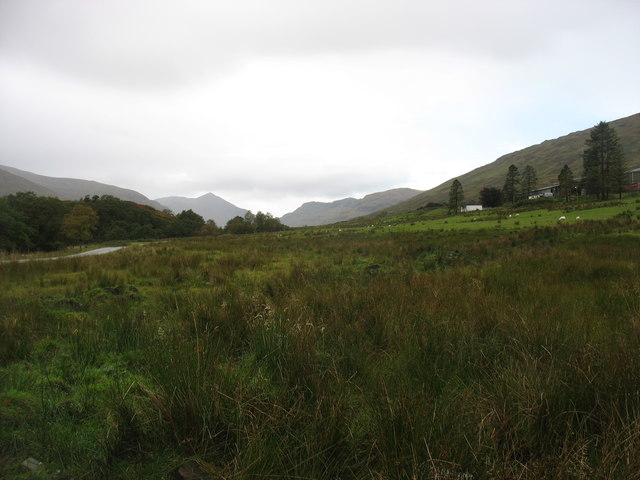
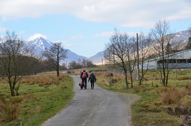
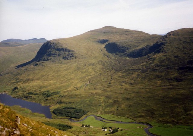
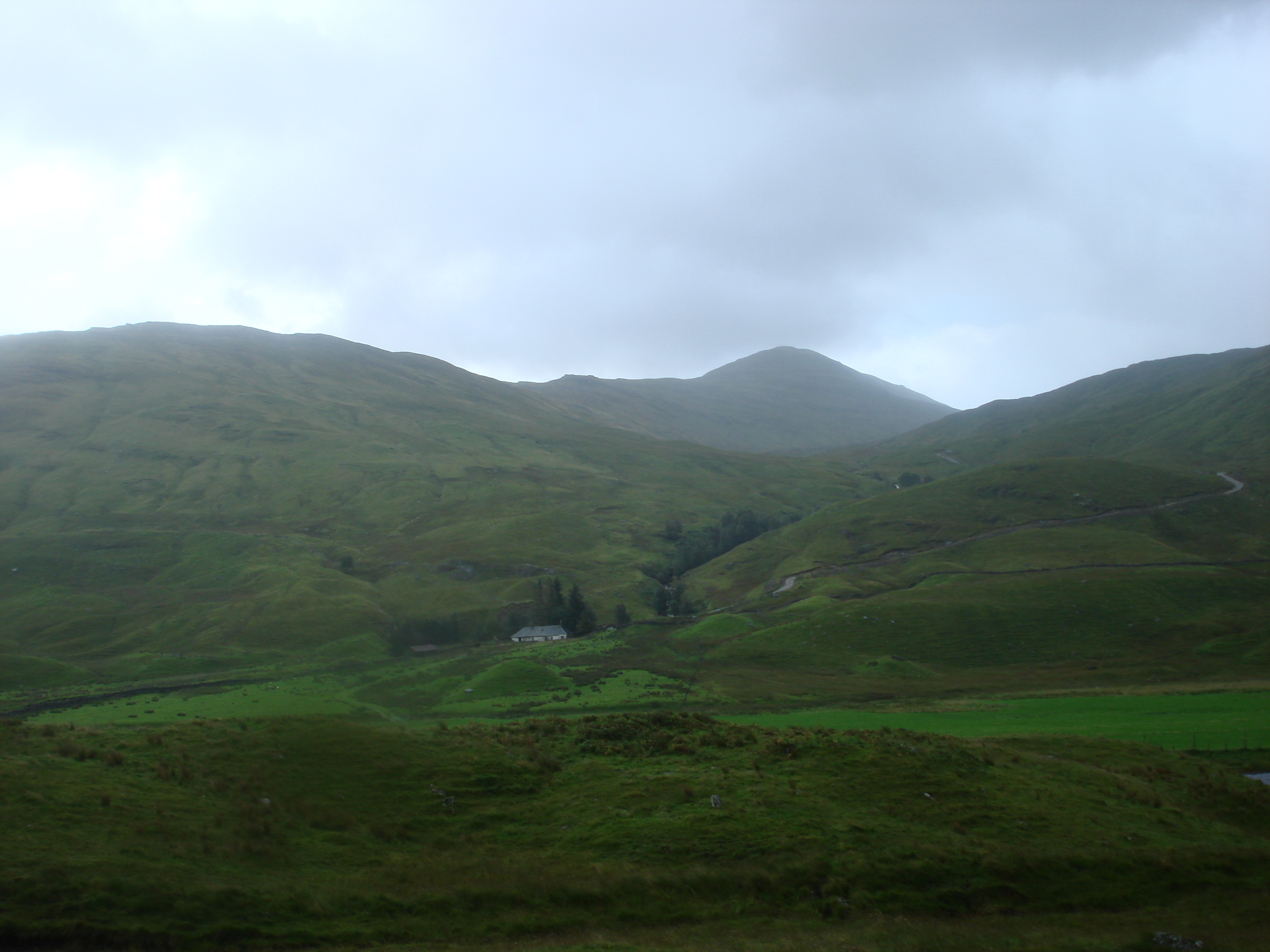
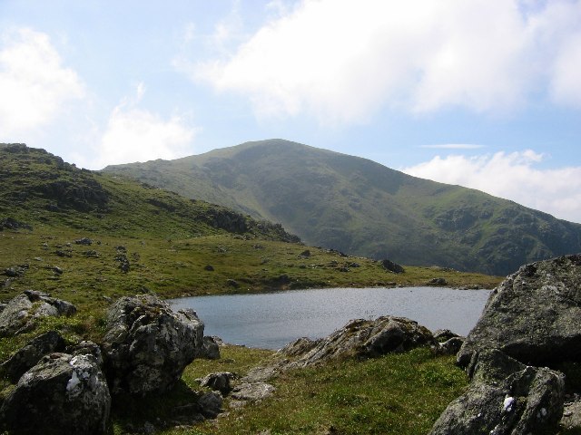
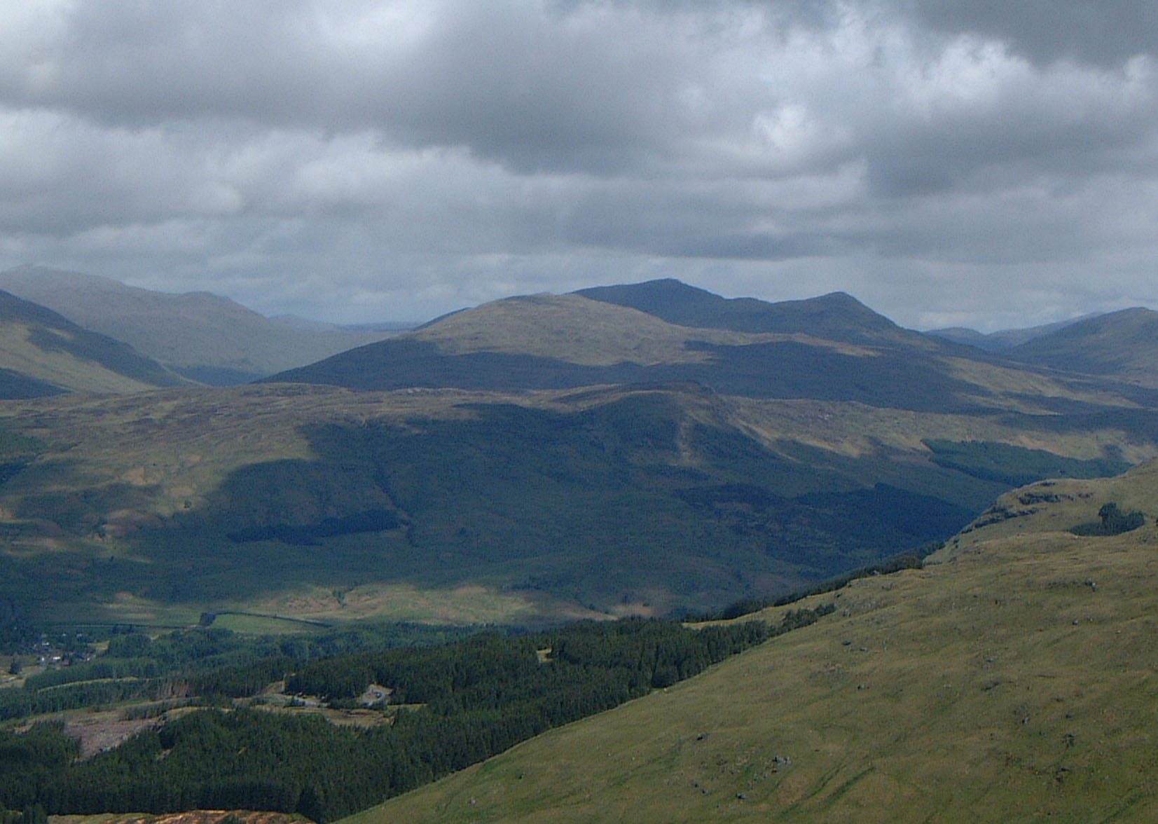
Breadalbane Mountains Images

Images are sourced within 2km of 56.499095/-4.481719 or Grid Reference NN4736. Thanks to Geograph Open Source API. All images are credited.

Hydro pipeline in Glen Lochay
Road in Glen Lochay near to High Botaurnie The word high, in High Botaurnie surely refers to the property being more deeply into the glen than to altitude as the locations, High and Low Botaurnie are at similar heights above sea level.
The distant, snow-patched mountain must be Beinn Sheasgarnaich.
Road in Glen Lochay near to High Botaurnie
The word high, in High Botaurnie surely refers to the property being more deeply into the glen than to altitude as the locations, High and Low Botaurnie are at similar heights above sea level. The distant, snow-patched mountain must be Beinn Sheasgarnaich.
Road passing 'last' car parking in Glen Lochay The car park has been installed presumably by the owning estate as it wants mountain walkers to drive no further. Significantly perhaps is that the green notice says "No parking beyond this point please' - a request, not an instruction!
Also significantly the road beyond this point is coloured yellow on the online version of OS Maps suggesting surely that the road beyond remains as a public one where parking should still be possible.
Road passing 'last' car parking in Glen Lochay
The car park has been installed presumably by the owning estate as it wants mountain walkers to drive no further. Significantly perhaps is that the green notice says "No parking beyond this point please' - a request, not an instruction! Also significantly the road beyond this point is coloured yellow on the online version of OS Maps suggesting surely that the road beyond remains as a public one where parking should still be possible.
Mountain slopes rising from road at cattle grid The grassy slope rises to a 799 metre, south-eastern top of the Munro, Beinn Sheasgarnaich.
The area here is rather confused as to how far the public can motor over the road surface in Glen Lochay. OS mapping as displayed currently on the Geograph website has several versions of 'yellow' public roads at different scales and even at one scale; that uncertainty continues with the status of the road crossing to upper Glen Lyon!
Inevitably, notices displayed by the local estate give a different and more restrictive view on where the public can drive and park.
Mountain slopes rising from road at cattle grid
The grassy slope rises to a 799 metre, south-eastern top of the Munro, Beinn Sheasgarnaich. The area here is rather confused as to how far the public can motor over the road surface in Glen Lochay. OS mapping as displayed currently on the Geograph website has several versions of 'yellow' public roads at different scales and even at one scale; that uncertainty continues with the status of the road crossing to upper Glen Lyon! Inevitably, notices displayed by the local estate give a different and more restrictive view on where the public can drive and park.
Road passing Kenknock Farm, Glen Lochay. View W If walking in this area, the last place to park your car is at NN476368
Road passing Kenknock Farm, Glen Lochay. View W
If walking in this area, the last place to park your car is at NN476368
In Glen Lochay, looking east (downstream)
Near Kenknock, Glen Lochay Near the end of the public road up the glen, with the pointed peak of Beinn Challuim ahead.
Near Kenknock, Glen Lochay
Near the end of the public road up the glen, with the pointed peak of Beinn Challuim ahead.
Track up Glen Lochay The start of the track westwards from the public road at Kenknock. The prominent peak is Beinn Challuim (1025m).
Track up Glen Lochay
The start of the track westwards from the public road at Kenknock. The prominent peak is Beinn Challuim (1025m).
Hydroelectric pipeline crossing Glen Lochay The pipeline conveys water collected in Glen Dochart through a tunnel to exit top left for the pipeline crossing. The pipe re-enters the hillside to tunnel northwards through to the power station at Lubreoch Dam on Loch Lyon. This is part of the Breadalbane hydroelectric scheme that was completed in 1961 (from 'The Dam Builders' by James Miller, Birlinn 2002).
Hydroelectric pipeline crossing Glen Lochay
The pipeline conveys water collected in Glen Dochart through a tunnel to exit top left for the pipeline crossing. The pipe re-enters the hillside to tunnel northwards through to the power station at Lubreoch Dam on Loch Lyon. This is part of the Breadalbane hydroelectric scheme that was completed in 1961 (from 'The Dam Builders' by James Miller, Birlinn 2002).
Hydro road above Glen Lochay The road over the Learg nan Lunn to Glen Lyon, shown as a track rather than a public road on the 1:25,000 map, although a few vehicles came through on my visit. The house at Lubchurran is in the trees L of centre with Beinn Cheathaich and Meall Glas above. The hydro pipeline to Glen Lyon re-enters the hill R of centre.
Hydro road above Glen Lochay
The road over the Learg nan Lunn to Glen Lyon, shown as a track rather than a public road on the 1:25,000 map, although a few vehicles came through on my visit. The house at Lubchurran is in the trees L of centre with Beinn Cheathaich and Meall Glas above. The hydro pipeline to Glen Lyon re-enters the hill R of centre.
Southern end of Meall nan Subh The SE ridge of Meall nan Subh (hill of the raspberries) with part of Creag nam Bodach in view across the Learg nan Lunn below.
Southern end of Meall nan Subh
The SE ridge of Meall nan Subh (hill of the raspberries) with part of Creag nam Bodach in view across the Learg nan Lunn below.
Peaty ridge, Meall nan Subh The ridge lies SE-NW with a number of cairns, small tops and lochans. The hill in view is the Munro Meall Ghaordaidh (1039m).
Peaty ridge, Meall nan Subh
The ridge lies SE-NW with a number of cairns, small tops and lochans. The hill in view is the Munro Meall Ghaordaidh (1039m).
Cairn on Meall nan Subh One of several cairns on this ridge, looking west towards Beinn Sheasgarnaich.
Cairn on Meall nan Subh
One of several cairns on this ridge, looking west towards Beinn Sheasgarnaich.
The River Lochay near Kenknock Looking upstream from the bridge. The Lochay rises on the hillsides below Beinn Challuim (in view ahead) and along with the River Dochart flows into Loch Tay at Killin.
The River Lochay near Kenknock
Looking upstream from the bridge. The Lochay rises on the hillsides below Beinn Challuim (in view ahead) and along with the River Dochart flows into Loch Tay at Killin.
Southern end of Meall nan Subh plateau
Allt Creamha
Allt Creamha
Hillside towards Glen Lochay
Show me another place!

Breadalbane Mountains is located at Grid Ref: NN4736 (Lat: 56.499095, Lng: -4.481719)

Unitary Authority: Stirling

Police Authority: Forth Valley

What 3 Words

///broadcast.pans.worms. Near Pubil, Perth & Kinross

Nearby Locations

Breadalbane Mountains

Related Wikis

Meall Ghaordaidh

Meall Ghaordaidh is a mountain in the Southern Highlands of Scotland, approximately 10 km north-west of Killin. The mountain can be ascended via Glen Lochay...

Sgiath Chùil

Sgiath Chùil is a mountain situated in the southern highlands of Scotland. It stands within Loch Lomond and the Trossachs National Park, on its northern...

Beinn Heasgarnich

Beinn Heasgarnich (Scottish Gaelic: Beinn Sheasgarnaich) is a mountain in the Breadalbane region of the Scottish Highlands. It lies about 2 km south of...

Meall Glas

Meall Glas is a mountain situated in the southern highlands of Scotland. It stands on the northern border of the Loch Lomond and the Trossachs National...

Nearby Amenities

Located within 500m of 56.499095,-4.481719
Power: tower
Source: bing
Lat/Long: 56.4987597/-4.4874495
Kenknock
Place: hamlet
Source: survey
Lat/Long: 56.4971002/-4.488127
Power: tower
Source: bing
Lat/Long: 56.4988785/-4.4855985
Power: tower
Source: bing
Lat/Long: 56.4989264/-4.4847502
Power: tower
Source: bing
Lat/Long: 56.4989831/-4.4837155
Power: tower
Source: bing
Lat/Long: 56.4990452/-4.4825876
Power: tower
Source: bing
Lat/Long: 56.4990984/-4.4814566
Power: tower
Source: bing
Lat/Long: 56.4991073/-4.4882142
Power: tower
Source: bing
Lat/Long: 56.4992669/-4.4790723
Power: tower
Source: bing
Lat/Long: 56.4993343/-4.4779862
Power: tower
Source: bing
Lat/Long: 56.4993769/-4.4888761
Power: tower
Source: bing
Lat/Long: 56.499384/-4.4768037
Power: tower
Source: bing
Lat/Long: 56.4994585/-4.475663
Power: tower
Source: bing
Lat/Long: 56.4995188/-4.4745736
Power: tower
Source: bing
Lat/Long: 56.4997387/-4.4897726
Power: pole
Lat/Long: 56.4972528/-4.4878523
Power: pole
Lat/Long: 56.4977779/-4.4881512
Power: pole
Lat/Long: 56.4982728/-4.4884357
Power: pole
Lat/Long: 56.4987614/-4.4887116
Power: pole
Lat/Long: 56.4990009/-4.488269
The data included in this document is from www.openstreetmap.org. The data is made available under ODbL.

Have you been to Breadalbane Mountains?

Leave your review of Breadalbane Mountains below (or comments, questions and feedback).