Kilpatrick Hills
Range Of Mountains, Range Of Hills in Dunbartonshire
Scotland
Kilpatrick Hills

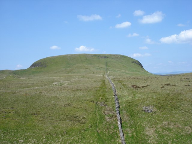
The Kilpatrick Hills, located in Dunbartonshire, Scotland, are a range of hills that stretch across an area of approximately 17 square miles. The hills are situated about 8 miles northwest of Glasgow and offer stunning views of the Clyde Estuary and the surrounding countryside.
The highest peak in the Kilpatrick Hills is Doughnot Hill, which stands at an elevation of 1,393 feet. This makes it a popular destination for hikers and nature enthusiasts looking to explore the area. The hills are also home to a variety of wildlife, including red deer, foxes, and a wide array of bird species.
The landscape of the Kilpatrick Hills is characterized by a mixture of craggy peaks, heather-covered moorland, and dense forests. Several walking trails traverse the area, allowing visitors to explore the hills at their own pace. The most well-known trail is the John Muir Way, which passes through the hills on its journey from Helensburgh to Falkirk.
In addition to its natural beauty, the Kilpatrick Hills also hold historical significance. At the foot of the hills lies the remains of the Antonine Wall, a Roman fortification built in the 2nd century AD. This UNESCO World Heritage Site provides insight into Scotland's ancient past and attracts history enthusiasts from around the world.
Overall, the Kilpatrick Hills in Dunbartonshire offer a diverse range of landscapes and activities for visitors to enjoy. Whether it's hiking, wildlife spotting, or exploring historical sites, this range of hills has something to offer for everyone.
If you have any feedback on the listing, please let us know in the comments section below.
Kilpatrick Hills Images
Images are sourced within 2km of 55.957923/-4.4477759 or Grid Reference NS4776. Thanks to Geograph Open Source API. All images are credited.

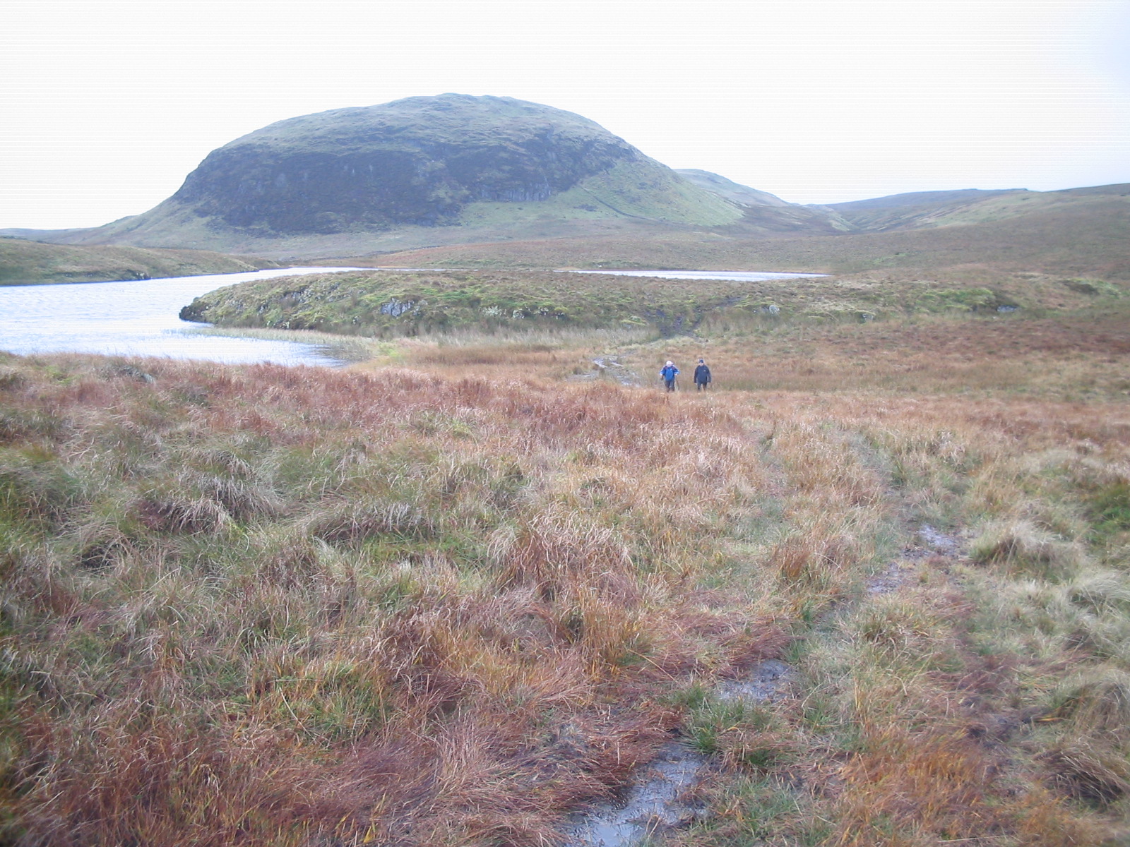
![Spout of the Three Marches "A waterfall on the Little Saughen Brae Burn. At this point three Laird's lands met at one time, hence the name" [OS Object Name Book (late 19th century)].
In his book &quot;The Waterfalls of Scotland&quot; (1987), Louis Stott comments that &quot;the burn comes to life with a five metre leap&quot;, and that the three estates meeting here were Wester Cameron (<a href="https://www.geograph.org.uk/photo/3355569">NS4583 : Wester Cameron Farm</a>), Strathleven (<a href="https://www.geograph.org.uk/photo/1058768">NS3978 : Strathleven House</a>) and Aucheneck (<a href="https://www.geograph.org.uk/photo/3620932">NS4883 : Aucheneck House</a>).
See <a href="https://www.geograph.org.uk/photo/2940310">NS4778 : Spout of the Three Marches</a> for another view. For a more distant view providing some context, see <a href="https://www.geograph.org.uk/photo/2940283">NS4778 : Spout of the Three Marches</a>.
One mile to the north-east, there used to be another waterfall called the <a href="https://www.geograph.org.uk/photo/2940257">NS4879 : Spout of the White Horse</a>; there is still a cascade of sorts there, but the area was greatly changed when a reservoir was built nearby.](https://s2.geograph.org.uk/geophotos/02/94/02/2940274_900a2342.jpg)


Kilpatrick Hills is located at Grid Ref: NS4776 (Lat: 55.957923, Lng: -4.4477759)
Unitary Authority: West Dunbartonshire
Police Authority: Argyll and West Dunbartonshire
What 3 Words
///instincts.blueberry.energy. Near Old Kilpatrick, West Dunbartonshire
Nearby Locations
Related Wikis

Duncolm
Duncolm (Scottish Gaelic: Dùn Choluim) is a hill in Scotland. It is the highest point in both West Dunbartonshire and the Kilpatrick Hills, at an elevation...
Kilpatrick Hills
The Kilpatrick Hills are a range of hills in central Scotland, stretching from Dumbarton in the west to Strathblane in the east. Strathblane divides the...

Loch Humphrey
Loch Humphrey is a loch in West Dunbartonshire, Scotland. It is fished for mainly perch and occasional trout by members of the Bearsden Angling Club, who...

Clydebank (district)
Clydebank (Scottish Gaelic: Bruach Chluaidh) was, from 1975 to 1996, one of nineteen local government districts in the Strathclyde region of Scotland,...
Nearby Amenities
Located within 500m of 55.957923,-4.4477759Have you been to Kilpatrick Hills?
Leave your review of Kilpatrick Hills below (or comments, questions and feedback).