Stodmarsh Valley

Valley in Kent Canterbury

England

Stodmarsh Valley

13-17, The Elms A terrace of three houses, built on <a href="https://www.geograph.org.uk/photo/4825520">TR2062 : Land adjacent to 11, The Elms</a>.
13-17, The Elms Credit: John Baker

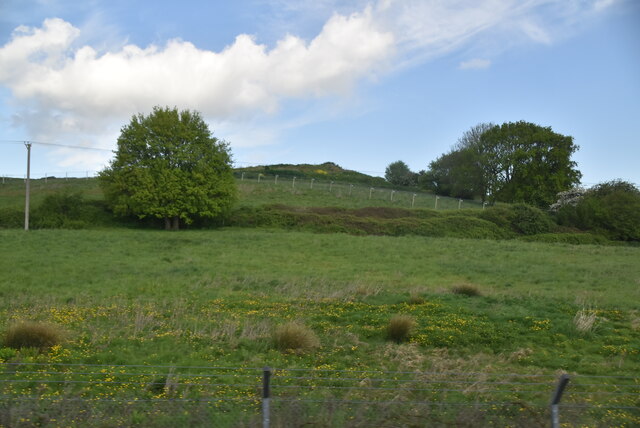
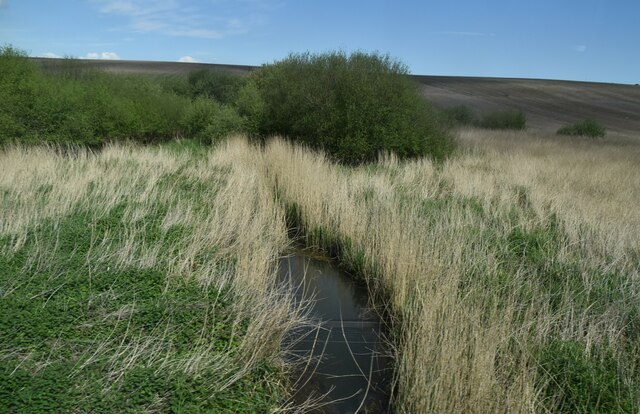
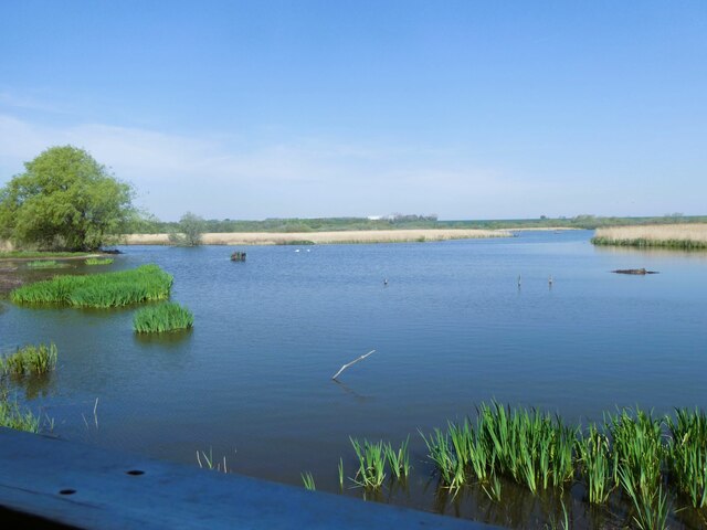
Stodmarsh Valley is a picturesque nature reserve located in the county of Kent, England. Situated just six miles east of the historic city of Canterbury, the valley spans over 1,000 hectares and is renowned for its diverse and unique wildlife.

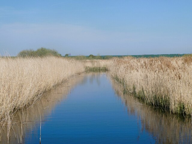
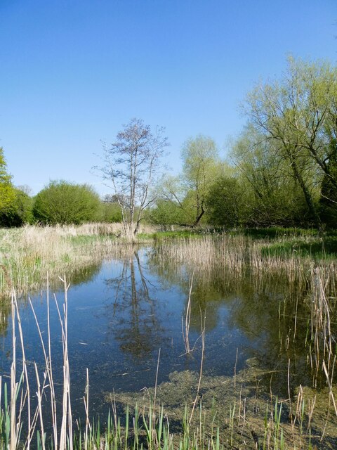
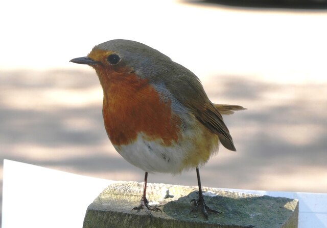
The valley is primarily made up of wetland habitats, including reed beds, marshes, and open water channels. These habitats provide an ideal environment for a wide range of bird species, making Stodmarsh Valley a haven for birdwatchers and nature enthusiasts. Over 200 bird species have been recorded in the area, including rare and endangered species such as the bittern and the marsh harrier.

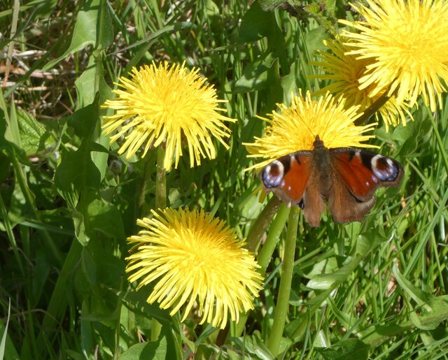
In addition to its avian population, Stodmarsh Valley is also home to various mammals, reptiles, and amphibians, including water voles, otters, grass snakes, and common frogs. The reserve's wetland environment also supports a rich array of plant life, with a diverse range of aquatic and marshland flora.

Visitors to Stodmarsh Valley can explore the reserve by following a network of well-maintained footpaths and boardwalks, which allow for close observation of the wildlife without disturbing their natural habitats. The site also features several bird hides strategically placed to provide optimal viewing opportunities.

Managed by the Kent Wildlife Trust, Stodmarsh Valley offers educational programs and events throughout the year, providing visitors with the opportunity to learn about the unique ecosystem and conservation efforts in place. Overall, Stodmarsh Valley is a must-visit destination for nature lovers looking to immerse themselves in the beauty and tranquility of Kent's natural landscapes.

If you have any feedback on the listing, please let us know in the comments section below.

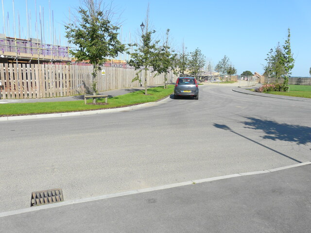
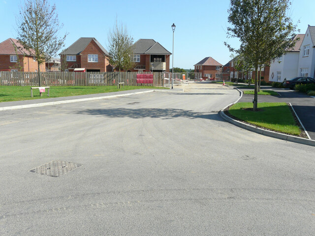
Stodmarsh Valley Images

Images are sourced within 2km of 51.307039/1.1744227 or Grid Reference TR2161. Thanks to Geograph Open Source API. All images are credited.

13-17, The Elms A terrace of three houses, built on <a href="https://www.geograph.org.uk/photo/4825520">TR2062 : Land adjacent to 11, The Elms</a>.
13-17, The Elms
A terrace of three houses, built on TR2062 : Land adjacent to 11, The Elms.
Building site, Island Road The advertisement board reads “A development of 25 homes for rent & shared ownership delivered in partnership with Canterbury City Council”
Building site, Island Road
The advertisement board reads “A development of 25 homes for rent & shared ownership delivered in partnership with Canterbury City Council”
Longwall Lane Longwall Lane is a road on a development, which has been named The Hoplands; it has been built on land, which was once <a href="https://www.geograph.org.uk/photo/4825555">TR2061 : Hoplands Farm</a>. 

Planning permission has been granted by Canterbury City Council under application number CA//16/00404 for an “outline planning application for a neighbourhood extension for the creation of up to 250 houses including affordable housing, neighbourhood centre (comprising Class A1 food store (400sq.m), Class D1 medical centre (380sq.m), Class D1 dentist (150sq.m), Class A1 pharmacy (150sq.m), Class D1 nursery (120sq.m) and Class A1 convenience retail (360sq.m)), commercial estate (comprising Class B1 business floor space (up to 5572sq.m), Class D1 apprenticeship centre (616sq.m) and Class D1/D2 community building (up to 672sq.m)), parish parkland and associated access, parking, amenity space and landscaping.
Longwall Lane
Longwall Lane is a road on a development, which has been named The Hoplands; it has been built on land, which was once TR2061 : Hoplands Farm. Planning permission has been granted by Canterbury City Council under application number CA//16/00404 for an “outline planning application for a neighbourhood extension for the creation of up to 250 houses including affordable housing, neighbourhood centre (comprising Class A1 food store (400sq.m), Class D1 medical centre (380sq.m), Class D1 dentist (150sq.m), Class A1 pharmacy (150sq.m), Class D1 nursery (120sq.m) and Class A1 convenience retail (360sq.m)), commercial estate (comprising Class B1 business floor space (up to 5572sq.m), Class D1 apprenticeship centre (616sq.m) and Class D1/D2 community building (up to 672sq.m)), parish parkland and associated access, parking, amenity space and landscaping.
Hoplands Road Hoplands Road is a road on a development, which has been named The Hoplands; it has been built on land, which was once <a href="https://www.geograph.org.uk/photo/4825555">TR2061 : Hoplands Farm</a>. 

Planning permission has been granted by Canterbury City Council under application number CA//16/00404 for an “outline planning application for a neighbourhood extension for the creation of up to 250 houses including affordable housing, neighbourhood centre (comprising Class A1 food store (400sq.m), Class D1 medical centre (380sq.m), Class D1 dentist (150sq.m), Class A1 pharmacy (150sq.m), Class D1 nursery (120sq.m) and Class A1 convenience retail (360sq.m)), commercial estate (comprising Class B1 business floor space (up to 5572sq.m), Class D1 apprenticeship centre (616sq.m) and Class D1/D2 community building (up to 672sq.m)), parish parkland and associated access, parking, amenity space and landscaping.
Hoplands Road
Hoplands Road is a road on a development, which has been named The Hoplands; it has been built on land, which was once TR2061 : Hoplands Farm. Planning permission has been granted by Canterbury City Council under application number CA//16/00404 for an “outline planning application for a neighbourhood extension for the creation of up to 250 houses including affordable housing, neighbourhood centre (comprising Class A1 food store (400sq.m), Class D1 medical centre (380sq.m), Class D1 dentist (150sq.m), Class A1 pharmacy (150sq.m), Class D1 nursery (120sq.m) and Class A1 convenience retail (360sq.m)), commercial estate (comprising Class B1 business floor space (up to 5572sq.m), Class D1 apprenticeship centre (616sq.m) and Class D1/D2 community building (up to 672sq.m)), parish parkland and associated access, parking, amenity space and landscaping.
Elliefred, Ash Crescent This was <a href="https://www.geograph.org.uk/photo/4825530">TR2062 : Elliefred, Ash Crescent</a> during the house’s construction.
Elliefred, Ash Crescent
This was TR2062 : Elliefred, Ash Crescent during the house’s construction.
Pastureland
Pastureland
Drainage channel
Drainage channel
Stodmarsh National Nature Reserve View from Reedbed Hide on the south side of the reserve.
Stodmarsh National Nature Reserve
View from Reedbed Hide on the south side of the reserve.
Stodmarsh National Nature Reserve View from the footpath of one of the drainage ditches through the reedbeds.
Stodmarsh National Nature Reserve
View from the footpath of one of the drainage ditches through the reedbeds.
Stodmarsh National Nature reserve Dandelions and peacock butterfly by one of the footpaths.
Stodmarsh National Nature reserve
Dandelions and peacock butterfly by one of the footpaths.
Stodmarsh National Nature Reserve Southern end of a lake in the reserve.
Stodmarsh National Nature Reserve
Southern end of a lake in the reserve.
Robin in the car park of Stodmarsh National Nature Reserve Robins and blue tits are fed by visitors and, therefore, become extremely tame. They appear so friendly but, of course, it's cupboard love.
Robin in the car park of Stodmarsh National Nature Reserve
Robins and blue tits are fed by visitors and, therefore, become extremely tame. They appear so friendly but, of course, it's cupboard love.
Black Horse Lane Part of a housing estate called The Hoplands for which planning permission has been granted by Canterbury City Council under application number CA//16/00404. 

An  “outline planning application for a neighbourhood extension for the creation of up to 250 houses including affordable housing, neighbourhood centre (comprising Class A1 food store (400sq.m), Class D1 medical centre (380sq.m), Class D1 dentist (150sq.m), Class A1 pharmacy (150sq.m), Class D1 nursery (120sq.m) and Class A1 convenience retail (360sq.m)), commercial estate (comprising Class B1 business floorspace (up to 5572sq.m), Class D1 apprenticeship centre (616sq.m) and Class D1/D2 community building (up to 672sq.m)), parish parkland and associated access, parking, amenity space and landscaping”.
Black Horse Lane
Part of a housing estate called The Hoplands for which planning permission has been granted by Canterbury City Council under application number CA//16/00404. An “outline planning application for a neighbourhood extension for the creation of up to 250 houses including affordable housing, neighbourhood centre (comprising Class A1 food store (400sq.m), Class D1 medical centre (380sq.m), Class D1 dentist (150sq.m), Class A1 pharmacy (150sq.m), Class D1 nursery (120sq.m) and Class A1 convenience retail (360sq.m)), commercial estate (comprising Class B1 business floorspace (up to 5572sq.m), Class D1 apprenticeship centre (616sq.m) and Class D1/D2 community building (up to 672sq.m)), parish parkland and associated access, parking, amenity space and landscaping”.
Black Horse Lane Part of a housing estate called The Hoplands for which planning permission has been granted by Canterbury City Council under application number CA//16/00404. An  “outline planning application for a neighbourhood extension for the creation of up to 250 houses including affordable housing, neighbourhood centre (comprising Class A1 food store (400sq.m), Class D1 medical centre (380sq.m), Class D1 dentist (150sq.m), Class A1 pharmacy (150sq.m), Class D1 nursery (120sq.m) and Class A1 convenience retail (360sq.m)), commercial estate (comprising Class B1 business floorspace (up to 5572sq.m), Class D1 apprenticeship centre (616sq.m) and Class D1/D2 community building (up to 672sq.m)), parish parkland and associated access, parking, amenity space and landscaping”.

The road is one of the furthest parts of this length of <a href="https://www.geograph.org.uk/photo/7309735">TR2061 : Black Horse Lane</a>.
Black Horse Lane
Part of a housing estate called The Hoplands for which planning permission has been granted by Canterbury City Council under application number CA//16/00404. An “outline planning application for a neighbourhood extension for the creation of up to 250 houses including affordable housing, neighbourhood centre (comprising Class A1 food store (400sq.m), Class D1 medical centre (380sq.m), Class D1 dentist (150sq.m), Class A1 pharmacy (150sq.m), Class D1 nursery (120sq.m) and Class A1 convenience retail (360sq.m)), commercial estate (comprising Class B1 business floorspace (up to 5572sq.m), Class D1 apprenticeship centre (616sq.m) and Class D1/D2 community building (up to 672sq.m)), parish parkland and associated access, parking, amenity space and landscaping”. The road is one of the furthest parts of this length of TR2061 : Black Horse Lane.
Longwall Lane Part of a housing estate called The Hoplands for which planning permission has been granted by Canterbury City Council under application number CA//16/00404. An  “outline planning application for a neighbourhood extension for the creation of up to 250 houses including affordable housing, neighbourhood centre (comprising Class A1 food store (400sq.m), Class D1 medical centre (380sq.m), Class D1 dentist (150sq.m), Class A1 pharmacy (150sq.m), Class D1 nursery (120sq.m) and Class A1 convenience retail (360sq.m)), commercial estate (comprising Class B1 business floorspace (up to 5572sq.m), Class D1 apprenticeship centre (616sq.m) and Class D1/D2 community building (up to 672sq.m)), parish parkland and associated access, parking, amenity space and landscaping”.

A similar view of <a href="https://www.geograph.org.uk/photo/6935546">TR2061 : Longwall Lane</a> was taken in July 2021.
Longwall Lane
Part of a housing estate called The Hoplands for which planning permission has been granted by Canterbury City Council under application number CA//16/00404. An “outline planning application for a neighbourhood extension for the creation of up to 250 houses including affordable housing, neighbourhood centre (comprising Class A1 food store (400sq.m), Class D1 medical centre (380sq.m), Class D1 dentist (150sq.m), Class A1 pharmacy (150sq.m), Class D1 nursery (120sq.m) and Class A1 convenience retail (360sq.m)), commercial estate (comprising Class B1 business floorspace (up to 5572sq.m), Class D1 apprenticeship centre (616sq.m) and Class D1/D2 community building (up to 672sq.m)), parish parkland and associated access, parking, amenity space and landscaping”. A similar view of TR2061 : Longwall Lane was taken in July 2021.
Lakehill Road Part of a housing estate called The Hoplands for which planning permission has been granted by Canterbury City Council under application number CA//16/00404.
Lakehill Road
Part of a housing estate called The Hoplands for which planning permission has been granted by Canterbury City Council under application number CA//16/00404.
Show me another place!

Stodmarsh Valley is located at Grid Ref: TR2161 (Lat: 51.307039, Lng: 1.1744227)

Administrative County: Kent

District: Canterbury

Police Authority: Kent

What 3 Words

///tricks.folks.knee. Near Sturry, Kent

Nearby Locations

Stodmarsh Valley

Related Wikis

Stodmarsh SSSI

Stodmarsh SSSI is a 623.2-hectare (1,540-acre) biological Site of Special Scientific Interest near Stodmarsh, north-east of Canterbury in Kent. Parts of...

Chislet Colliery Halt railway station

Chislet Colliery Halt was a minor station on the Ashford to Ramsgate line. It opened in September 1919 and closed in 1971. == History == Chislet Colliery...

Stodmarsh

Stodmarsh is a small village in the civil parish of Wickhambreaux, in the Canterbury district, in east Kent, England. It is 5 miles to the east of Canterbury...

Hersden

Hersden is a village east of Canterbury in Kent, South East England. It was established as a planned coalmining village in the 1920s and is on the A28...

Have you been to Stodmarsh Valley?

Leave your review of Stodmarsh Valley below (or comments, questions and feedback).