Bramling Bottom
Valley in Kent Canterbury
England
Bramling Bottom

Bramling Bottom, also known as Bramling Valley, is a charming village located in the county of Kent, England. Situated in the southeast region of the country, this rural community offers a picturesque setting surrounded by rolling hills and lush greenery.
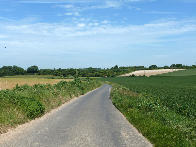
The village is known for its tranquil atmosphere and beautiful countryside views, making it a popular destination for nature lovers and those seeking a peaceful retreat. Bramling Bottom is renowned for its idyllic walking trails, providing ample opportunities for outdoor activities and exploration. Visitors can enjoy leisurely strolls along the meandering paths, taking in the scenic beauty of the surrounding landscapes.
The village itself is small, with a close-knit community that fosters a friendly and welcoming atmosphere. The local residents take pride in maintaining the village's traditional character, with many of the houses showcasing charming thatched roofs and historic architecture. The village also boasts a quaint church, which adds to its rustic charm.
Although Bramling Bottom may be secluded, it is conveniently located near several larger towns and cities. Canterbury, a historic city famous for its cathedral and cultural heritage, is only a short drive away. The coastal town of Whitstable, known for its seafood and charming harbor, is also within easy reach.
In summary, Bramling Bottom, Kent is a picturesque village nestled in a scenic valley, offering a peaceful retreat for nature enthusiasts and those seeking a break from the hustle and bustle of city life.
If you have any feedback on the listing, please let us know in the comments section below.
Bramling Bottom Images
Images are sourced within 2km of 51.25402/1.1748952 or Grid Reference TR2155. Thanks to Geograph Open Source API. All images are credited.


Bramling Bottom is located at Grid Ref: TR2155 (Lat: 51.25402, Lng: 1.1748952)
Administrative County: Kent
District: Canterbury
Police Authority: Kent
What 3 Words
///expanded.compelled.stardom. Near Littlebourne, Kent
Nearby Locations
Related Wikis
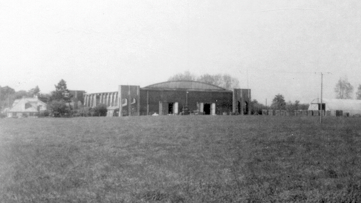
Bekesbourne Aerodrome
Bekesbourne Aerodrome was an airport located at the southeast edge of the village of Bekesbourne, southeast of Canterbury, Kent. It operated from 1916...

Adisham
Adisham (formerly Adesham) is a village and civil parish in the English county of Kent. It is twinned with Campagne-lès-Hesdin in France. == Geography... ==

Bramling
Bramling is a hamlet five miles (8 km) east of Canterbury in Kent, England. It lies on the A257 road between Littlebourne and Wingham. The local public...
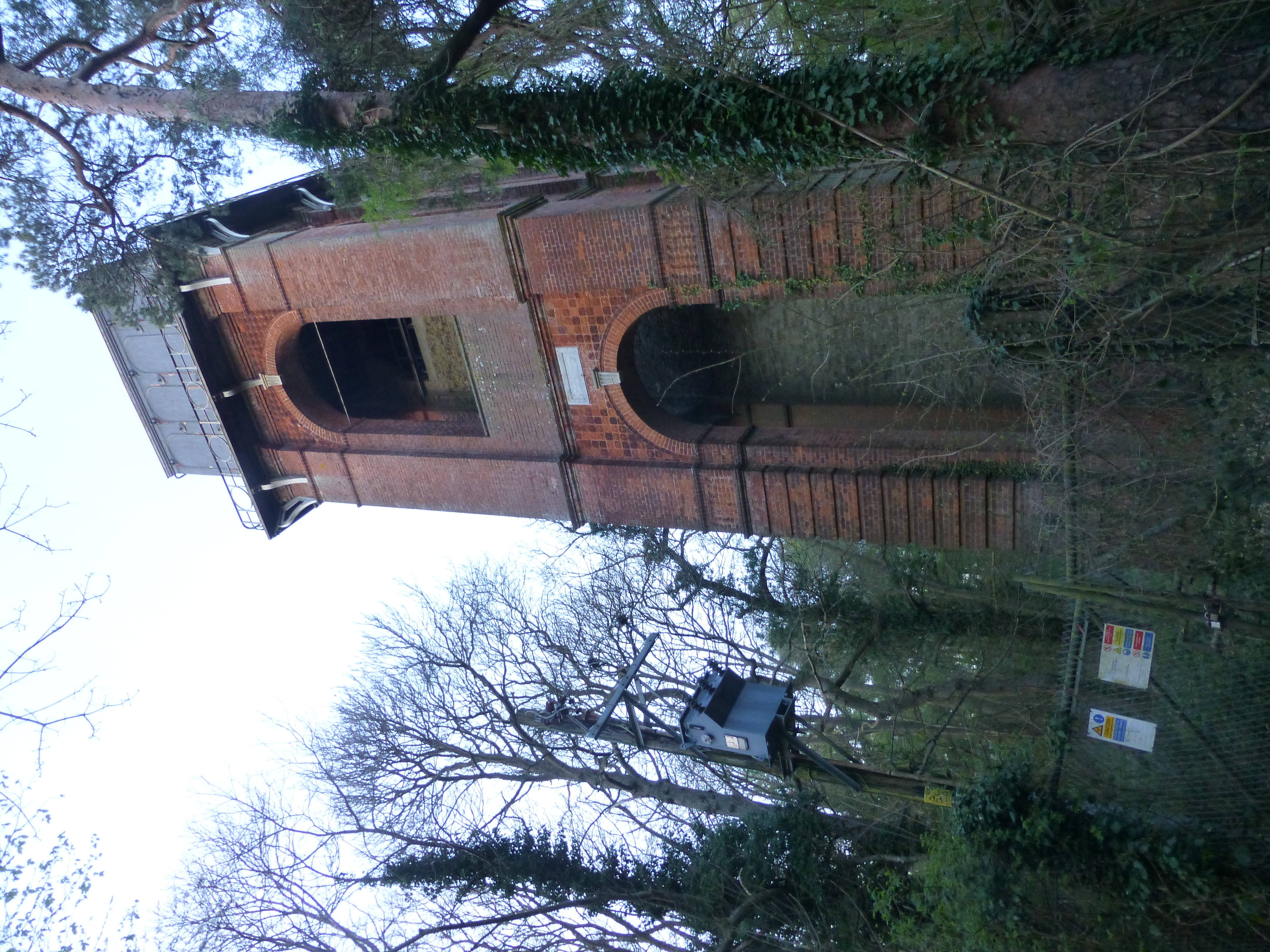
Adisham Water Tower
Adisham Water Tower is a Grade II listed building located in the parish of Adisham, Kent. The structure was built in 1903 in an Edwardian Italianate Revival...
Have you been to Bramling Bottom?
Leave your review of Bramling Bottom below (or comments, questions and feedback).