Bloods Dale
Valley in Norfolk Broadland
England
Bloods Dale
Bloods Dale, also known as Bloods Valley, is a charming village located in the county of Norfolk, England. Situated in the heart of the picturesque Norfolk countryside, the village is surrounded by lush green fields, rolling hills, and meandering streams, making it an idyllic destination for nature lovers and those seeking tranquility.
The village itself is small, with a population of around 300 residents, giving it a close-knit community feel. It is characterized by its traditional Norfolk architecture, with quaint cottages built from local stone, giving the village a timeless and charming atmosphere.
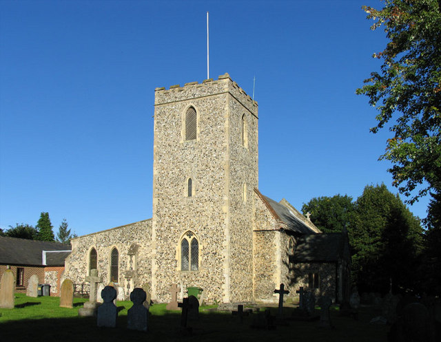
Bloods Dale is well-known for its rich history, with evidence of human habitation dating back to prehistoric times. The village boasts a medieval church, St. Mary's, which stands proudly as a testament to its past. The church features stunning stained glass windows and intricate carvings, offering visitors a glimpse into the village's heritage.
Despite its size, Bloods Dale has a vibrant community spirit, with various social events and activities taking place throughout the year. The village hosts an annual summer fair, where locals and visitors come together to enjoy traditional games, delicious food, and live music.
Surrounding the village, visitors can explore the stunning Norfolk Broads, a network of rivers, lakes, and wetlands that are home to a wide array of wildlife. The Broads offer opportunities for boating, fishing, and birdwatching, making it a popular destination for outdoor enthusiasts.
In conclusion, Bloods Dale, Norfolk (Valley) is a picturesque village steeped in history and natural beauty. Its charming architecture, close-knit community, and proximity to the Norfolk Broads make it an appealing destination for those seeking a peaceful and authentic English countryside experience.
If you have any feedback on the listing, please let us know in the comments section below.
Bloods Dale Images
Images are sourced within 2km of 52.668947/1.2321764 or Grid Reference TG1812. Thanks to Geograph Open Source API. All images are credited.


Bloods Dale is located at Grid Ref: TG1812 (Lat: 52.668947, Lng: 1.2321764)
Administrative County: Norfolk
District: Broadland
Police Authority: Norfolk
What 3 Words
///locker.mermaids.upwardly. Near Costessey, Norfolk
Nearby Locations
Related Wikis

Marriott's Way
The Marriott's Way is a footpath, cycle-path and bridleway in north Norfolk, England, between Norwich and Aylsham via Themelthorpe. It forms part of the...
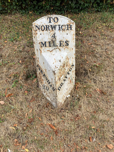
Drayton, Norfolk
Drayton, Norfolk, is a suburban village in the English county of Norfolk. The village is located in the district of Broadland, 4.3 miles (6.9 km) north...

Drayton railway station
Drayton railway station is a former station in Norfolk, England. Constructed by the Midland and Great Northern Joint Railway in the 1880s, on the line...

Costessey
Costessey ( KOSS-ee) is a town and civil parish in the South Norfolk district of Norfolk, England, and is 4 miles (6.4 km) north west of Norwich. The...
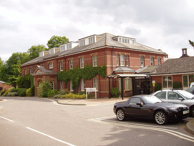
Hellesdon Hospital
Hellesdon Hospital is a mental health facility in Hellesdon, Norfolk, England. It is managed by Norfolk and Suffolk NHS Foundation Trust. == History... ==

Hellesdon High School
Hellesdon High School is a secondary school and sixth form with academy status in Hellesdon, Norfolk, England. The school is part of the Wensum Trust....
Thorpe Marriott
Thorpe Marriott is a residential area in Norfolk, England covering part of Taverham and Drayton parishes. Much of the housing was built in the latter part...
Dussindale & Hellesdon Rovers F.C.
Dussindale & Hellesdon Rovers Football Club is a football club based in Norwich, England. They are currently members of the Eastern Counties League Division...
Nearby Amenities
Located within 500m of 52.668947,1.2321764Have you been to Bloods Dale?
Leave your review of Bloods Dale below (or comments, questions and feedback).