Cranedown Bottom

Valley in Sussex Wealden

England

Cranedown Bottom

Wayfaring tree - Viburnum lantana
Wayfaring tree - Viburnum lantana Credit: Ian Cunliffe

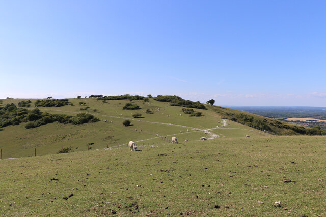
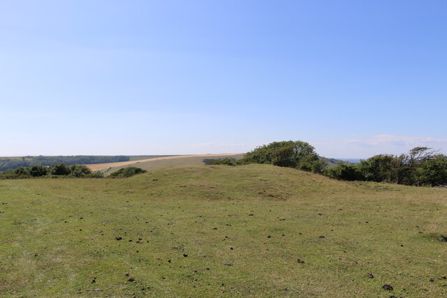
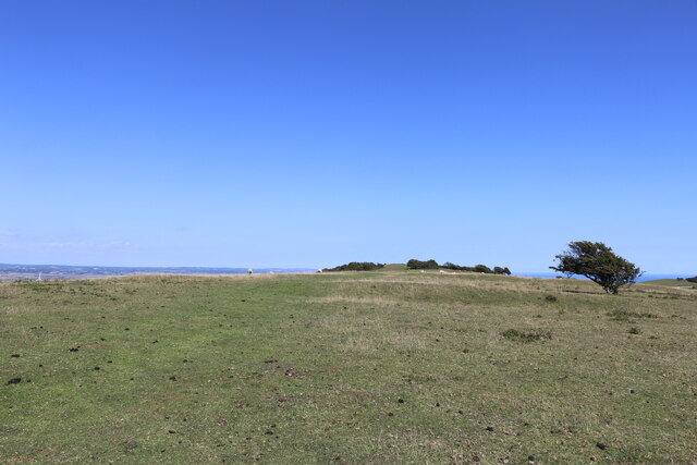
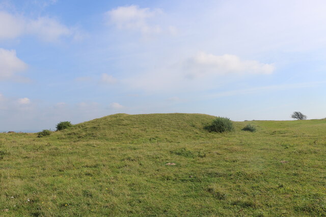
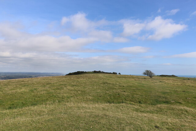
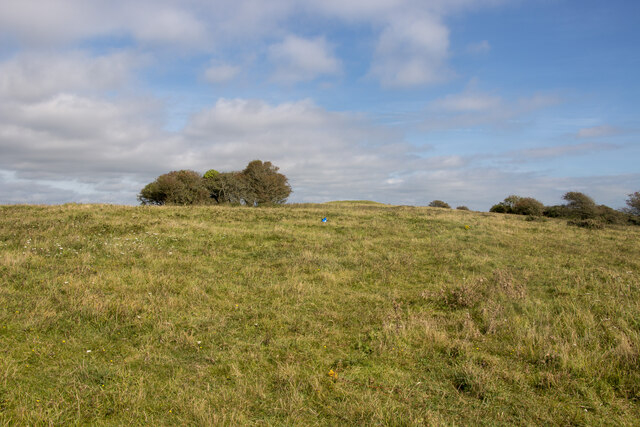
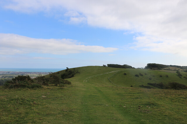
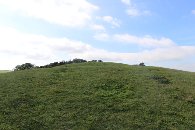
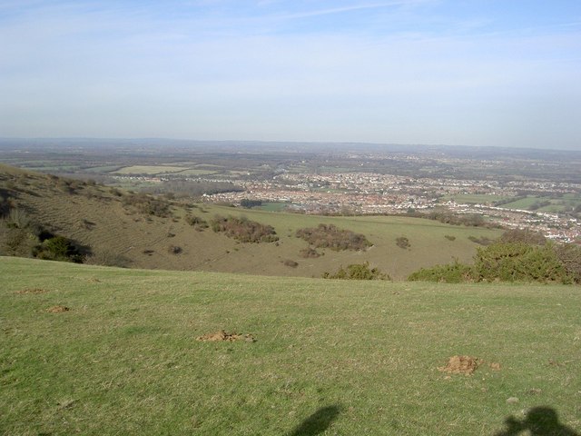
Cranedown Bottom is a picturesque valley located in Sussex, England. Situated in the South Downs National Park, it offers breathtaking views of the surrounding countryside and is a popular destination for nature enthusiasts and hikers.

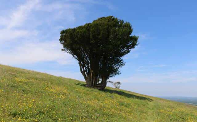
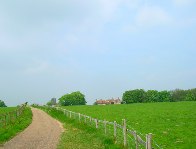
The valley is characterized by its rolling hills, lush green meadows, and meandering streams. The landscape is dotted with small woodlands, adding to its natural beauty. Cranedown Bottom is particularly known for its diverse wildlife, including rare bird species, butterflies, and wildflowers. It provides a tranquil environment for visitors to immerse themselves in the wonders of nature.

The valley is home to several walking trails, which cater to different levels of difficulty and length. These trails offer visitors the opportunity to explore the stunning scenery, observe wildlife, and enjoy the fresh air. The valley is also a haven for birdwatching enthusiasts, who can spot a variety of species, such as kestrels, buzzards, and skylarks.

Cranedown Bottom is a perfect spot for a picnic or a leisurely stroll. Visitors can relax by the stream, listen to the soothing sounds of nature, and take in the panoramic views. The valley is known for its tranquility and serenity, providing an escape from the hustle and bustle of city life.

Overall, Cranedown Bottom is a hidden gem in Sussex, offering a peaceful retreat for those seeking to reconnect with nature. Its stunning landscapes, diverse wildlife, and peaceful atmosphere make it a must-visit destination for nature lovers and outdoor enthusiasts.

If you have any feedback on the listing, please let us know in the comments section below.

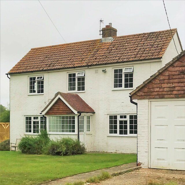
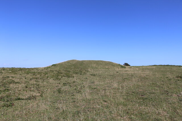
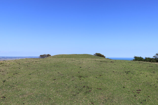
Cranedown Bottom Images

Images are sourced within 2km of 50.809693/0.22086634 or Grid Reference TQ5603. Thanks to Geograph Open Source API. All images are credited.

Wayfaring tree - Viburnum lantana
House on Green Lane
House on Green Lane
Coombe Hill viewed in a west-northwest direction, East Sussex This photo looks over part of the dry valley of Willingdon Bottom toward Coombe Hill. The archaeological features on Coombe Hill, including a causewayed enclosure and barrows, lie on the crest of the hill and in a saddle of land on the western side.
Coombe Hill viewed in a west-northwest direction, East Sussex
This photo looks over part of the dry valley of Willingdon Bottom toward Coombe Hill. The archaeological features on Coombe Hill, including a causewayed enclosure and barrows, lie on the crest of the hill and in a saddle of land on the western side.
Bronze-Age bowl barrow on Combe Hill, East Sussex This westerly looking photo shows the most easterly of the barrows on Combe Hill.
Bronze-Age bowl barrow on Combe Hill, East Sussex
This westerly looking photo shows the most easterly of the barrows on Combe Hill.
Bronze Age bowl barrow viewed from the west, East Sussex The bowl barrow in the photo is being viewed from the west. It appears to have been originally dug in Victorian times without proper records being kept.
Bronze Age bowl barrow viewed from the west, East Sussex
The bowl barrow in the photo is being viewed from the west. It appears to have been originally dug in Victorian times without proper records being kept.
Westward view of the most westerly bowl barrow on Combe Hill This Bronze Age bowl barrow is the most westerly barrow on Combe Hill, East Sussex. The top of the barrow has a circular depression indicating that it has been excavated.
Westward view of the most westerly bowl barrow on Combe Hill
This Bronze Age bowl barrow is the most westerly barrow on Combe Hill, East Sussex. The top of the barrow has a circular depression indicating that it has been excavated.
Ring and ditch of the causewayed enclosure on Combe Hill This photo looks eastward along the top of Combe Hill in East Sussex. The photo shows a segment of the ring and ditch feature which forms part of the causewayed enclosure. There are several causeways which cut the rings into parts and one of these is indicated to the north of centre in the photo. The most easterly of the bowl barrows on this ceremonial site can be seen on the high ground which marks the horizon.
Ring and ditch of the causewayed enclosure on Combe Hill
This photo looks eastward along the top of Combe Hill in East Sussex. The photo shows a segment of the ring and ditch feature which forms part of the causewayed enclosure. There are several causeways which cut the rings into parts and one of these is indicated to the north of centre in the photo. The most easterly of the bowl barrows on this ceremonial site can be seen on the high ground which marks the horizon.
Eastward view of the more westerly bowl barrow on Coombe Hill In 1908, three and a half bronze axes were unearthed from the bowl barrow in the photo by the then owner of Friston Place, (Curwen 1940 p.108) Three of the four axes had been broken. It is likely that the breakages were deliberate, and done in a ritual manner, in order to "kill" the objects so that they could be used as votive offerings.
Eastward view of the more westerly bowl barrow on Coombe Hill
In 1908, three and a half bronze axes were unearthed from the bowl barrow in the photo by the then owner of Friston Place, (Curwen 1940 p.108) Three of the four axes had been broken. It is likely that the breakages were deliberate, and done in a ritual manner, in order to "kill" the objects so that they could be used as votive offerings.
View from the western barrow to the eastern one, Coombe Hill This photo was taken from the top of the western bowl barrow and it looks over the archaeological site of the Neolithic "causewayed enclosure" toward the eastern, bowl barrow. The bowl barrows are Bronze Age features.
View from the western barrow to the eastern one, Coombe Hill
This photo was taken from the top of the western bowl barrow and it looks over the archaeological site of the Neolithic "causewayed enclosure" toward the eastern, bowl barrow. The bowl barrows are Bronze Age features.
Saucer or disc barrow on Combe Hill, East Sussex The disc or saucer shaped barrow is an example of one of the rarest forms of round barrow with only approximately 60 of them in the country. Because of this rarity they are always considered to be of national importance and they are bestowed with official recognition and protected status.
The saucer barrow, in the photo, is a shallow depression which is difficult to see and photograph and it is for that reason that I placed a blue bag in the centre of the feature. Although the saucer shaped barrow lacks the visual impact of either of the nearby bowl barrows, it retains considerable archaeological potential for research as there is no evidence of antiquarian investigation.
Saucer or disc barrow on Combe Hill, East Sussex
The disc or saucer shaped barrow is an example of one of the rarest forms of round barrow with only approximately 60 of them in the country. Because of this rarity they are always considered to be of national importance and they are bestowed with official recognition and protected status. The saucer barrow, in the photo, is a shallow depression which is difficult to see and photograph and it is for that reason that I placed a blue bag in the centre of the feature. Although the saucer shaped barrow lacks the visual impact of either of the nearby bowl barrows, it retains considerable archaeological potential for research as there is no evidence of antiquarian investigation.
Prehistoric barrow between Cold Crouch and Coombe Hill, East Sussex The convex hill to the east of the Wealdway, in the photo, is made of chalk and it is a natural part of the escarpment. Built on top of the hill, there is an earthen, prehistoric barrow with panoramic, eastern views towards Eastbourne and the English Channel.
Prehistoric barrow between Cold Crouch and Coombe Hill, East Sussex
The convex hill to the east of the Wealdway, in the photo, is made of chalk and it is a natural part of the escarpment. Built on top of the hill, there is an earthen, prehistoric barrow with panoramic, eastern views towards Eastbourne and the English Channel.
Westward view of a barrow between Cold Crouch and Coombe Hill This photo shows a barrow on the summit of a steep hill between Cold Crouch and Coombe Hill in East Sussex.
Westward view of a barrow between Cold Crouch and Coombe Hill
This photo shows a barrow on the summit of a steep hill between Cold Crouch and Coombe Hill in East Sussex.
Yew tree on Coombe Hill, East Sussex This photo shows a single yew tree growing on the slopes of Coombe Hill. It is surrounded by a variety of colourful, downland flowers
Yew tree on Coombe Hill, East Sussex
This photo shows a single yew tree growing on the slopes of Coombe Hill. It is surrounded by a variety of colourful, downland flowers
Black cattle on Coombe Hill, East Sussex Viewing the top of Coombe Hill from a southerly direction, the photo shows one of the herd of black cattle standing on top of the most westerly bowl barrow while the other is grazing at further distance.
Black cattle on Coombe Hill, East Sussex
Viewing the top of Coombe Hill from a southerly direction, the photo shows one of the herd of black cattle standing on top of the most westerly bowl barrow while the other is grazing at further distance.
Herd of black cattle grazing on pasture at Coombe Hill, East Sussex This photo shows a herd of black cattle grazing on pasture at Coombe Hill.
Herd of black cattle grazing on pasture at Coombe Hill, East Sussex
This photo shows a herd of black cattle grazing on pasture at Coombe Hill.
Wealdway from near Willingdon Bottom to the top of Coombe Hill This photo shows a section of the Wealdway which tracks past Willingdon Bottom to the top of Coombe Hill. Out of sight, the Wealdway then turns westwards and passes through the Neolithic causewayed enclosure on top of Coombe Hill.
Wealdway from near Willingdon Bottom to the top of Coombe Hill
This photo shows a section of the Wealdway which tracks past Willingdon Bottom to the top of Coombe Hill. Out of sight, the Wealdway then turns westwards and passes through the Neolithic causewayed enclosure on top of Coombe Hill.
Northward view of yew tree on Coombe Hill, East Sussex The photo shows a northward view of a prominent yew tree on Coombe Hill.
Northward view of yew tree on Coombe Hill, East Sussex
The photo shows a northward view of a prominent yew tree on Coombe Hill.
Downland, summer flowers on Butts Brow, Willingdon, East Sussex A colourful assemblage of wild flowers growing on the steep slope near the top of Butts Brow.
Downland, summer flowers on Butts Brow, Willingdon, East Sussex
A colourful assemblage of wild flowers growing on the steep slope near the top of Butts Brow.
Show me another place!

Cranedown Bottom is located at Grid Ref: TQ5603 (Lat: 50.809693, Lng: 0.22086634)

Administrative County: East Sussex

District: Wealden

Police Authority: Sussex

What 3 Words

///city.good.bake. Near Friston, East Sussex

Related Wikis

Folkington Reservoir

Folkington Reservoir is a 5.8-hectare (14-acre) biological Site of Special Scientific Interest south-west of Polegate in East Sussex.The banks of the reservoir...

Folkington Manor

Folkington Manor (pronounced Fo'ington) is a grade II* listed country house situated in the village of Folkington two miles (3.2 km) west of Polegate,...

Church of St Peter ad Vincula, Folkington

The Church of St Peter ad Vincula, Folkington, East Sussex is a parish church dating from the 13th century. Built of flint and rubble, it is a Grade I...

Willingdon Community School

Willingdon Community School is an 11–16 coeducational secondary school located in the Lower Willingdon area of Eastbourne in the English county of East...

Combe Hill, East Sussex

Combe Hill is a causewayed enclosure, near Eastbourne in East Sussex, on the northern edge of the South Downs. It consists of an inner circuit of ditches...

Willingdon Down

Willingdon Down is a 67.5-hectare (167-acre) biological Site of Special Scientific Interest west of Willingdon, a suburb of Eastbourne in East Sussex....

Wootton Manor

Wootton Manor is a country house in Folkington, East Sussex. Originally a mediaeval manor house, from which parts of the chapel survive, it was rebuilt...

Ovenden's Mill, Polegate

Ovenden's Mill or Mockett's Mill is a grade II* listed tower mill at Polegate, East Sussex, England which has been restored but is now in a poor state...

Have you been to Cranedown Bottom?

Leave your review of Cranedown Bottom below (or comments, questions and feedback).