Butchershole Bottom

Valley in Sussex Wealden

England

Butchershole Bottom

Bridleway
Bridleway Credit: N Chadwick

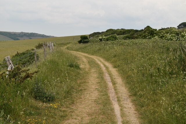
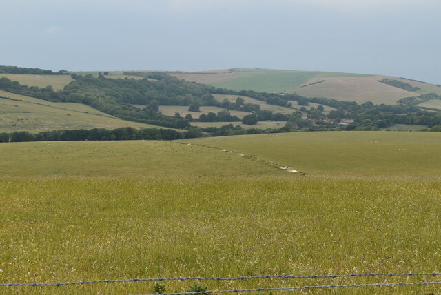
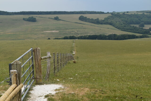
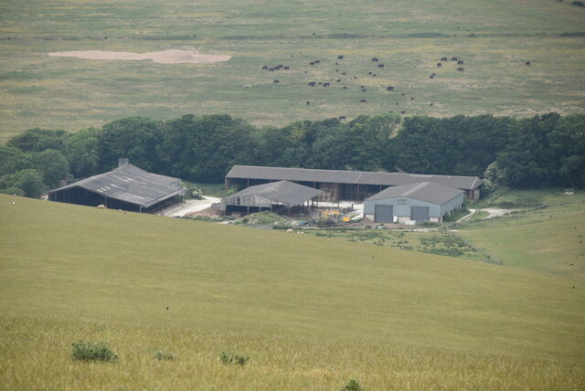
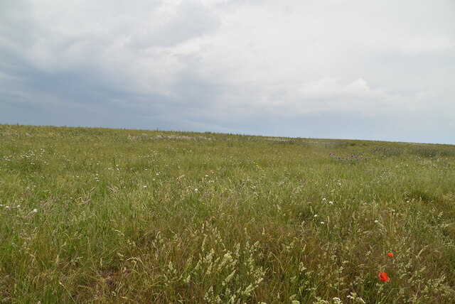
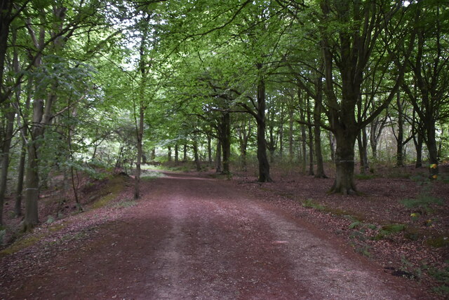
Butchershole Bottom, Sussex, is a picturesque valley located in the South East of England. It lies within the administrative county of East Sussex and is nestled between the towns of Uckfield and Crowborough. The valley stretches for approximately two miles, encompassing lush green fields, wooded areas, and a small stream that meanders through its center.

The name "Butchershole Bottom" is believed to have originated from its historical association with the local butchery trade. The term "bottom" refers to a low-lying area, indicating its position within the landscape. While the exact origins of the name remain uncertain, it provides a glimpse into the valley's past.

The natural beauty of Butchershole Bottom attracts outdoor enthusiasts, nature lovers, and those seeking tranquility away from the bustling cities. The valley is home to a diverse range of flora and fauna, with wildflowers blooming in the spring and a variety of bird species inhabiting the area throughout the year. The dense woodland provides an ideal habitat for various wildlife, including deer, foxes, and rabbits.

Visitors to Butchershole Bottom can explore the valley through numerous footpaths and trails, which offer stunning views of the surrounding countryside. The peaceful atmosphere and idyllic scenery make it a popular spot for walking, picnicking, and photography.

Overall, Butchershole Bottom in Sussex is a serene and scenic valley, offering a peaceful retreat from the urban landscape. Its natural beauty, diverse wildlife, and historical significance make it an appealing destination for both locals and tourists alike.

If you have any feedback on the listing, please let us know in the comments section below.

Butchershole Bottom Images

Images are sourced within 2km of 50.772502/0.20048107 or Grid Reference TV5599. Thanks to Geograph Open Source API. All images are credited.

Bridleway
Bridleway
Rolling downland The South Downs is one of the four areas of chalk downland in southern England. They extend from the eastern side of Hampshire through Sussex, culminating in the cliffs at Beachy Head.
The South Downs is England's newest National Park, its designation taking effect on March 31, 2010. There are many Sites of Special Scientific Interest within the park.
The area is relatively unpopulated, although along its southern periphery there is an almost uninterrupted ribbon of seaside towns. It is extremely popular with walkers, having one principal long distance footpath, the South Downs Way, and many interconnecting ones. There are three principal gaps in the upland through which rivers flow; and there are also many dry valleys along its length.
The South Downs have a long history; there are archaeological remains from Neolithic times. Until the middle of the 20th century, sheep-rearing was the main occupation of those living on the Downs.

At 886ft, Butser Hill is the highest point of the South Downs.

Extract from Wikipedia <span class="nowrap"><a title="http://en.wikipedia.org/wiki/South_Downs" rel="nofollow ugc noopener" href="http://en.wikipedia.org/wiki/South_Downs">Link</a><img style="margin-left:2px;" alt="External link" title="External link - shift click to open in new window" src="https://s1.geograph.org.uk/img/external.png" width="10" height="10"/></span>
Rolling downland
The South Downs is one of the four areas of chalk downland in southern England. They extend from the eastern side of Hampshire through Sussex, culminating in the cliffs at Beachy Head. The South Downs is England's newest National Park, its designation taking effect on March 31, 2010. There are many Sites of Special Scientific Interest within the park. The area is relatively unpopulated, although along its southern periphery there is an almost uninterrupted ribbon of seaside towns. It is extremely popular with walkers, having one principal long distance footpath, the South Downs Way, and many interconnecting ones. There are three principal gaps in the upland through which rivers flow; and there are also many dry valleys along its length. The South Downs have a long history; there are archaeological remains from Neolithic times. Until the middle of the 20th century, sheep-rearing was the main occupation of those living on the Downs. At 886ft, Butser Hill is the highest point of the South Downs. Extract from Wikipedia LinkExternal link
Fence into Duttle's Bottom
Oxendean Farm
Oxendean Farm
Chalk meadow
Chalk meadow
Footpath off bridleway
Brick shelter
Brick shelter
Descending from Willingdon Hill
Fate at edge of Friston Forest An open access forest managed by the Forestry Commission.

Forestry website <span class="nowrap"><a title="http://www.forestry.gov.uk/website/recreation.nsf/LUWebDocsByKey/EnglandEastSussexNoForestFristonForest" rel="nofollow ugc noopener" href="http://www.forestry.gov.uk/website/recreation.nsf/LUWebDocsByKey/EnglandEastSussexNoForestFristonForest">Link</a><img style="margin-left:2px;" alt="External link" title="External link - shift click to open in new window" src="https://s1.geograph.org.uk/img/external.png" width="10" height="10"/></span>
Fate at edge of Friston Forest
An open access forest managed by the Forestry Commission. Forestry website LinkExternal link
Chalk grassland
Chalk grassland
Chalk downland The South Downs is one of the four areas of chalk downland in southern England. They extend from the eastern side of Hampshire through Sussex, culminating in the cliffs at Beachy Head.
The South Downs is England's newest National Park, its designation taking effect on March 31, 2010. There are many Sites of Special Scientific Interest within the park.
The area is relatively unpopulated, although along its southern periphery there is an almost uninterrupted ribbon of seaside towns. It is extremely popular with walkers, having one principal long distance footpath, the South Downs Way, and many interconnecting ones. There are three principal gaps in the upland through which rivers flow; and there are also many dry valleys along its length.
The South Downs have a long history; there are archaeological remains from Neolithic times. Until the middle of the 20th century, sheep-rearing was the main occupation of those living on the Downs.

At 886ft, Butser Hill is the highest point of the South Downs.

Extract from Wikipedia <span class="nowrap"><a title="http://en.wikipedia.org/wiki/South_Downs" rel="nofollow ugc noopener" href="http://en.wikipedia.org/wiki/South_Downs">Link</a><img style="margin-left:2px;" alt="External link" title="External link - shift click to open in new window" src="https://s1.geograph.org.uk/img/external.png" width="10" height="10"/></span>
Chalk downland
The South Downs is one of the four areas of chalk downland in southern England. They extend from the eastern side of Hampshire through Sussex, culminating in the cliffs at Beachy Head. The South Downs is England's newest National Park, its designation taking effect on March 31, 2010. There are many Sites of Special Scientific Interest within the park. The area is relatively unpopulated, although along its southern periphery there is an almost uninterrupted ribbon of seaside towns. It is extremely popular with walkers, having one principal long distance footpath, the South Downs Way, and many interconnecting ones. There are three principal gaps in the upland through which rivers flow; and there are also many dry valleys along its length. The South Downs have a long history; there are archaeological remains from Neolithic times. Until the middle of the 20th century, sheep-rearing was the main occupation of those living on the Downs. At 886ft, Butser Hill is the highest point of the South Downs. Extract from Wikipedia LinkExternal link
Edge of Friston Forest An open access forest managed by the Forestry Commission.

Forestry website <span class="nowrap"><a title="http://www.forestry.gov.uk/website/recreation.nsf/LUWebDocsByKey/EnglandEastSussexNoForestFristonForest" rel="nofollow ugc noopener" href="http://www.forestry.gov.uk/website/recreation.nsf/LUWebDocsByKey/EnglandEastSussexNoForestFristonForest">Link</a><img style="margin-left:2px;" alt="External link" title="External link - shift click to open in new window" src="https://s1.geograph.org.uk/img/external.png" width="10" height="10"/></span>
Edge of Friston Forest
An open access forest managed by the Forestry Commission. Forestry website LinkExternal link
Edge of Friston Forest
Friston Forest An open access forest managed by the Forestry Commission.

Forestry website <span class="nowrap"><a title="http://www.forestry.gov.uk/website/recreation.nsf/LUWebDocsByKey/EnglandEastSussexNoForestFristonForest" rel="nofollow ugc noopener" href="http://www.forestry.gov.uk/website/recreation.nsf/LUWebDocsByKey/EnglandEastSussexNoForestFristonForest">Link</a><img style="margin-left:2px;" alt="External link" title="External link - shift click to open in new window" src="https://s1.geograph.org.uk/img/external.png" width="10" height="10"/></span>
Friston Forest
An open access forest managed by the Forestry Commission. Forestry website LinkExternal link
Bridleway, Friston Forest An open access forest managed by the Forestry Commission.

Forestry website <span class="nowrap"><a title="http://www.forestry.gov.uk/website/recreation.nsf/LUWebDocsByKey/EnglandEastSussexNoForestFristonForest" rel="nofollow ugc noopener" href="http://www.forestry.gov.uk/website/recreation.nsf/LUWebDocsByKey/EnglandEastSussexNoForestFristonForest">Link</a><img style="margin-left:2px;" alt="External link" title="External link - shift click to open in new window" src="https://s1.geograph.org.uk/img/external.png" width="10" height="10"/></span>
Bridleway, Friston Forest
An open access forest managed by the Forestry Commission. Forestry website LinkExternal link
Friston Forest
Friston Forest
Bridleway, Friston Forest An open access forest managed by the Forestry Commission.

Forestry website <span class="nowrap"><a title="http://www.forestry.gov.uk/website/recreation.nsf/LUWebDocsByKey/EnglandEastSussexNoForestFristonForest" rel="nofollow ugc noopener" href="http://www.forestry.gov.uk/website/recreation.nsf/LUWebDocsByKey/EnglandEastSussexNoForestFristonForest">Link</a><img style="margin-left:2px;" alt="External link" title="External link - shift click to open in new window" src="https://s1.geograph.org.uk/img/external.png" width="10" height="10"/></span>
Bridleway, Friston Forest
An open access forest managed by the Forestry Commission. Forestry website LinkExternal link
Show me another place!

Butchershole Bottom is located at Grid Ref: TV5599 (Lat: 50.772502, Lng: 0.20048107)

Administrative County: East Sussex

District: Wealden

Police Authority: Sussex

What 3 Words

///submits.popular.grafted. Near Friston, East Sussex

Nearby Locations

Butchershole Bottom

Related Wikis

East Dean and Friston

East Dean and Friston is a civil parish in the Wealden District of East Sussex, England.The two villages in the parish are in a dry valley on the South...

Seaford to Beachy Head

Seaford to Beachy Head is a 1,108.7-hectare (2,740-acre) biological and geological Site of Special Scientific Interest which stretches from Seaford to...

Seven Sisters Sheep Centre

The Seven Sisters Sheep Centre was a farm near East Dean, in the Seven Sisters Country Park of the South Downs. It held a large collection of about 50...

RAF Friston

Royal Air Force Friston or more simply RAF Friston is a former Royal Air Force satellite station and Emergency Landing Ground located in East Sussex, England...

Lullington Heath

Lullington Heath is a 72.7-hectare (180-acre) biological Site of Special Scientific Interest west of Eastbourne in East Sussex. It is a national nature...

Seven Sisters, East Sussex

The Seven Sisters are a series of chalk sea cliffs on the English Channel coast, and are a stretch of the sea-eroded section of the South Downs range of...

SM UB-121

SM UB-121 was a German Type UB III submarine or U-boat in the German Imperial Navy (German: Kaiserliche Marine) during World War I. She was commissioned...

Friston Forest

Friston Forest is a forest, located between Seaford and Eastbourne in East Sussex. It is part of the South Downs National Park area. The forest is managed...

Nearby Amenities

Located within 500m of 50.772502,0.20048107
Barrier: kissing_gate
Foot: yes
Material: wood
Lat/Long: 50.7689117/0.1972367
Parking
Butchershole
Fee: yes
Operator: Forestry Comission
Lat/Long: 50.7733859/0.2045625
The data included in this document is from www.openstreetmap.org. The data is made available under ODbL.

Have you been to Butchershole Bottom?

Leave your review of Butchershole Bottom below (or comments, questions and feedback).