Flagstaff Bottom
Valley in Sussex Wealden
England
Flagstaff Bottom

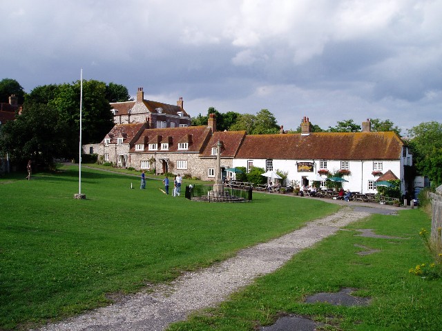
Flagstaff Bottom is a small valley located in the county of Sussex, England. Situated near the village of Newick, it is known for its picturesque beauty and tranquil surroundings. The valley is nestled between rolling hills and is characterized by its lush green meadows, dense woodlands, and a meandering river that flows through its heart.
The area is popular among nature enthusiasts and hikers due to its extensive network of walking trails, which offer stunning views of the surrounding countryside. The valley is home to a diverse range of wildlife, including deer, foxes, and various bird species, making it a haven for wildlife enthusiasts and birdwatchers.
Flagstaff Bottom is also known for its rich history. The name "Flagstaff" is said to originate from a flagpole that once stood in the area, serving as a marker for travelers. The valley was primarily used for agricultural purposes in the past, with farms dotting the landscape. Although modern development has taken place, the valley has managed to retain its rural charm and remains largely untouched by urbanization.
Visitors to Flagstaff Bottom can enjoy picnicking by the river, exploring the woodlands, or simply taking in the peaceful atmosphere. The valley is easily accessible by car or public transportation, and there are parking facilities available for those wishing to explore the area on foot.
Overall, Flagstaff Bottom is a hidden gem in Sussex, offering a serene escape from the hustle and bustle of everyday life, and providing a glimpse into the natural beauty and history of the region.
If you have any feedback on the listing, please let us know in the comments section below.
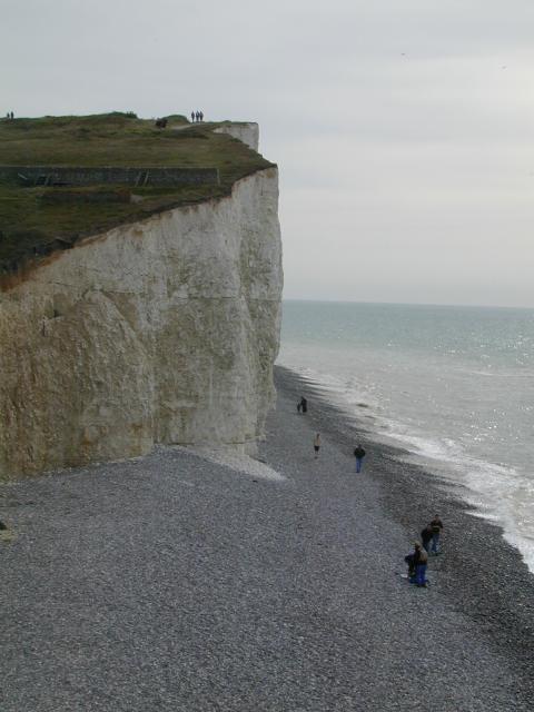
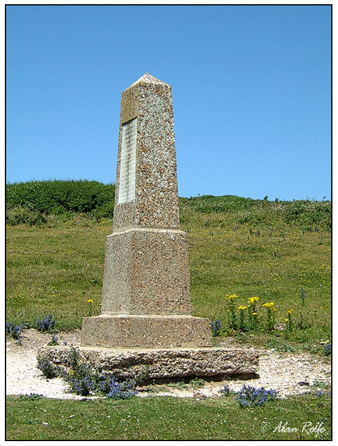
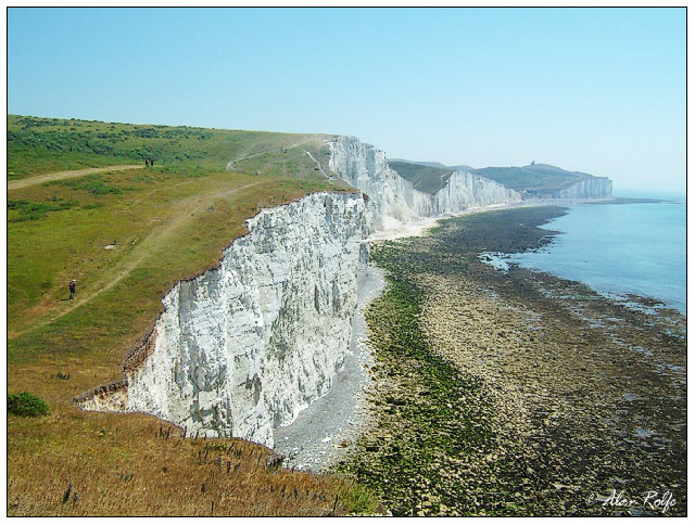
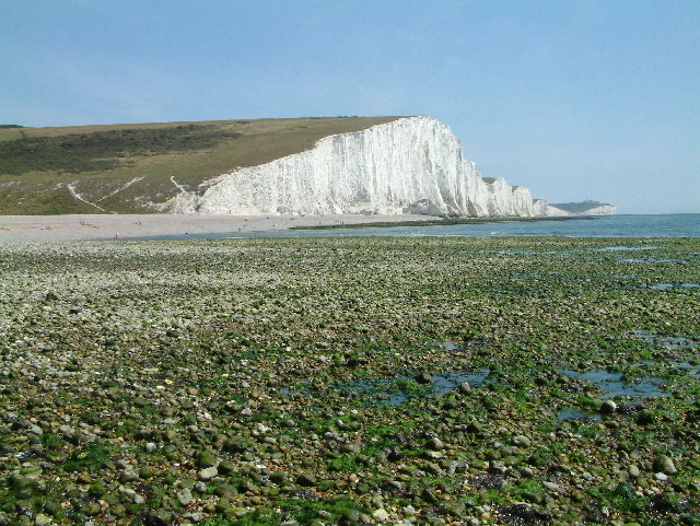
Flagstaff Bottom Images
Images are sourced within 2km of 50.751679/0.18483081 or Grid Reference TV5496. Thanks to Geograph Open Source API. All images are credited.


Flagstaff Bottom is located at Grid Ref: TV5496 (Lat: 50.751679, Lng: 0.18483081)
Administrative County: East Sussex
District: Wealden
Police Authority: Sussex
What 3 Words
///encounter.smarting.baseline. Near Friston, East Sussex
Related Wikis

Seaford to Beachy Head
Seaford to Beachy Head is a 1,108.7-hectare (2,740-acre) biological and geological Site of Special Scientific Interest which stretches from Seaford to...

East Dean and Friston
East Dean and Friston is a civil parish in the Wealden District of East Sussex, England.The two villages in the parish are in a dry valley on the South...

Seven Sisters Sheep Centre
The Seven Sisters Sheep Centre was a farm near East Dean, in the Seven Sisters Country Park of the South Downs. It held a large collection of about 50...

SM UB-121
SM UB-121 was a German Type UB III submarine or U-boat in the German Imperial Navy (German: Kaiserliche Marine) during World War I. She was commissioned...

RAF Friston
Royal Air Force Friston or more simply RAF Friston is a former Royal Air Force satellite station and Emergency Landing Ground located in East Sussex, England...

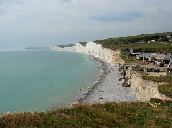
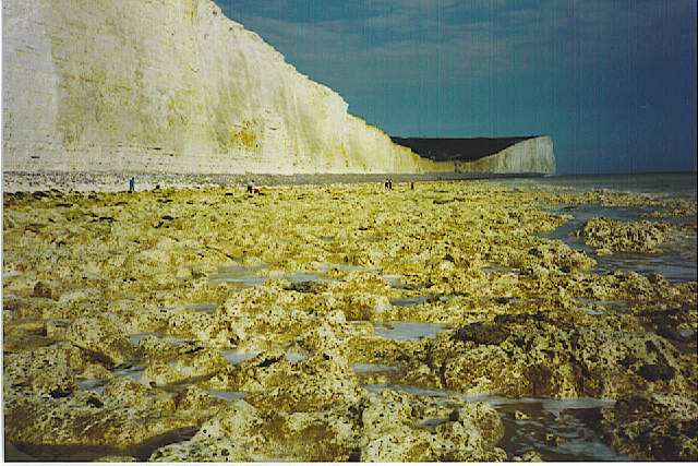
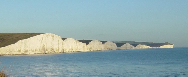
Seven Sisters, East Sussex
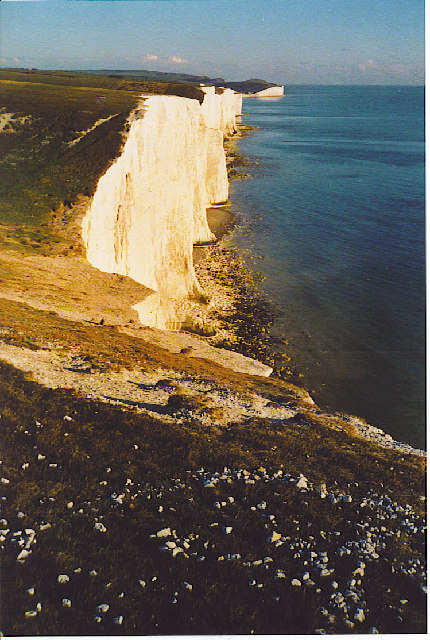
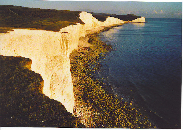
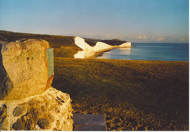
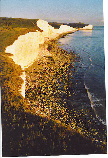
The Seven Sisters are a series of chalk sea cliffs on the English Channel coast, and are a stretch of the sea-eroded section of the South Downs range of...
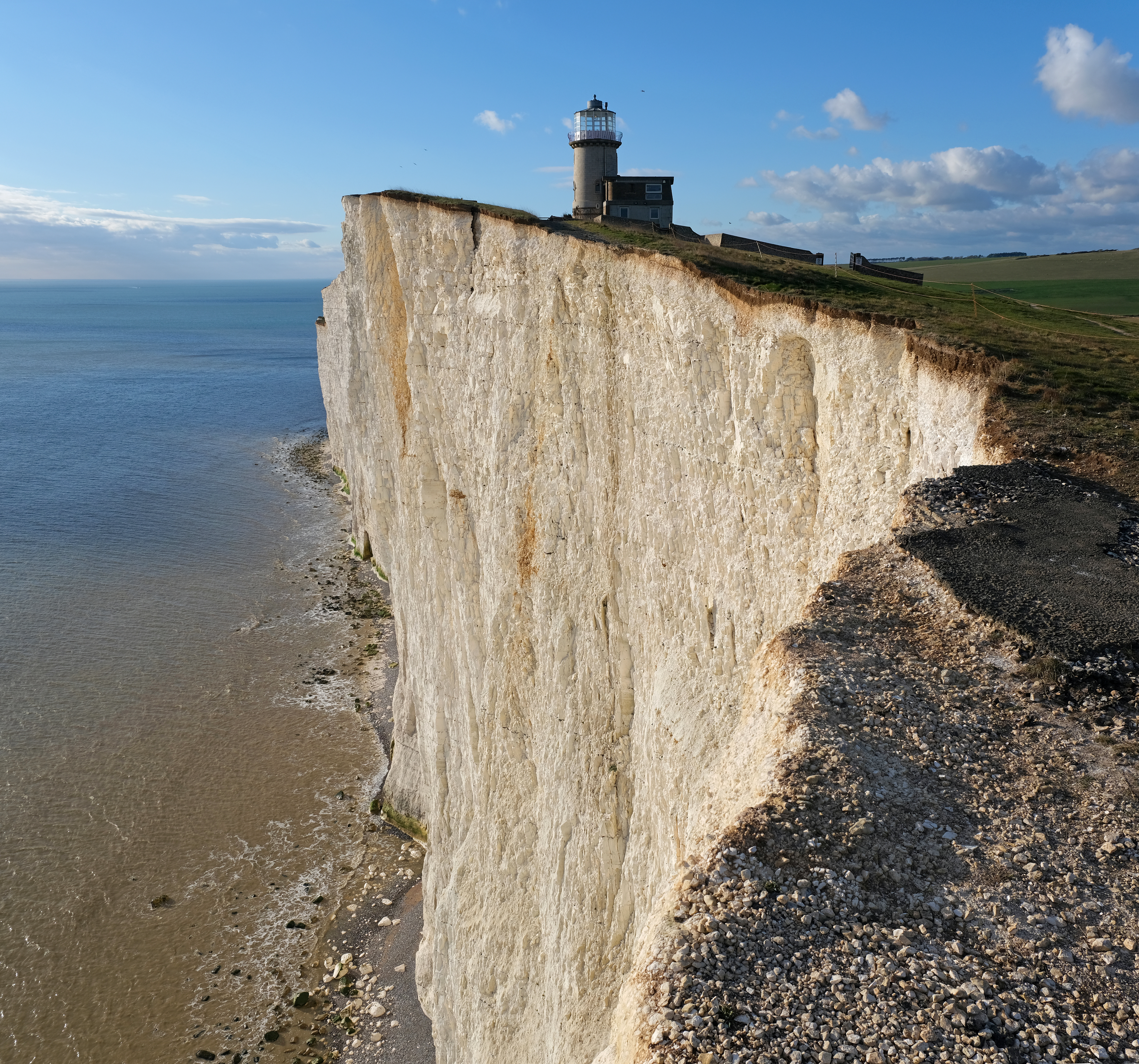
Belle Tout Lighthouse
The Belle Tout Lighthouse (also spelled Belle Toute) is a decommissioned lighthouse and British landmark located at Beachy Head, East Sussex, close to...
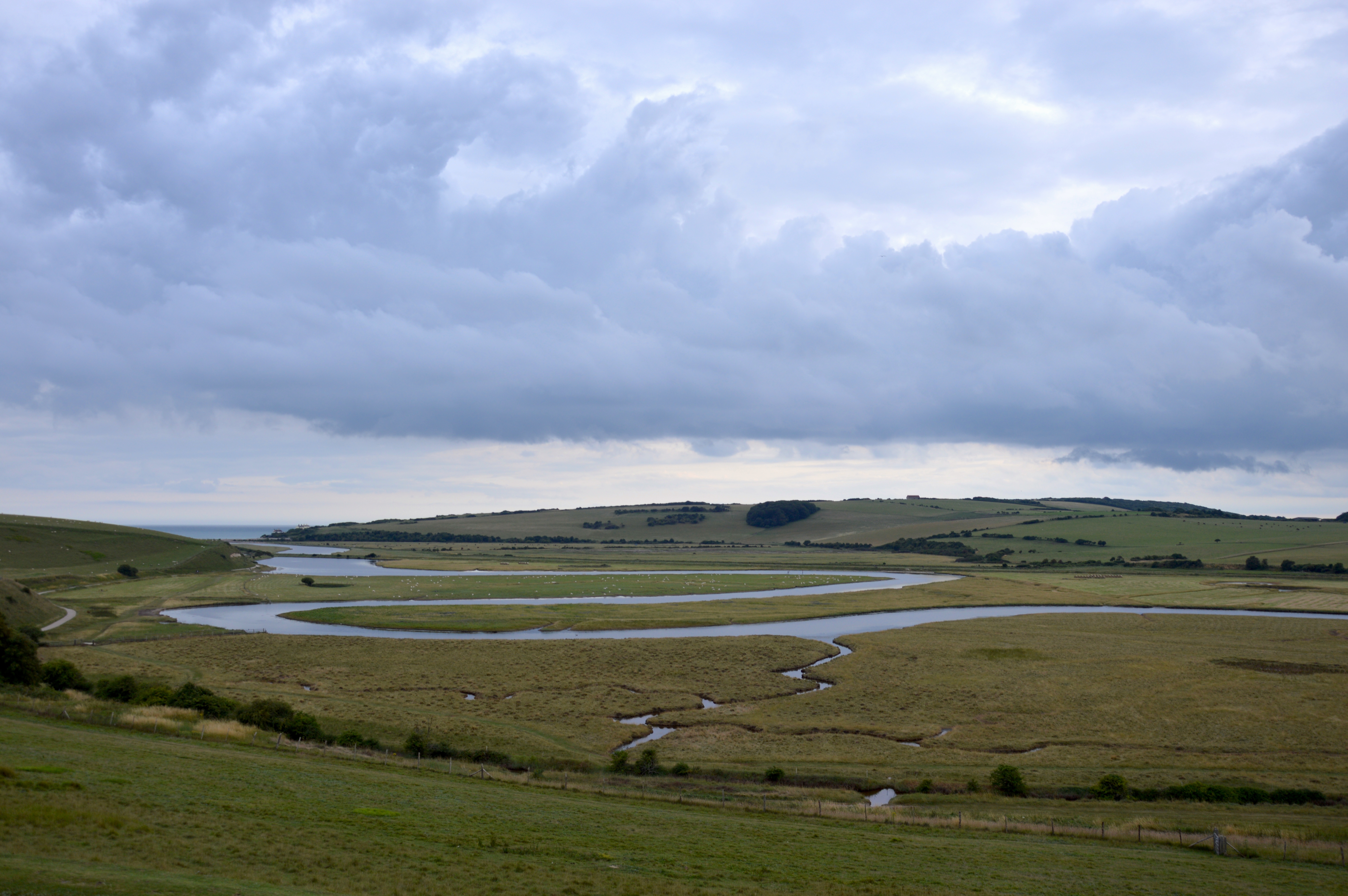
River Cuckmere
The River Cuckmere rises near Heathfield in East Sussex, England on the southern slopes of the Weald. The name of the river probably comes from an Old...
Nearby Amenities
Located within 500m of 50.751679,0.18483081Have you been to Flagstaff Bottom?
Leave your review of Flagstaff Bottom below (or comments, questions and feedback).