Shelford Bottom

Valley in Cambridgeshire South Cambridgeshire

England

Shelford Bottom

A spring morning on The Roman Road Bright and warm, with a lot of vivid greens.
A spring morning on The Roman Road Credit: John Sutton

Shelford Bottom is a picturesque valley located in the county of Cambridgeshire, England. Situated just south of the village of Great Shelford, this tranquil area is known for its natural beauty and charming countryside views.

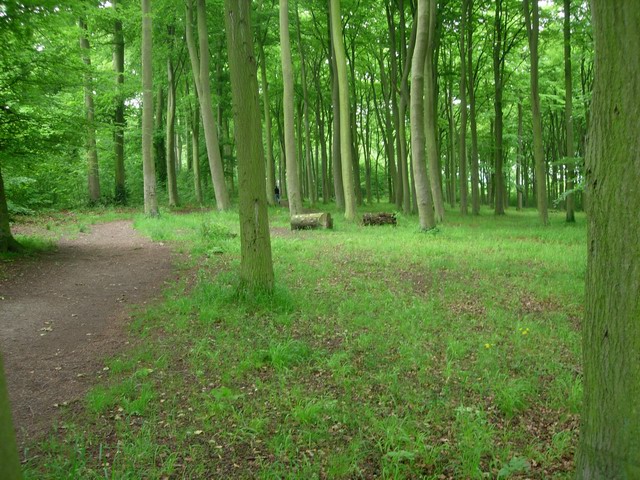
The valley is nestled between gentle rolling hills, creating a peaceful and idyllic setting. Lush green fields stretch as far as the eye can see, dotted with trees and hedgerows that provide a habitat for various wildlife species. The River Cam flows through the valley, adding to its scenic charm.

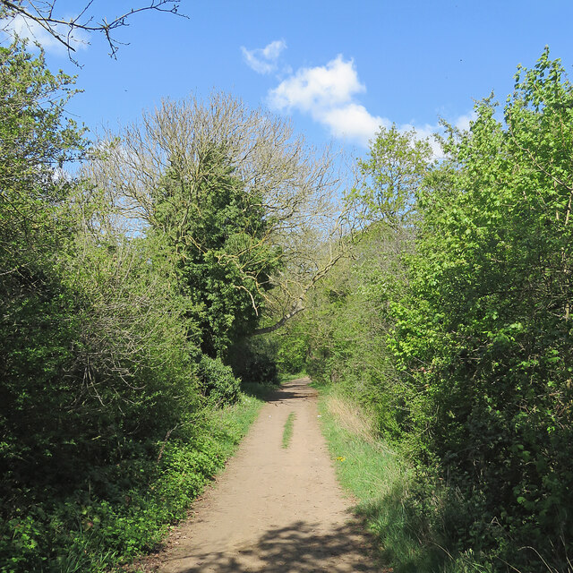
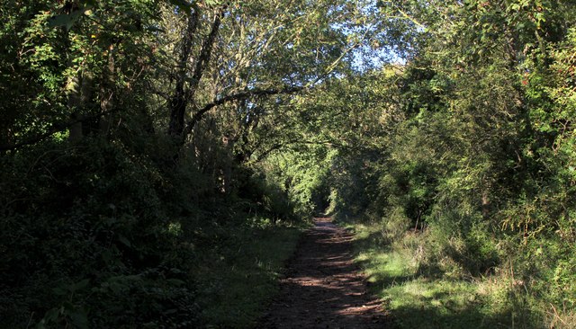
Shelford Bottom is a popular destination for nature lovers and outdoor enthusiasts. The valley offers numerous walking trails and pathways, allowing visitors to explore its serene surroundings at their own pace. The paths wind through the meadows, offering breathtaking views of the countryside and the opportunity to spot local wildlife such as birds, rabbits, and deer.

In addition to its natural attractions, Shelford Bottom is also home to a couple of historic landmarks. The picturesque St. Mary's Church, with its distinctive architecture, is a prominent feature of the valley. There is also a historic mill nearby, which adds to the area's charm and provides a glimpse into its past.

Overall, Shelford Bottom is a hidden gem in Cambridgeshire, offering visitors a chance to escape the hustle and bustle of city life and immerse themselves in the tranquil beauty of the countryside. Whether it's a leisurely walk, a picnic by the river, or simply enjoying the breathtaking views, Shelford Bottom has something to offer for everyone seeking a peaceful retreat.

If you have any feedback on the listing, please let us know in the comments section below.

Shelford Bottom Images

Images are sourced within 2km of 52.16421/0.16471402 or Grid Reference TL4853. Thanks to Geograph Open Source API. All images are credited.

A spring morning on The Roman Road Bright and warm, with a lot of vivid greens.
A spring morning on The Roman Road
Bright and warm, with a lot of vivid greens.
The Roman Road on the North Eastern Edge of Wandlebury CP The Roman Road runs for 10 miles between Cambridge and Suffolk. This is part of the northern section of the route, known as Worsted or Wool Street. Built to a higher standard, it has been designated a scheduled monument.
Nowadays it is a green way utilised for leisure purposes.
Along the border of Wandlebury Country Park the route passes through an extended green tunnel of vegetation.
The Roman Road on the North Eastern Edge of Wandlebury CP
The Roman Road runs for 10 miles between Cambridge and Suffolk. This is part of the northern section of the route, known as Worsted or Wool Street. Built to a higher standard, it has been designated a scheduled monument. Nowadays it is a green way utilised for leisure purposes. Along the border of Wandlebury Country Park the route passes through an extended green tunnel of vegetation.
Field Boundary near Mag's Hill
Autumn in Wandlebury Country Park Wandlebury Country Park is on the Gog Magog Hills to the south-east of Cambridge. It includes an Iron Age hill fort from the 5th century BC and an old stable block dating from the 18th century. The Country Park is managed by Cambridge Past, Present & Future who acquired the site in 1954.
Autumn in Wandlebury Country Park
Wandlebury Country Park is on the Gog Magog Hills to the south-east of Cambridge. It includes an Iron Age hill fort from the 5th century BC and an old stable block dating from the 18th century. The Country Park is managed by Cambridge Past, Present & Future who acquired the site in 1954.
Field boundary - Hill Farm
Good size wild border
Dull crop on a dull day Sugar Beet.
Dull crop on a dull day
Sugar Beet.
Twin paths on the Roman Road
Roman Road still in use today!
Shaded section of the Roman Road
Footpath in Wandlebury Country Park A footpath near the eastern edge of the park.
Footpath in Wandlebury Country Park
A footpath near the eastern edge of the park.
The Roman Road: winter sunshine The gentle climb to the top of The Gogs on a bright February morning.
The Roman Road: winter sunshine
The gentle climb to the top of The Gogs on a bright February morning.
View towards Hill Farm In the Gog Magog Hills, from the Roman Road.
View towards Hill Farm
In the Gog Magog Hills, from the Roman Road.
View north-east from the Roman Road In the Gog Magog Hills. The distant rise is Limepit Hill.
View north-east from the Roman Road
In the Gog Magog Hills. The distant rise is Limepit Hill.
Harvested fields - Hill Farm
View of Hill Farms from the Roman Road
Field boundary NE of the Roman Road
Show me another place!

Shelford Bottom is located at Grid Ref: TL4853 (Lat: 52.16421, Lng: 0.16471402)

Administrative County: Cambridgeshire

District: South Cambridgeshire

Police Authority: Cambridgeshire

What 3 Words

///shocked.moguls.puncture. Near Fulbourn, Cambridgeshire

Related Wikis

Beechwoods

Beechwoods is a 9.8 hectare Local Nature Reserve south-east of Cambridge, England. It is owned by County Farms and managed by the Wildlife Trust for Bedfordshire...

Gog Magog Golf Course

Gog Magog Golf Course is an 88.4-hectare (218-acre) biological Site of Special Scientific Interest on Gog Magog Golf Club south-east of Cambridge in Cambridgeshire...

Beechwoods nature reserve

The Beechwoods nature reserve is managed by the Wildlife Trust for Bedfordshire, Cambridgeshire, Northamptonshire and Peterborough. It is located in Cambridge...

Gog Magog Hills

The Gog Magog Hills are a range of low chalk hills, extending for several miles to the southeast of Cambridge in England. The highest points are situated...

Gog Magog Golf Club

Gog Magog Golf Club is a golf club, located in Shelford Bottom, Cambridgeshire, England. It is located about 4 miles south of Cambridge. == History... ==

Middlefield, Stapleford

Middlefield is a mansion in Stapleford, Cambridgeshire, England, designed in 1908–9 by Edwin Lutyens. It is a grade II* listed building.Middlefield was...

Little Trees Hill

Little Trees Hill is one of the highest points of the Gog Magog Hills, a ridge of low chalk hills extending for several miles to the south-east of Cambridge...

Wandlebury Hill

Wandlebury Hill (grid reference TL493534) is a peak in the Gog Magog Hills, a ridge of low chalk hills extending for several miles to the southeast of...

Nearby Amenities

Located within 500m of 52.16421,0.16471402
Bus Stop
Cottages
Naptan AtcoCode: 0500SGRED027
Naptan NaptanCode: CMBGMDTM
Naptan Verified: no
Public Transport: platform
Source: naptan
Lat/Long: 52.1662815/0.1597569
Source: survey
Lat/Long: 52.164688/0.1600563
Crossing
Crossing: marked
Lat/Long: 52.1660855/0.1611191
Crossing
Crossing: marked
Lat/Long: 52.1660115/0.1612853
Bench
Backrest: no
Lat/Long: 52.1667667/0.170134
Noexit: yes
Lat/Long: 52.1653379/0.1611632
Bus Stop
Cottages
Naptan AtcoCode: 0500SGRED026
Naptan NaptanCode: CMBGMDTJ
Naptan Verified: no
Public Transport: platform
Source: naptan
Lat/Long: 52.1662608/0.1593592
The data included in this document is from www.openstreetmap.org. The data is made available under ODbL.

Have you been to Shelford Bottom?

Leave your review of Shelford Bottom below (or comments, questions and feedback).