Buckland Bottom

Valley in Hertfordshire East Hertfordshire

England

Buckland Bottom

Buckland, Herts Approaching Buckland from Barkway. The entire square is pretty much the green fields you see here, with this sapling-lined road cutting across it.
Buckland, Herts Credit: Paul Dixon

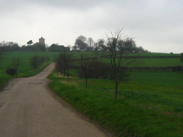
Buckland Bottom is a picturesque valley located in the county of Hertfordshire, England. Nestled between the Chiltern Hills and the Vale of Aylesbury, this scenic landscape offers breathtaking views and a tranquil atmosphere for visitors to enjoy.

The valley is known for its rolling hills, lush green meadows, and charming villages scattered throughout. It is a popular destination for nature enthusiasts, hikers, and those seeking a peaceful retreat from the hustle and bustle of city life.

Buckland Bottom is home to a diverse range of flora and fauna, with an abundance of wildlife thriving in its natural habitat. Visitors can spot various bird species, including red kites and buzzards, soaring above the valley. The surrounding woodlands are populated with ancient oak and beech trees, providing a serene setting for leisurely walks and picnics.

The valley is also steeped in history, with evidence of human settlement dating back to prehistoric times. Archaeological finds have uncovered remnants of Roman villas and Iron Age hillforts, testament to the area's rich past.

In addition to its natural beauty, Buckland Bottom offers a range of recreational activities for visitors. The valley is crisscrossed with well-maintained footpaths and bridleways, making it an ideal location for walkers and cyclists. The nearby villages boast charming pubs, quaint shops, and local cafes, offering a taste of traditional English hospitality.

Overall, Buckland Bottom is a hidden gem in Hertfordshire, offering a perfect blend of natural beauty, history, and recreational opportunities for all who visit.

If you have any feedback on the listing, please let us know in the comments section below.

Buckland Bottom Images

Images are sourced within 2km of 51.978769/-0.035022794 or Grid Reference TL3532. Thanks to Geograph Open Source API. All images are credited.

Buckland, Herts Approaching Buckland from Barkway. The entire square is pretty much the green fields you see here, with this sapling-lined road cutting across it.
Buckland, Herts
Approaching Buckland from Barkway. The entire square is pretty much the green fields you see here, with this sapling-lined road cutting across it.
St. Andrew's Church - Buckland, Hertfordshire This church was built by Nicholas de Bokeland in 1348. The exact date is known because he left a note of this on the glass of one of the chancel windows. Although Nicholas's glass has now gone, some fragments of 14th century glass remain in other windows. St. Andrew's is no longer used for regular worship and is now cared for by The Churches Conservation Trust.
St. Andrew's Church - Buckland, Hertfordshire
This church was built by Nicholas de Bokeland in 1348. The exact date is known because he left a note of this on the glass of one of the chancel windows. Although Nicholas's glass has now gone, some fragments of 14th century glass remain in other windows. St. Andrew's is no longer used for regular worship and is now cared for by The Churches Conservation Trust.
'The Countryman' inn, Chipping, Herts. The road in the picture is the A.10, once the Roman road called Ermine Street.
'The Countryman' inn, Chipping, Herts.
The road in the picture is the A.10, once the Roman road called Ermine Street.
Bush Wood The lane leads to Hyde Hall Farm.
Bush Wood
The lane leads to Hyde Hall Farm.
The hamlet of Mill End, Herts. This shows the start of Mill End, travelling north.
The hamlet of Mill End, Herts.
This shows the start of Mill End, travelling north.
Five House Farm Barns These farm barns are rented out as business units.
Five House Farm Barns
These farm barns are rented out as business units.
Public Footpath, just west of Buckland, Herts.
St Andrew, Buckland, Herts
St Andrew, Buckland, Herts - Iron crosses in churchyard
St Andrew, Buckland, Herts - East end
St Andrew, Buckland, Herts - Wall monument
St Andrew, Buckland, Herts - Label head
St Andrew, Buckland, Herts - Window
St Andrew, Buckland, Herts - Blocked doorway
The A.10, just south of Reed This road follows the course of a Roman road known as Ermine Street.
The A.10, just south of Reed
This road follows the course of a Roman road known as Ermine Street.
Show me another place!

Buckland Bottom is located at Grid Ref: TL3532 (Lat: 51.978769, Lng: -0.035022794)

Administrative County: Hertfordshire

District: East Hertfordshire

Police Authority: Hertfordshire

What 3 Words

///daring.headings.thatched. Near Buntingford, Hertfordshire

Related Wikis

Chipping, Hertfordshire

Chipping is a hamlet in the civil parish of Buckland in the East Hertfordshire district, in the county of Hertfordshire, England. Situated along the A10...

Buckland, Hertfordshire

Buckland is a village and civil parish in the East Hertfordshire district of Hertfordshire, England. The village is situated on the A10 road, with the...

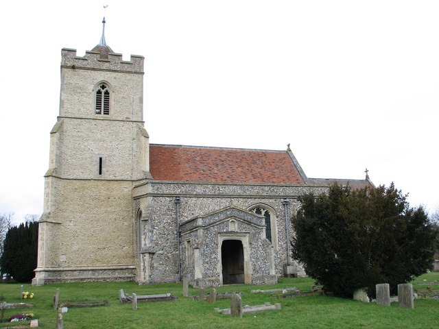
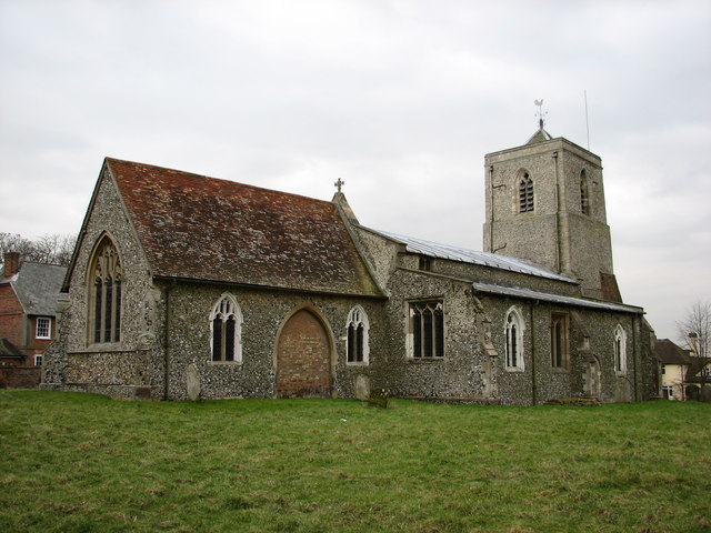
St Andrew's Church, Buckland

St Andrew's Church is a redundant Anglican church in the village of Buckland, Hertfordshire, England. It is recorded in the National Heritage List for...

Hawkins Wood

Hawkins Wood is a 10 hectare nature reserve south of Therfield in Hertfordshire. It is managed by the Herts and Middlesex Wildlife Trust.The wood is thought...

Blagrove Common

Blagrove Common is a 4.0-hectare (9.9-acre) Site of Special Scientific Interest in Green End near Sandon in Hertfordshire. It is managed by the Hertfordshire...

Freman College

Freman College is an upper school and sixth form with academy status in Buntingford, Hertfordshire, England. It was established as Ward Freman School in...

Throcking

Throcking is a village and former civil parish, now in the parish of Cottered, in the East Hertfordshire district, in the county of Hertfordshire, England...

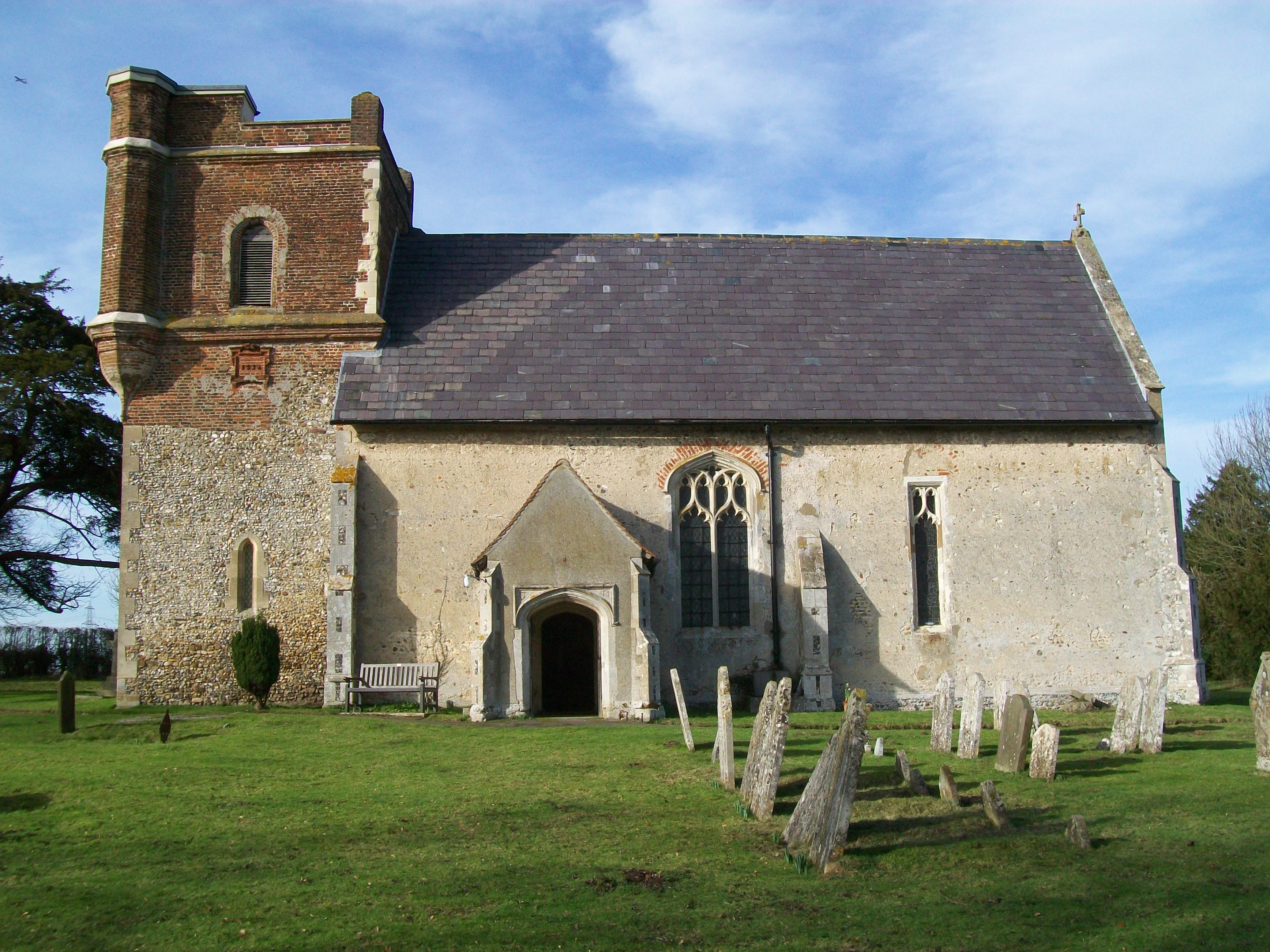
All Saints' Church, Sandon

All Saints' Church is a Church of England Parish Church in Sandon, Hertfordshire, England. It is listed Grade I. == History == At the time of the Domesday...

Nearby Amenities

Located within 500m of 51.978769,-0.035022794
Note: No marker post here but i've split the difference between the two to put the fork in footpaths here
Lat/Long: 51.9760141/-0.0346174
Ford: yes
Lat/Long: 51.9746421/-0.0332586
Power: pole
Ref: WPA 12
Source: Bing
Source Ref: interpolation
Lat/Long: 51.9748553/-0.0386129
Material: wood
Power: pole
Ref: WPA 18
Source: Bing
Source Ref: interpolation
Lat/Long: 51.9811203/-0.0371645
Material: wood
Power: pole
Ref: WPA 13
Source: Bing
Source Ref: interpolation
Lat/Long: 51.9758335/-0.0384144
Material: wood
Power: pole
Ref: WPA 17
Source: Bing
Source Ref: interpolation
Lat/Long: 51.9800729/-0.0374166
Material: wood
Power: pole
Ref: WPA 16
Source: Bing
Source Ref: interpolation
Lat/Long: 51.9791312/-0.0376312
Design: h-frame
Power: tower
Ref: WPA 20
Source: Bing
Source Ref: survey
Tower Type: anchor
Lat/Long: 51.9829209/-0.0367407
Material: wood
Power: pole
Ref: WPA 14
Source: Bing
Source Ref: interpolation
Lat/Long: 51.97699/-0.0381194
Material: wood
Power: pole
Ref: WPA 19
Source: survey
Lat/Long: 51.9820401/-0.0369359
Material: wood
Power: pole
Ref: WPA 15
Source: Bing
Source Ref: interpolation
Lat/Long: 51.9780639/-0.0378726
Material: wood
Power: pole
Ref: 22
Lat/Long: 51.9822954/-0.0358852
Material: wood
Power: pole
Ref: 21
Source: survey
Lat/Long: 51.9831485/-0.0364371
Note: This marker post shows the fork in footpaths to be here (but so does the marker post to the north)
Lat/Long: 51.9755383/-0.034364
Note: This marker post shows the fork in footpaths to be here (but so does the marker post to the south)
Lat/Long: 51.9765345/-0.034873
Power: pole
Lat/Long: 51.9815014/-0.0355466
Power: pole
Lat/Long: 51.9804331/-0.0350779
Power: pole
Lat/Long: 51.97951/-0.0348425
Power: pole
Lat/Long: 51.9777162/-0.0343618
Power: pole
Lat/Long: 51.9750941/-0.0324547
Power: pole
Lat/Long: 51.9785634/-0.0345998
Power: pole
Lat/Long: 51.9764031/-0.0333854
The data included in this document is from www.openstreetmap.org. The data is made available under ODbL.

Have you been to Buckland Bottom?

Leave your review of Buckland Bottom below (or comments, questions and feedback).