Sally Rainbow's Dell

Valley in Hertfordshire East Hertfordshire

England

Sally Rainbow's Dell

Main Road, Bramfield
Main Road, Bramfield Credit: David Howard

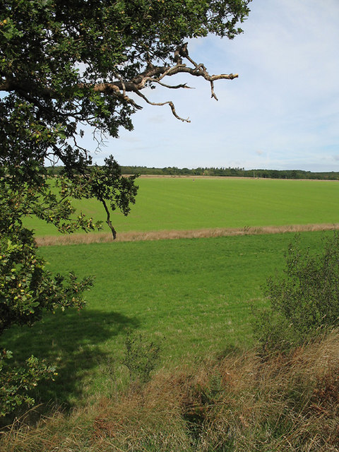
Sally Rainbow's Dell is a picturesque village located in the county of Hertfordshire, England. Situated in a valley surrounded by rolling hills and lush greenery, the village is known for its serene beauty and tranquil atmosphere.

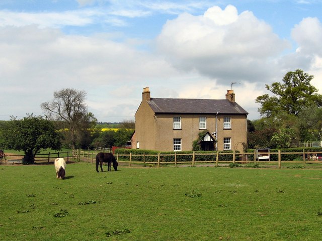
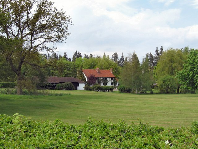
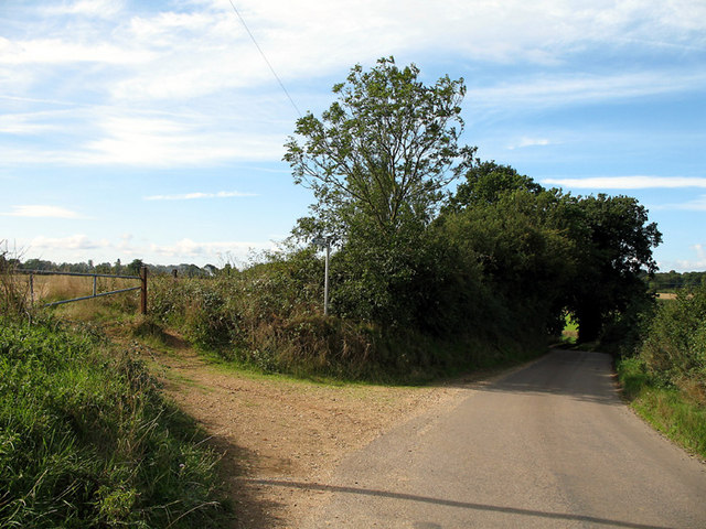
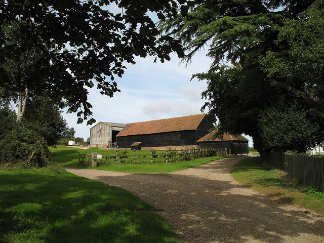
The Dell, as it is commonly referred to by locals, is home to a close-knit community that takes pride in preserving the village's charm and heritage. Traditional thatched cottages, with their vibrant flower gardens and well-maintained lawns, line the narrow streets, creating a postcard-worthy scene.

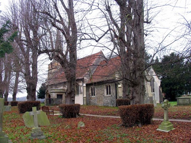
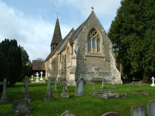
The village church, St. Mary's, stands proudly at the heart of Sally Rainbow's Dell. Dating back to the 12th century, this historic structure showcases stunning architecture and intricate stained glass windows. It serves as a gathering place for both religious ceremonies and community events.

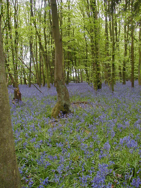
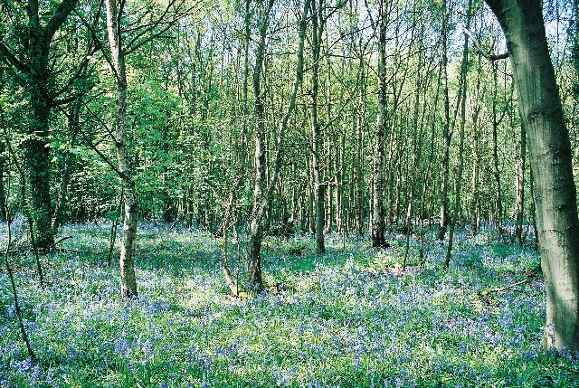
Nature lovers and outdoor enthusiasts are drawn to the Dell's surrounding countryside, which offers numerous walking trails and scenic views. The nearby Rainbow Woods, named after the village's founder, Sally Rainbow, is a popular destination for hiking and picnicking.

Despite its rural setting, Sally Rainbow's Dell is conveniently located near major transportation links. The village is within easy reach of the A1(M) motorway, providing easy access to nearby towns and cities. The bustling town of Welwyn Garden City is just a short drive away, offering a wide range of amenities, including shopping centers, restaurants, and entertainment venues.

Overall, Sally Rainbow's Dell is a hidden gem in Hertfordshire, boasting natural beauty, a strong sense of community, and a rich history that captivates residents and visitors alike.

If you have any feedback on the listing, please let us know in the comments section below.

Sally Rainbow's Dell Images

Images are sourced within 2km of 51.830632/-0.12696098 or Grid Reference TL2916. Thanks to Geograph Open Source API. All images are credited.

Main Road, Bramfield
Looking towards Priest Wood, Bramfield
Main Road, Bramfield
Angry skies, Widow Bushes near Stapleford
Bramfield Village Looking north from the village church.
Bramfield Village
Looking north from the village church.
Bluebells in Row Wood
Hazeldell Wood Sally & I were out for a walk to celebrate Beltane and the arrival of Spring. The woods were beautiful. There was a carpet of bluebells in almost every one.
Hazeldell Wood
Sally & I were out for a walk to celebrate Beltane and the arrival of Spring. The woods were beautiful. There was a carpet of bluebells in almost every one.
Bramfield Shelter Built 2 June 1953 to commemorate Queen Elizabeth's Coronation it was originally the village well house.
Bramfield Shelter
Built 2 June 1953 to commemorate Queen Elizabeth's Coronation it was originally the village well house.
Bramfield Village Post Office A rare sight these days, a working, village post office and store.
Bramfield Village Post Office
A rare sight these days, a working, village post office and store.
Bacon's Farm On the other side of the farmhouse there live a flock of chickens.
The eggs are sold from an honesty-box by the gate.
Bacon's Farm
On the other side of the farmhouse there live a flock of chickens. The eggs are sold from an honesty-box by the gate.
Bramfieldbury This house may be on the site of the dwelling-house said to have been built by Robert Ware, bursar of St. Albans, at Bramfield. It is generally called Bramfieldbury or Nancy Bury.
Bramfieldbury
This house may be on the site of the dwelling-house said to have been built by Robert Ware, bursar of St. Albans, at Bramfield. It is generally called Bramfieldbury or Nancy Bury.
Greenhill This house stands just to the south of Bramfield Woods.
It is the only house in this grid-square apart from the Lodge-house at the end of the drive.
Greenhill
This house stands just to the south of Bramfield Woods. It is the only house in this grid-square apart from the Lodge-house at the end of the drive.
Westend Farmland Farmland to the south of Bramfield.  The oak tree in the foreground has fully developed acorns.  Beyond the near boundary, the field has a new crop, possibly winter wheat, growing.   The small dot near the centre of the photo is a pair of joggers on the bridleway that cuts diagonally across the field.
Westend Farmland
Farmland to the south of Bramfield. The oak tree in the foreground has fully developed acorns. Beyond the near boundary, the field has a new crop, possibly winter wheat, growing. The small dot near the centre of the photo is a pair of joggers on the bridleway that cuts diagonally across the field.
Bridleway and road near Westend Farm On the road between Bramfield and the B1000.  The road hugs the east side of the shallow valley.   On the left is a bridleway to Goldings Plantation.
Bridleway and road near Westend Farm
On the road between Bramfield and the B1000. The road hugs the east side of the shallow valley. On the left is a bridleway to Goldings Plantation.
Great Gobions Farm Entrance to the farm.  The track to the right is a public bridleway.
Great Gobions Farm
Entrance to the farm. The track to the right is a public bridleway.
Conservation Walks Marker Post marking the route and showing a map of a local conservation walk.  The section it is indicating does not appear as a footpath on the OS map.
Conservation Walks Marker
Post marking the route and showing a map of a local conservation walk. The section it is indicating does not appear as a footpath on the OS map.
Veteran Hornbeam Pollard along old green lane Veteran trees like this provide a really important wildlife habitat.
Veteran Hornbeam Pollard along old green lane
Veteran trees like this provide a really important wildlife habitat.
St Andrew, Bramfield, Herts
Show me another place!

Sally Rainbow's Dell is located at Grid Ref: TL2916 (Lat: 51.830632, Lng: -0.12696098)

Administrative County: Hertfordshire

District: East Hertfordshire

Police Authority: Hertfordshire

What 3 Words

///trades.goats.chew. Near Datchworth, Hertfordshire

Related Wikis

Bramfield, Hertfordshire

Bramfield is a village and civil parish in the East Hertfordshire district, in the county of Hertfordshire, England. Nearby settlements include Hertford...

Stapleford railway station

Stapleford railway station was a station on the Hertford Loop Line, and was situated in the village of Stapleford, Hertfordshire, England. == History... ==

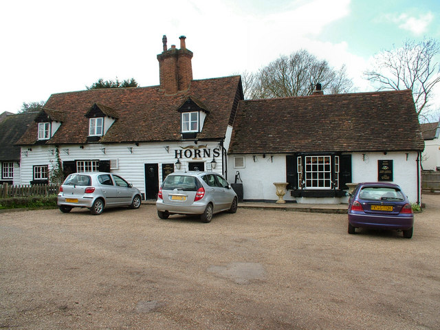
The Horns, Bull's Green

The Horns is a public house in Datchworth, Hertfordshire, England. It is situated on Bramfield Road in Bull's Green, a hamlet in the parish of Datchworth...

Waterford, Hertfordshire

Waterford is a village in the East Hertfordshire district of Hertfordshire, England. It is located on the A119 road, around 2.5 km (1.6 miles) north of...

Tewin Orchard and Hopkyns Wood

Tewin Orchard and Hopkyns Wood is a 4.3-hectare (11-acre) nature reserve in Tewin in Hertfordshire. It is managed by the Herts and Middlesex Wildlife Trust...

Tewin

Tewin is an English village and civil parish in Hertfordshire, England between the towns of Welwyn Garden City, Stevenage, Welwyn (village) and the county...

Stapleford, Hertfordshire

Not to be confused with Stapleford, Nottinghamshire. Stapleford is a village and civil parish of 134 acres (54 ha) on the A119 road, in the East Hertfordshire...
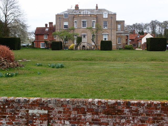
Marden Hill

Marden Hill is a Grade II* listed country house close to the village of Tewin, Hertfordshire.The house, originally Jacobean but substantially rebuilt in...

Nearby Amenities

Located within 500m of 51.830632,-0.12696098
Power: pole
Lat/Long: 51.8300144/-0.133633
Power: pole
Lat/Long: 51.830026/-0.1323536
Power: pole
Lat/Long: 51.8300211/-0.1311868
Power: pole
Lat/Long: 51.8300111/-0.1292691
Power: pole
Lat/Long: 51.8299954/-0.1276276
Power: pole
Lat/Long: 51.8306526/-0.1261148
Power: pole
Lat/Long: 51.8318593/-0.1259565
Power: pole
Lat/Long: 51.8326599/-0.1254094
Power: pole
Lat/Long: 51.8336958/-0.1244491
Power: pole
Lat/Long: 51.8343323/-0.1242024
The data included in this document is from www.openstreetmap.org. The data is made available under ODbL.

Have you been to Sally Rainbow's Dell?

Leave your review of Sally Rainbow's Dell below (or comments, questions and feedback).