Rye Farm Gill

Valley in Sussex Horsham

England

Rye Farm Gill

Rear of house on Marlpost Road The house is called "Woodlands" according to the large-scale map. This is also a cross-grid shot. The camera was just in the square to the west.
Rear of house on Marlpost Road Credit: Ian Cunliffe

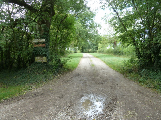
Rye Farm Gill, located in Sussex, England, is a picturesque valley that stretches for approximately 3 miles. Nestled amidst rolling hills and lush greenery, it is a popular destination for nature enthusiasts and hikers seeking tranquility and scenic beauty. The gill, or small ravine, is carved by a gently flowing stream that meanders through the valley, adding to its charm.

The landscape of Rye Farm Gill is characterized by a diverse range of flora and fauna. The valley is home to a variety of plant species, including oak, beech, and ash trees, which create a dense canopy providing shade and shelter. Wildflowers such as bluebells, primroses, and cowslips carpet the forest floor in the spring, creating a vibrant display of colors.

The stream that runs through Rye Farm Gill is an important habitat for many aquatic creatures, including trout and other fish species. The valley also attracts a wide array of birdlife, making it a birdwatcher's paradise. Visitors may spot species such as kingfishers, woodpeckers, and owls among the trees.

Apart from its natural beauty, Rye Farm Gill offers several well-maintained walking trails and footpaths, allowing visitors to explore the valley at their own pace. The peaceful ambiance and stunning vistas make it an ideal spot for relaxation and reflection.

Overall, Rye Farm Gill in Sussex is a captivating valley that showcases the unspoiled beauty of the English countryside. Its diverse ecosystem and tranquil atmosphere make it a must-visit destination for nature lovers and those seeking an escape from the hustle and bustle of everyday life.

If you have any feedback on the listing, please let us know in the comments section below.

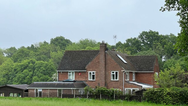
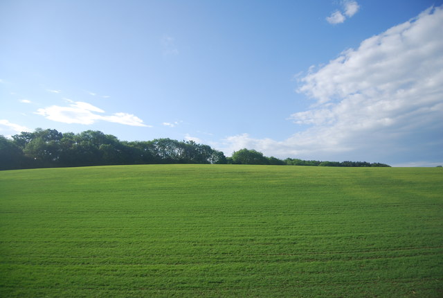
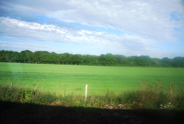
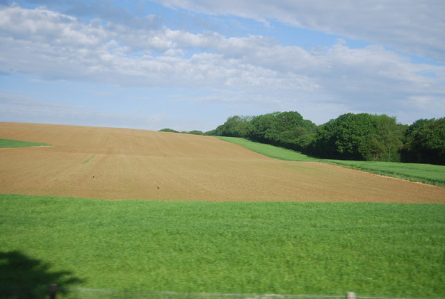
Rye Farm Gill Images

Images are sourced within 2km of 51.032399/-0.3827124 or Grid Reference TQ1327. Thanks to Geograph Open Source API. All images are credited.

Rear of house on Marlpost Road The house is called "Woodlands" according to the large-scale map. This is also a cross-grid shot. The camera was just in the square to the west.
Rear of house on Marlpost Road
The house is called "Woodlands" according to the large-scale map. This is also a cross-grid shot. The camera was just in the square to the west.
View north across fields west of Madgeland Farm It had begun to rain lightly when I took this shot.
View north across fields west of Madgeland Farm
It had begun to rain lightly when I took this shot.
Shelley's Wood across an arable field
Shelley's Wood
Shelley's Wood
The lower slopes of Sharpenhurst Hill
Farmland, Sharpenhurst Farm
Lambs near Barns Green
Level crossing, Emms Lane
Valewood Farmhouse Grade II listed.  <span class="nowrap"><a title="http://www.britishlistedbuildings.co.uk/en-299292-valewood-itchingfield" rel="nofollow ugc noopener" href="http://www.britishlistedbuildings.co.uk/en-299292-valewood-itchingfield">Link</a><img style="margin-left:2px;" alt="External link" title="External link - shift click to open in new window" src="https://s1.geograph.org.uk/img/external.png" width="10" height="10"/></span>
Valewood Farmhouse
Grade II listed. LinkExternal link
Horses in a field near Grassy Copse
Footpath 1904/2 to Emms Farm and Courtlands Farm
College Farm Track
College Farm Track
Signpost, Downs Link The Downs Link is a 37-mile (59 km) footpath and bridleway linking the North Downs Way <a title="https://www.geograph.org.uk/snippet/174" href="https://www.geograph.org.uk/snippet/174">Link</a>  at St. Martha's Hill in Surrey with the South Downs Way <a title="https://www.geograph.org.uk/snippet/1186" href="https://www.geograph.org.uk/snippet/1186">Link</a>  near Steyning in West Sussex and on via the Coastal Link to Shoreham-by-Sea. Most of the route follows two dismantled railway lines, both closed by the Beeching cuts in the 1960s. The Shoreham-On-Sea to Christ’s Hospital line and the Christ’s Hospital to Shalford Junction line. The link opened in 1984. 
Cycle Route 223 follows the Downs link from Guildford to Shoreham.
The logo for the walk is the viaduct across the River Arun <a href="https://www.geograph.org.uk/photo/1870646">TQ0932 : Double Viaduct over the River Arun</a>.
A full history of the Cranleigh line (Christ’s Hospital to Shalford Junction) can be read at <span class="nowrap"><a title="http://en.wikipedia.org/wiki/Cranleigh_Line" rel="nofollow ugc noopener" href="http://en.wikipedia.org/wiki/Cranleigh_Line">Link</a><img style="margin-left:2px;" alt="External link" title="External link - shift click to open in new window" src="https://s1.geograph.org.uk/img/external.png" width="10" height="10"/></span>
Signpost, Downs Link
The Downs Link is a 37-mile (59 km) footpath and bridleway linking the North Downs Way Link at St. Martha's Hill in Surrey with the South Downs Way Link near Steyning in West Sussex and on via the Coastal Link to Shoreham-by-Sea. Most of the route follows two dismantled railway lines, both closed by the Beeching cuts in the 1960s. The Shoreham-On-Sea to Christ’s Hospital line and the Christ’s Hospital to Shalford Junction line. The link opened in 1984. Cycle Route 223 follows the Downs link from Guildford to Shoreham. The logo for the walk is the viaduct across the River Arun TQ0932 : Double Viaduct over the River Arun. A full history of the Cranleigh line (Christ’s Hospital to Shalford Junction) can be read at LinkExternal link
Downs Link near College Farm
Downs Link The Downs Link is a 37-mile (59 km) footpath and bridleway linking the North Downs Way <a title="https://www.geograph.org.uk/snippet/174" href="https://www.geograph.org.uk/snippet/174">Link</a>  at St. Martha's Hill in Surrey with the South Downs Way <a title="https://www.geograph.org.uk/snippet/1186" href="https://www.geograph.org.uk/snippet/1186">Link</a>  near Steyning in West Sussex and on via the Coastal Link to Shoreham-by-Sea. Most of the route follows two dismantled railway lines, both closed by the Beeching cuts in the 1960s. The Shoreham-On-Sea to Christ’s Hospital line and the Christ’s Hospital to Shalford Junction line. The link opened in 1984. 
Cycle Route 223 follows the Downs link from Guildford to Shoreham.
The logo for the walk is the viaduct across the River Arun <a href="https://www.geograph.org.uk/photo/1870646">TQ0932 : Double Viaduct over the River Arun</a>.
A full history of the Cranleigh line (Christ’s Hospital to Shalford Junction) can be read at <span class="nowrap"><a title="http://en.wikipedia.org/wiki/Cranleigh_Line" rel="nofollow ugc noopener" href="http://en.wikipedia.org/wiki/Cranleigh_Line">Link</a><img style="margin-left:2px;" alt="External link" title="External link - shift click to open in new window" src="https://s1.geograph.org.uk/img/external.png" width="10" height="10"/></span>
Downs Link
The Downs Link is a 37-mile (59 km) footpath and bridleway linking the North Downs Way Link at St. Martha's Hill in Surrey with the South Downs Way Link near Steyning in West Sussex and on via the Coastal Link to Shoreham-by-Sea. Most of the route follows two dismantled railway lines, both closed by the Beeching cuts in the 1960s. The Shoreham-On-Sea to Christ’s Hospital line and the Christ’s Hospital to Shalford Junction line. The link opened in 1984. Cycle Route 223 follows the Downs link from Guildford to Shoreham. The logo for the walk is the viaduct across the River Arun TQ0932 : Double Viaduct over the River Arun. A full history of the Cranleigh line (Christ’s Hospital to Shalford Junction) can be read at LinkExternal link
Large tree by the Downs Link
Footpath crossroads
Footpath crossroads
Trees in a field
Trees in a field
Show me another place!

Rye Farm Gill is located at Grid Ref: TQ1327 (Lat: 51.032399, Lng: -0.3827124)

Administrative County: West Sussex

District: Horsham

Police Authority: Sussex

What 3 Words

///developer.secret.gossiping. Near Southwater, West Sussex

Related Wikis

Barns Green

Barns Green is a village in the Horsham district of West Sussex, England. It lies on the Billingshurst to Itchingfield road 2+1⁄2 miles (4.0 km) north...

Downs Link

The Downs Link is a 36.7 miles (59.1 km) footpath and bridleway linking the North Downs Way at St. Martha's Hill in Surrey with the South Downs Way near...

Itchingfield

Itchingfield is a small village and civil parish in the Horsham district of West Sussex, England. It lies on the Barns Green to Broadbridge Heath road...

Holy Innocents Church, Southwater

Holy Innocents Church is the Anglican parish church of Southwater, a village in the Horsham District of West Sussex, England. Built in 1849, the church...

Christ's Hospital

Christ's Hospital is a public school (English fee-charging boarding school for pupils aged 11–18) with a royal charter located to the south of Horsham...

Brooks Green

Brooks Green is a hamlet in the Shipley civil parish of the Horsham District of West Sussex, England. It is in the north-west of the parish, approximately...

Southwater

Southwater is a large village and civil parish in the Horsham District of West Sussex, England, with a population of roughly 10,000. It is administered...

Southwater railway station

Southwater was a railway station on the Steyning Line which served the village of Southwater. A goods siding allowed for the transportation of coal and...

Nearby Amenities

Located within 500m of 51.032399,-0.3827124
Bus Stop
Trout Lane
Bus: yes
Naptan AtcoCode: 4400HR0555
Naptan Bearing: S
Naptan CommonName: Trout Lane
Naptan Indicator: Pointers Corner
Naptan Landmark: Two Mile Ash Road
Naptan NaptanCode: wsxdpwgt
Naptan Street: Trout Lane
Naptan Verified: no
Public Transport: platform
Source: naptan_import
Lat/Long: 51.0289896/-0.38576
Railway: crossing
Lat/Long: 51.0354167/-0.3787481
Railway: crossing
Lat/Long: 51.035441/-0.3787687
Railway: crossing
Lat/Long: 51.0344844/-0.3812285
Railway: crossing
Lat/Long: 51.0345154/-0.3812413
Richmond Farm
Place: farm
Lat/Long: 51.0300799/-0.3829864
Rye Farm
Place: isolated_dwelling
Wikidata: Q26488511
Lat/Long: 51.0311045/-0.3838732
Melrose Farm
Place: farm
Lat/Long: 51.0289464/-0.3810596
Southlands Farm
Place: farm
Lat/Long: 51.0290898/-0.3824632
Post Box
Collection Times: Mo-Fr 09:00; Sa 07:00
Operator: Royal Mail
Post Box Mounting: wooden_post
Post Box Type: lamp
Ref: RH13 31D
Royal Cypher: EIIR
Source: survey
Lat/Long: 51.0290516/-0.3857935
The data included in this document is from www.openstreetmap.org. The data is made available under ODbL.

Have you been to Rye Farm Gill?

Leave your review of Rye Farm Gill below (or comments, questions and feedback).