York Dale

Valley in Yorkshire

England

York Dale

School House Dale
School House Dale Credit: David Brown

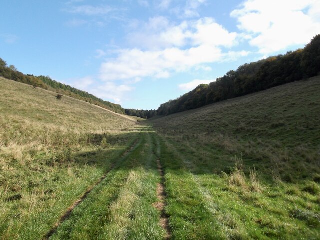
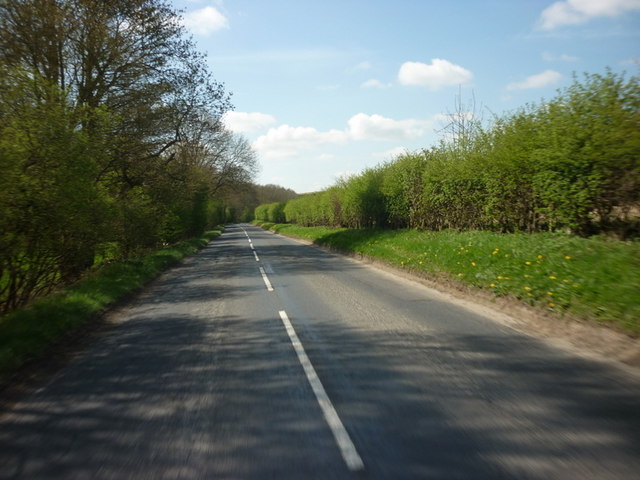
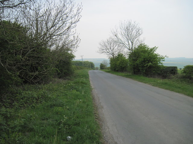
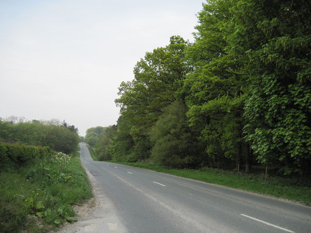
York Dale is a picturesque valley located in the county of Yorkshire, England. Nestled amidst rolling hills and lush greenery, this idyllic destination offers a serene and tranquil escape for visitors seeking a peaceful retreat. The valley is situated approximately 10 miles northwest of the historic city of York, hence its name.

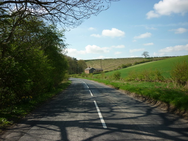
The landscape of York Dale is characterized by its undulating hills, which provide breathtaking panoramic views of the surrounding countryside. The valley is dotted with charming villages and hamlets, each with its own unique character and charm. The local architecture reflects the area's rich heritage, with traditional stone cottages and farmhouses blending seamlessly into the natural surroundings.

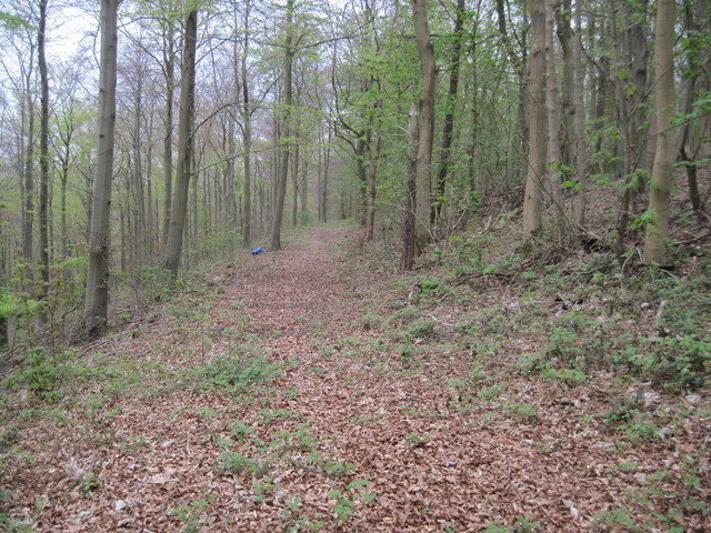
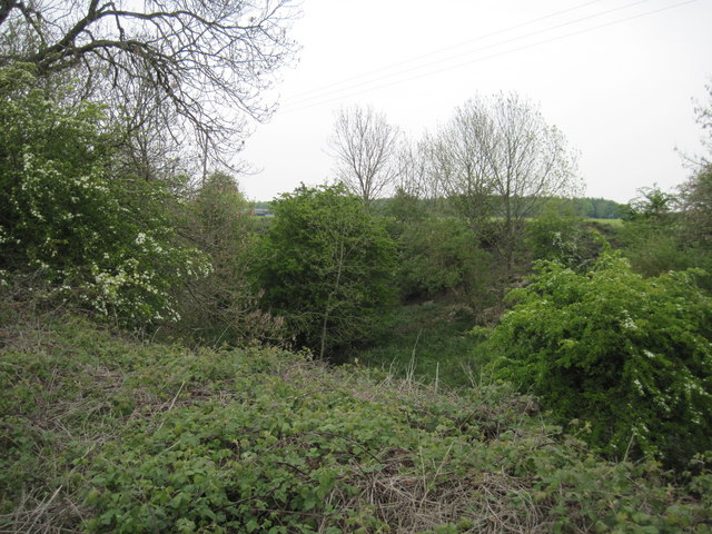
Nature enthusiasts will find plenty to explore in York Dale, as the valley is home to an abundance of wildlife and flora. Nature reserves and walking trails offer opportunities for leisurely strolls and birdwatching. The River Ouse meanders through the valley, providing a picturesque backdrop for leisurely boat rides or fishing excursions.

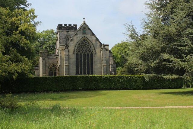
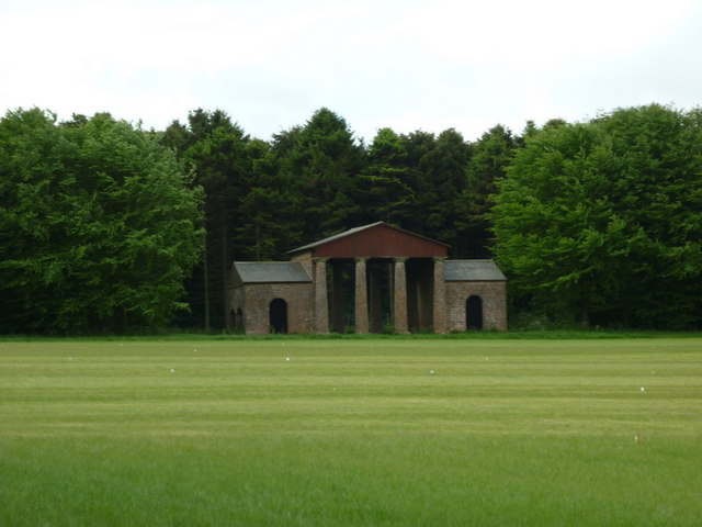
For history buffs, York Dale is steeped in a rich past. The valley boasts several historical sites and landmarks, including ancient stone circles, Roman ruins, and medieval castles. Visitors can immerse themselves in the region's heritage by exploring these well-preserved remnants of the past.

In terms of amenities, the valley offers a range of accommodation options, from cozy bed and breakfasts to luxurious country retreats. Local pubs and restaurants serve up hearty Yorkshire fare, showcasing the region's culinary delights.

Overall, York Dale in Yorkshire presents a captivating blend of natural beauty, historical significance, and warm hospitality, making it a truly remarkable destination for visitors to explore and enjoy.

If you have any feedback on the listing, please let us know in the comments section below.

York Dale Images

Images are sourced within 2km of 54.05569/-0.59542294 or Grid Reference SE9263. Thanks to Geograph Open Source API. All images are credited.

School House Dale
School House Dale
Sledmere House and knot garden A view of the western elevation of the house over the colourful knot garden.
Sledmere House and knot garden
A view of the western elevation of the house over the colourful knot garden.
Sledmere, St Mary's The lichen encrusted benchmark with bolt is on the west face of the church tower.
Sledmere, St Mary's
The lichen encrusted benchmark with bolt is on the west face of the church tower.
Sledmere, St Mary's There is a lichen encrusted benchmark with bolt on the west face of the church tower.
Sledmere, St Mary's
There is a lichen encrusted benchmark with bolt on the west face of the church tower.
Sledmere, Kirby Lane The benchmark is cut into the roadside wall on the east side of the lane.
Sledmere, Kirby Lane
The benchmark is cut into the roadside wall on the east side of the lane.
Sledmere, Kirby Lane There is a benchmark cut into the roadside wall on the east side of the lane. It is to the left of the bag in the photo.
Sledmere, Kirby Lane
There is a benchmark cut into the roadside wall on the east side of the lane. It is to the left of the bag in the photo.
Sledmere, Kirby Lane According to the OS benchmark database there was a wooden post with a cutmark. Today there are a pair of new wooden gateposts and 1 older wooden gatepost. All were checked and no benchmark was found.
Sledmere, Kirby Lane
According to the OS benchmark database there was a wooden post with a cutmark. Today there are a pair of new wooden gateposts and 1 older wooden gatepost. All were checked and no benchmark was found.
Sledmere House from The Parterre Grade I Listed Georgian Country House between Driffield and Malton, in East Yorkshire.
The present house was begun in 1751, extended in 1790 - and rebuilt after a fire in 1911. Set in a park of 960 acres designed by Capability Brown in 1777.
Venue to the "Tribfest" started in 2007 - featuring tribute bands from across the world.
The Parterre looks to be undergoing some renovation.

<span class="nowrap"><a title="https://www.sledmerehouse.com" rel="nofollow ugc noopener" href="https://www.sledmerehouse.com">Link</a><img style="margin-left:2px;" alt="External link" title="External link - shift click to open in new window" src="https://s1.geograph.org.uk/img/external.png" width="10" height="10"/></span>
Sledmere House from The Parterre
Grade I Listed Georgian Country House between Driffield and Malton, in East Yorkshire. The present house was begun in 1751, extended in 1790 - and rebuilt after a fire in 1911. Set in a park of 960 acres designed by Capability Brown in 1777. Venue to the "Tribfest" started in 2007 - featuring tribute bands from across the world. The Parterre looks to be undergoing some renovation. LinkExternal link
Sledmere House Grade I Listed Georgian Country House between Driffield and Malton, in East Yorkshire.
The present house was begun in 1751, extended in 1790 - and rebuilt after a fire in 1911. Set in a park of 960 acres designed by Capability Brown in 1777.
Venue to the "Tribfest" started in 2007 - featuring tribute bands from across the world.

<span class="nowrap"><a title="https://www.sledmerehouse.com" rel="nofollow ugc noopener" href="https://www.sledmerehouse.com">Link</a><img style="margin-left:2px;" alt="External link" title="External link - shift click to open in new window" src="https://s1.geograph.org.uk/img/external.png" width="10" height="10"/></span>
Sledmere House
Grade I Listed Georgian Country House between Driffield and Malton, in East Yorkshire. The present house was begun in 1751, extended in 1790 - and rebuilt after a fire in 1911. Set in a park of 960 acres designed by Capability Brown in 1777. Venue to the "Tribfest" started in 2007 - featuring tribute bands from across the world. LinkExternal link
St.Mary's Church, Sledmere As seen from the grounds of Sledmere House
<span class="nowrap"><a title="https://www.sledmerehouse.com" rel="nofollow ugc noopener" href="https://www.sledmerehouse.com">Link</a><img style="margin-left:2px;" alt="External link" title="External link - shift click to open in new window" src="https://s1.geograph.org.uk/img/external.png" width="10" height="10"/></span>
St.Mary's Church, Sledmere
As seen from the grounds of Sledmere House LinkExternal link
Part of the Stable Block at Sledmere House Roughly 200 year old stable block

<span class="nowrap"><a title="https://www.sledmerehouse.com" rel="nofollow ugc noopener" href="https://www.sledmerehouse.com">Link</a><img style="margin-left:2px;" alt="External link" title="External link - shift click to open in new window" src="https://s1.geograph.org.uk/img/external.png" width="10" height="10"/></span>
Part of the Stable Block at Sledmere House
Roughly 200 year old stable block LinkExternal link
The B1251 towards Fimber Hill roundabout
Beech  Wood  along  York  Bank Masses of old Beech leaves litter this woodland path which goes along the bank before swinging right as it meets Egg Dale. This is private land on the Sledmere Estate.
Beech Wood along York Bank
Masses of old Beech leaves litter this woodland path which goes along the bank before swinging right as it meets Egg Dale. This is private land on the Sledmere Estate.
Chalk  Pit  (Disused) At the side of the Wetwang to Sledmere road
Chalk Pit (Disused)
At the side of the Wetwang to Sledmere road
Minor  Road  to  Wetwang This minor road runs from Sledmere to Wetwang
Minor Road to Wetwang
This minor road runs from Sledmere to Wetwang
Road  into  Sledmere The B1251 from Fridaythorpe approaching Sledmere. Claypits Wood on the right.
Road into Sledmere
The B1251 from Fridaythorpe approaching Sledmere. Claypits Wood on the right.
The Deer House at Sledmere Estate
Show me another place!

York Dale is located at Grid Ref: SE9263 (Lat: 54.05569, Lng: -0.59542294)

Division: East Riding

Unitary Authority: East Riding of Yorkshire

Police Authority: Humberside

What 3 Words

///district.sprouting.rests. Near Fimber, East Yorkshire

Nearby Locations

Sylvia Grove York Dale

Related Wikis

Eleanor Cross, Sledmere

A replica Eleanor Cross was erected in Sledmere, East Riding of Yorkshire, in 1896–98. The tall stone structure was constructed by the Sykes family of...

Wagoners' Memorial

The Wagoners' Memorial is a war memorial in Sledmere, in the East Riding of Yorkshire in England. The unusual squat columnar memorial was designed by...
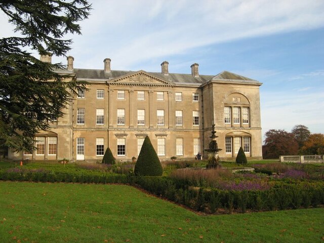
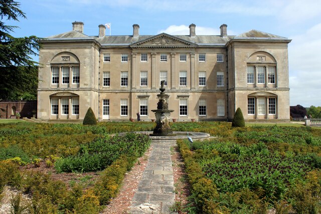
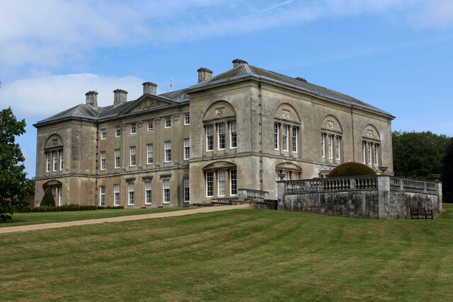
Sledmere House

Sledmere House is a Grade I listed Georgian country house, containing Chippendale, Sheraton and French furnishings and many fine pictures, set within a...

Towthorpe, East Riding of Yorkshire

Towthorpe is a hamlet and former civil parish, now in the parish of Fimber, in the East Riding of Yorkshire, England. It is situated in the Yorkshire...

Nearby Amenities

Located within 500m of 54.05569,-0.59542294
The data included in this document is from www.openstreetmap.org. The data is made available under ODbL.

Have you been to York Dale?

Leave your review of York Dale below (or comments, questions and feedback).