Nettle Dale

Valley in Yorkshire Scarborough

England

Nettle Dale

Brompton Dale The dry valley of Brompton Dale.
Brompton Dale Credit: T Eyre

Nettle Dale is a picturesque valley located in the county of Yorkshire, England. Situated in the heart of the Yorkshire Dales National Park, it offers stunning natural beauty and a tranquil atmosphere. The valley is named after the abundance of stinging nettles that grow along its streams and meadows.

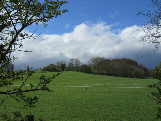
The landscape of Nettle Dale is characterized by rolling hills, lush green meadows, and rich woodlands. It is surrounded by towering limestone cliffs that add to its dramatic beauty. The valley is crisscrossed by several small streams that flow into the River Wharfe, which runs through the heart of the Yorkshire Dales.

Nettle Dale is home to a diverse range of flora and fauna, including wildflowers, ferns, and various species of birds and butterflies. The valley is particularly known for its vibrant display of bluebells during the spring season, attracting nature enthusiasts and photographers alike.

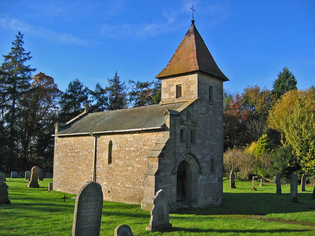
The area is also rich in history, with evidence of human habitation dating back to ancient times. There are several archaeological sites in the vicinity, including ancient burial mounds and stone circles, offering glimpses into the area's past.

For outdoor enthusiasts, Nettle Dale offers ample opportunities for hiking, cycling, and wildlife spotting. Several well-marked trails traverse the valley, providing breathtaking views of the surrounding countryside. The peaceful ambiance of Nettle Dale makes it a perfect getaway for those seeking respite from the hustle and bustle of city life.

In conclusion, Nettle Dale is a captivating valley nestled within the Yorkshire Dales National Park. Its natural beauty, diverse wildlife, and rich history make it a must-visit destination for nature lovers and history enthusiasts alike.

If you have any feedback on the listing, please let us know in the comments section below.

Nettle Dale Images

Images are sourced within 2km of 54.234999/-0.58940263 or Grid Reference SE9283. Thanks to Geograph Open Source API. All images are credited.

Brompton Dale The dry valley of Brompton Dale.
Brompton Dale
The dry valley of Brompton Dale.
Arden Bank Looking SW from the road.
Arden Bank
Looking SW from the road.
Headon Plantation A narrow strip of woodland alongside Wydale Lane.
Headon Plantation
A narrow strip of woodland alongside Wydale Lane.
Cliff Lane view Looking SE from Cliff Lane.
Cliff Lane view
Looking SE from Cliff Lane.
Rain clouds approaching Another heavy shower on the way.
Rain clouds approaching
Another heavy shower on the way.
Near Brompton Looking SE.
Near Brompton
Looking SE.
Wydale Cote Farm
Wydale Cote Farm
Start of the footpath on Snainton Lane
Snainton, Snainton Lane and Cliff Lane According to the OS benchmark database there is a benchmark cut into a gatepost where the lane divides into two, on the west side of the lane. The gatehole has been widened and new wooden gateposts erected.
Snainton, Snainton Lane and Cliff Lane
According to the OS benchmark database there is a benchmark cut into a gatepost where the lane divides into two, on the west side of the lane. The gatehole has been widened and new wooden gateposts erected.
Snainton, Coachman Inn  According to the OS benchmark database there is a benchmark cut into the south face of the pub and at the south-east angle. Nothing was found.
Snainton, Coachman Inn
According to the OS benchmark database there is a benchmark cut into the south face of the pub and at the south-east angle. Nothing was found.
Snainton, Station Road, Methodist Church The very worn benchmark is cut into the gable end of the church which is on the west side of the lane.
Snainton, Station Road, Methodist Church
The very worn benchmark is cut into the gable end of the church which is on the west side of the lane.
Snainton, Station Lane, Methodist Church There is a very worn benchmark cut into the gable end of the church which is on the west side of the lane.
Snainton, Station Lane, Methodist Church
There is a very worn benchmark cut into the gable end of the church which is on the west side of the lane.
Snainton, St Stephen's church The bolt benchmark is cut into the east facing wall of the church, and cut into a right cornerstone.
Snainton, St Stephen's church
The bolt benchmark is cut into the east facing wall of the church, and cut into a right cornerstone.
Snainton, St Stephen's church There is a bolt benchmark cut into the east facing wall of the church, and cut into a right cornerstone.
Snainton, St Stephen's church
There is a bolt benchmark cut into the east facing wall of the church, and cut into a right cornerstone.
Snainton, Nettledale Lane The benchmark is cut into the west facing wall of a lone stone building on the west side of the lane. The cutmark is to the right of the door.
Snainton, Nettledale Lane
The benchmark is cut into the west facing wall of a lone stone building on the west side of the lane. The cutmark is to the right of the door.
Snainton, Nettledale Lane There is a benchmark cut into the west facing wall of the lone stone building on the west side of the lane. The cutmark is to the right of the door.
Snainton, Nettledale Lane
There is a benchmark cut into the west facing wall of the lone stone building on the west side of the lane. The cutmark is to the right of the door.
Snainton, Nettledale Lane The rivet benchmark is cut into a large stone at the top of a culvert on the west side of the lane, and to the south of the entrance to Seven Acres.
Snainton, Nettledale Lane
The rivet benchmark is cut into a large stone at the top of a culvert on the west side of the lane, and to the south of the entrance to Seven Acres.
Snainton, Seven Acres There is a rivet benchmark cut into a large stone at the top of a culvert on the west side of the Nettledale Lane, and to the south of the entrance to Seven Acres.
Snainton, Seven Acres
There is a rivet benchmark cut into a large stone at the top of a culvert on the west side of the Nettledale Lane, and to the south of the entrance to Seven Acres.
Show me another place!

Nettle Dale is located at Grid Ref: SE9283 (Lat: 54.234999, Lng: -0.58940263)

Division: North Riding

Administrative County: North Yorkshire

District: Scarborough

Police Authority: North Yorkshire

What 3 Words

///throwaway.evoked.bronzer. Near East Ayton, North Yorkshire

Related Wikis

Snainton

Snainton is a village and civil parish in North Yorkshire, England. According to the 2011 UK Census, Snainton parish had a population of 754, a decrease...

Wydale Hall

Wydale Hall is a Christian Conference centre run by the Diocese of York. The house is located near Brompton-by-Sawdon in the foothills of the North York...

Snainton railway station

Snainton railway station was situated on the North Eastern Railway's Pickering to Seamer branch line. It served the village of Snainton, North Yorkshire...

Ebberston

Ebberston is a village and former civil parish, now in the parish of Ebberston and Yedingham in North Yorkshire, England, and is 34 miles (55 km) east...

Brompton, east North Yorkshire

Brompton is a civil parish in the Scarborough district of North Yorkshire, England, containing the villages of Brompton-by-Sawdon and Sawdon. The village...

Ebberston Hall

Ebberston Hall is a Grade II* listed country house in Ebberston, North Yorkshire, England. It was constructed during 18th century for William Thompson...

Marske Hall, Richmondshire

Marske Hall is a Grade II* listed country house in Marske, North Yorkshire, England. == History == Markse Hall was bought in 1596 by the then Archbishop...

Chapel of Rest, Brompton, Scarborough

The Chapel of Rest, Brompton Cemetery, Brompton, Scarborough, in North Yorkshire, England is an early work by the ecclesiastical architect Temple Moore...

Have you been to Nettle Dale?

Leave your review of Nettle Dale below (or comments, questions and feedback).