Rake Bottom

Valley in Hampshire East Hampshire

England

Rake Bottom

Pasture, East Meon Ewes and lambs close to the foot of the scarp above Stonylands Farm.
Pasture, East Meon Credit: Andrew Smith

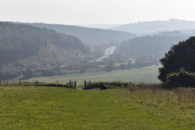
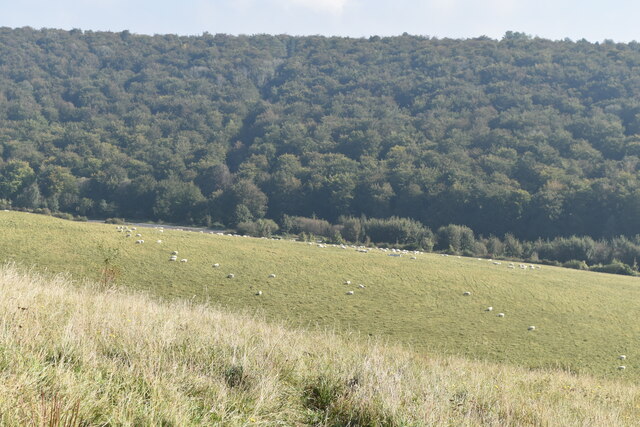
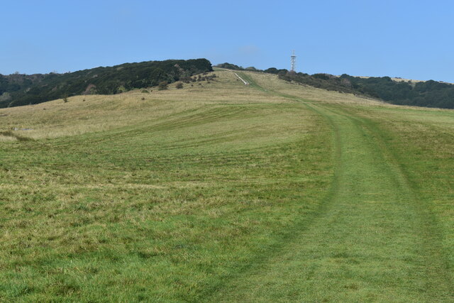
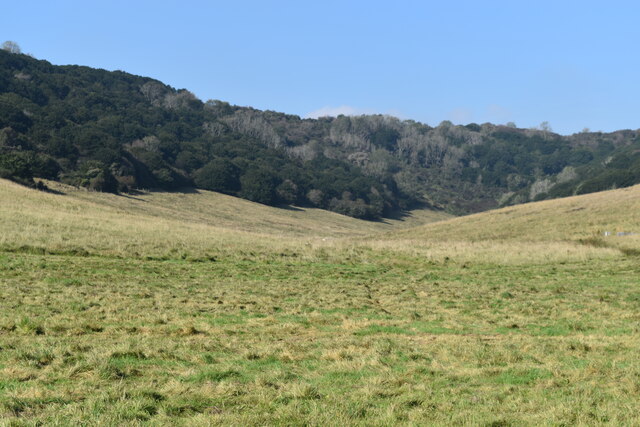
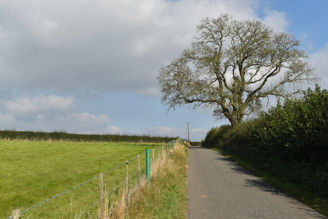
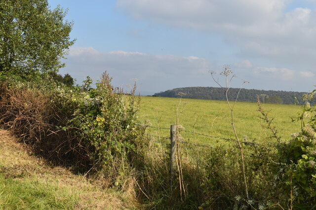
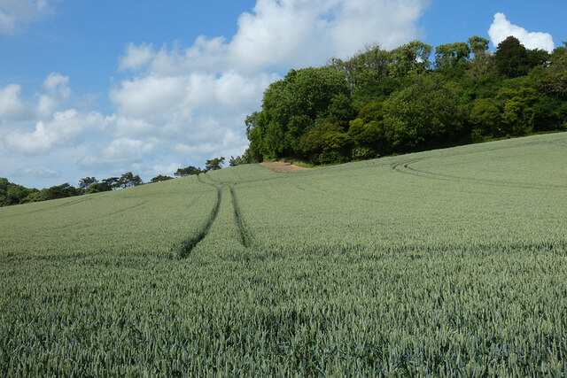
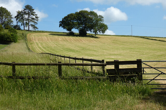
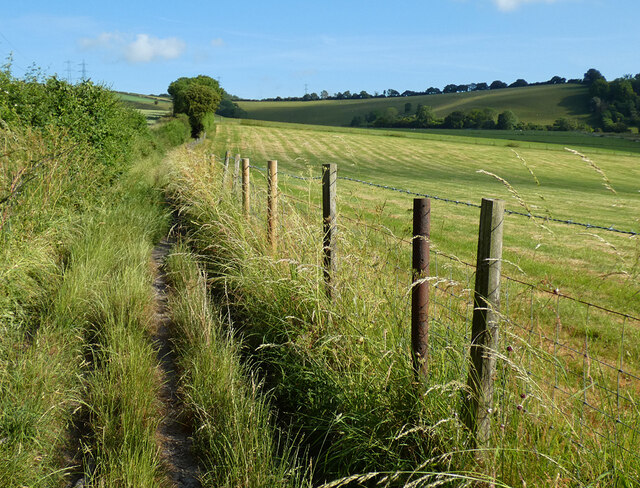
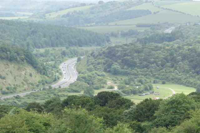
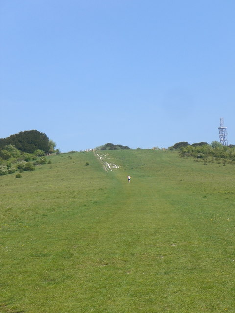
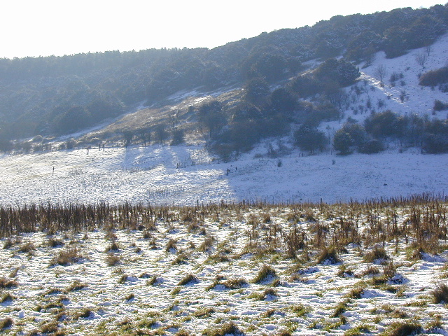
Rake Bottom is a picturesque valley located in the county of Hampshire, in southern England. Situated amidst the rolling hills of the South Downs National Park, the valley is renowned for its natural beauty and tranquil atmosphere. It is a popular destination for nature enthusiasts and hikers who seek to explore the stunning landscapes of the region.

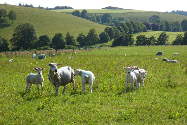
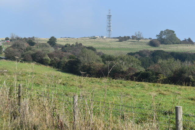
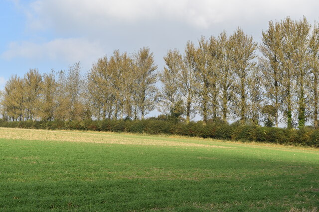
The valley is characterized by its lush green meadows, dense woodlands, and gently flowing streams that meander through the countryside. The area is home to a diverse range of flora and fauna, including several species of wildflowers, birds, and small mammals. This biodiversity contributes to the valley's rich ecological significance.

Rake Bottom is also steeped in history, with evidence of human habitation dating back to prehistoric times. The site has yielded archaeological finds such as ancient tools and pottery shards, providing valuable insights into the region's past.

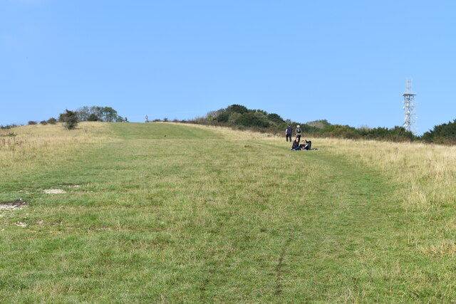
The valley offers a variety of recreational activities for visitors. Hiking trails wind through the valley, providing stunning vistas of the surrounding countryside. Additionally, the streams and rivers that flow through Rake Bottom offer opportunities for fishing and picnicking along their banks.

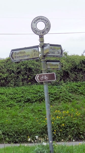
The nearby village of Rake Bottom provides essential amenities for visitors, including accommodations, cafes, and local shops. The village's quaint charm and traditional architecture add to the overall appeal of the area.

In conclusion, Rake Bottom in Hampshire is a picturesque valley with a rich natural and historical heritage. Its scenic landscapes, abundant wildlife, and recreational opportunities make it a must-visit destination for those seeking a peaceful retreat in the heart of the English countryside.

If you have any feedback on the listing, please let us know in the comments section below.
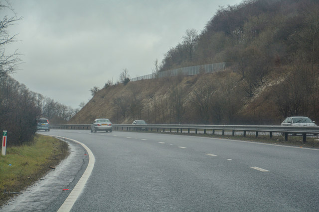
Rake Bottom Images

Images are sourced within 2km of 50.981686/-0.9926202 or Grid Reference SU7020. Thanks to Geograph Open Source API. All images are credited.

Pasture, East Meon Ewes and lambs close to the foot of the scarp above Stonylands Farm.
Pasture, East Meon
Ewes and lambs close to the foot of the scarp above Stonylands Farm.
Looking towards the summit of Butser Hill
View from Butser Hill, looking over the A3
View towards the summit of Butser Hill
Sheep grazing on Butser Hill The steep woodland is on the other side of the A3, just visible to left of centre.
Sheep grazing on Butser Hill
The steep woodland is on the other side of the A3, just visible to left of centre.
Curving grassy path up Butser Hill
Hillhampton Bottom Dry valley with hanging woodland, on the southern slopes of Butser Hill.
Hillhampton Bottom
Dry valley with hanging woodland, on the southern slopes of Butser Hill.
Line of trees near North Lane
Prominent tree beside North Lane
Hedge and field beside Hogs Lodge Lane The distant trees are on War Down
Hedge and field beside Hogs Lodge Lane
The distant trees are on War Down
Old Direction Sign - Signpost by Oxenbourne Lane, East Meon Parish Annulus finial - 3 Worboys arms; Hampshire Parish halo by the UC road, in parish of East Meon (East Hampshire District), near Oxenbourne House, at T-junction.

To be surveyed

Milestone Society National ID: HA_SU6921
Old Direction Sign - Signpost by Oxenbourne Lane, East Meon Parish
Annulus finial - 3 Worboys arms; Hampshire Parish halo by the UC road, in parish of East Meon (East Hampshire District), near Oxenbourne House, at T-junction. To be surveyed Milestone Society National ID: HA_SU6921
Farmland, East Meon Wheat on the western side of Barrow Hill.
Farmland, East Meon
Wheat on the western side of Barrow Hill.
Farmland, East Meon A mown field on the western flank of Browning's Hill.
Farmland, East Meon
A mown field on the western flank of Browning's Hill.
Byway and pasture, East Meon I don't think there is anything in place to prohibit motorised vehicles, but clearly nothing larger than a motorbike attempts the climb onto the scarp using this route.
Byway and pasture, East Meon
I don't think there is anything in place to prohibit motorised vehicles, but clearly nothing larger than a motorbike attempts the climb onto the scarp using this route.
The A3 Heading South Skirting the Queen Elizabeth Country Park. As seen on an overcast day.
The A3 Heading South
Skirting the Queen Elizabeth Country Park. As seen on an overcast day.
East Hampshire : London Road A3 Looking along London Road, the A3, heading through East Hampshire.
East Hampshire : London Road A3
Looking along London Road, the A3, heading through East Hampshire.
East Hampshire : London Road A3 Looking along London Road, the A3, heading through East Hampshire.
East Hampshire : London Road A3
Looking along London Road, the A3, heading through East Hampshire.
Lone jogger running up Butser Hill This area would normally have a number of people walking up or down the hill on a sunny weekend, but it's pretty much deserted during the Coronavirus lockdown.
Lone jogger running up Butser Hill
This area would normally have a number of people walking up or down the hill on a sunny weekend, but it's pretty much deserted during the Coronavirus lockdown.
Show me another place!

Rake Bottom is located at Grid Ref: SU7020 (Lat: 50.981686, Lng: -0.9926202)

Administrative County: Hampshire

District: East Hampshire

Police Authority: Hampshire

What 3 Words

///currently.bloodshot.barefoot. Near Petersfield, Hampshire

Nearby Locations

Rake Bottom

Related Wikis

Butser Hill

Butser Hill is a hill and nature reserve in Hampshire, England. South-west of Petersfield, it is a 239.7-hectare (592-acre) biological and geological Site...

East Hampshire (UK Parliament constituency)

East Hampshire is a constituency represented in the House of Commons of the UK Parliament since 2010 by Damian Hinds of the Conservative Party.Further...

Ramsdean

Ramsdean is a village in the East Hampshire district of Hampshire, England. It is 2.7 miles (4.3 km) west of Petersfield. The nearest railway station is...

Oxenbourne Down, Clanfield

Oxenbourne Down, Clanfield is a 84.8-hectare (210-acre) Local Nature Reserve north of Clanfield in Hampshire. It is owned and managed by Hampshire County...

Nearby Amenities

Located within 500m of 50.981686,-0.9926202
Barrier: stile
Lat/Long: 50.9794396/-0.990987
Barrier: stile
Lat/Long: 50.9844293/-0.991139
Barrier: kissing_gate
Lat/Long: 50.9856831/-0.995031
Ramsdean Down
Place: locality
Source: OS_OpenData_StreetView
Lat/Long: 50.9814385/-0.9867418
Rake Bottom
Place: locality
Source: OS_OpenData_StreetView
Lat/Long: 50.9806482/-0.991441
The data included in this document is from www.openstreetmap.org. The data is made available under ODbL.

Have you been to Rake Bottom?

Leave your review of Rake Bottom below (or comments, questions and feedback).