Rosedale

Valley in Yorkshire Ryedale

England

Rosedale

Gill Bank The unoccupied Gill Bank near Thorgill.
Gill Bank Credit: T Eyre

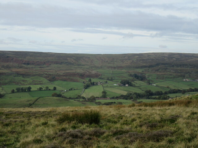
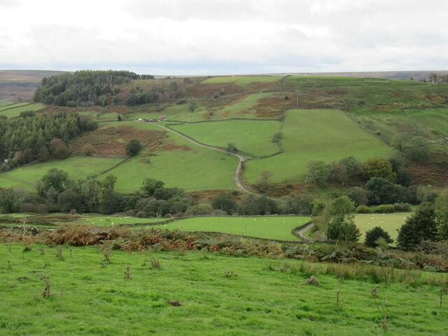
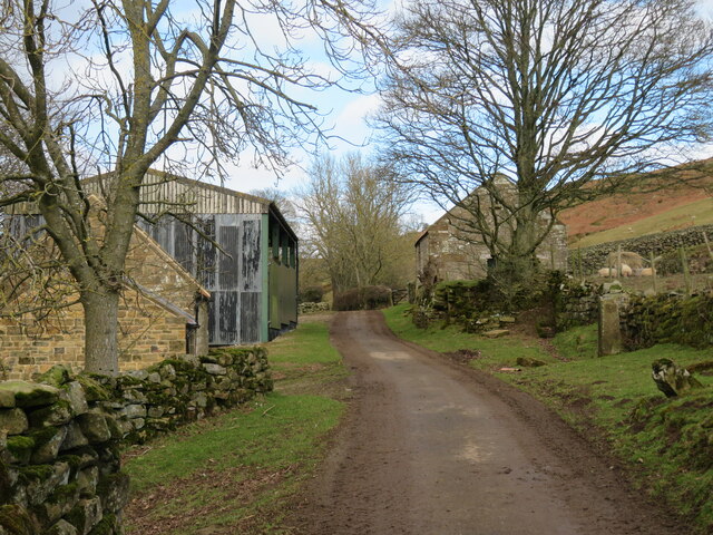
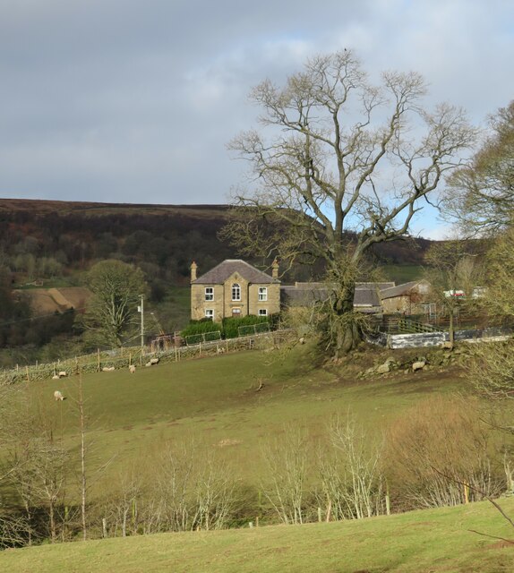
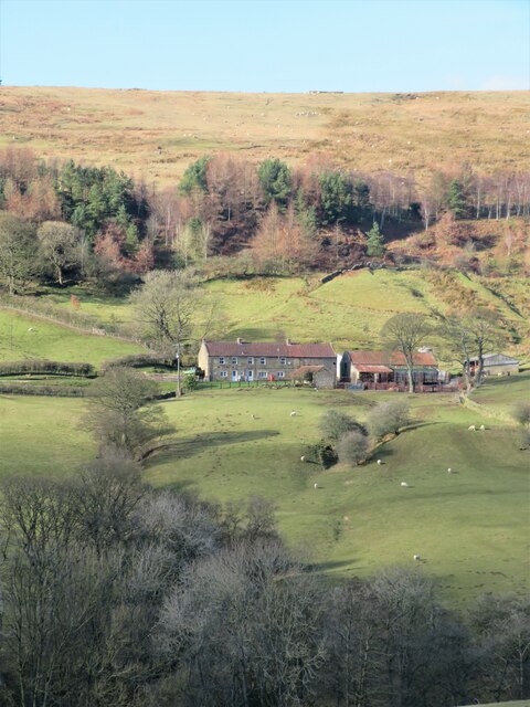
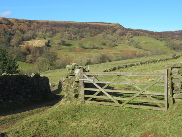
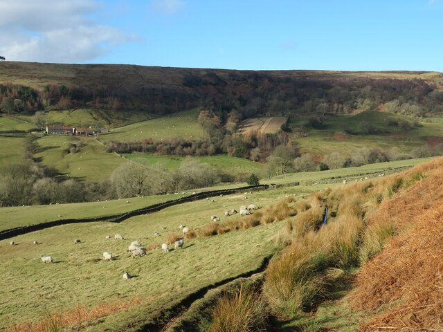
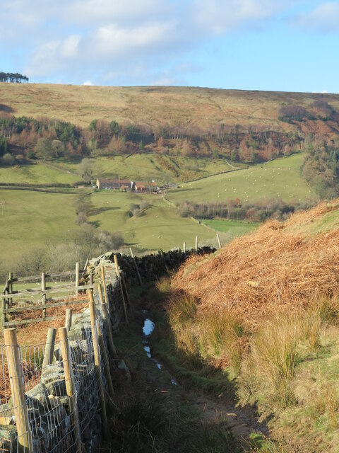
Rosedale, Yorkshire, also known as Rosedale Valley, is a picturesque and historic valley located in the North York Moors National Park in North Yorkshire, England. It is situated approximately 12 miles north-west of Pickering and 15 miles south-west of Whitby. The valley is renowned for its stunning natural beauty, with its rolling hills, lush green fields, and charming villages.

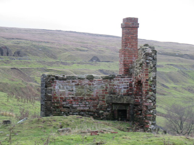
Rosedale Valley has a rich history, dating back to the Roman times when it was a significant route for traders. In the 19th century, it became a hub for iron ore mining and was home to several mining communities. The remnants of this industrial past can still be seen today, with the preserved ruins of the old mines and kilns adding a unique character to the landscape.

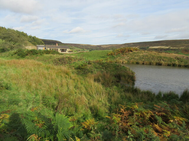
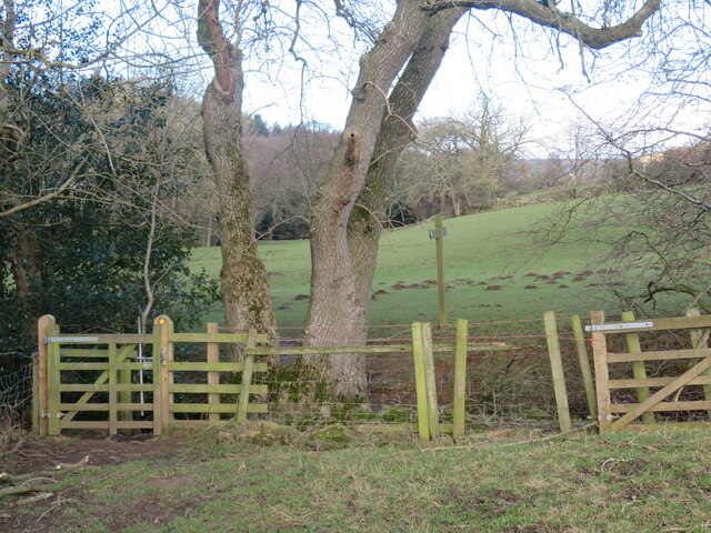
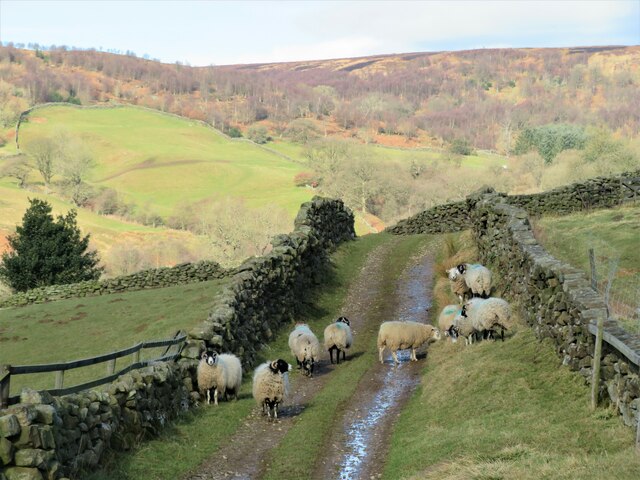
The valley also offers numerous opportunities for outdoor enthusiasts. There are several walking and cycling trails that meander through the valley, allowing visitors to explore its scenic beauty and enjoy panoramic views of the surrounding countryside. The area is also popular for birdwatching, with a variety of species to be spotted, including red grouse, curlews, and lapwings.

For those interested in history and culture, Rosedale Abbey is a must-visit. The village is home to the picturesque ruins of a 12th-century Cistercian Priory, which was once a thriving religious community. Today, the village has a handful of amenities, including a tearoom, a pub, and a small shop.

Overall, Rosedale Valley offers a serene escape from the hustle and bustle of city life, with its unspoiled natural beauty, rich history, and ample opportunities for outdoor activities. It is a hidden gem within the North York Moors National Park and a popular destination for nature lovers and history enthusiasts alike.

If you have any feedback on the listing, please let us know in the comments section below.

Rosedale Images

Images are sourced within 2km of 54.367528/-0.91255053 or Grid Reference SE7097. Thanks to Geograph Open Source API. All images are credited.
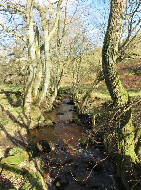
Gill Bank The unoccupied Gill Bank near Thorgill.
Gill Bank
The unoccupied Gill Bank near Thorgill.
Victorian postbox, Daleside Road, Rosedale East, North Yorkshire In the wall of the Tree Relaxation Retreat.
Victorian postbox, Daleside Road, Rosedale East, North Yorkshire
In the wall of the Tree Relaxation Retreat.
Rosedale view Looking west across Rosedale.
Rosedale view
Looking west across Rosedale.
Shooting lodge in Northdale Shooting lodge by a pond in Northdale.
Shooting lodge in Northdale
Shooting lodge by a pond in Northdale.
Northdale Looking west into Northdale.
Northdale
Looking west into Northdale.
Remains of one of the Black Houses One of the 'Black Houses' by the railway.
Remains of one of the Black Houses
One of the 'Black Houses' by the railway.
Iron Kilns model Iron model of the iron kilns at Rosedale.
Iron Kilns model
Iron model of the iron kilns at Rosedale.
Footpath through North Dale The photograph would suggest a pleasant rural stroll, but on this February day it was anything but.  Fields oozing water with deep and slippery mud along the route of the path making progress slow and difficult. probably rather better on a fine July day. Path number 25.130/52 heading north from Rosedale Abbey.
Footpath through North Dale
The photograph would suggest a pleasant rural stroll, but on this February day it was anything but. Fields oozing water with deep and slippery mud along the route of the path making progress slow and difficult. probably rather better on a fine July day. Path number 25.130/52 heading north from Rosedale Abbey.
Bridge over Northdale Beck The bridge is at a junction of paths with a bridleway [number 25.130/50] crossing the beck.
Bridge over Northdale Beck
The bridge is at a junction of paths with a bridleway [number 25.130/50] crossing the beck.
Northdale Beck Small beck heading down North Dale to join the River Seven at Rosedale Abbey.
Northdale Beck
Small beck heading down North Dale to join the River Seven at Rosedale Abbey.
Lane approaching Northdale Farm The buildings here, including the old stone barn to the right, may belong to Northfield Farm which is another 300m or so along the lane. Old OS maps of the mid 19th century show this as Southfield House, with nearby Northdale Farm missing, thus one would assume that the original farm was here, although traces of a farmhouse seem to have gone.
Lane approaching Northdale Farm
The buildings here, including the old stone barn to the right, may belong to Northfield Farm which is another 300m or so along the lane. Old OS maps of the mid 19th century show this as Southfield House, with nearby Northdale Farm missing, thus one would assume that the original farm was here, although traces of a farmhouse seem to have gone.
Northdale Farm This looks like a substantial Victorian house which first appears on the 1891 OS map.
Northdale Farm
This looks like a substantial Victorian house which first appears on the 1891 OS map.
Sheep in the lane at Northdale Farm Pretending to look nonchalant, these sheep have probably escaped from a nearby pasture. The OS has been rather enthusiastic with the yellow colouring here as the rough lane is shown as a surfaced road. Tarmac ends at least 200m further back at the farm entrance.
Sheep in the lane at Northdale Farm
Pretending to look nonchalant, these sheep have probably escaped from a nearby pasture. The OS has been rather enthusiastic with the yellow colouring here as the rough lane is shown as a surfaced road. Tarmac ends at least 200m further back at the farm entrance.
View across North Dale North Dale is a quiet and little visited offshoot of Rosedale with just four farms along the valley. The view across the dale is towards West Northdale Farm, which looks like a row of cottages, but is likely to be a much altered 'longhouse' type of traditional building.
View across North Dale
North Dale is a quiet and little visited offshoot of Rosedale with just four farms along the valley. The view across the dale is towards West Northdale Farm, which looks like a row of cottages, but is likely to be a much altered 'longhouse' type of traditional building.
North Dale A junction of paths at this point. Down the track to the left is path number 25.130/41 heading towards West Northdale Farm, whilst behind the camera position an old track, which is a right of way, slants up the hillside.
North Dale
A junction of paths at this point. Down the track to the left is path number 25.130/41 heading towards West Northdale Farm, whilst behind the camera position an old track, which is a right of way, slants up the hillside.
Track down the hillside This track drops down from the heathery moor top into Northdale. The track is full of ruts and the ruts are mostly full of water, but anyone using the route can easily avoid wet feet. On the far side of the valley is West Northdale Farm.
Track down the hillside
This track drops down from the heathery moor top into Northdale. The track is full of ruts and the ruts are mostly full of water, but anyone using the route can easily avoid wet feet. On the far side of the valley is West Northdale Farm.
Tread carefully! Part of the old track that descends the hillside above Northfield Farm. This short section between a wall to one side and a steep bank on the other has become a sort of natural ditch full of water and goo, but this can be avoided and the route is preferable to the soaking fields in the dale bottom.
Tread carefully!
Part of the old track that descends the hillside above Northfield Farm. This short section between a wall to one side and a steep bank on the other has become a sort of natural ditch full of water and goo, but this can be avoided and the route is preferable to the soaking fields in the dale bottom.
Florence Terrace, Rosedale East Originally built to house workers in the iron mining industry, the terrace dates from the 1860's just as a mining boom began in the dale. The terrace is less than half its original length, and if each of these is divided into two [hard to be sure], then there are 8 cottages left, whereas the old 25" OS maps would suggest 34 cottages with an area of allotment gardens at the rear. The parish of Rosedale East had 371 inhabitants in 1851, but 20 years later this had grown to 2041. The census of 2011 revealed that the population now is below that of 1851.
Florence Terrace, Rosedale East
Originally built to house workers in the iron mining industry, the terrace dates from the 1860's just as a mining boom began in the dale. The terrace is less than half its original length, and if each of these is divided into two [hard to be sure], then there are 8 cottages left, whereas the old 25" OS maps would suggest 34 cottages with an area of allotment gardens at the rear. The parish of Rosedale East had 371 inhabitants in 1851, but 20 years later this had grown to 2041. The census of 2011 revealed that the population now is below that of 1851.
Show me another place!

Rosedale is located at Grid Ref: SE7097 (Lat: 54.367528, Lng: -0.91255053)

Division: North Riding

Administrative County: North Yorkshire

District: Ryedale

Police Authority: North Yorkshire

What 3 Words

///initiated.beefed.goods. Near Kirkbymoorside, North Yorkshire

Nearby Locations

Swine Stye Hill Rosedale

Related Wikis

Ironstone mining in Rosedale

The Ironstone mining in Rosedale, was a major mining concern, in Rosedale, North Yorkshire, England. It flourished in the 19th century and ceased in the...

Rosedale, North Yorkshire

Rosedale is a valley located almost in the centre of the North York Moors national park in North Yorkshire, England. The nearest town is Kirkbymoorside...

Rosedale Priory

Rosedale Priory was a priory in Rosedale Abbey, North Yorkshire, England that was founded c. 1150–1199. By the time the priory was suppressed in 1535,...

Rosedale Abbey

Rosedale Abbey is a village in the Ryedale district of North Yorkshire, England. It is approximately 8 miles (13 km) north-west of Pickering, 8 miles south...

Nearby Amenities

Located within 500m of 54.367528,-0.91255053
Rosedale East
Place: hamlet
Lat/Long: 54.3689338/-0.9072529
Post Box
Post Box Type: wall
Ref: YO18 85
Royal Cypher: VR
Royal Cypher Wikidata: Q33102356
Lat/Long: 54.3699085/-0.9127266
Ele: 222
Natural: peak
Source Ele: estimated from contours
Lat/Long: 54.3681886/-0.9086524
Hill Farm
Addr Postcode: YO18 8RH
Addr Street: Daleside Road
Place: hamlet
Lat/Long: 54.3694754/-0.9143964
Telephone
Booth: K6
Covered: booth
Lat/Long: 54.3689741/-0.9104864
Craven Garth Farm
Place: farm
Lat/Long: 54.3691978/-0.9155732
Bench
Source: survey;gps
Lat/Long: 54.3691641/-0.910842
Bench
Source: survey;gps
Lat/Long: 54.3691066/-0.9109768
Noexit: yes
Note: No obvious route to this from the south
Source: survey
Lat/Long: 54.3716913/-0.9115123
The data included in this document is from www.openstreetmap.org. The data is made available under ODbL.

Have you been to Rosedale?

Leave your review of Rosedale below (or comments, questions and feedback).