Bubwith Clough

Valley in Yorkshire

England

Bubwith Clough

Northfield Road Looking across the A163 from Street Lane on the east side of Bubwith.
Northfield Road Credit: DS Pugh

Bubwith Clough is a picturesque valley located in the East Riding of Yorkshire, England. Nestled between the villages of Bubwith and Melbourne, this tranquil area is known for its natural beauty and diverse wildlife.

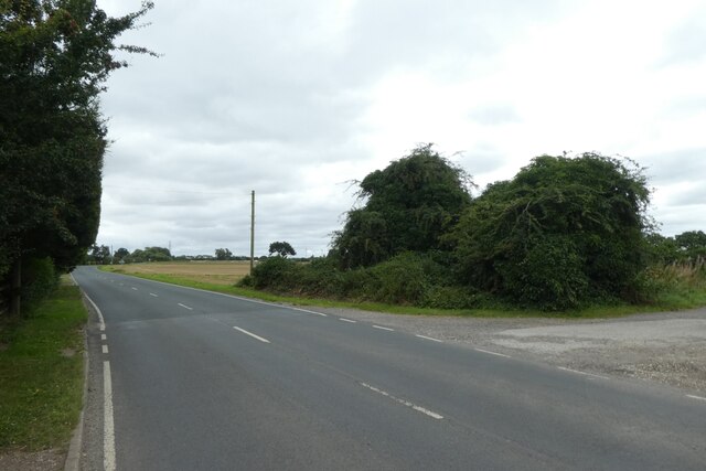
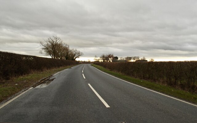
The valley is characterized by its gently rolling hills, lush green fields, and meandering streams. It is surrounded by a mix of deciduous woodland, open pastures, and agricultural land, creating a rich and varied landscape. Bubwith Clough is particularly renowned for its ancient woodland, which is home to a wide range of plant and animal species.

Walking along the footpaths that crisscross the valley, visitors can enjoy stunning views of the surrounding countryside and take in the peaceful atmosphere. The area is a haven for nature lovers, offering opportunities for birdwatching, photography, and wildlife spotting. Common sightings include native birds such as kingfishers, herons, and woodpeckers, as well as deer, foxes, and rabbits.

Bubwith Clough is also home to a number of historic landmarks, including the Grade II listed Bubwith Bridge. This charming stone bridge, dating back to the 18th century, spans the River Derwent and provides a picturesque focal point within the valley.

Overall, Bubwith Clough offers a serene and idyllic setting for those seeking a peaceful retreat in the heart of Yorkshire. Its natural beauty, diverse wildlife, and historic charm make it a hidden gem worth exploring.

If you have any feedback on the listing, please let us know in the comments section below.

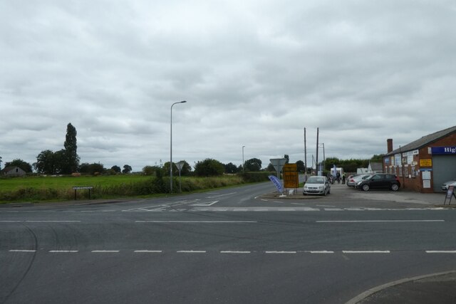
Bubwith Clough Images

Images are sourced within 2km of 53.819793/-0.9249569 or Grid Reference SE7036. Thanks to Geograph Open Source API. All images are credited.

Northfield Road Looking across the A163 from Street Lane on the east side of Bubwith.
Northfield Road
Looking across the A163 from Street Lane on the east side of Bubwith.
Street Lane near Bubwith station site Looking along Street Lane where it meets the Bubwith Rail Trail.
Street Lane near Bubwith station site
Looking along Street Lane where it meets the Bubwith Rail Trail.
Entrance to the airfield
Bubwith Ings I didn't realise it had been so wet
Bubwith Ings
I didn't realise it had been so wet
Bubwith Ings No birds today
Bubwith Ings
No birds today
December light on Northfield Road
Breighton Airfield Looking through the entrance onto the airfield. The runway is 11/29.
Breighton Airfield
Looking through the entrance onto the airfield. The runway is 11/29.
Road beside the airfield Looking along Gunby Road towards Breighton.
Road beside the airfield
Looking along Gunby Road towards Breighton.
Field beside Gunby Road Looking across farmland between Breighton and Bubwith.
Field beside Gunby Road
Looking across farmland between Breighton and Bubwith.
Gunby Road Looking along Gunby Road between Breighton and Bubwith.
Gunby Road
Looking along Gunby Road between Breighton and Bubwith.
Entering Bubwith Looking along Breighton Road at the south side of Bubwith.
Entering Bubwith
Looking along Breighton Road at the south side of Bubwith.
Bubwith station The former railway station on the Selby to Market Weighton line. For more information see: <span class="nowrap"><a title="https://en.wikipedia.org/wiki/Bubwith_railway_station" rel="nofollow ugc noopener" href="https://en.wikipedia.org/wiki/Bubwith_railway_station">Link</a><img style="margin-left:2px;" alt="External link" title="External link - shift click to open in new window" src="https://s1.geograph.org.uk/img/external.png" width="10" height="10"/></span>
Bubwith station
The former railway station on the Selby to Market Weighton line. For more information see: LinkExternal link
Bubwith Main Street Looking along Main Street from Church Street.
Bubwith Main Street
Looking along Main Street from Church Street.
Main Street, Bubwith Viewed from Church Street.
Main Street, Bubwith
Viewed from Church Street.
Dyon Drain Looking along Dyon Drain from the A163.
Dyon Drain
Looking along Dyon Drain from the A163.
A163 and parking area Looking towards the bridge over the River Derwent.
A163 and parking area
Looking towards the bridge over the River Derwent.
Bridge over the Derwent Looking towards Derwent Bridge which is a Grade II* listed structure.
Bridge over the Derwent
Looking towards Derwent Bridge which is a Grade II* listed structure.
Rail trail near High Field Station The former Market Weighton to Selby via Bubwith railway line is now a cycle path called the Bubwith Rail Trail. This is the site of the former High Field station. More information on the station can be found at: <span class="nowrap"><a title="https://en.wikipedia.org/wiki/High_Field_railway_station" rel="nofollow ugc noopener" href="https://en.wikipedia.org/wiki/High_Field_railway_station">Link</a><img style="margin-left:2px;" alt="External link" title="External link - shift click to open in new window" src="https://s1.geograph.org.uk/img/external.png" width="10" height="10"/></span>
Rail trail near High Field Station
The former Market Weighton to Selby via Bubwith railway line is now a cycle path called the Bubwith Rail Trail. This is the site of the former High Field station. More information on the station can be found at: LinkExternal link
Show me another place!

Bubwith Clough is located at Grid Ref: SE7036 (Lat: 53.819793, Lng: -0.9249569)

Division: East Riding

Unitary Authority: East Riding of Yorkshire

Police Authority: Humberside

What 3 Words

///pampering.livid.survivor. Near Bubwith, East Yorkshire

Related Wikis

Bubwith

Bubwith is a village and civil parish in the East Riding of Yorkshire, England. The village is situated about 6 miles (10 km) north-east of Selby, and...

Bubwith railway station

Bubwith railway station was a station on the Selby to Driffield Line in the East Riding of Yorkshire, England serving the village of Bubwith. It opened...

ARTTS International

ARTTS International was a multi-discipline film, television, radio and stage training centre in Bubwith, East Riding of Yorkshire, England established...

Duffield Castle, North Yorkshire

Duffield Castle lay on the flood plain of the River Derwent in the parish of North Duffield in the English county of North Yorkshire. It was documented...

Nearby Amenities

Located within 500m of 53.819793,-0.9249569
Pub
White Swan Bubwith
Addr City: Selby
Addr Postcode: YO8 6LT
Addr Street: Main Street
Floor Material: carpet
Food: yes
Parking: yes
Real Ale: 3 from Copper Dragon, Old Mill, Black Sheep, may vary
Wheelchair: yes
Wheelchair Description: ramp at entrance, then flat
Lat/Long: 53.8189131/-0.9212427
Parking
Bubwith Bridge Parking
Lat/Long: 53.8194687/-0.9262016
Bus Stop
Bubwith White Swan
Naptan AtcoCode: 2200YEA00673
Naptan Bearing: W
Naptan CommonName: Bubwith White Swan
Naptan Crossing: Staithe Street
Naptan Landmark: Pub
Naptan Street: Main Street
Naptan Verified: yes
Source: naptan_import
Lat/Long: 53.8187467/-0.9203417
Bus Stop
Bubwith White Swan
Naptan AtcoCode: 2200YEA01581
Naptan Bearing: E
Naptan CommonName: Bubwith White Swan
Naptan Crossing: Church Street
Naptan Landmark: Near Number 19
Naptan Street: Main Street
Naptan Verified: yes
Source: naptan_import
Lat/Long: 53.8188186/-0.9203399
Barrier: kissing_gate
Lat/Long: 53.8195247/-0.9263108
Parking
Lat/Long: 53.8193889/-0.9285488
Tourism: picnic_site
Lat/Long: 53.8192725/-0.9251525
Parking
Lat/Long: 53.8194499/-0.9184824
The data included in this document is from www.openstreetmap.org. The data is made available under ODbL.

Have you been to Bubwith Clough?

Leave your review of Bubwith Clough below (or comments, questions and feedback).