Blackbird's Bottom

Valley in Oxfordshire South Oxfordshire

England

Blackbird's Bottom

K6 telephone box and bus shelter, Cray's Pond
K6 telephone box and bus shelter, Cray's Pond Credit: JThomas

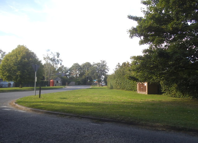
Blackbird's Bottom is a picturesque valley located in the county of Oxfordshire, England. Nestled amidst the rolling hills and lush greenery, this scenic area is a haven for nature lovers and outdoor enthusiasts. The valley is named after the abundance of blackbirds that inhabit the region, adding to the charm and tranquility of the surroundings.

Surrounded by dense woodlands and meandering streams, Blackbird's Bottom offers a serene and peaceful environment. The valley is characterized by its gentle slopes, which provide breathtaking views of the surrounding countryside. Visitors can enjoy leisurely walks along the numerous trails that crisscross the area, immersing themselves in the beauty of nature.

The valley is also home to a diverse range of flora and fauna, making it a paradise for wildlife enthusiasts. The woodlands are filled with ancient oak trees, creating a rich habitat for a variety of bird species, including blackbirds, thrushes, and woodpeckers. In addition, the area is home to a range of small mammals such as rabbits, foxes, and badgers.

Blackbird's Bottom is a popular destination for those seeking respite from the hustle and bustle of city life. Its peaceful atmosphere and stunning natural beauty make it an ideal spot for picnics, photography, and simply enjoying the tranquility of the countryside. Whether it's a leisurely stroll through the woods or a moment of reflection by the babbling brooks, Blackbird's Bottom offers an idyllic retreat for visitors seeking solace in nature.

If you have any feedback on the listing, please let us know in the comments section below.

Blackbird's Bottom Images

Images are sourced within 2km of 51.517737/-1.0885727 or Grid Reference SU6380. Thanks to Geograph Open Source API. All images are credited.

K6 telephone box and bus shelter, Cray's Pond
Bus shelter on the B4256, Cray's Pond
B4526, Cray's Pond
B4526, Cray's Pond
The White Lion, Cray's Pond Not currently open (2022).
See <a href="https://www.geograph.org.uk/photo/2829589">SU6380 : The White Lion, Crays Pond</a> for happier times.
The White Lion, Cray's Pond
Not currently open (2022). See SU6380 : The White Lion, Crays Pond for happier times.
Garage and car sales, Cray's Pond
Gated track and footpath off Goring Road
Goring Road The B471 towards Woodcote.
Goring Road
The B471 towards Woodcote.
House on Goring Road
Roadworks on Goring Road (B471)
Recreation ground, Woodcote
George VI postbox on Goring Road, Woodcote Postbox No. RG8 356.
George VI postbox on Goring Road, Woodcote
Postbox No. RG8 356.
Greenmoor hill views
B471 heading north Towards Woodcote.
B471 heading north
Towards Woodcote.
 St John the Baptist Church, Whitchurch Hill
St John the Baptist Church, Whitchurch Hill
Grazing and woodland, Whitchurch Hill
B471, Whitchurch Hill Heading north towards Woodcote.
B471, Whitchurch Hill
Heading north towards Woodcote.
Elizabeth II postbox, Whitchurch Hill Postbox No. RG8 216.
Elizabeth II postbox, Whitchurch Hill
Postbox No. RG8 216.
Goring Road from the B4526
Show me another place!

Blackbird's Bottom is located at Grid Ref: SU6380 (Lat: 51.517737, Lng: -1.0885727)

Administrative County: Oxfordshire

District: South Oxfordshire

Police Authority: Thames Valley

What 3 Words

///belief.slurping.craft. Near Goring, Oxfordshire

Related Wikis

Crays Pond

Crays Pond is a hamlet situated in the parish of Goring Heath in South Oxfordshire. Crays Pond is about 2.4 miles (3.9 km) northeast of Goring-on-Thames...

Goring Heath

Goring Heath is a hamlet and civil parish in the Chiltern Hills in South Oxfordshire. The civil parish includes the villages of Whitchurch Hill and Crays...

The Oratory Preparatory School

The Oratory Prep School is a Roman Catholic day and boarding school for some 330 boys and girls aged from two to thirteen, founded in 1925. The school...

Goring Rural District

Goring was a rural district in Oxfordshire, England from 1894 to 1932. It was formed from that part of the Bradfield rural sanitary district which was...

Whitchurch Hill

Whitchurch Hill is a village in the Chiltern Hills in Oxfordshire, about 5.5 miles (9 km) northwest of Reading, Berkshire, near Whitchurch-on-Thames. The...

Elvendon

Elvendon is a small settlement in Oxfordshire and the Chiltern Hills, near Goring. It includes the grade II listed building Elvendon Priory. == Etymology... ==

Hartslock

Hartslock, also known as Hartslock Woods, is a 41.8-hectare (103-acre) biological Site of Special Scientific Interest (SSSI) in a wooded area on the north...

Woodcote

Woodcote is a village and civil parish in South Oxfordshire, about 5 miles (8 km) southeast of Wallingford and about 7 miles (11 km) northwest of Reading...

Nearby Amenities

Located within 500m of 51.517737,-1.0885727
Cray's Pond
Alt Name: Crays Pond
Place: hamlet
Wikidata: Q5183060
Wikipedia: en:Crays Pond
Lat/Long: 51.5209663/-1.0835591
Created By: Merkaartor 0.13
Lat/Long: 51.5169954/-1.0856079
Created By: Merkaartor 0.13
Lat/Long: 51.516931/-1.0875177
Created By: Merkaartor 0.13
Lat/Long: 51.5177679/-1.0887837
Created By: Merkaartor 0.13
Lat/Long: 51.5180367/-1.0892343
Created By: Merkaartor 0.13
Lat/Long: 51.5141505/-1.0897664
Created By: Merkaartor 0.13
Lat/Long: 51.5140771/-1.0890626
Created By: Merkaartor 0.13
Lat/Long: 51.5139484/-1.0901999
Created By: Merkaartor 0.13
Lat/Long: 51.5137767/-1.0906719
Created By: Merkaartor 0.13
Lat/Long: 51.5136909/-1.0914015
Created By: Merkaartor 0.13
Lat/Long: 51.5139698/-1.0881185
Created By: Merkaartor 0.13
Lat/Long: 51.5139484/-1.0871958
Created By: Merkaartor 0.13
Lat/Long: 51.5140557/-1.0863589
Barrier: kissing_gate
Lat/Long: 51.5219708/-1.0886333
Created By: Merkaartor 0.13
Lat/Long: 51.5183043/-1.0910367
Created By: Merkaartor 0.13
Lat/Long: 51.5180518/-1.0928605
Created By: Merkaartor 0.13
Lat/Long: 51.5176176/-1.0940193
Created By: Merkaartor 0.13
Lat/Long: 51.5174245/-1.0955643
Bus Stop
Goring Road
Bus: yes
Naptan AtcoCode: 340001610NOR
Naptan Bearing: NW
Naptan CommonName: Goring Road
Naptan Indicator: Opposite
Naptan Landmark: Opp Bus Shelter
Naptan NaptanCode: oxfgmagj
Naptan Street: Reading Road
Naptan Verified: no
Public Transport: platform
Shelter: yes
Source: naptan_import
Wheelchair: no
Lat/Long: 51.5205017/-1.083433
Goring Road
Naptan AtcoCode: 340001610SOU
Naptan Bearing: SE
Naptan BusStopType: CUS
Naptan CommonName: Goring Road
Naptan Indicator: Corner
Naptan Landmark: Bus Shelter
Naptan NaptanCode: oxfgdwjm
Naptan Street: Reading Road
Naptan Verified: no
Source: naptan_import
Lat/Long: 51.5205599/-1.0833714
Barrier: kissing_gate
Foot: yes
Lat/Long: 51.5158971/-1.0888471
Barrier: kissing_gate
Foot: yes
Lat/Long: 51.516186/-1.0880545
Barrier: kissing_gate
Foot: yes
Lat/Long: 51.5166396/-1.0868099
Barrier: kissing_gate
Foot: yes
Lat/Long: 51.5172383/-1.0842467
Addr Housenumber: 1
Source: survey
Lat/Long: 51.5220042/-1.0868556
Addr Housenumber: 8
Source: survey
Lat/Long: 51.5217905/-1.0861046
Entrance: main
Lat/Long: 51.514478/-1.0849316
Barrier: kissing_gate
Bicycle: no
Foot: yes
Lat/Long: 51.5136743/-1.0909031
Location Transition: yes
Power: pole
Lat/Long: 51.5196707/-1.0825101
Power: pole
Lat/Long: 51.5187427/-1.0830438
Power: pole
Lat/Long: 51.5177655/-1.0836004
Location Transition: yes
Power: pole
Lat/Long: 51.5196557/-1.0823894
Power: pole
Lat/Long: 51.5176862/-1.0834609
Power: pole
Lat/Long: 51.5170862/-1.0825436
Power: pole
Lat/Long: 51.518721/-1.0829593
Power: pole
Lat/Long: 51.5177913/-1.0835011
Power: pole
Lat/Long: 51.5169802/-1.0839584
Power: pole
Lat/Long: 51.5162508/-1.0849375
Power: pole
Lat/Long: 51.51574/-1.0856187
Power: pole
Lat/Long: 51.5149488/-1.0862893
Power: pole
Lat/Long: 51.5140608/-1.0869598
Direction: 205
Fixme: survey for panel count
Generator Method: photovoltaic
Generator Output Electricity: yes
Generator Solar Modules: 12
Generator Source: solar
Generator Type: solar_photovoltaic_panel
Location: roof
Power: generator
Lat/Long: 51.5210633/-1.0843432
The data included in this document is from www.openstreetmap.org. The data is made available under ODbL.

Have you been to Blackbird's Bottom?

Leave your review of Blackbird's Bottom below (or comments, questions and feedback).