Barthol Chapel

Settlement in Aberdeenshire

Scotland

Barthol Chapel

Turnip field north of Hillbrae Looking westwards down a field of turnips to the north of Hillbrae.
Turnip field north of Hillbrae Credit: Scott Cormie

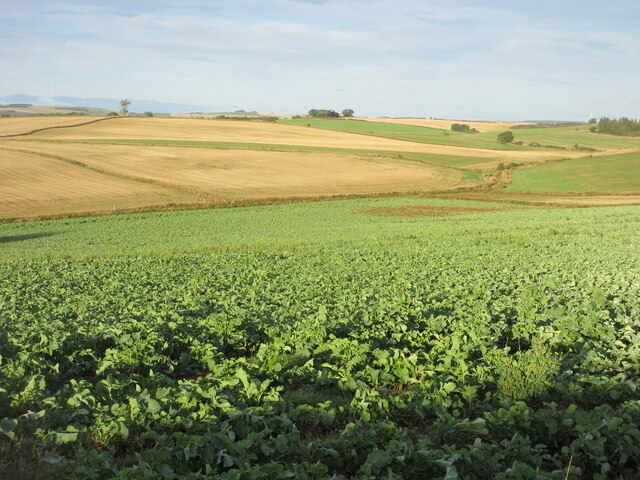
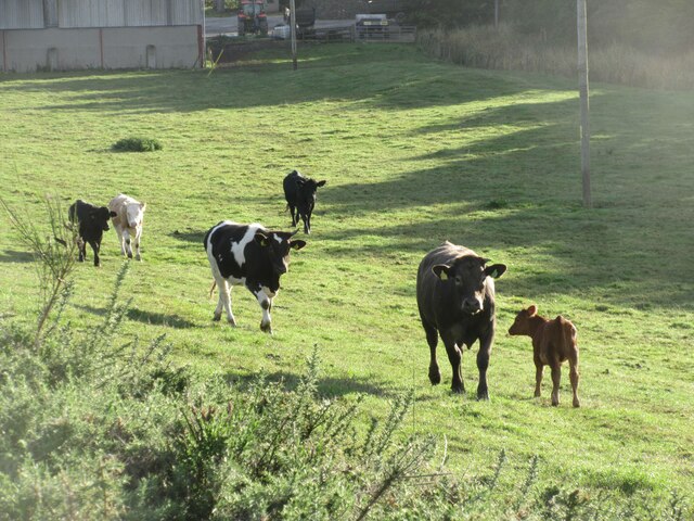
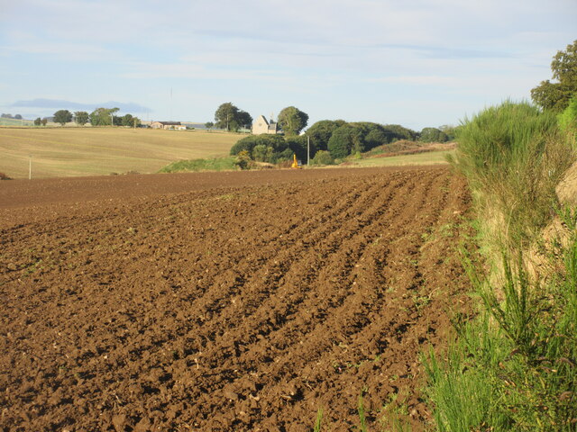
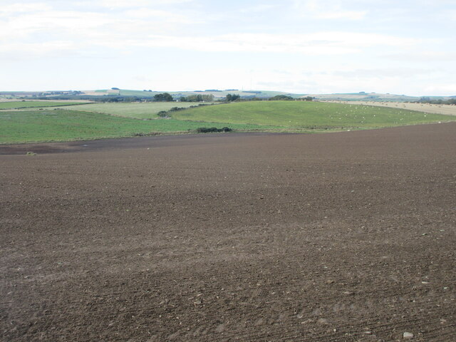
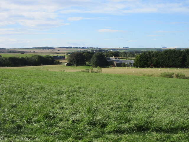
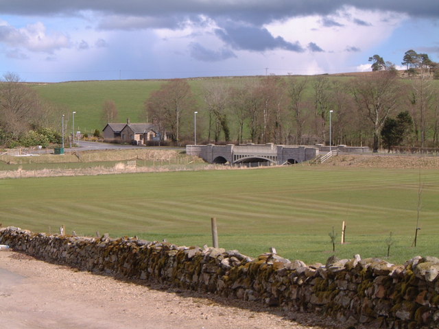
Barthol Chapel is a small village located in the Aberdeenshire region of Scotland. Situated approximately 20 miles northwest of Aberdeen, it is nestled amidst picturesque countryside and rolling hills. The village is known for its tranquil and idyllic setting, making it a popular destination for those seeking a peaceful retreat away from the hustle and bustle of city life.

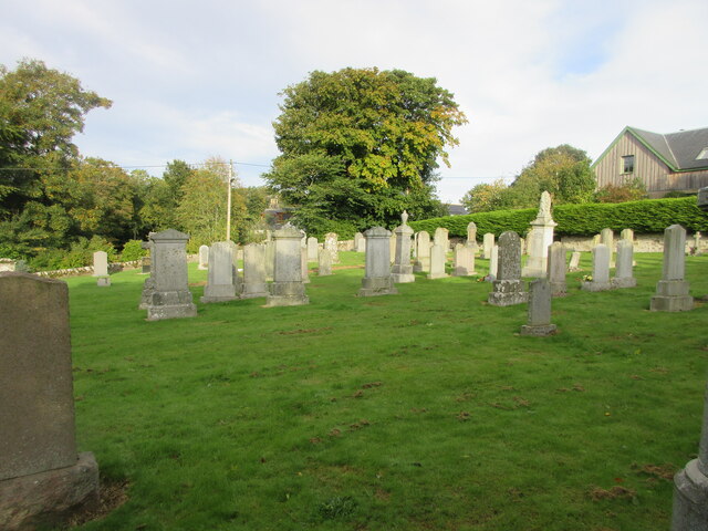
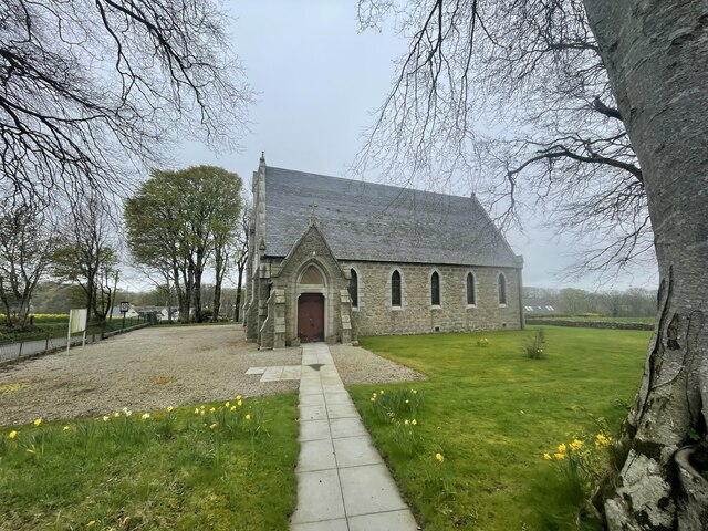
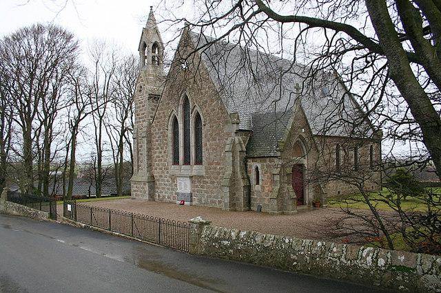
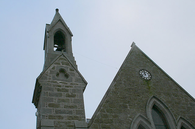
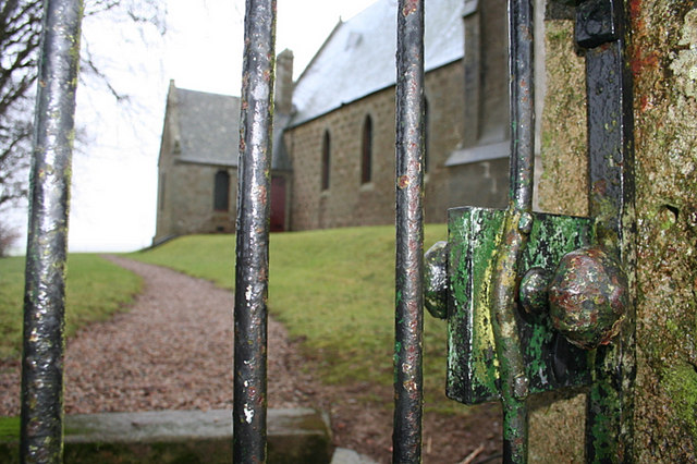
Despite its small size, Barthol Chapel boasts a rich history dating back centuries. The village takes its name from the nearby Chapel of St. Bartholomew, an ancient place of worship that has stood since the 12th century. The chapel, with its distinctive architecture and historical significance, serves as a reminder of the area's religious heritage.

The village itself consists of a collection of traditional stone houses, many of which date back to the 18th and 19th centuries. The architecture reflects the region's traditional Scottish style, with slate roofs, white-washed walls, and quaint wooden doors and windows.

Barthol Chapel is also home to a close-knit community that takes pride in its village's natural beauty and heritage. The residents actively participate in community events and initiatives, fostering a strong sense of belonging and camaraderie. The village boasts a primary school, a community hall, and a local pub, which serves as a hub for social gatherings and events.

Visitors to Barthol Chapel can enjoy exploring the surrounding countryside, with its abundance of walking trails and scenic viewpoints. The village's proximity to Aberdeen also allows for easy access to a range of amenities, cultural attractions, and transport links.

If you have any feedback on the listing, please let us know in the comments section below.

Barthol Chapel Images

Images are sourced within 2km of 57.396911/-2.30973 or Grid Reference NJ8134. Thanks to Geograph Open Source API. All images are credited.

Turnip field north of Hillbrae Looking westwards down a field of turnips to the north of Hillbrae.
Turnip field north of Hillbrae
Looking westwards down a field of turnips to the north of Hillbrae.
Cattle near Earlsford Frisky cattle in a field west of Earlsford.
Cattle near Earlsford
Frisky cattle in a field west of Earlsford.
Ploughed field near Hardford Looking westwards over a newly ploughed field near Hardford, with Barthol Chapel in the distance.
Ploughed field near Hardford
Looking westwards over a newly ploughed field near Hardford, with Barthol Chapel in the distance.
Barthol Chapel Barthol Chapel from the west, showing the bell tower, western gable, and war memorial plaque under the windows.
Barthol Chapel
Barthol Chapel from the west, showing the bell tower, western gable, and war memorial plaque under the windows.
Barthol Chapel Cemetery Looking westwards from within the cemetery at Barthol Chapel.
Barthol Chapel Cemetery
Looking westwards from within the cemetery at Barthol Chapel.
Field west of Barthol Chapel New growth in a field west of Barthol Chapel, looking south-west towards South Flobbets.
Field west of Barthol Chapel
New growth in a field west of Barthol Chapel, looking south-west towards South Flobbets.
Large field near South Blackstocks Large field of soil to the west of South Blackstocks.
Large field near South Blackstocks
Large field of soil to the west of South Blackstocks.
Woodland at Throopmuir Looking south-west from the Crossroads at Braikley to woodland at Throopmuir.
Woodland at Throopmuir
Looking south-west from the Crossroads at Braikley to woodland at Throopmuir.
Barthol Chapel Geocaching is a type of global treasure hunt of people looking for caches, or hidden stashes of objects. Geocaching may also be described as a series of hide-and-seek games, where hiders provide online clues for seekers. Seekers use global positioning system (GPS) devices to find hidden caches
Barthol Chapel
Geocaching is a type of global treasure hunt of people looking for caches, or hidden stashes of objects. Geocaching may also be described as a series of hide-and-seek games, where hiders provide online clues for seekers. Seekers use global positioning system (GPS) devices to find hidden caches
Sheep by Tulloford Sheep grazing by Tulloford.
Sheep by Tulloford
Sheep grazing by Tulloford.
Trees by Tulloford A tree-lined road by Tulloford looking west.
Trees by Tulloford
A tree-lined road by Tulloford looking west.
The road to Keillyford.
The Church of Scotland at Barthol Chapel.
Church tower  and clock at Barthol Chapel church.
Church tower and clock at Barthol Chapel church.
Births, Marriages, and Deaths. Imagine the emotions that spurred the hands that turned the knob that opened this gate over the years!!
Births, Marriages, and Deaths.
Imagine the emotions that spurred the hands that turned the knob that opened this gate over the years!!
Turn left for Chapel of Barthol.
Dwellings at Old Balgove.
The impressive Aulton of Fochel Farm Remove full stop in conformity with site style.
The impressive Aulton of Fochel Farm
Remove full stop in conformity with site style.
Show me another place!

Barthol Chapel is located at Grid Ref: NJ8134 (Lat: 57.396911, Lng: -2.30973)

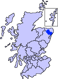
Unitary Authority: Aberdeenshire

Police Authority: North East

What 3 Words

///recipient.students.subsystem. Near Oldmeldrum, Aberdeenshire

Nearby Locations

Barthol Chapel

Related Wikis

Barthol Chapel

Barthol Chapel is a small village in the Formartine area of Aberdeenshire, Scotland, named after the Catholic saint, St Bartholomew. Barthol Chapel has...

Formartine

Formartine (Scottish Gaelic: Fearann Mhàrtainn meaning "Martin's land") is a committee area in Aberdeenshire, Scotland. This district extends north from...
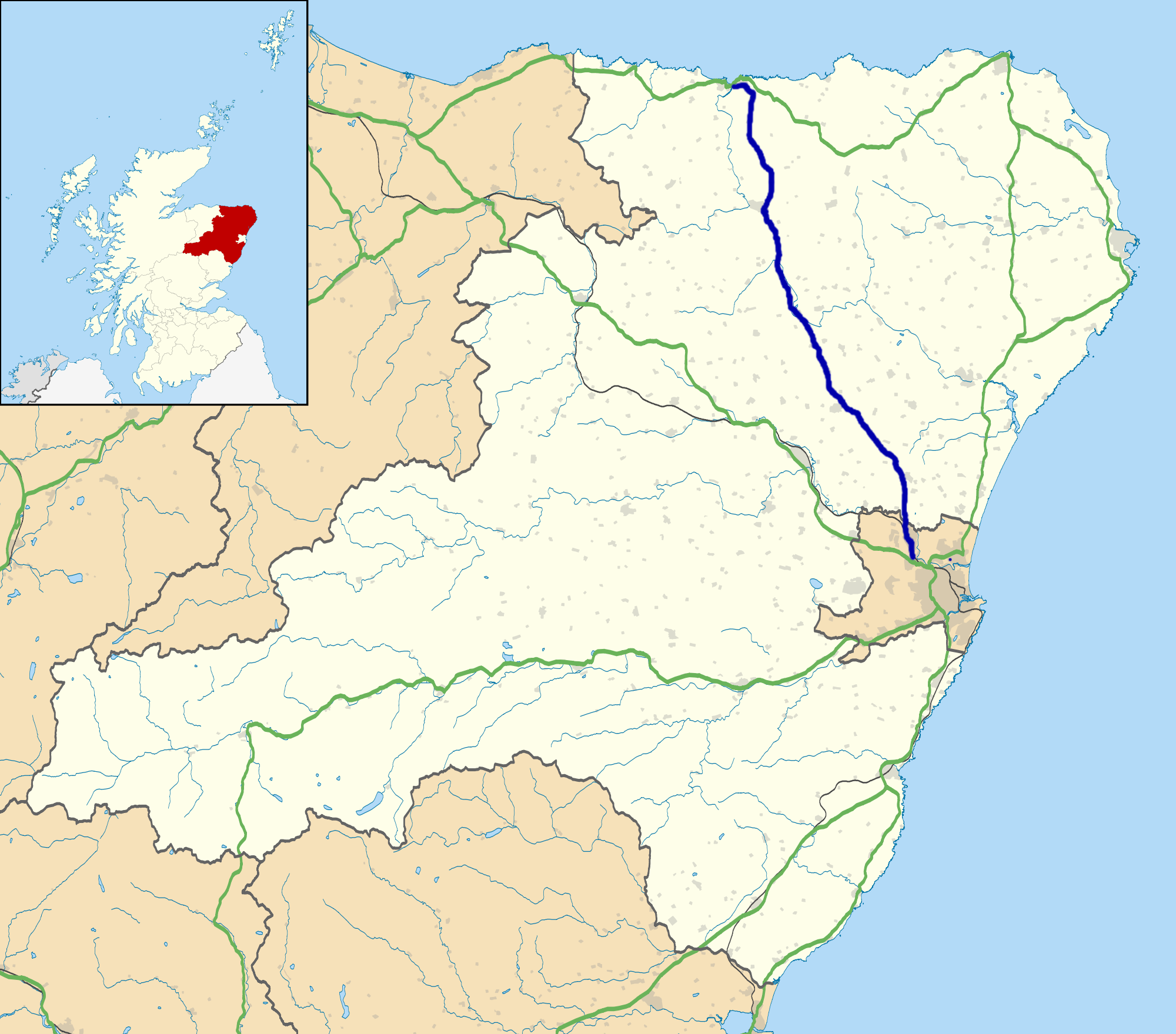
A947 road

The A947 is a single-carriageway road in Scotland that links Aberdeen to Banff via several towns in Aberdeenshire, including Newmachar, Oldmeldrum, Fyvie...

Tillyhilt Castle

Tillyhilt Castle was a 16th-century tower house 6.5 miles (10.5 km) west of Ellon, 1 mile (1.6 km) northwest of Tarves, Aberdeenshire, Scotland. ��2�...

Woodhead, Aberdeenshire

Woodhead of Fyvie, often simply called "Woodhead", is an inland hamlet in Formartine, Aberdeenshire, Scotland, that lies to the east of Fyvie near the...

Methlick

Methlick (Gaelic: Maothulach) is a village in the Formartine area of Aberdeenshire, Scotland, situated on the River Ythan 11.2 kilometres (7.0 mi) north...

Haddo House

Haddo House is a Scottish stately home located near Tarves in Aberdeenshire, approximately 20 miles (32 km) north of Aberdeen (grid reference NJ868347...

Meldrum transmitting station

The Meldrum transmitting station is a broadcasting and telecommunications facility, situated on Core Hill, 4.3 miles (6.9 km) north-west of the village...

Nearby Amenities

Located within 500m of 57.396911,-2.30973
Post Box
Lat/Long: 57.3964006/-2.3096234
Barthol Chapel
Place: village
Lat/Long: 57.3966122/-2.3094147
Power: pole
Lat/Long: 57.3934105/-2.3142543
Power: pole
Lat/Long: 57.3937143/-2.3132763
Power: pole
Lat/Long: 57.3940429/-2.3122447
Power: pole
Lat/Long: 57.3943456/-2.3112283
Power: pole
Lat/Long: 57.3946639/-2.3102082
Power: pole
Lat/Long: 57.3946019/-2.3094948
Power: pole
Lat/Long: 57.394512/-2.3084363
Power: pole
Lat/Long: 57.394418/-2.3073279
Power: pole
Lat/Long: 57.3943942/-2.3070422
Power: pole
Lat/Long: 57.394325/-2.3063135
Power: pole
Lat/Long: 57.3942237/-2.3051706
Power: pole
Lat/Long: 57.394139/-2.3041217
Power: pole
Lat/Long: 57.3942175/-2.3157865
Power: pole
Lat/Long: 57.3947889/-2.3160703
Power: pole
Lat/Long: 57.3953841/-2.3163541
Power: pole
Lat/Long: 57.3960134/-2.3163503
Power: pole
Lat/Long: 57.3966416/-2.3163637
Power: pole
Lat/Long: 57.3973256/-2.3163599
Power: pole
Lat/Long: 57.3931769/-2.3065359
Power: pole
Lat/Long: 57.3937959/-2.3067814
Power: pole
Lat/Long: 57.3949377/-2.3076558
Power: pole
Lat/Long: 57.3954978/-2.3083078
Power: pole
Lat/Long: 57.4001482/-2.3137936
Power: pole
Lat/Long: 57.399877/-2.3126205
Power: pole
Lat/Long: 57.400566/-2.3126531
Power: pole
Lat/Long: 57.3991997/-2.3125835
Power: pole
Lat/Long: 57.3987942/-2.3125748
Power: pole
Lat/Long: 57.398786/-2.3118897
Power: pole
Lat/Long: 57.3981896/-2.3108936
Power: pole
Lat/Long: 57.3976212/-2.309941
The data included in this document is from www.openstreetmap.org. The data is made available under ODbL.

Have you been to Barthol Chapel?

Leave your review of Barthol Chapel below (or comments, questions and feedback).