Aris Dale

Valley in Shetland

Scotland

Aris Dale

Hill of Arisdale No build up of peat on the exposed ridge and the underlying Dalriadan quartzite is exposed. This is the highest point on Yell and the terrain is just like Highland Perthshire at around 800m above sea level.
Hill of Arisdale Credit: Richard Webb

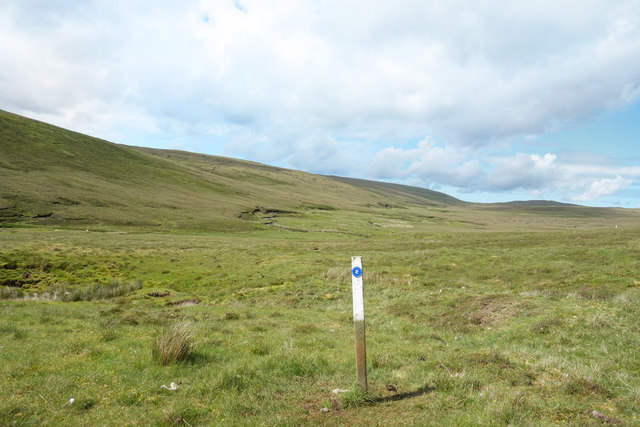
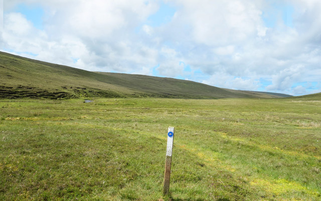
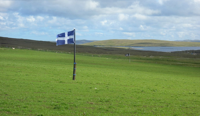
Aris Dale is a picturesque valley located on the island of Shetland, which is part of the Shetland Islands in Scotland. Nestled between rolling hills and surrounded by stunning natural beauty, Aris Dale offers visitors a tranquil and idyllic escape from the hustle and bustle of everyday life.

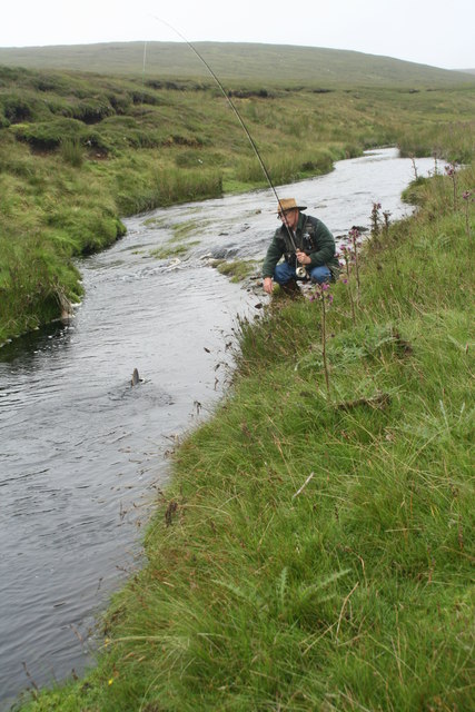
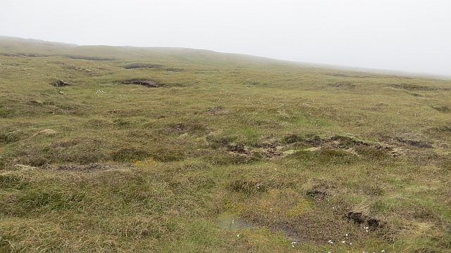
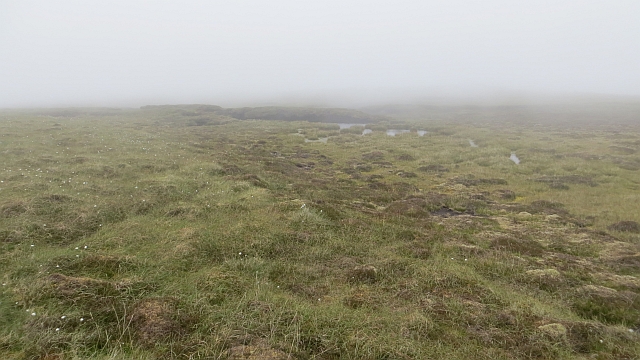
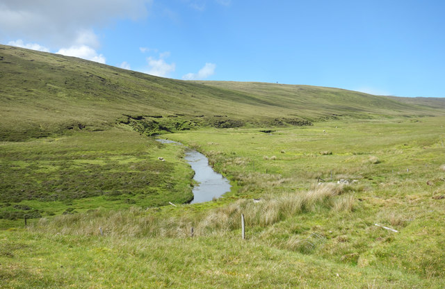
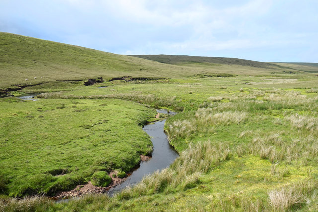
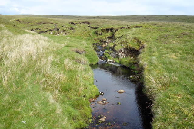
The valley is characterized by its lush green landscapes, dotted with grazing sheep and colorful wildflowers. The meandering Aris Water river flows through the valley, adding to its charm and providing a peaceful soundtrack to the surroundings. The river is also home to various species of fish, attracting anglers from far and wide.

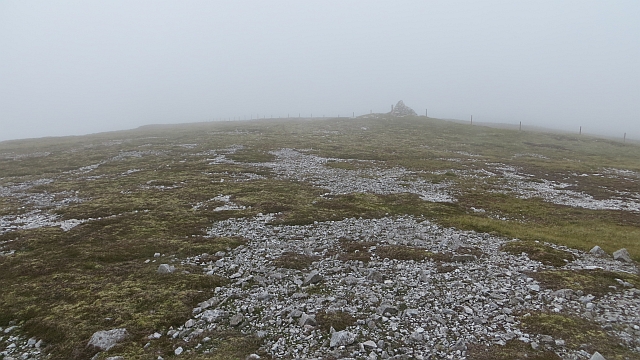
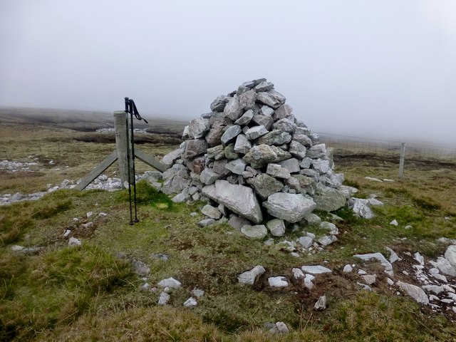
Aris Dale is a popular destination for hikers and nature enthusiasts, with a network of walking trails that allow visitors to explore the valley and its surrounding hills. The trails offer stunning views of the valley, as well as opportunities to spot local wildlife, including birds, seals, and even otters.

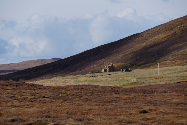
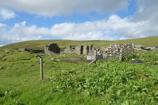
In addition to its natural wonders, Aris Dale is also home to a small community of residents who live in charming cottages and farmhouses. The community is known for its warm hospitality and strong sense of community spirit.

While Aris Dale may be a rural and secluded destination, it is located within easy reach of nearby amenities and attractions. The town of Lerwick, the capital of Shetland, is just a short drive away, offering shops, restaurants, and cultural attractions.

Overall, Aris Dale is a hidden gem in the Shetland Islands, offering visitors a chance to immerse themselves in the beauty of nature while experiencing the warmth and charm of a close-knit community.

If you have any feedback on the listing, please let us know in the comments section below.
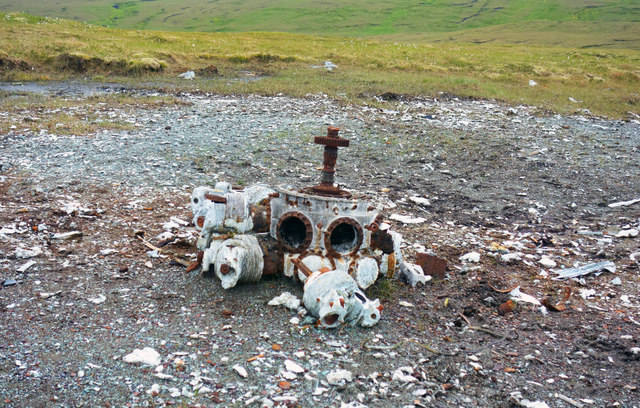
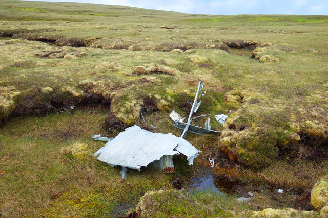
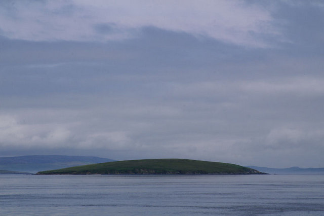
Aris Dale Images

Images are sourced within 2km of 60.533185/-1.1286423 or Grid Reference HU4783. Thanks to Geograph Open Source API. All images are credited.

Hill of Arisdale No build up of peat on the exposed ridge and the underlying Dalriadan quartzite is exposed. This is the highest point on Yell and the terrain is just like Highland Perthshire at around 800m above sea level.
Hill of Arisdale
No build up of peat on the exposed ridge and the underlying Dalriadan quartzite is exposed. This is the highest point on Yell and the terrain is just like Highland Perthshire at around 800m above sea level.
Hill of Arisdale Moorland yomp to summit and trig with Jenny, Rick and Tricky.
Name: Hill of Arisdale
Hill number: 1541
Height: 210m / 689ft
Area: 22: Shetland Islands
Class: Ma
Grid ref: HU 49451 84158
Summit feature: large cairn
Drop: 210m
Col: Sea
Hill of Arisdale
Moorland yomp to summit and trig with Jenny, Rick and Tricky. Name: Hill of Arisdale Hill number: 1541 Height: 210m / 689ft Area: 22: Shetland Islands Class: Ma Grid ref: HU 49451 84158 Summit feature: large cairn Drop: 210m Col: Sea
Arisdale Burn on Yell Trout fishing on Arisdale Burn above the ruined house along the track to the crash site of an RAF Catalina at Willa-mina Hoga.
Arisdale Burn on Yell
Trout fishing on Arisdale Burn above the ruined house along the track to the crash site of an RAF Catalina at Willa-mina Hoga.
Hill of Arisdale Peaty slopes to the east of the summit.
Hill of Arisdale
Peaty slopes to the east of the summit.
Hill of Arisdale A broad boggy ridge north of the summit.
Hill of Arisdale
A broad boggy ridge north of the summit.
Catalina crash site Debris from a crashed RAF Catalina on hillside. The aircraft crashed on 19 January 1942 and there were three survivors.
Catalina crash site
Debris from a crashed RAF Catalina on hillside. The aircraft crashed on 19 January 1942 and there were three survivors.
The house of Arisdale in Aris Dale No longer occupied.
The house of Arisdale in Aris Dale
No longer occupied.
Aris Dale A short way north of the deserted farmstead at Arisdale.
Aris Dale
A short way north of the deserted farmstead at Arisdale.
Way Mark on the Catalina Trail One of the more extreme things to do on Yell is to take a hike up to the place where an aircraft crashed in 1942 with the loss of seven of the ten people aboard.
The site is remote and a lot of the debris has never been removed. A simple memorial has been put up amidst the emptiness.
To be honest, there is no trail as such and beyond the ruins of the farm at Arisdale you just follow the way markers over terrain similar to this.
A great sense of achievement when you get there, and it gets you to a part of the island hardly anybody goes to.
Way Mark on the Catalina Trail
One of the more extreme things to do on Yell is to take a hike up to the place where an aircraft crashed in 1942 with the loss of seven of the ten people aboard. The site is remote and a lot of the debris has never been removed. A simple memorial has been put up amidst the emptiness. To be honest, there is no trail as such and beyond the ruins of the farm at Arisdale you just follow the way markers over terrain similar to this. A great sense of achievement when you get there, and it gets you to a part of the island hardly anybody goes to.
Catalina Trail Way Marker There is a way marked hike up Arisdale to the site where an aircraft crashed in 1942. There is no path as such, you just make your own way from one post to the next.
Catalina Trail Way Marker
There is a way marked hike up Arisdale to the site where an aircraft crashed in 1942. There is no path as such, you just make your own way from one post to the next.
The Burn of Arisdale below Mossy Hill The Burn of Arisdale flows southwards for around 6 kms from its source in the heart of the southern part of Yell.
I took a slight detour from the way marked Catalina Trail which runs up the valley to get this first Geograph for HU4783.
The Burn of Arisdale below Mossy Hill
The Burn of Arisdale flows southwards for around 6 kms from its source in the heart of the southern part of Yell. I took a slight detour from the way marked Catalina Trail which runs up the valley to get this first Geograph for HU4783.
Ruins at Arisdale The main farmhouse at Arisdale, itself now falling into ruin, is a substantial two storey building, but nearby are the remains of a much older habitation.
Ruins at Arisdale
The main farmhouse at Arisdale, itself now falling into ruin, is a substantial two storey building, but nearby are the remains of a much older habitation.
Shetland flag in a field This field has been newly seeded and the Shetland flag, along with a Jolly Roger and a couple of scarecrows, is scaring those pesky birds off. It seems to work, the grass is coming up nicely.
This is at the farm in Arisdale, where some of the fields are still in use although the associated buildings are in ruins.
Shetland flag in a field
This field has been newly seeded and the Shetland flag, along with a Jolly Roger and a couple of scarecrows, is scaring those pesky birds off. It seems to work, the grass is coming up nicely. This is at the farm in Arisdale, where some of the fields are still in use although the associated buildings are in ruins.
Burn of Sundrabister The way marked walk up Aris Dale is not particularly difficult although there is no path as such. Mostly moorland grass and scrubby heather, with innumerable small boggy channels to jump over, this is the only place where we had to walk up and down a bit to find somewhere to cross.
Burn of Sundrabister
The way marked walk up Aris Dale is not particularly difficult although there is no path as such. Mostly moorland grass and scrubby heather, with innumerable small boggy channels to jump over, this is the only place where we had to walk up and down a bit to find somewhere to cross.
Memorial for air crash victims In January 1942 an aircraft with a crew of 10 crashed here with the loss of 7 lives. Bits of wreckage are still strewn around.
This memorial was put here in 1991.
A lot of information about the event is on <span class="nowrap"><a title="http://www.aircrashsites-scotland.co.uk/catalina_arisdale.htm" rel="nofollow ugc noopener" href="http://www.aircrashsites-scotland.co.uk/catalina_arisdale.htm">Link</a><img style="margin-left:2px;" alt="External link" title="External link - shift click to open in new window" src="https://s1.geograph.org.uk/img/external.png" width="10" height="10"/></span>
Memorial for air crash victims
In January 1942 an aircraft with a crew of 10 crashed here with the loss of 7 lives. Bits of wreckage are still strewn around. This memorial was put here in 1991. A lot of information about the event is on LinkExternal link
Air Crash Debris from 1942 In January 1942 an RAF aircraft crashed here with the loss of 7 lives. Substantial bits of the plane are still here, this is the largest but other debris is scattered around the area.
The site is preserved as a memorial.
Air Crash Debris from 1942
In January 1942 an RAF aircraft crashed here with the loss of 7 lives. Substantial bits of the plane are still here, this is the largest but other debris is scattered around the area. The site is preserved as a memorial.
Air Crash Site, Engine Debris The remains of an aircraft which crashed here in 1942 are still scattered around. The crash must have burnt away the peat right down to the stony subsoil and 75 years on parts of the site have not yet regrown any vegetation. 
A lot of information about the crash can be found on <span class="nowrap"><a title="http://www.aircrashsites-scotland.co.uk/catalina_arisdale.htm" rel="nofollow ugc noopener" href="http://www.aircrashsites-scotland.co.uk/catalina_arisdale.htm">Link</a><img style="margin-left:2px;" alt="External link" title="External link - shift click to open in new window" src="https://s1.geograph.org.uk/img/external.png" width="10" height="10"/></span>
Air Crash Site, Engine Debris
The remains of an aircraft which crashed here in 1942 are still scattered around. The crash must have burnt away the peat right down to the stony subsoil and 75 years on parts of the site have not yet regrown any vegetation. A lot of information about the crash can be found on LinkExternal link
Air Crash Site, Scattered Debris Smaller items of wreckage are scattered around the main crash site.
Air Crash Site, Scattered Debris
Smaller items of wreckage are scattered around the main crash site.
Show me another place!

Aris Dale is located at Grid Ref: HU4783 (Lat: 60.533185, Lng: -1.1286423)

Unitary Authority: Shetland Islands

Police Authority: Highlands and Islands

What 3 Words

///tomato.meanders.thing. Near Ulsta, Shetland Islands

Nearby Locations

Aris Dale Mossy Hill

Related Wikis

Ulsta

Ulsta is a village in the south-west of the island of Yell, Shetland, Scotland. North Ness Hall is the local community facility. The car ferry to Toft...

Otterswick

Otterswick is a hamlet on the island of Yell in the Shetland Islands, on the inlet of Otters Wick. It is on the east side of the island. There is also...

Copister

Copister is a village in Yell. It is a former centre for haaf fishing, and has a shingle beach. == References == Blackadder, Jill Slee (2003). Shetland...

Uynarey

Uynarey is one of the Shetland islands in Yell Sound, just to the north of Bigga, and east of Brother Island. It is an RSPB reserve. The name comes from...

Gossabrough

Gossabrough is a coastal hamlet, wick and ness on the southeast side of the island of Yell, Shetland, Scotland. The Wick of Gossabrough lies between the...

Bigga, Shetland

Bigga is an uninhabited island in the Yell Sound between the Mainland and Yell in Shetland, Scotland. == Geography and geology == Just over 1,000 metres...

Burravoe

Burravoe is a community on the north shore of Burra Voe, in the south-east part of the island of Yell in the Shetland Islands, Scotland. The name Burravoe...

Old Haa Museum

The Old Haa of Brough in located in Burravoe, Yell, Shetland, Scotland. Built for Robert Tyrie, a merchant, in 1672, houses the local museum for Burravoe...

Have you been to Aris Dale?

Leave your review of Aris Dale below (or comments, questions and feedback).