Dawdon Dene

Valley in Durham

England

Dawdon Dene

Dalton Pumping Station Grade II listed pumping station from the 1870s, designed by Thomas Hawksley. The pumping station was taken out of use in the 1940s, and the upper portion of the central tower was removed in the 1960s. After several abortive attempts to re-purpose the building, as of August 2021 it is in the process of being renovated as a wedding venue.
Dalton Pumping Station Credit: David Robinson

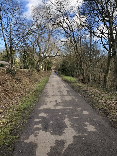
Dawdon Dene is a picturesque valley located in Durham, England. Situated in the village of Dawdon, it is a popular destination for nature enthusiasts and those seeking tranquility in a stunning natural setting. The dene is nestled between two hillsides, providing a sense of seclusion and shelter from the outside world.

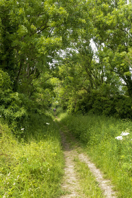
The valley is renowned for its lush greenery, with dense woodland covering the slopes and a meandering stream flowing through its heart. The stream, known as the Dawdon Burn, adds to the charm of the dene, providing a soothing soundtrack as it cascades over rocks and meanders through the landscape.

Visitors to Dawdon Dene can explore numerous walking trails that wind through the valley, offering opportunities to admire the diverse flora and fauna that call the area home. The woodland boasts a rich variety of tree species, including oak, beech, and birch, creating a vibrant tapestry of colors throughout the seasons.

Wildlife enthusiasts will be delighted by the array of animals that inhabit the dene. From squirrels and rabbits to a variety of bird species, including woodpeckers and owls, there is always something to captivate nature lovers.

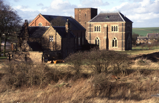
Dawdon Dene also holds historical significance, with remnants of old mine workings visible in some areas. These reminders of the region's coal mining past add an extra layer of interest and serve as a testament to the area's industrial heritage.

Overall, Dawdon Dene offers a peaceful retreat for those seeking solace in nature. Its picturesque surroundings, abundant wildlife, and historical significance make it a must-visit destination for both locals and tourists alike.

If you have any feedback on the listing, please let us know in the comments section below.

Dawdon Dene Images

Images are sourced within 2km of 54.827836/-1.3575857 or Grid Reference NZ4148. Thanks to Geograph Open Source API. All images are credited.

Dalton Pumping Station Grade II listed pumping station from the 1870s, designed by Thomas Hawksley. The pumping station was taken out of use in the 1940s, and the upper portion of the central tower was removed in the 1960s. After several abortive attempts to re-purpose the building, as of August 2021 it is in the process of being renovated as a wedding venue.
Dalton Pumping Station
Grade II listed pumping station from the 1870s, designed by Thomas Hawksley. The pumping station was taken out of use in the 1940s, and the upper portion of the central tower was removed in the 1960s. After several abortive attempts to re-purpose the building, as of August 2021 it is in the process of being renovated as a wedding venue.
Allotments At Dawdon Allotment gardens in front of colliery rows at Dawdon. Dawdon Colliery was one of the last to close in the Durham coalfield.
Allotments At Dawdon
Allotment gardens in front of colliery rows at Dawdon. Dawdon Colliery was one of the last to close in the Durham coalfield.
The Coalface Micro pub on Church Street, Seaham
The Coalface
Micro pub on Church Street, Seaham
Church Street, Seaham
Byron carvings These wood carvings commemorate Lord Byron and his wife Anne Isabella Milbanke, who were married at nearby Seaham Hall in 1815. The carvings are by Seaham artist, David Gross and stand outside the Byron Place shopping centre and were unveiled in January 2016. Beyond, the pedestrianised Church Street leads up to St John's Parish Church.
Byron carvings
These wood carvings commemorate Lord Byron and his wife Anne Isabella Milbanke, who were married at nearby Seaham Hall in 1815. The carvings are by Seaham artist, David Gross and stand outside the Byron Place shopping centre and were unveiled in January 2016. Beyond, the pedestrianised Church Street leads up to St John's Parish Church.
Byron carvings These wood carvings commemorate Lord Byron and his wife Anne Isabella Milbanke, who were married at nearby Seaham Hall in 1815. The carvings are by Seaham artist, David Gross and stand outside the Byron Place shopping centre and were unveiled in January 2016.
Byron carvings
These wood carvings commemorate Lord Byron and his wife Anne Isabella Milbanke, who were married at nearby Seaham Hall in 1815. The carvings are by Seaham artist, David Gross and stand outside the Byron Place shopping centre and were unveiled in January 2016.
Church Street A wide pedestrianised street leading towards the Parish Church.
Church Street
A wide pedestrianised street leading towards the Parish Church.
The Hat and Feathers Originally three shops, numbers 57 to 59 Church Street were a pawnbrokers, wardrobe dealer, and chemist and dentist during the 1890s. Following the turn of the century they went on to become a milliners – hat makers – confectioners and drapers. Then for almost 60 years, from 1923 to 1981, two of the shops were home to Doggarts family run department store, which sold furniture, clothes and fine hats with feathers. In 2013 after a £1.2m conversion the premises became a Wetherspoon pub. <span class="nowrap"><a title="https://cannybrew.com/media/photo-galleries/weatherspoons-turn-former-seaham-seaside-department-store-into-latest-pub-gallery/" rel="nofollow ugc noopener" href="https://cannybrew.com/media/photo-galleries/weatherspoons-turn-former-seaham-seaside-department-store-into-latest-pub-gallery/">Link</a><img style="margin-left:2px;" alt="External link" title="External link - shift click to open in new window" src="https://s1.geograph.org.uk/img/external.png" width="10" height="10"/></span>

<a href="https://www.geograph.org.uk/photo/7343974">NZ4249 : Sign of The Hat and Feathers</a>.
The Hat and Feathers
Originally three shops, numbers 57 to 59 Church Street were a pawnbrokers, wardrobe dealer, and chemist and dentist during the 1890s. Following the turn of the century they went on to become a milliners – hat makers – confectioners and drapers. Then for almost 60 years, from 1923 to 1981, two of the shops were home to Doggarts family run department store, which sold furniture, clothes and fine hats with feathers. In 2013 after a £1.2m conversion the premises became a Wetherspoon pub. LinkExternal link NZ4249 : Sign of The Hat and Feathers.
Sign of The Hat and Feathers Sign for The Hat and Feathers <a href="https://www.geograph.org.uk/photo/7343967">NZ4249 : The Hat and Feathers</a>.
Sign of The Hat and Feathers
Sign for The Hat and Feathers NZ4249 : The Hat and Feathers.
Memory Lane and Oddfellows Arms The Memory Lane bar opened in 2019 in premises previously occupied by Hutchinsons fruit and vegetable shop. At the same time the Oddfellows Arms next door was renovated.

<a href="https://www.geograph.org.uk/photo/7343996">NZ4249 : Sign of The Oddfellows Arms</a>.
Memory Lane and Oddfellows Arms
The Memory Lane bar opened in 2019 in premises previously occupied by Hutchinsons fruit and vegetable shop. At the same time the Oddfellows Arms next door was renovated. NZ4249 : Sign of The Oddfellows Arms.
Sign of The Oddfellows Arms Sign for The Oddfellows Arms <a href="https://www.geograph.org.uk/photo/7343990">NZ4249 : Memory Lane and Oddfellows Arms</a>.
Sign of The Oddfellows Arms
Sign for The Oddfellows Arms NZ4249 : Memory Lane and Oddfellows Arms.
Valentes Seaham 
The cafe on Church Street was established in 1920 and was originally an ice cream parlour. Woolworths opened next door in 1936. It closed in 1989 and for a time was an Ethel Austin shop. More recently it has housed a charity shop.
Valentes Seaham
The cafe on Church Street was established in 1920 and was originally an ice cream parlour. Woolworths opened next door in 1936. It closed in 1989 and for a time was an Ethel Austin shop. More recently it has housed a charity shop.
Parish Church of St John the Evangelist, Seaham 
The Grade II listed <span class="nowrap"><a title="https://historicengland.org.uk/listing/the-list/list-entry/1277262?section=official-list-entry" rel="nofollow ugc noopener" href="https://historicengland.org.uk/listing/the-list/list-entry/1277262?section=official-list-entry">Link</a><img style="margin-left:2px;" alt="External link" title="External link - shift click to open in new window" src="https://s1.geograph.org.uk/img/external.png" width="10" height="10"/></span> church by Thomas Prosser dates from 1840. The  north aisle was added in 1860 and the  choir and vicar's vestries were added by R.J.Johnson in 1885-6.

An historic timeline can be found on the church website: <span class="nowrap"><a title="https://stjohns-seaham.org.uk/church-history" rel="nofollow ugc noopener" href="https://stjohns-seaham.org.uk/church-history">Link</a><img style="margin-left:2px;" alt="External link" title="External link - shift click to open in new window" src="https://s1.geograph.org.uk/img/external.png" width="10" height="10"/></span>
Parish Church of St John the Evangelist, Seaham
The Grade II listed LinkExternal link church by Thomas Prosser dates from 1840. The north aisle was added in 1860 and the choir and vicar's vestries were added by R.J.Johnson in 1885-6. An historic timeline can be found on the church website: LinkExternal link
The Inn Between On the corner of South Railway Street and Adelaide Row. Originally a Newcastle Breweries pub and  previously named the Masons Arms (1831-1861) and Northumberland Arms. It acquired the name The Inn Between in the 1980s. It was refurbished and opened up in 2020 after being closed and boarded up for ten years.

<a href="https://www.geograph.org.uk/photo/7344848">NZ4249 : Sign of the Inn Between</a>.
The Inn Between
On the corner of South Railway Street and Adelaide Row. Originally a Newcastle Breweries pub and previously named the Masons Arms (1831-1861) and Northumberland Arms. It acquired the name The Inn Between in the 1980s. It was refurbished and opened up in 2020 after being closed and boarded up for ten years. NZ4249 : Sign of the Inn Between.
Sign of the Inn Between Sign for the Inn Between <a href="https://www.geograph.org.uk/photo/7344844">NZ4249 : The Inn Between</a>.
Sign of the Inn Between
Sign for the Inn Between NZ4249 : The Inn Between.
Former inclined railway to Seaham docks Looking down the former incline that ran from Seaham colliery to Seaham docks. Now a foot / cycle route from the railway station to the town centre and the Durham coast.
Former inclined railway to Seaham docks
Looking down the former incline that ran from Seaham colliery to Seaham docks. Now a foot / cycle route from the railway station to the town centre and the Durham coast.
Path descending towards Dalton-le-Dale The steepening path lined with trees, descending between fields.
Members of a walking party can be seen in the distance.
Path descending towards Dalton-le-Dale
The steepening path lined with trees, descending between fields. Members of a walking party can be seen in the distance.
Show me another place!

Dawdon Dene is located at Grid Ref: NZ4148 (Lat: 54.827836, Lng: -1.3575857)

Unitary Authority: County Durham

Police Authority: Durham

What 3 Words

///moving.newer.foal. Near Seaham, Co. Durham

Related Wikis

Dalton-le-Dale

Dalton-le-Dale is a small village in County Durham, in England. The parish population taken at the 2011 census was 1,546. It is situated on the old A19...
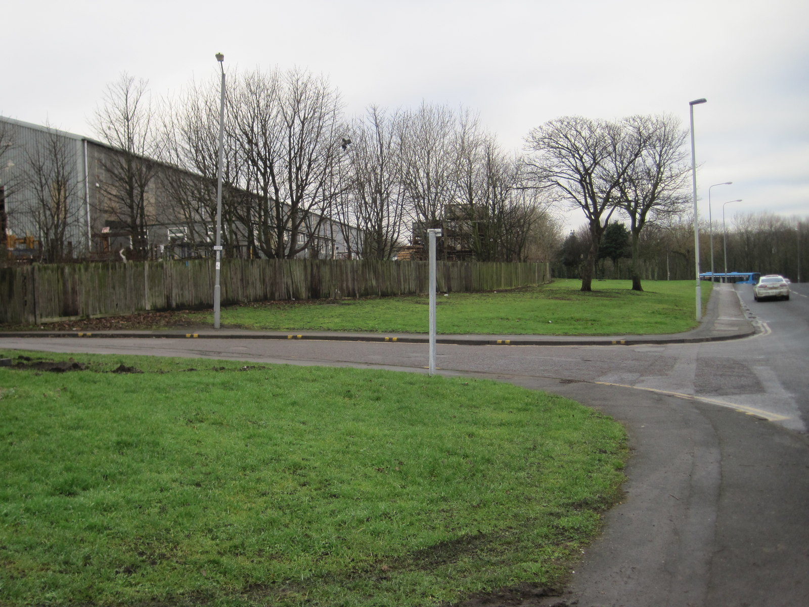
Deneside

Deneside is an area in Seaham, County Durham, in England. It is situated to the west of Seaham. == References == == External links == The most spectacular...

Stony Cut, Cold Hesledon

Stony Cut, Cold Hesledon is a Site of Special Scientific Interest in the Easington district of north-east County Durham, England. It consists of a shallow...

Cold Hesledon

Cold Hesledon is a village and former civil parish, now in the parishes of Murton and Dalton-le-Dale, in the County Durham district, in the ceremonial...

Seaham Colliery

The Seaham Colliery was a coal mine in County Durham in the North of England. The mine suffered an underground explosion in 1880 which resulted in the...

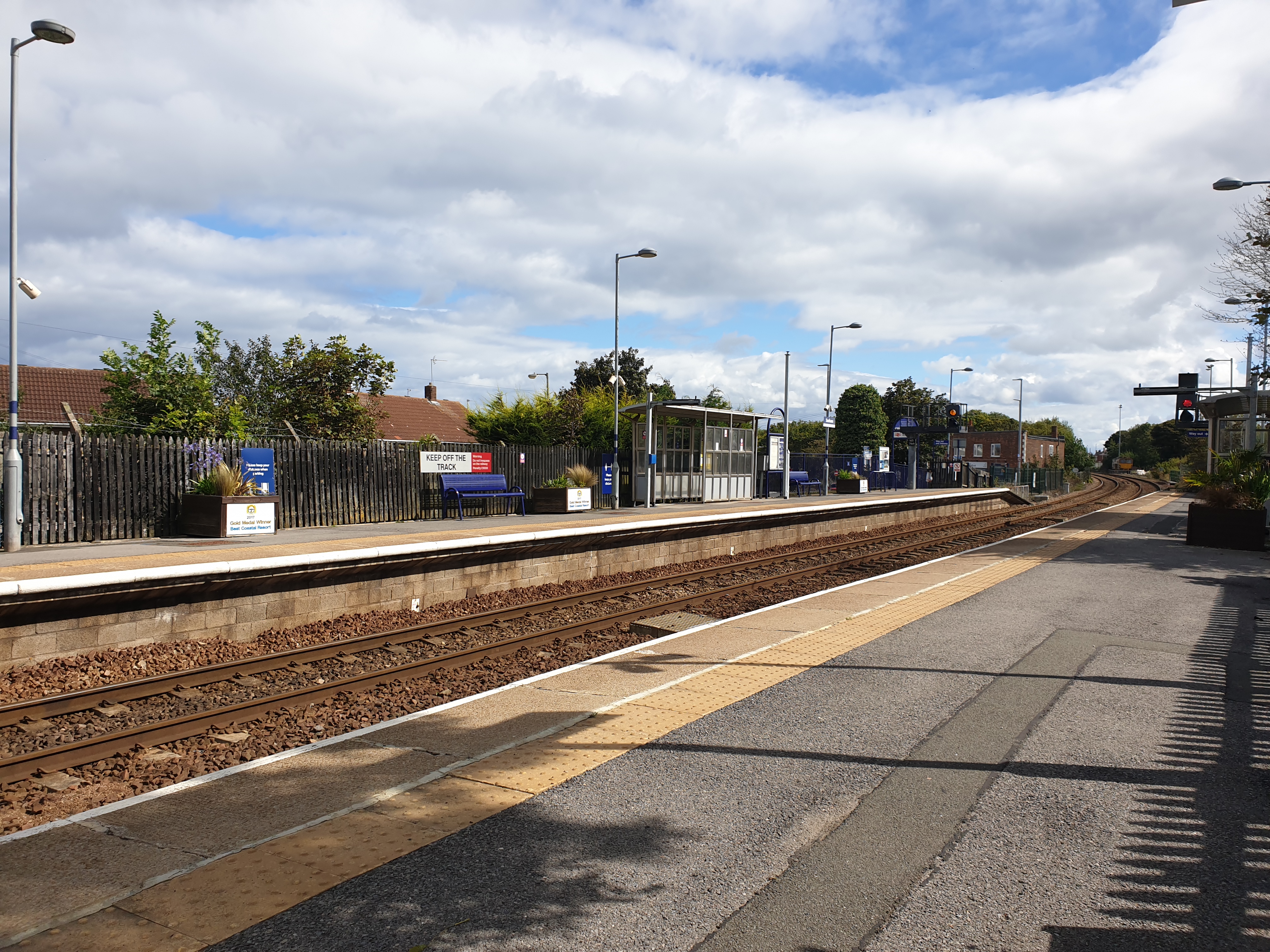
Seaham railway station

Seaham is a railway station on the Durham Coast Line, which runs between Newcastle and Middlesbrough via Hartlepool. The station, situated 5 miles 11 chains...

Seaham Harbour railway station

Seaham Harbour railway station was a railway station that served the town of Seaham Harbour in County Durham, North East England. For much of its existence...

Northlea

Northlea is an area of Seaham, County Durham, England, to the north west of Seaham town centre and close to the North Sea coast. == References ==

Nearby Amenities

Located within 500m of 54.827836,-1.3575857
Traffic Calming: hump
Lat/Long: 54.8282748/-1.356417
Traffic Calming: hump
Lat/Long: 54.8285252/-1.3597648
Traffic Calming: hump
Lat/Long: 54.8281037/-1.3609669
Traffic Calming: hump
Lat/Long: 54.827394/-1.3619355
Power: pole
Lat/Long: 54.8285743/-1.3545048
Power: pole
Lat/Long: 54.83082/-1.3591209
Power: pole
Lat/Long: 54.83045/-1.35804
Power: pole
Lat/Long: 54.83008/-1.3569336
Power: pole
Lat/Long: 54.8297107/-1.3558258
Power: pole
Lat/Long: 54.8290773/-1.3558258
Power: pole
Lat/Long: 54.8284121/-1.3558406
Power: pole
Lat/Long: 54.8275546/-1.355862
Power: pole
Lat/Long: 54.8265859/-1.3558835
Power: pole
Lat/Long: 54.8257021/-1.3558969
Power: pole
Lat/Long: 54.8249681/-1.3558969
Power: pole
Lat/Long: 54.8241708/-1.3559157
Power: pole
Lat/Long: 54.8296746/-1.3522881
Power: pole
Lat/Long: 54.8291063/-1.353433
Power: pole
Lat/Long: 54.8267527/-1.3544853
Power: pole
Lat/Long: 54.8256341/-1.3544734
Power: pole
Lat/Long: 54.8246915/-1.3544633
Power: pole
Lat/Long: 54.8238571/-1.3544544
Traffic Calming: hump
Lat/Long: 54.8259779/-1.363977
Traffic Calming: hump
Lat/Long: 54.8284979/-1.3601562
The data included in this document is from www.openstreetmap.org. The data is made available under ODbL.

Have you been to Dawdon Dene?

Leave your review of Dawdon Dene below (or comments, questions and feedback).