Dalton-le-Dale

Settlement in Durham

England

Dalton-le-Dale

Dalton Pumping Station Grade II listed pumping station from the 1870s, designed by Thomas Hawksley. The pumping station was taken out of use in the 1940s, and the upper portion of the central tower was removed in the 1960s. After several abortive attempts to re-purpose the building, as of August 2021 it is in the process of being renovated as a wedding venue.
Dalton Pumping Station Credit: David Robinson

Dalton-le-Dale is a small village located in County Durham, in the northeast of England. Situated approximately 5 miles east of the city of Durham, the village is nestled within a picturesque rural landscape. With a population of around 2,000 residents, Dalton-le-Dale offers a peaceful and close-knit community atmosphere.

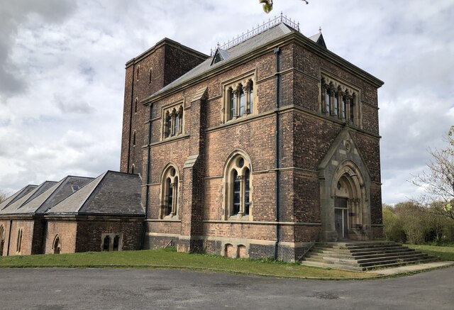
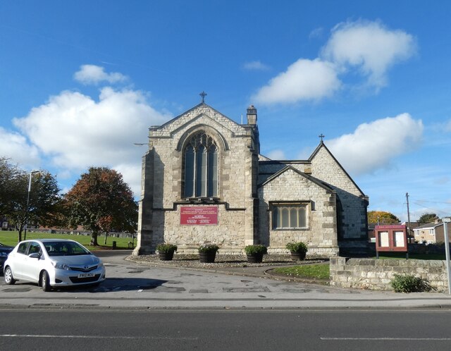
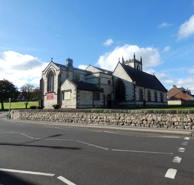
The village is known for its rich history, dating back to medieval times. One of its notable landmarks is St. Andrew's Church, which dates back to the 12th century and showcases impressive architectural features. The church is often visited by tourists and locals alike, offering a glimpse into the village's historical legacy.

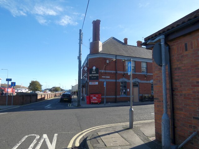
In terms of amenities, Dalton-le-Dale boasts a range of facilities to cater to its residents. These include a primary school, a community center, and a village hall, which hosts various events and activities. The village also has a few local shops, a pub, and a post office, providing essential services to the community.

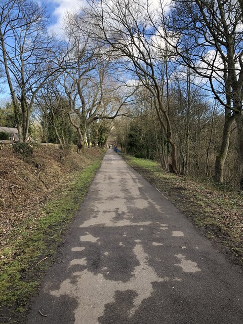
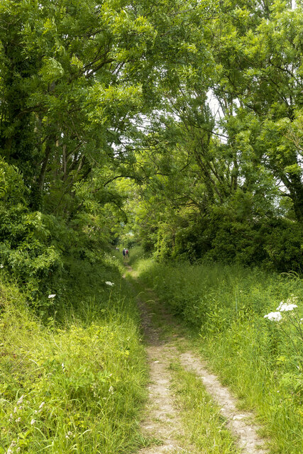
Surrounded by beautiful countryside, Dalton-le-Dale offers ample opportunities for outdoor activities. The village is located just a short distance from the stunning coastline, providing residents with easy access to picturesque beaches and coastal walks. The nearby Dalton Park is a popular retail outlet center, offering a range of shops and leisure facilities.

With its idyllic location, rich history, and strong sense of community, Dalton-le-Dale is an attractive place to live for those seeking a peaceful and charming village lifestyle.

If you have any feedback on the listing, please let us know in the comments section below.

Dalton-le-Dale Images

Images are sourced within 2km of 54.828052/-1.361068 or Grid Reference NZ4148. Thanks to Geograph Open Source API. All images are credited.
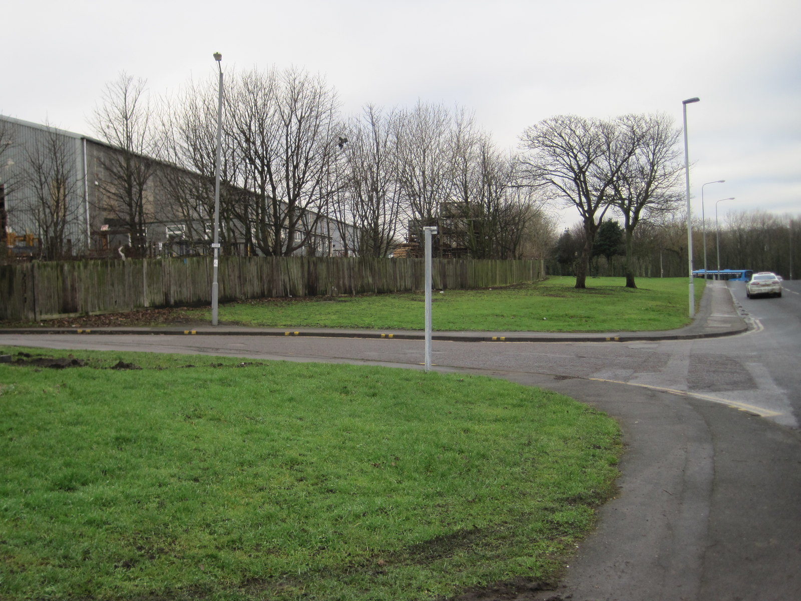
Dalton Pumping Station Grade II listed pumping station from the 1870s, designed by Thomas Hawksley. The pumping station was taken out of use in the 1940s, and the upper portion of the central tower was removed in the 1960s. After several abortive attempts to re-purpose the building, as of August 2021 it is in the process of being renovated as a wedding venue.
Dalton Pumping Station
Grade II listed pumping station from the 1870s, designed by Thomas Hawksley. The pumping station was taken out of use in the 1940s, and the upper portion of the central tower was removed in the 1960s. After several abortive attempts to re-purpose the building, as of August 2021 it is in the process of being renovated as a wedding venue.
Allotments At Dawdon Allotment gardens in front of colliery rows at Dawdon. Dawdon Colliery was one of the last to close in the Durham coalfield.
Allotments At Dawdon
Allotment gardens in front of colliery rows at Dawdon. Dawdon Colliery was one of the last to close in the Durham coalfield.
Church Street, Seaham
Valentes Seaham 
The cafe on Church Street was established in 1920 and was originally an ice cream parlour. Woolworths opened next door in 1936. It closed in 1989 and for a time was an Ethel Austin shop. More recently it has housed a charity shop.
Valentes Seaham
The cafe on Church Street was established in 1920 and was originally an ice cream parlour. Woolworths opened next door in 1936. It closed in 1989 and for a time was an Ethel Austin shop. More recently it has housed a charity shop.
Parish Church of St John the Evangelist, Seaham 
The Grade II listed <span class="nowrap"><a title="https://historicengland.org.uk/listing/the-list/list-entry/1277262?section=official-list-entry" rel="nofollow ugc noopener" href="https://historicengland.org.uk/listing/the-list/list-entry/1277262?section=official-list-entry">Link</a><img style="margin-left:2px;" alt="External link" title="External link - shift click to open in new window" src="https://s1.geograph.org.uk/img/external.png" width="10" height="10"/></span> church by Thomas Prosser dates from 1840. The  north aisle was added in 1860 and the  choir and vicar's vestries were added by R.J.Johnson in 1885-6.

An historic timeline can be found on the church website: <span class="nowrap"><a title="https://stjohns-seaham.org.uk/church-history" rel="nofollow ugc noopener" href="https://stjohns-seaham.org.uk/church-history">Link</a><img style="margin-left:2px;" alt="External link" title="External link - shift click to open in new window" src="https://s1.geograph.org.uk/img/external.png" width="10" height="10"/></span>
Parish Church of St John the Evangelist, Seaham
The Grade II listed LinkExternal link church by Thomas Prosser dates from 1840. The north aisle was added in 1860 and the choir and vicar's vestries were added by R.J.Johnson in 1885-6. An historic timeline can be found on the church website: LinkExternal link
The Inn Between On the corner of South Railway Street and Adelaide Row. Originally a Newcastle Breweries pub and  previously named the Masons Arms (1831-1861) and Northumberland Arms. It acquired the name The Inn Between in the 1980s. It was refurbished and opened up in 2020 after being closed and boarded up for ten years.

<a href="https://www.geograph.org.uk/photo/7344848">NZ4249 : Sign of the Inn Between</a>.
The Inn Between
On the corner of South Railway Street and Adelaide Row. Originally a Newcastle Breweries pub and previously named the Masons Arms (1831-1861) and Northumberland Arms. It acquired the name The Inn Between in the 1980s. It was refurbished and opened up in 2020 after being closed and boarded up for ten years. NZ4249 : Sign of the Inn Between.
Sign of the Inn Between Sign for the Inn Between <a href="https://www.geograph.org.uk/photo/7344844">NZ4249 : The Inn Between</a>.
Sign of the Inn Between
Sign for the Inn Between NZ4249 : The Inn Between.
Former inclined railway to Seaham docks Looking down the former incline that ran from Seaham colliery to Seaham docks. Now a foot / cycle route from the railway station to the town centre and the Durham coast.
Former inclined railway to Seaham docks
Looking down the former incline that ran from Seaham colliery to Seaham docks. Now a foot / cycle route from the railway station to the town centre and the Durham coast.
Path descending towards Dalton-le-Dale The steepening path lined with trees, descending between fields.
Members of a walking party can be seen in the distance.
Path descending towards Dalton-le-Dale
The steepening path lined with trees, descending between fields. Members of a walking party can be seen in the distance.
Dene Road approaching Dalton-le-Dale The road, heading west is about to enter the village at Dalton-le-Dale in the valley of Dawdon Dene, close to Seaham.
Dene Road approaching Dalton-le-Dale
The road, heading west is about to enter the village at Dalton-le-Dale in the valley of Dawdon Dene, close to Seaham.
Dalton Park Outlet Shopping Centre Dalton Park is a shopping centre on the outskirts of Murton, County Durham. It is built on the site of the town's former colliery spoil heaps. It is the largest factory outlet style shopping centre in the North East, where branded goods are sold at discounted prices, usually discontinued lines of stock, previous seasons ranges or items specifically made for the outlet market place. Compare this photograph with the one at <a title="https://www.geograph.org.uk/photo/2037" href="https://www.geograph.org.uk/photo/2037">Link</a> taken in 2005, since when the entrance area has had a makeover.
Dalton Park Outlet Shopping Centre
Dalton Park is a shopping centre on the outskirts of Murton, County Durham. It is built on the site of the town's former colliery spoil heaps. It is the largest factory outlet style shopping centre in the North East, where branded goods are sold at discounted prices, usually discontinued lines of stock, previous seasons ranges or items specifically made for the outlet market place. Compare this photograph with the one at Link taken in 2005, since when the entrance area has had a makeover.
Dalton Park Outlet Shopping Centre Dalton Park is a shopping centre on the outskirts of Murton, County Durham. It is built on the site of the town's former colliery spoil heaps. It is the largest factory outlet style shopping centre in the North East, where branded goods are sold at discounted prices, usually discontinued lines of stock, previous seasons ranges or items specifically made for the outlet market place. This photograph shows the main shopping concourse which is partially covered in.
Dalton Park Outlet Shopping Centre
Dalton Park is a shopping centre on the outskirts of Murton, County Durham. It is built on the site of the town's former colliery spoil heaps. It is the largest factory outlet style shopping centre in the North East, where branded goods are sold at discounted prices, usually discontinued lines of stock, previous seasons ranges or items specifically made for the outlet market place. This photograph shows the main shopping concourse which is partially covered in.
Dalton Moor The new fishing pond on Dalton Moor I'm not sure what it is called.
Dalton Moor
The new fishing pond on Dalton Moor I'm not sure what it is called.
Pithead wheel, Murton Many of the colliery villages in the north-east have preserved the pithead wheel as a memorial to a bygone industry. For another example see [<a href="https://www.geograph.org.uk/gridref/NZ2443">NZ2443</a>]. This one is attractively located in an extensive public open space.
Pithead wheel, Murton
Many of the colliery villages in the north-east have preserved the pithead wheel as a memorial to a bygone industry. For another example see [NZ2443]. This one is attractively located in an extensive public open space.
Murton County Primary School From the outside, looks rather date compared with most school buildings, but it's what goes on in there that counts.
Murton County Primary School
From the outside, looks rather date compared with most school buildings, but it's what goes on in there that counts.
Murton Library, Barnes Road
Dalton Moor
Dalton Moor
Show me another place!

Dalton-le-Dale is located at Grid Ref: NZ4148 (Lat: 54.828052, Lng: -1.361068)

Unitary Authority: County Durham

Police Authority: Durham

What 3 Words

///armed.photocopy.cling. Near Seaham, Co. Durham

Related Wikis

Dalton-le-Dale

Dalton-le-Dale is a small village in County Durham, in England. The parish population taken at the 2011 census was 1,546. It is situated on the old A19...

Deneside

Deneside is an area in Seaham, County Durham, in England. It is situated to the west of Seaham. == References == == External links == The most spectacular...

Stony Cut, Cold Hesledon

Stony Cut, Cold Hesledon is a Site of Special Scientific Interest in the Easington district of north-east County Durham, England. It consists of a shallow...

Cold Hesledon

Cold Hesledon is a village and former civil parish, now in the parishes of Murton and Dalton-le-Dale, in the County Durham district, in the ceremonial...
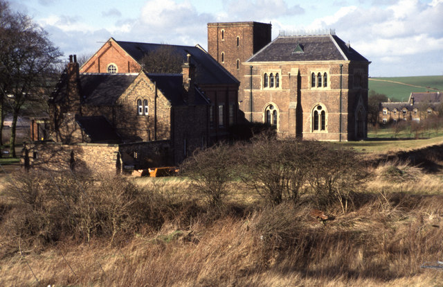
Seaham Colliery

The Seaham Colliery was a coal mine in County Durham in the North of England. The mine suffered an underground explosion in 1880 which resulted in the...

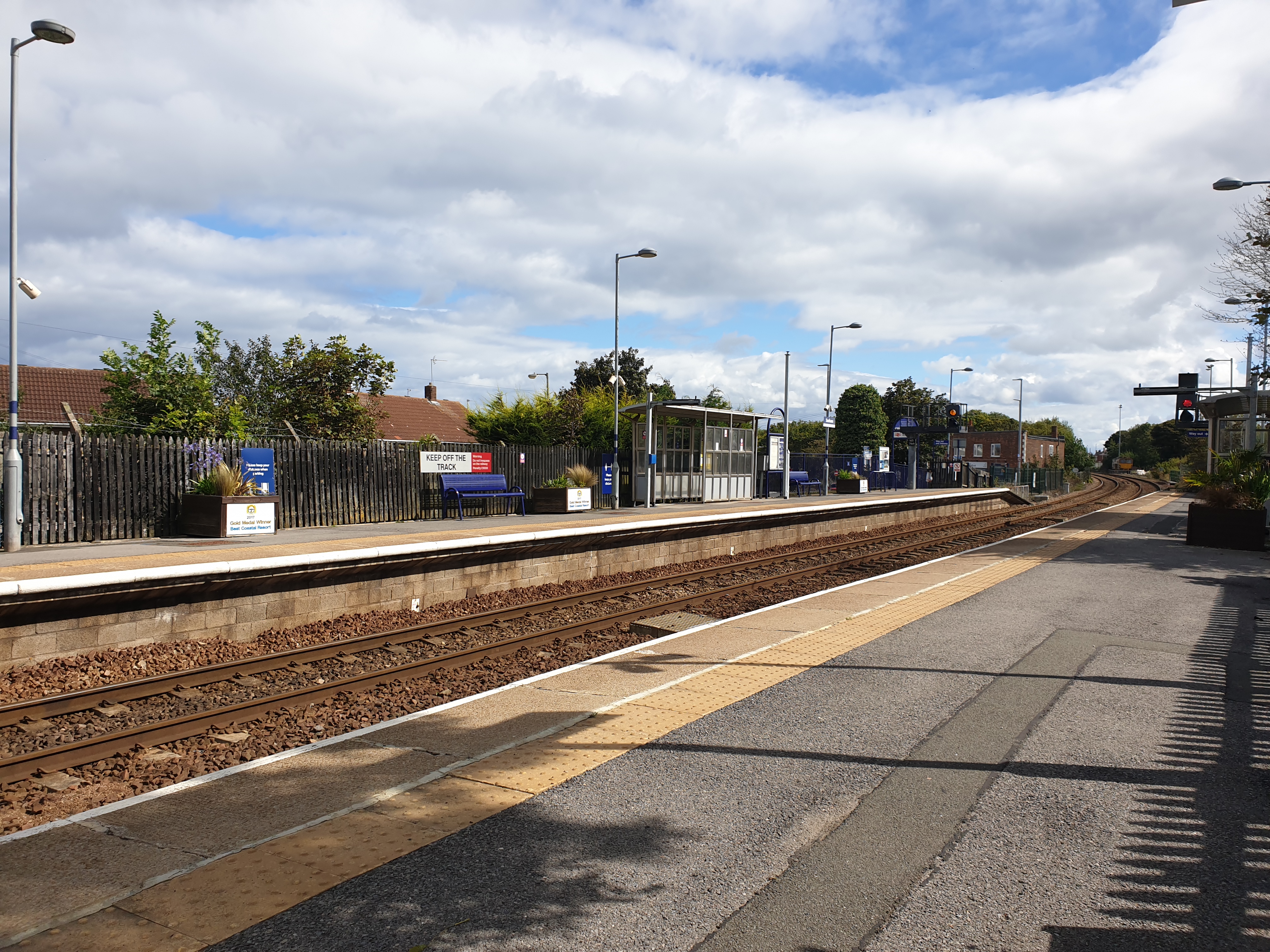
Seaham railway station

Seaham is a railway station on the Durham Coast Line, which runs between Newcastle and Middlesbrough via Hartlepool. The station, situated 5 miles 11 chains...

Dalton Park

Dalton Park is a shopping centre on the outskirts of Murton, County Durham, England. It is the largest factory outlet style shopping centre in North East...

Seaham Harbour railway station

Seaham Harbour railway station was a railway station that served the town of Seaham Harbour in County Durham, North East England. For much of its existence...

Nearby Amenities

Located within 500m of 54.828052,-1.361068
Dalton le Dale
Place: hamlet
Source: npe
Wikidata: Q5211663
Wikipedia: en:Dalton-le-Dale
Lat/Long: 54.8258379/-1.3653352
Traffic Calming: hump
Lat/Long: 54.8282748/-1.356417
Traffic Calming: hump
Lat/Long: 54.8285252/-1.3597648
Traffic Calming: hump
Lat/Long: 54.8281037/-1.3609669
Traffic Calming: hump
Lat/Long: 54.827394/-1.3619355
Traffic Calming: hump
Lat/Long: 54.8255961/-1.3652152
Bus Stop
Dalton Heights Roundabout
Bench: yes
Bin: yes
Bus: yes
Departures Board: timetable
Naptan AtcoCode: 13003307A
Naptan Bearing: N
Naptan CommonName: Dalton Heights Roundabout
Naptan Indicator: north bound
Naptan Landmark: Landmark not known
Naptan NaptanCode: durapmjp
Naptan Notes: Westlea Road (B1285)- North of Junction With The Graham Way- Dalton-le-Dale
Naptan Street: B1285 Stockton Road
Naptan Verified: no
Public Transport: platform
Shelter: yes
Source: naptan_import
Lat/Long: 54.8303083/-1.3671956
Power: pole
Lat/Long: 54.8285743/-1.3545048
Power: pole
Lat/Long: 54.83082/-1.3591209
Power: pole
Lat/Long: 54.83045/-1.35804
Power: pole
Lat/Long: 54.83008/-1.3569336
Power: pole
Lat/Long: 54.8297107/-1.3558258
Power: pole
Lat/Long: 54.8290773/-1.3558258
Power: pole
Lat/Long: 54.8284121/-1.3558406
Power: pole
Lat/Long: 54.8275546/-1.355862
Power: pole
Lat/Long: 54.8265859/-1.3558835
Power: pole
Lat/Long: 54.8257021/-1.3558969
Power: pole
Lat/Long: 54.8249681/-1.3558969
Power: pole
Lat/Long: 54.8267527/-1.3544853
Traffic Calming: hump
Lat/Long: 54.8259779/-1.363977
Traffic Calming: hump
Lat/Long: 54.8284979/-1.3601562
Post Box
Drive Through: no
Operator: Royal Mail
Operator Wikidata: Q638098
Post Box Type: lamp
Lat/Long: 54.8298589/-1.3675733
Operator: Northern Powergrid
Operator Wikidata: Q7058871
Power: substation
Lat/Long: 54.830677/-1.3672566
The data included in this document is from www.openstreetmap.org. The data is made available under ODbL.

Have you been to Dalton-le-Dale?

Leave your review of Dalton-le-Dale below (or comments, questions and feedback).